
An exceptional vivid view of the Holy Land.

The Holy Land. Exhibiting the Places and Cities Mentioned in the Old and New Testament.
sold
- Digital Map Information
- Suitable for large format printing
- DPI: 300
- File Size: 12.32 MB
- File Type: ZIP / TIFF
- ICC color profile embedded
- Delivered instantly via download link
An uncommon view and map of the Holy Land, Israel, or Palestine by Endicott. Focusing on the city of Jerusalem, which is oversized and presented just right of center, this map covers the Holy Land from the Jorden River to the Mediterranean and from Sidon to Zoar. ... (more details)
Possibly the finest map of Florida of its era.
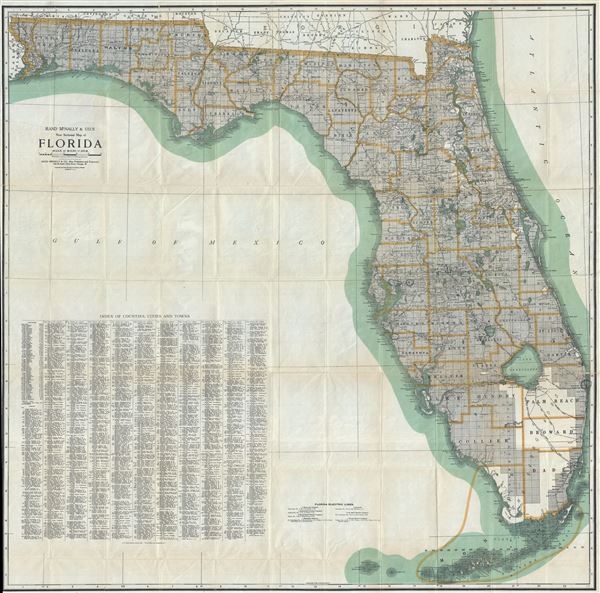
Rand McNally and Co.'s New Sectional Map of Florida.
sold
- Digital Map Information
- Suitable for large format printing
- Full resolution TIFF file
- ICC color profile embedded
- Delivered instantly via download link
This is an extremely scarce and monumentally proportioned c. 1925 large format map of Florida by Rand McNally and Company. The state of Florida is presented on a massive scale with extraordinary detail throughout noting towns, cities, rivers, electric lines, ... (more details)
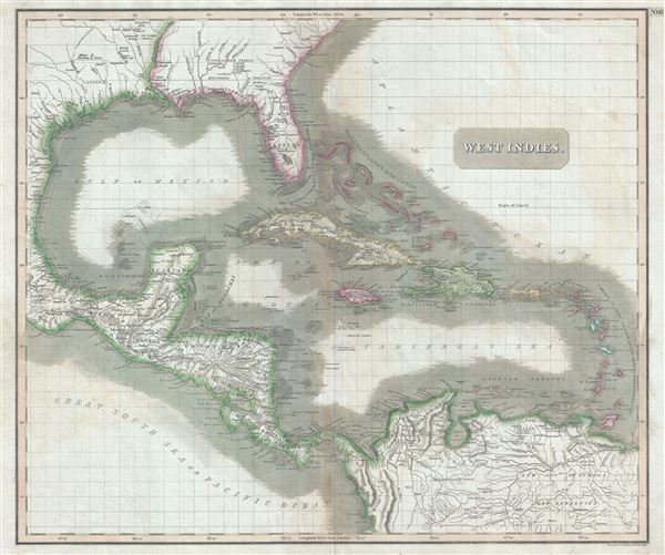
West Indies.
sold
- Digital Map Information
- Suitable for large format printing
- DPI: 300
- File Size: 18.46 MB
- File Type: ZIP / TIFF
- ICC color profile embedded
- Delivered instantly via download link
This is a fascinating 1814 map of the West Indies and Central America by the Edinburgh cartographer John Thomson. It covers from the Carolinas south through Texas, Mexico and Central America to the northern part of South America as well as Venezuela and the ... (more details)
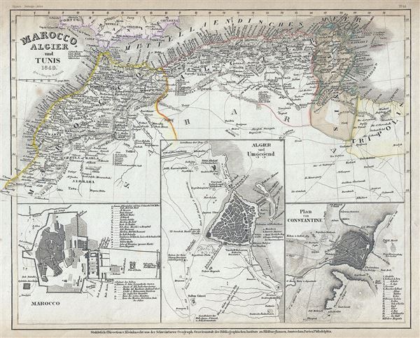
Marocco, Algier and Tunis.
sold
- Digital Map Information
- Suitable for large format printing
- Full resolution TIFF file
- ICC color profile embedded
- Delivered instantly via download link
This is a fine 1849 map of the Barbary Coast by Joseph Meyer. It covers the northern Africa and the western Mediterranean Coast of Africa from Morocco to Tripoli, including modern day Morocco, Algeria, Tunisia and parts of Libya. Numerous cities, towns, ... (more details)
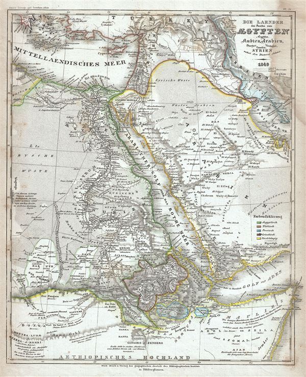
Die Laender des Pascha von Egypten Aeypten Nubien, Arabien, Darfur, Candia, Cordofan, Syrien nebst den District Adana.
sold
- Digital Map Information
- Suitable for large format printing
- Full resolution TIFF file
- ICC color profile embedded
- Delivered instantly via download link
This is an attractive 1849 map of Egypt and Arabia by Joseph Meyer. It covers from Greece and the Aegean Islands south as far as modern day Ethiopia and east as far as the Quatar. The map is color coded to show Egyptian, Turkish, Persian, Greek and ... (more details)
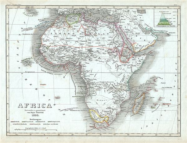
Africa.
sold
- Digital Map Information
- Suitable for large format printing
- Full resolution TIFF file
- ICC color profile embedded
- Delivered instantly via download link
This is a fine map of Africa by Joseph Meyer dating to 1850. It covers the entire continent from the Mediterranean Sea to Cape Town, including Madagascar on the cusp of the great exploratory expeditions of the mid-19th century undertaken by Speke, ... (more details)
Scarce early map of the Falkland Islands or Islas Malvinas.
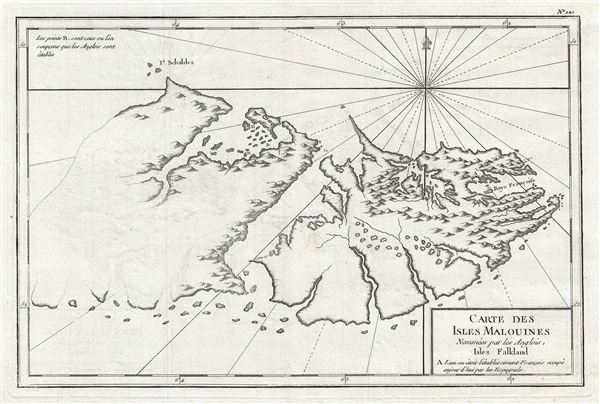
Carte des isles Malouines nommees par les Anglois, Isles Falkland.
sold
- Digital Map Information
- Suitable for large format printing
- DPI: 300
- File Size: 3.83 MB
- File Type: ZIP / TIFF
- ICC color profile embedded
- Delivered instantly via download link
An exceptional 1787 map of the Falkland Islands or Isles Malvinas issued by Etienne Andre Philippe de Pretot. The map covers the East Falkland in some detail and the eastern parts of West Falkland. The western parts of West Falkland are ghosted ... (more details)

Lawyers Mortgage Company’s Map of Manhattan and Bronx showing House Numbers Transportation Lines with Guide Numbers.
sold
- Digital Map Information
- Suitable for large format printing
- File Size: 42.07 MB
- File Type: ZIP / TIFF
- ICC color profile embedded
- Delivered instantly via download link
This is an excellent map of New York City by the by the A. G. Hagstrom Co. in c.1922. This large scale folding map covers all of Manhattan and the Bronx in extraordinary detail. Parts of Jersey City, Hoboken, Queens and Brooklyn are also ... (more details)
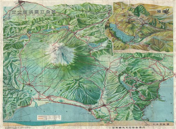
Guide Map of Fuji, Hakone Area.
sold
- Digital Map Information
- Suitable for large format printing
- Full resolution TIFF file
- ICC color profile embedded
- Delivered instantly via download link
This is a beautiful 1952 or Showa 27 bi-lingual Japanese panoramic view of Mt. Fuji, Hakone, Japan. Issued by the Japan Tourism Association, it notes roads, railways and towns along with other important features. A large inset of the ... (more details)
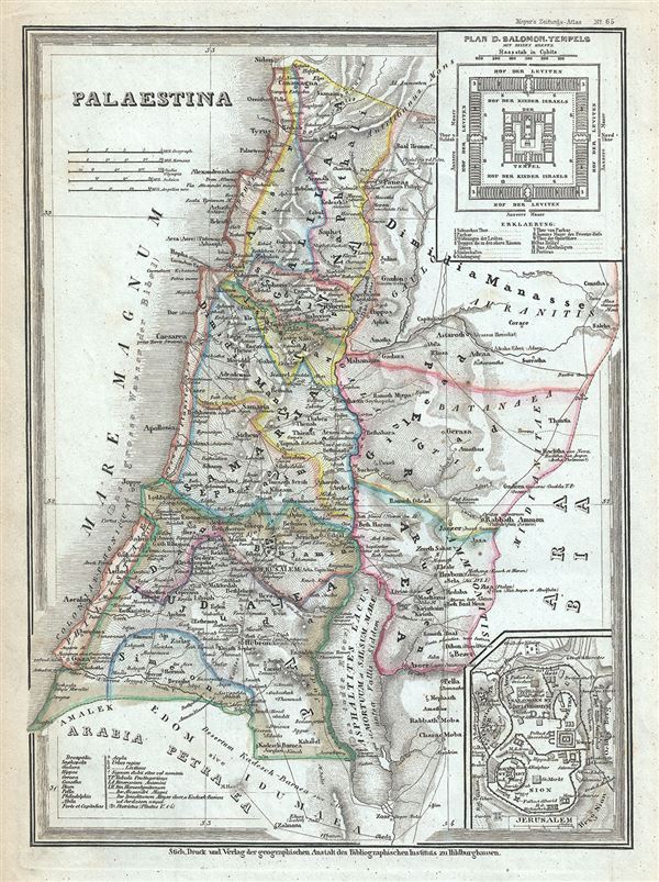
Palaestina.
sold
- Digital Map Information
- Suitable for large format printing
- Full resolution TIFF file
- ICC color profile embedded
- Delivered instantly via download link
This is an attractive 1852 map of Palestine, Israel or the Holy Land, by Joseph Meyer. This map is a curious combination of a contemporary and a historic map and includes the modern day nations of Israel, Palestine and Lebanon, as ... (more details)
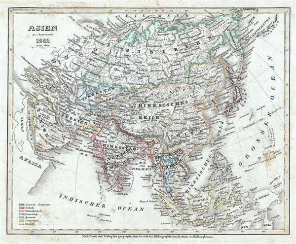
Asien.
sold
- Digital Map Information
- Suitable for large format printing
- DPI: 600
- File Size: 5.6 MB
- File Type: ZIP / TIFF
- ICC color profile embedded
- Delivered instantly via download link
This is a fine example of Joseph Meyer's 1852 map of Asia. It covers the entire continent from the Mediterranean Sea to the North Pacific Ocean, including the Aleutian Islands. The map covers Turkey, Arabia, Persia, the Indian ... (more details)

China-Propria oder das eigentliche China.
sold
- Digital Map Information
- Suitable for large format printing
- Full resolution TIFF file
- ICC color profile embedded
- Delivered instantly via download link
This is a lovely 1854 map of China by Joseph Meyer. It covers the traditional provinces of mainland China, as well as Formosa or Taiwan. The Grand Canal and the Great Wall are noted. Formosa or Taiwan is also included, though ... (more details)

Griechenland die Jonischen Inseln und Candia.
sold
- Digital Map Information
- Suitable for large format printing
- Full resolution TIFF file
- ICC color profile embedded
- Delivered instantly via download link
This is a beautiful 1854 map of Greece and the Archipelago by Joseph Meyer. It covers Greece from the Ambracian Gulf south as far as Crete or Candia and includes the Ionian and Aegean Islands. An inset near the left border ... (more details)
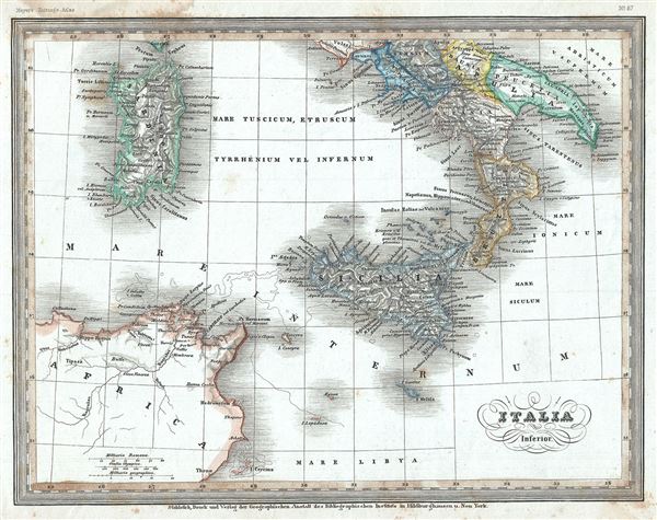
Italia Inferior.
sold
- Digital Map Information
- Suitable for large format printing
- Full resolution TIFF file
- ICC color profile embedded
- Delivered instantly via download link
This is a fine 1852 Joseph Meyer map of southern Italy during ancient Roman times. It covers the southern part of Italy from Anzio (Antium, as it was called in ancient times) south past Sicily to the Kerkennah Island ... (more details)
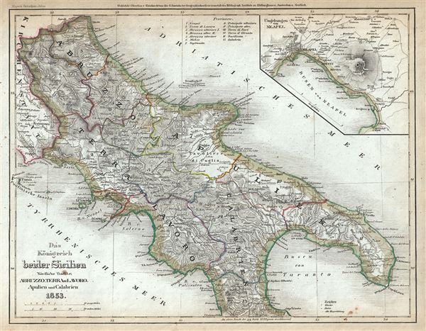
Das Konigreich beider Sicilien. Nordliche Halfte: Abruzzo, Terra di Lavoro, Apulien, Calabrien.
sold
- Digital Map Information
- Suitable for large format printing
- Full resolution TIFF file
- ICC color profile embedded
- Delivered instantly via download link
This is a scarce 1853 map of the southern Italy. It covers the northern part of the Kingdom of Naples (a common reference for the 'Kingdom of the Two Sicilies') or Calabria, from Ascoli (Ascoli Piceno) south to ... (more details)

Das Konigreich beider Sicilien sudliche Haelfte: Sicilien und Calabrien
sold
- Digital Map Information
- Suitable for large format printing
- Full resolution TIFF file
- ICC color profile embedded
- Delivered instantly via download link
This is a nice example of Joseph Meyer's 1852 map of southern Italy. It covers the southern part of the Kingdom of Naples (a common reference for the 'Kingdom of the Two Sicilies') or Calabria, from Cetaro ... (more details)

Portugal und die Azores.
sold
- Digital Map Information
- Suitable for large format printing
- Full resolution TIFF file
- ICC color profile embedded
- Delivered instantly via download link
This is a beautiful 1853 map of Portugal by Joseph Meyer. It covers the entire nation of Portugal as well as parts of neighboring Spain. Includes an inset of the Azores or Western Islands. Another two ... (more details)

Britisches Nord-America.
sold
- Digital Map Information
- Suitable for large format printing
- Full resolution TIFF file
- ICC color profile embedded
- Delivered instantly via download link
This is a beautiful 1849 example of Joseph Meyer's map of modern day Canada, or more specifically, British North America. The map covers the continent from modern day Alaska (Russian America) to ... (more details)
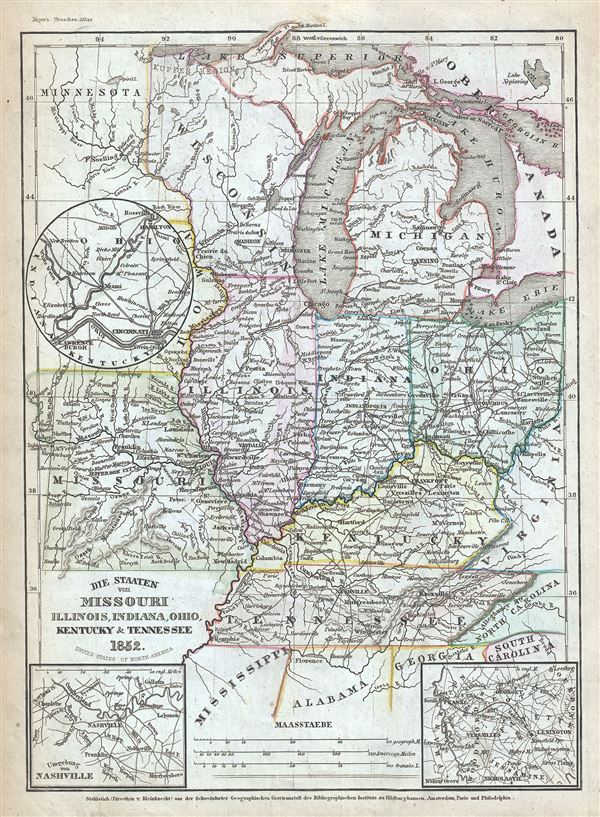
Die Staaten von Missouri, Illinois, Indiana, Ohio, Kentucky and Tennessee.
sold
- Digital Map Information
- Suitable for large format printing
- Full resolution TIFF file
- ICC color profile embedded
- Delivered instantly via download link
This is a fine example of Joseph Meyer's 1852 map of the American Midwest. It covers the states of Missouri, Illinois, Indiana, Ohio, Michigan, Wisconsin, Kentucky and Tennessee as well as parts ... (more details)
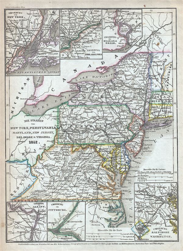
Die Staaten von New York, Pennsylvania, Maryland, New Jersey, Delaware and Virginia.
sold
- Digital Map Information
- Suitable for large format printing
- Full resolution TIFF file
- ICC color profile embedded
- Delivered instantly via download link
This is a fine example of Joseph Meyer's 1852 map of the Mid-Atlantic States. It covers New York, Pennsylvania, New Jersey, Maryland, New Jersey, Delaware and Virginia as well as parts of ... (more details)