
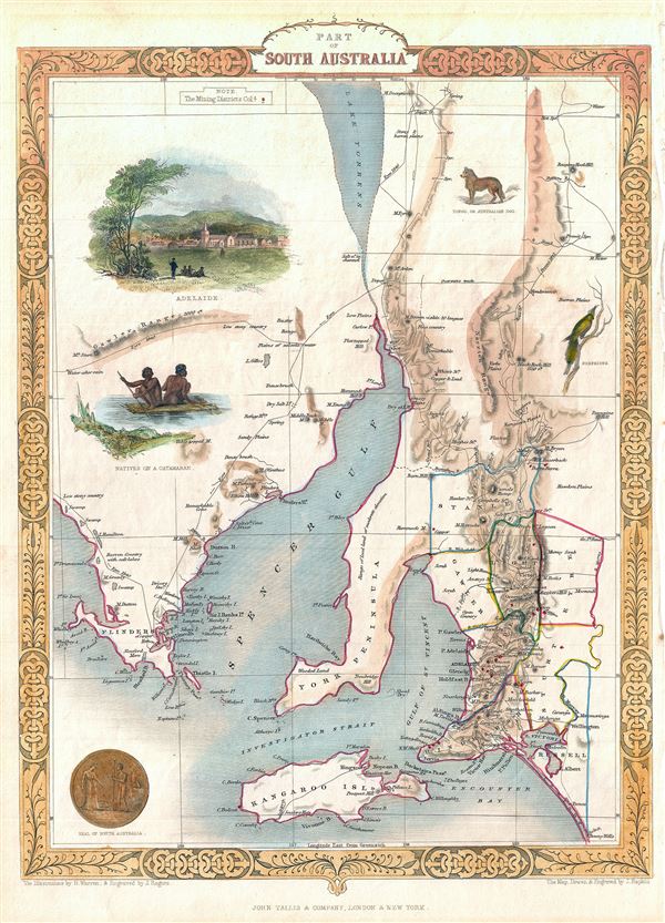
Part of South Australia.
sold
- Digital Map Information
- Suitable for large format printing
- DPI: 300
- File Size: 4.7 MB
- File Type: ZIP / TIFF
- ICC color profile embedded
- Delivered instantly via download link
This is a beautiful example of John Tallis and John Rapkin's 1851 map of South Australia, Australia. Centered on the Spencer Gulf, it covers the southeastern part of the state of South Australia from Lake Torrens to Kangaroo Island and Bonny Wells. This map ... (more details)

Van Diemen's Island or Tasmania.
sold
- Digital Map Information
- Suitable for large format printing
- DPI: 300
- File Size: 5.38 MB
- File Type: ZIP / TIFF
- ICC color profile embedded
- Delivered instantly via download link
This is an impressive 1851 Tallis map of Van Diemen's Island or Tasmania. The map covers the entire island of Tasmania in considerable detail noting towns, lakes, mountain ranges and other topographical features. Van Diemen's Land was colonized by the ... (more details)
One of the first illustrations of the Great Boston Fire of 1872.

Boston - General View of th Ruins, From the West Side of Washington Street - The Old South Chuyrch and the 'Transcript' Building in th Foreground.
sold
- Digital Map Information
- Suitable for large format printing
- File Size: 6.75 MB
- File Type: ZIP / TIFF
- ICC color profile embedded
- Delivered instantly via download link
A dramatic journalistic view of Boston, Massachusetts prepared to illustrate the Great Boston Fire of 1872. Issued just three weeks after the tragic fire (November 7-8, 1872), this is one of the first publications to illustrate the fire's ... (more details)
The first view to illustrate the devastation following the Great Boston Fire of 1872.

Bird's-Eye View of Boston, Showing the Burned District.
sold
- Digital Map Information
- Suitable for large format printing
- File Size: 16.27 MB
- File Type: ZIP / TIFF
- ICC color profile embedded
- Delivered instantly via download link
A dramatic journalistic view of Boston, Massachusetts prepared to illustrate the devastation following the Great Boston Fire of 1872. Issued just three weeks after the tragic fire (November 7-8, 1872), this is one of the first ... (more details)
Exceptional map of Asia showing both East Sea and Sea of Korea.

Carte des Indes, dea la Chine and des Iles de Sumatra, Java and c. Dressee sur les Memoires les pulus nouveaux and sur les meilleures Observations, tirees des Relations les plus fideles.
sold
- Digital Map Information
- Suitable for large format printing
- DPI: 300
- File Size: 14.58 MB
- File Type: ZIP / TIFF
- ICC color profile embedded
- Delivered instantly via download link
An exceptional 1719 map of the East India Islands by Henri Chatelain. Centered on China, Chatelain's map covers from the Caspian Sea to the semi-mythical Terre de la Compagnie and India to New Guinea. It provides ... (more details)
The earliest obtainable specific map of the Great Lakes.
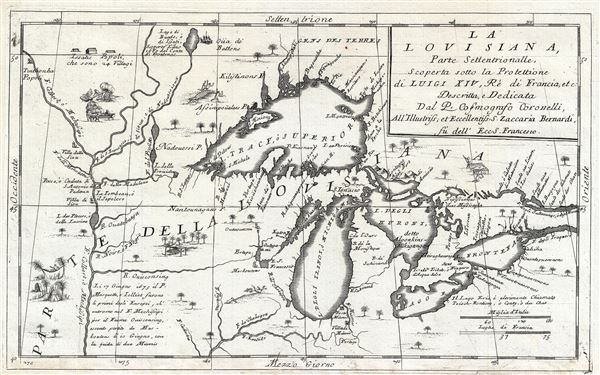
La Louisiana, Parte Settentrionalle, Scoperta sotto la Protettione di Luigi XIV, Re di Francia et Descritta, e Dedicata Dal P. Cosmografo Coronelli, All'Illustriss, et Eccellentiss, S. Zaccaria Bernardi su dell Ecc. S. Francesco.
sold
- Digital Map Information
- Suitable for large format printing
- DPI: 300
- File Size: 6.07 MB
- File Type: ZIP / TIFF
- ICC color profile embedded
- Delivered instantly via download link
This rare 1694 production by Venetian cartographer Vincenzo Coronelli is the earliest and most important obtainable map of the Great Lakes and the headwaters of the Mississippi. Coronelli's map centers on Lake ... (more details)
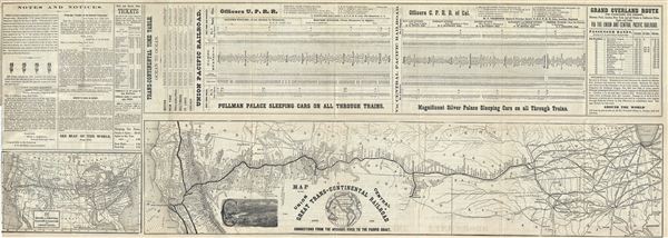
Map of the Great Trans-Continental Railroad and its Connections from the Missouri River to the Pacific Coast.
sold
- Digital Map Information
- Suitable for large format printing
- File Size: 15.67 MB
- File Type: ZIP / TIFF
- ICC color profile embedded
- Delivered instantly via download link
This is a fine 1871 map of the Great Trans-Continental Railroad or the Union and Central Pacific Railroad lines, showing its various connections from Missouri River to the Pacific coast. The map covers the ... (more details)

Crofutt's New Map of Omaha and Council Bluffs, showing the New Railroad Bridge over the Missouri River, Connecting the Two Cotoes.
sold
- Digital Map Information
- Suitable for large format printing
- File Size: 7.5 MB
- File Type: ZIP / TIFF
- ICC color profile embedded
- Delivered instantly via download link
This is a scarce 1871 George A. Crofutt map of Omaha, Nebraska and Council Bluffs, Iowa, showing the railroad bridge over the Missouri River, connecting the two cities. Centered on the Missouri River, the ... (more details)
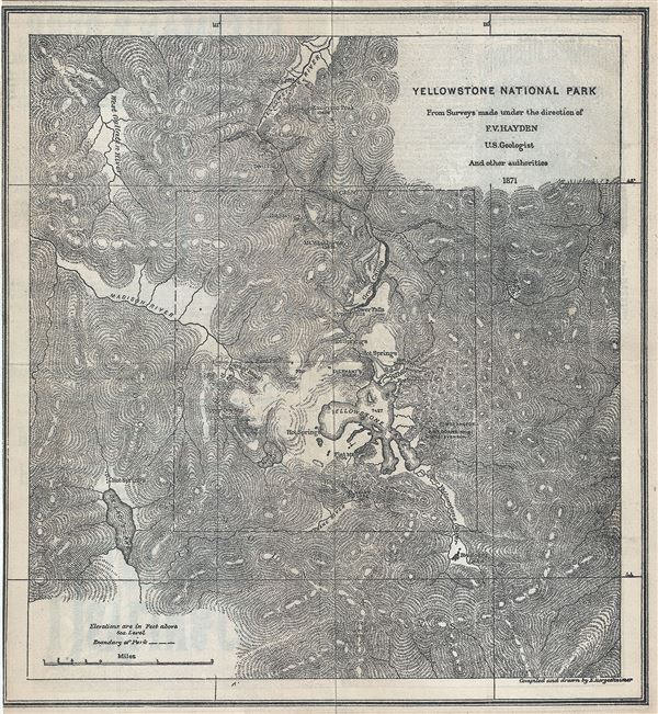
Yellowstone National Park.
sold
- Digital Map Information
- Suitable for large format printing
- File Size: 4.51 MB
- File Type: ZIP / TIFF
- ICC color profile embedded
- Delivered instantly via download link
This is a fine 1871 geological map of the spectacular Yellowstone National Park, Wyoming issued by George A. Crofutt. Centered on Yellowstone Lake, the map covers the entire park as well as the adjacent ... (more details)
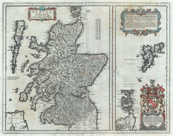
Scotia Regnum cum insulis adjacentibus.
sold
- Digital Map Information
- Suitable for large format printing
- DPI: 300
- File Size: 13.77 MB
- File Type: ZIP / TIFF
- ICC color profile embedded
- Delivered instantly via download link
This is a beautiful map of the Kingdom of Scotland by Joan Blaeu in 1662. Essentially divided into two panels within a single border, the panel on the left depicts Scotland from its southern border to ... (more details)
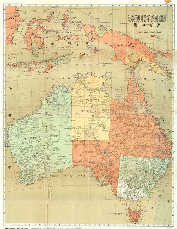
Australia.
sold
- Digital Map Information
- Suitable for large format printing
- File Size: 31.17 MB
- File Type: ZIP / TIFF
- ICC color profile embedded
- Delivered instantly via download link
This is a beautiful 1942 or Showa 17 World War II era Japanese map of Australia and New Guinea issued by the Economy Research Bureau of Manchuria Railway Corporation. It covers Australia in its ... (more details)

[Untitled].
sold
- Digital Map Information
- Suitable for large format printing
- File Size: 11.05 MB
- File Type: ZIP / TIFF
- ICC color profile embedded
- Delivered instantly via download link
This is a fascinating and whimsical 1940s manuscript map of Brookhaven and Smithtown located in Suffolk County, NY. The map covers the northern shore of Long Island from Mount Sinai to ... (more details)
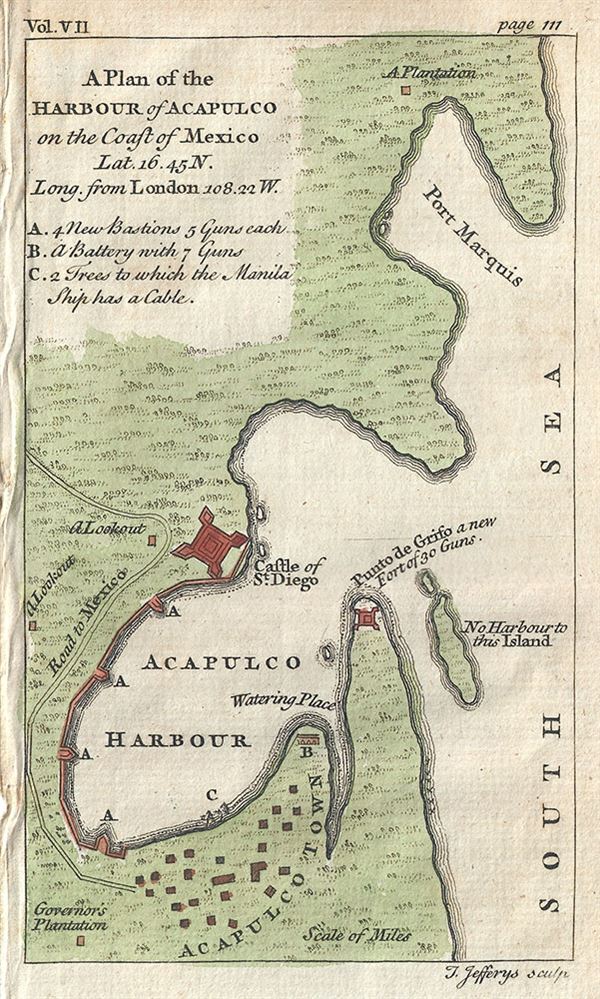
A Plan of the Harbour of Acapulco on the Coast of Mexico.
sold
- Digital Map Information
- Suitable for large format printing
- DPI: 300
- File Size: 0.72 MB
- File Type: ZIP / TIFF
- ICC color profile embedded
- Delivered instantly via download link
This is a beautiful c.1756 map or plan of the harbor of Acapulco, Mexico by Thomas Jefferys. Oriented to the east, the plan details Acapulco Bay and its fortified port. In the 18th ... (more details)
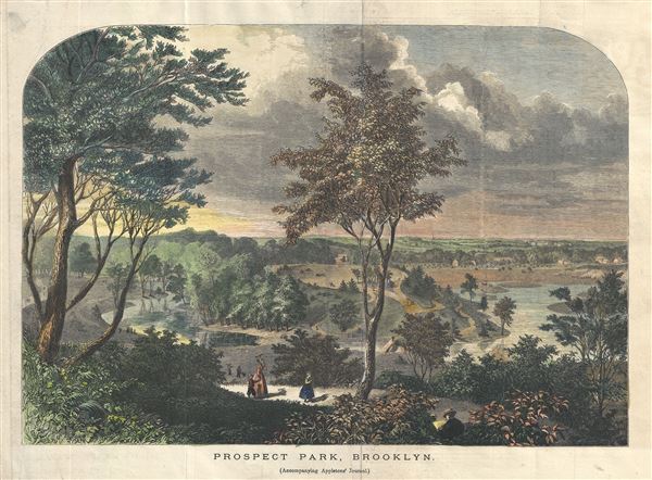
Prospect Park, Brooklyn.
sold
- Digital Map Information
- Suitable for large format printing
- File Size: 5.94 MB
- File Type: ZIP / TIFF
- ICC color profile embedded
- Delivered instantly via download link
This is a beautiful 1870 view of Prospect Park, Brooklyn, issued by D. Appleton. Drawn while the park was still under construction, it reveals Prospect Park as conceived by the ... (more details)
One of only three known examples, this map marks a major milestone in the urban mapping of Philadelphia, and is one of the first to show Fairmount Park's design.
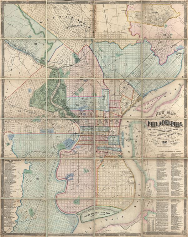
New Map of the City of Philadelphia, reduced by Photography from a large survey made expressly for the City and corrected from Plans and Draughts in the Department of Surveys, by John. H. Dye, Draughtsman and Surveyor.
sold
- Digital Map Information
- Suitable for large format printing
- File Size: 104.62 MB
- File Type: ZIP / TIFF
- ICC color profile embedded
- Delivered instantly via download link
An exceptional 1869 folding wall map of Philadelphia, Pennsylvania by John H. Dye and Henry J. Toudy. This map covers the urban center of Philadelphia along both sides the ... (more details)
Scarce Italian issue Pre-Revolutionary War Map of Boston.
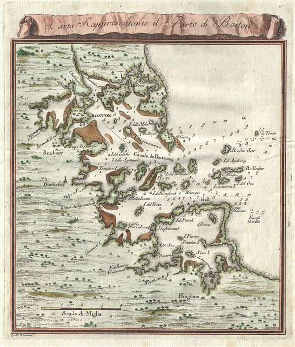
Carta Rappresentante il Porto di Boston.
sold
- Digital Map Information
- Suitable for large format printing
- DPI: 300
- File Size: 2.14 MB
- File Type: ZIP / TIFF
- ICC color profile embedded
- Delivered instantly via download link
Issued between the French and Indian War and the American Revolutionary War, this is a fascinating 1763 map of Boston, Massachusetts, and its vicinity by G. M. Terreni. ... (more details)

Johnson's New Military Map of the United States showing the Forts, Military Posts etc. with enlarged plans of Southern Harbors from Authentic Data Obtained at the War Department Washington.
sold
- Digital Map Information
- Suitable for large format printing
- File Size: 15.27 MB
- File Type: ZIP / TIFF
- ICC color profile embedded
- Delivered instantly via download link
Printed at the height of the American Civil War, this is a fine example of Johnson's 1863 Military Map of the United States. Created at the height of the American Civil ... (more details)

Johnson's North America.
sold
- Digital Map Information
- Suitable for large format printing
- File Size: 17.98 MB
- File Type: ZIP / TIFF
- ICC color profile embedded
- Delivered instantly via download link
A beautiful example of Johnson and Ward's 1863 map of North America. It offers a fascinating snapshot of North America, particularly the United States, Canada and ... (more details)

Johnson's Map of the World on Mercator's Projection.
sold
- Digital Map Information
- Suitable for large format printing
- File Size: 17.65 MB
- File Type: ZIP / TIFF
- ICC color profile embedded
- Delivered instantly via download link
This is A. J. Johnson and Ward's fine 1863 map of the world on Mercator's Projection. It depicts the entire world centered on the Americas. Offering a fascinating ... (more details)
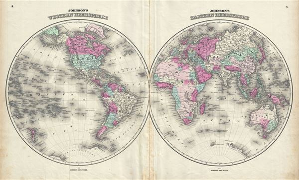
Johnson's Western Hemisphere. Johnson's Eastern Hemisphere.
sold
- Digital Map Information
- Suitable for large format printing
- File Size: 16.26 MB
- File Type: ZIP / TIFF
- ICC color profile embedded
- Delivered instantly via download link
This is an 1863 A. J. Johnson and Benjamin P. Ward map of the world on a hemispherical projection. Offering a look at the world during a period of rapid ... (more details)