

Los Aspectos del Cielo.
sold
- Digital Map Information
- Suitable for large format printing
- DPI: 300
- File Size: 0.64 MB
- File Type: ZIP / TIFF
- ICC color profile embedded
- Delivered instantly via download link
This is a charming 1754 chart or weather map by Gabriel Ramirez. The chart depicts the wind pattern across the world with five circular illustrations, each focusing on a different region. The first illustration features the antemeridian or the 180th meridian ... (more details)

Las invenciones modernas.
sold
- Digital Map Information
- Suitable for large format printing
- DPI: 300
- File Size: 1.04 MB
- File Type: ZIP / TIFF
- ICC color profile embedded
- Delivered instantly via download link
This is a lovely 1754 illustration of Modern Inventions by Gabriel Ramirez. The chart includes three figures, representing new and 'modern' inventions of the time. The first figure is that of a pendulum, the second appears to be a kind of fountain, while the ... (more details)

La Bruxula.
sold
- Digital Map Information
- Suitable for large format printing
- DPI: 300
- File Size: 0.61 MB
- File Type: ZIP / TIFF
- ICC color profile embedded
- Delivered instantly via download link
This is a fine example of the 1754 illustration of the compass rose by Gabriel Ramirez. The chart includes two illustrations, the top illustration being that of a compass. The bottom illustration is that of the compass rose or the windrose consisting of 32 ... (more details)
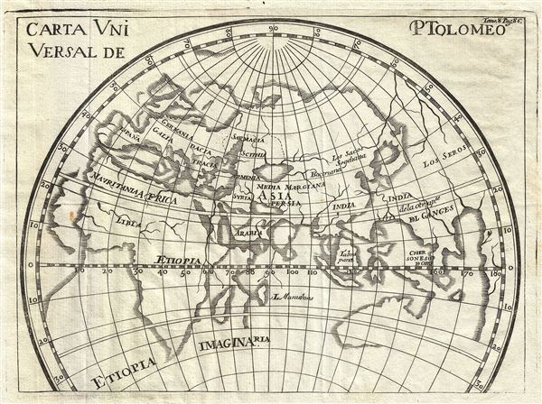
Carta Universal de Ptolomeo.
sold
- Digital Map Information
- Suitable for large format printing
- DPI: 300
- File Size: 1.63 MB
- File Type: ZIP / TIFF
- ICC color profile embedded
- Delivered instantly via download link
This is an interesting 1754 map by Gabriel Ramirez depicting the map of the Geographical System of the ancient Greek geographer Ptolemy. The map covers the regions between Spain and Southeast Asia. Of course, the world of the ancient Greeks centered on the ... (more details)

Las colonias Europeas en America.
sold
- Digital Map Information
- Suitable for large format printing
- DPI: 300
- File Size: 0.49 MB
- File Type: ZIP / TIFF
- ICC color profile embedded
- Delivered instantly via download link
This is a scarce 1754 map of North America and South America by Gabriel Ramirez. The map covers all of North and South America during colonial times. The map names several colonial territories and cities, with limited inland detail, especially in the ... (more details)
Exceptional large folding map of Central Park.

Map of the Central Park Showing the progress of the Work up to January 1st 1861.
sold
- Digital Map Information
- Suitable for large format printing
- File Size: 11.54 MB
- File Type: ZIP / TIFF
- ICC color profile embedded
- Delivered instantly via download link
An altogether extraordinary hand colored map of New York City's Central Park prepared and printed for inclusion in the Fifth Annual Report of the Board of Commissioners of the Central Park . This map first appeared in 1861, with the present example ... (more details)
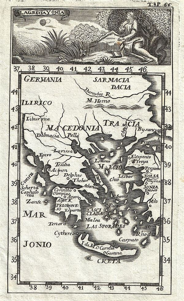
La Grecia Y Onia.
sold
- Digital Map Information
- Suitable for large format printing
- DPI: 300
- File Size: 0.71 MB
- File Type: ZIP / TIFF
- ICC color profile embedded
- Delivered instantly via download link
This is an appealing 1754 map of Greece and the Ionian Islands by Gabriel Ramirez. The map covers from Germania and Sarmatia to Crete and from Illyricum (in modern day Albania) east as far as the Sea of Marmara. The map identifies ancient Greek ... (more details)
Map identifying the Solomanic treasure cities Ophir and Tarshish.

El Puerto de Ophir. Ila Antigua Derrota de Tarsis.
sold
- Digital Map Information
- Suitable for large format printing
- DPI: 300
- File Size: 0.6 MB
- File Type: ZIP / TIFF
- ICC color profile embedded
- Delivered instantly via download link
This is a fine 1754 map of Africa by Gabriel Ramirez. It covers the entire continent of Africa with adjacent parts of Europe and Arabia. The map identifies the biblical port of Ophir. Associated with the legends of King Solomon, Ophier was ... (more details)

Esphera Armillar.
sold
- Digital Map Information
- Suitable for large format printing
- DPI: 300
- File Size: 1.11 MB
- File Type: ZIP / TIFF
- ICC color profile embedded
- Delivered instantly via download link
This is a fine 1754 diagram of an Armillary Sphere by Gabriel Ramirez. The diagram illustrates an Armillary Sphere along with two smaller figures in the lower left and right quadrants respectively. The Armillary Sphere is an old ... (more details)

Las Colonias Phenicias.
sold
- Digital Map Information
- Suitable for large format printing
- DPI: 300
- File Size: 1.37 MB
- File Type: ZIP / TIFF
- ICC color profile embedded
- Delivered instantly via download link
This is an interesting 1754 map of the Phoenician colonies along the Mediterranean coast by Gabriel Ramirez. Centered on the Mediterranean Sea, it covers from Portugal east as far as Arabia, including the Barbary Coast and the ... (more details)
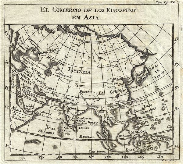
El Comercio de los Europeos en Asia.
$175.00
Acquire
- Digital Map Information
- Suitable for large format printing
- DPI: 300
- File Size: 1.26 MB
- File Type: ZIP / TIFF
- ICC color profile embedded
- Delivered instantly via download link
This is an appealing 1754 map of Asia by Gabriel Ramirez. It focuses on the trade of the Europeans in Asia and depicts Asia as it was understood in the middle of the 18th century, from Egypt east as far as New Guinea. ... (more details)
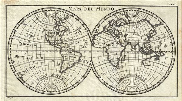
Mapa del Mundo.
sold
- Digital Map Information
- Suitable for large format printing
- DPI: 300
- File Size: 2.42 MB
- File Type: ZIP / TIFF
- ICC color profile embedded
- Delivered instantly via download link
This is a scarce 1754 map of the World in two hemispheres by Gabriel Ramirez. It covers the western and eastern hemispheres and depicts the world as it was understood in the middle part of the 18th century, before the ... (more details)
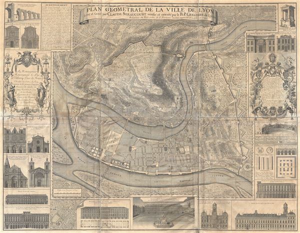
Plan Geometral de la Ville de Lyon.
sold
- Digital Map Information
- Suitable for large format printing
- File Size: 116.5 MB
- File Type: ZIP / TIFF
- ICC color profile embedded
- Delivered instantly via download link
A gigantic wall map of Lyon, France by R. P Gregorie and Claude Seraucourt. Originally issued in 1735, the present example reflects a c. 1880 restrike of the 1740 revised edition. Oriented to the east, this map ... (more details)
Scarce 18th century celestial chart.

Parte del Celeste Austral. Primera E'mispherio. Segunda del E'mispherio. Primera Parte del E'mispherio Celeste Septentrional. Segunda E'mispherio Celeste. Parte del Septentrional.
sold
- Digital Map Information
- Suitable for large format printing
- DPI: 300
- File Size: 9.33 MB
- File Type: ZIP / TIFF
- ICC color profile embedded
- Delivered instantly via download link
This is a rare and desirable 1754 set of two celestial maps or charts depicting the stars and constellations of the northern and southern hemispheres by Gabriel Ramirez. Printed on two sheets each, the two ... (more details)
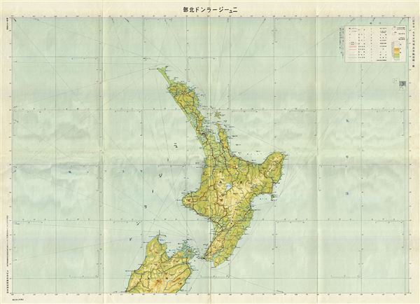
New Zealand.
sold
- Digital Map Information
- Suitable for large format printing
- Full resolution TIFF file
- ICC color profile embedded
- Delivered instantly via download link
This is a scarce and beautiful 1942 or Showa 17 Japanese map of the North Island or New Zealand by the Imperial Japan Government Land Survey Division. The map covers all of North Island, the world's 14th ... (more details)

Tasmania, Australia.
sold
- Digital Map Information
- Suitable for large format printing
- Full resolution TIFF file
- ICC color profile embedded
- Delivered instantly via download link
This is a scarce 1942 or Showa 17 Japanese map or chart of Tasmania and Victoria, Australia by the Imperial Japan Government Land Survey Division. The map covers all of Tasmania or Van Diemen's Land as ... (more details)
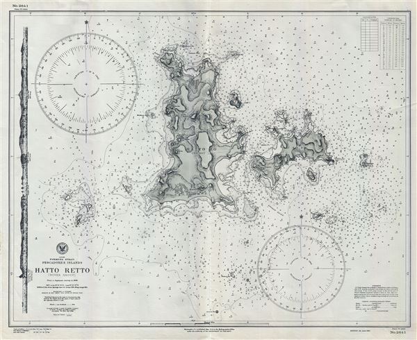
Japan Formosa Strait Pescadores Islands Hatta Retto (Rover Group).
sold
- Digital Map Information
- Suitable for large format printing
- File Size: 20.67 MB
- File Type: ZIP / TIFF
- ICC color profile embedded
- Delivered instantly via download link
This is an uncommon 1941 World War II era map or nautical chart of Hatta-Retto or the Rover Group by the U.S. Navy Hydrographic Office. This chart covers the Islands of Pachau and Tsiang. Hatta-Retto ... (more details)
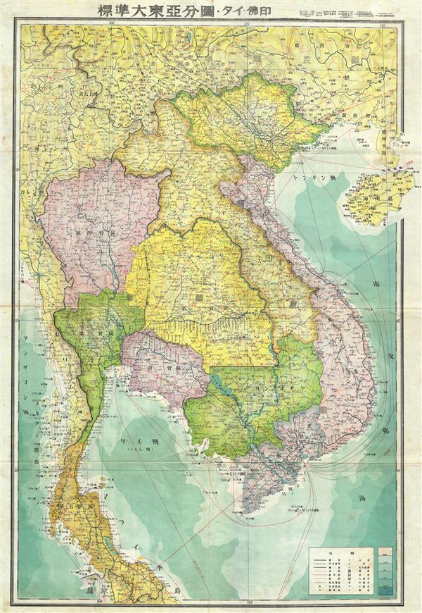
Indochina.
sold
- Digital Map Information
- Suitable for large format printing
- File Size: 24.77 MB
- File Type: ZIP / TIFF
- ICC color profile embedded
- Delivered instantly via download link
This is a beautiful 1943 or Showa 18 large format map of Cambodia, Vietnam, Laos and Thailand issued by the Japanese during World War II. The map offers superb detail regarding topographic features ... (more details)
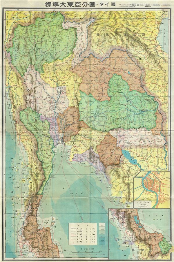
Thailand.
sold
- Digital Map Information
- Suitable for large format printing
- File Size: 21.99 MB
- File Type: ZIP / TIFF
- ICC color profile embedded
- Delivered instantly via download link
This is a beautiful 1943 or Showa 18 large format Japanese map of Thailand dating to World War II. The map covers the entirety of the country with an inset city plan of Bangkok in the lower left ... (more details)

Australia.
sold
- Digital Map Information
- Suitable for large format printing
- File Size: 20.8 MB
- File Type: ZIP / TIFF
- ICC color profile embedded
- Delivered instantly via download link
This is a stunning large format Japanese map of Australia dating to World War II. Issued in 1943, the map covers the entirety of the continent with color coding according to state. Offers ... (more details)