
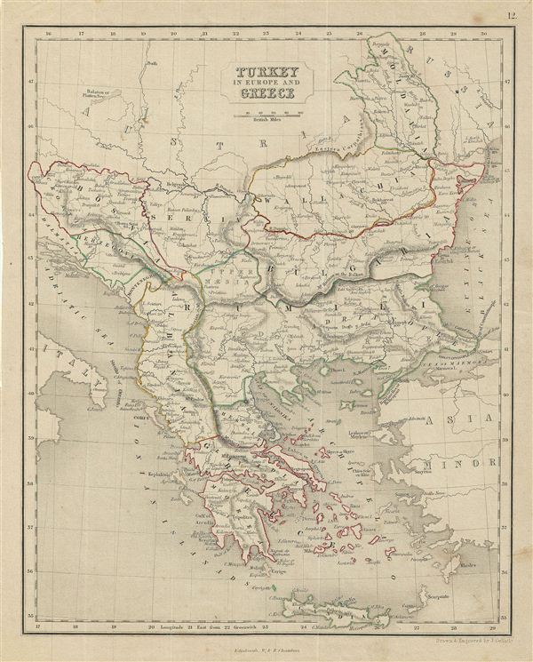
Turkey in Europe and Greece.
sold
- Digital Map Information
- Suitable for large format printing
- DPI: 300
- File Size: 3.75 MB
- File Type: ZIP / TIFF
- ICC color profile embedded
- Delivered instantly via download link
This is a fine example of the 1845 Chambers map of Greece, the Balkans, and the eruopean Part of Turkey. It covers from Moldova to Crete and from the Adriatic to the Black Sea. The modern day states of Greece, Albania, Moldova, Bosnia, Croatia, Serbia, Bulgaria ... (more details)

Sweden & Norway.
sold
- Digital Map Information
- Suitable for large format printing
- DPI: 300
- File Size: 3.69 MB
- File Type: ZIP / TIFF
- ICC color profile embedded
- Delivered instantly via download link
This is a fine example of the 1845 Chambers map of Sweden and Norway. It covers from the Arctic Sea south to Denmark and east as far as the Gulf of Finland. Includes the modern day nations of Sweden and Norway. The legendary and semi-mythical whirlpool known ... (more details)

Russia in Europe.
sold
- Digital Map Information
- Suitable for large format printing
- DPI: 300
- File Size: 3.76 MB
- File Type: ZIP / TIFF
- ICC color profile embedded
- Delivered instantly via download link
This is a fine example of the 1845 Chambers map of european Russia. The map covers from the Arctic Ocean to the Black Sea and from Sweden to Tartary. In 1825, a few years before this map was drawn, Russian army officers, called the Decembrists, protested ... (more details)
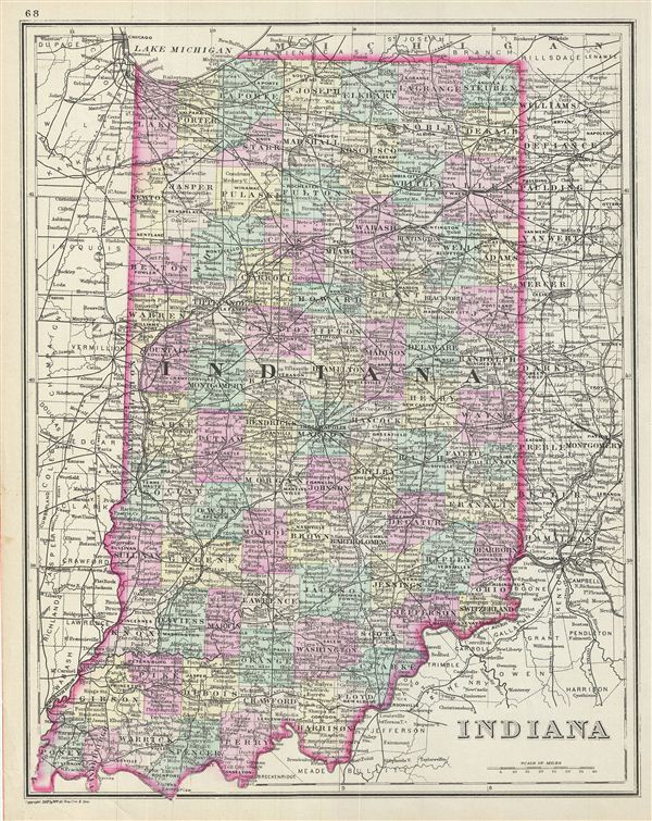
Indiana.
sold
- Digital Map Information
- Suitable for large format printing
- File Size: 7.29 MB
- File Type: ZIP / TIFF
- ICC color profile embedded
- Delivered instantly via download link
This is a fine example of William M. Bradley's 1887 map of Indiana. It covers the entire state in considerable detail. Parts of neighboring Illinois, Ohio and Michigan are also depicted. The map also delineates survey grids referencing the work of the ... (more details)

County and Township Map of Dakota.
sold
- Digital Map Information
- Suitable for large format printing
- File Size: 5.92 MB
- File Type: ZIP / TIFF
- ICC color profile embedded
- Delivered instantly via download link
A fine example of William M. Bradley's 1887 map of Dakota. It covers modern day North and South Dakota in before they were separated. The map also delineates survey grids referencing the work of the U.S. Land Survey. Various towns, cities, forts, ... (more details)
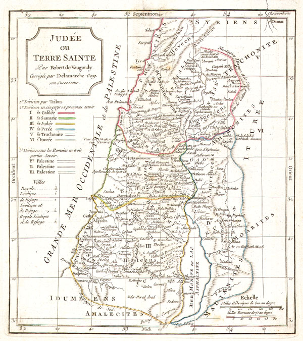
Judee ou Terre Sainte
sold
- Digital Map Information
- Suitable for large format printing
- Full resolution TIFF file
- ICC color profile embedded
- Delivered instantly via download link
This is a fine example of Delamarche's 1832 map of Israel, Palestine, or the Holy Land. It details the region on both sides of the Jordan River with the Mediterranean shoreline running from Asher to Judah. Includes the Biblical cities of Soddom ... (more details)
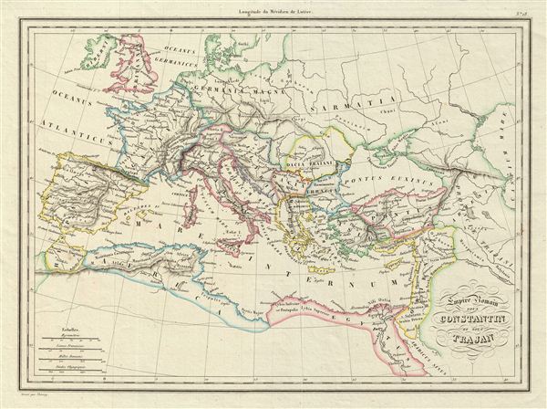
Empire Romain sous Constantin et sous Trajan.
sold
- Digital Map Information
- Suitable for large format printing
- DPI: 300
- File Size: 4.24 MB
- File Type: ZIP / TIFF
- ICC color profile embedded
- Delivered instantly via download link
This is a fine example of the 1837 Malte-Brun map of the Roman empire under Constantine and Trajan. It depicts the extent of the Roman empire under the rule of Constantine the Great, and covers most of europe, the and parts of North Africa, and ... (more details)
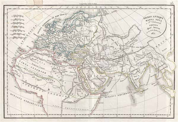
Orbis Antiqui Mappa Nova.
sold
- Digital Map Information
- Suitable for large format printing
- DPI: 300
- File Size: 7.14 MB
- File Type: ZIP / TIFF
- ICC color profile embedded
- Delivered instantly via download link
This is a fine example of Delamarche's 1832 map of the world as known to the ancients, including europe, northern Africa and western Asian. The map shows the ancient world from the Atlantic Ocean to Burma in Asia and from the Indian Ocean to ... (more details)

Spanische Halbinsel, Blatt 1.
sold
- Digital Map Information
- Suitable for large format printing
- File Size: 13.25 MB
- File Type: ZIP / TIFF
- ICC color profile embedded
- Delivered instantly via download link
This is a beautiful example of Stieler's 1873 map of northwest Spain and Portugal. It covers from the Bay of Biscay to Toledo in the south and Biscay in the east. Map is densely detailed with both political and physical data. Various ... (more details)

Sud-Westliches Deutschland und die Schweiz.
sold
- Digital Map Information
- Suitable for large format printing
- File Size: 12.7 MB
- File Type: ZIP / TIFF
- ICC color profile embedded
- Delivered instantly via download link
This is a beautiful example of Stieler's 1873 map of southwest Germany and Switzerland. Centered on Stuttgart, this map covers from Verviers in Belgium to the northern part of Italy and includes the modern day countries of Germany, ... (more details)
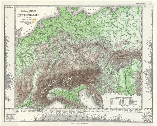
Fluss uund Bergkarte von Deutschland und den anliegenden Landern.
sold
- Digital Map Information
- Suitable for large format printing
- File Size: 4.22 MB
- File Type: ZIP / TIFF
- ICC color profile embedded
- Delivered instantly via download link
This is a beautiful example of Stieler's 1857 physical map of the rivers and mountains of Germany and its neighboring countries. It covers from Denmark to the northern part of Italy and includes the modern day countries of Germany, ... (more details)

Grossbritannien Im Maassstabe Von 1:1.500.000. Nordliches Blatt: Schottland U. Der Nordlichste Theil England's.
sold
- Digital Map Information
- Suitable for large format printing
- File Size: 10.53 MB
- File Type: ZIP / TIFF
- ICC color profile embedded
- Delivered instantly via download link
This is a beautiful example of Stieler's 1873 map of Scotland. The map covers Scotland in full from Caithness to Wigtown in the south inclusive of the Hebrides. Two insets along the right margin detail edinburgh and the Shetland ... (more details)

Nord-Westliches Deutschland, Niederlande und Belgien.
sold
- Digital Map Information
- Suitable for large format printing
- File Size: 9.81 MB
- File Type: ZIP / TIFF
- ICC color profile embedded
- Delivered instantly via download link
This is a beautiful example of Stieler's 1873 map of Holland (the Netherlands), Belgium and northwestern Germany. It covers from Holstein to Paris, France. An inset in the top right quadrant of the map details Lubeck and another ... (more details)
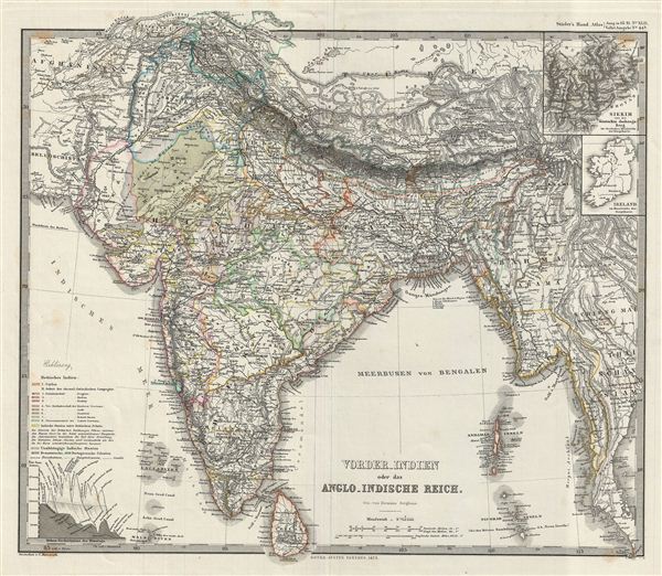
vorder-Indien oder das Anglo-Indische Reich.
sold
- Digital Map Information
- Suitable for large format printing
- File Size: 10.01 MB
- File Type: ZIP / TIFF
- ICC color profile embedded
- Delivered instantly via download link
This is a beautiful example of Stieler's 1873 map of the Indian Subcontinent. It covers the entire subcontinent from the Himalayas south as far as Ceylon (Sri Lanka) and from Sindh as far east as Burma. The modern day nations of ... (more details)

Sud-America in zwei Blattern.
sold
- Digital Map Information
- Suitable for large format printing
- File Size: 9.67 MB
- File Type: ZIP / TIFF
- ICC color profile embedded
- Delivered instantly via download link
This is a beautiful example of Stieler's 1873 map of the northern part of South America. It covers the northern part of the continent including Panama, Colombia, Venezuela, ecuador, Peru, Brazil, Bolivia, Chile and Guyana. Map is ... (more details)
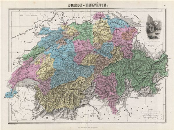
Suisse ou Helvetie.
sold
- Digital Map Information
- Suitable for large format printing
- File Size: 9.87 MB
- File Type: ZIP / TIFF
- ICC color profile embedded
- Delivered instantly via download link
This is a fine example of J. Migeon's 1878 map of Switzerland or the Helvetic Republic. The map covers the entirety of Switzerland divided into its constituent Cantons from Vaud to Grisons. The upper right quadrant features a ... (more details)

Hollande et Belgique.
sold
- Digital Map Information
- Suitable for large format printing
- File Size: 7.55 MB
- File Type: ZIP / TIFF
- ICC color profile embedded
- Delivered instantly via download link
This is a fine example of J. Migeon's 1878 map of Holland (The Netherlands) and Belgium. The map covers the United Kingdom of Netherlands including Holland and Belgium from the North Sea to the Duchy of Luxembourg. The upper ... (more details)
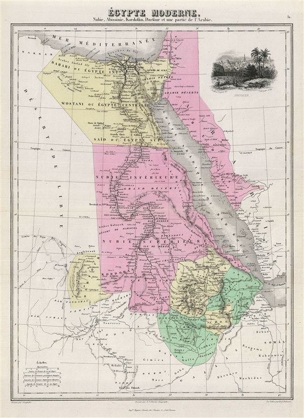
Egypte Moderne. Nubie, Abissinie, Kordofan, Darfour et une partie de l'Arabie.
sold
- Digital Map Information
- Suitable for large format printing
- File Size: 7.09 MB
- File Type: ZIP / TIFF
- ICC color profile embedded
- Delivered instantly via download link
This is a fine example of J. Migeon's 1878 map of egypt. The map covers egypt, Nubia and Abyssinia (ethiopia), Kordofan and Darfour (parts of Sudan), as well as part of Arabia. The upper right quadrant contains a beautiful ... (more details)

Algerie.
sold
- Digital Map Information
- Suitable for large format printing
- File Size: 7.21 MB
- File Type: ZIP / TIFF
- ICC color profile embedded
- Delivered instantly via download link
This is a fine example of J. Migeon's 1878 map of Algeria. The French colony of Algeria is depicted divided into the administrative districts of Oran, Alger and Constantine. The map also includes adjacent portions of ... (more details)

Siberie ou Russie d'Asie.
sold
- Digital Map Information
- Suitable for large format printing
- File Size: 8.65 MB
- File Type: ZIP / TIFF
- ICC color profile embedded
- Delivered instantly via download link
This is a fine example of J. Migeon's 1878 map of Russia in Asia. Migeon's map covers the Russian empire in Asia from european Russia and the Ural Mountains to the Bering Strait and from the Arctic Circle south as far ... (more details)