

Persia Arabia & c.
sold
- Digital Map Information
- Suitable for large format printing
- File Size: 9.56 MB
- File Type: ZIP / TIFF
- ICC color profile embedded
- Delivered instantly via download link
An excellent 1855 first edition example of Colton's map of Persia, Arabia and Afghanistan. Like most of Colton's Asia maps, this map was derived from an earlier wall map of the world produced by Colton and D. Griffing Johnson. The map covers from the ... (more details)

Turkey in Asia and the Caucasian Provinces of Russia.
sold
- Digital Map Information
- Suitable for large format printing
- File Size: 10.16 MB
- File Type: ZIP / TIFF
- ICC color profile embedded
- Delivered instantly via download link
An excellent 1855 first edition example of Colton's map of Turkey in Asia and the Caucuses. Like most of Colton's Asia maps, this map was derived from an earlier wall map of the world produced by Colton and D. Griffing Johnson. Covers from the Crimea ... (more details)

Asia.
sold
- Digital Map Information
- Suitable for large format printing
- File Size: 3.14 MB
- File Type: ZIP / TIFF
- ICC color profile embedded
- Delivered instantly via download link
An excellent 1855 first edition example of Colton's map of Asia. Like most of Colton's Asia maps, this map was derived from an earlier wall map of the world produced by Colton and D. Griffing Johnson. The map covers the entire continent from the ... (more details)

Greece and the Ionian Republic.
sold
- Digital Map Information
- Suitable for large format printing
- File Size: 9.55 MB
- File Type: ZIP / TIFF
- ICC color profile embedded
- Delivered instantly via download link
An excellent 1855 first edition example of Colton's map of Greece. Like most of Colton's europe maps, this map was derived from an earlier wall map of the world produced by Colton and D. Griffing Johnson. The map covers from Corfu to Thera and ... (more details)

Turkey in Europe.
sold
- Digital Map Information
- Suitable for large format printing
- File Size: 9.68 MB
- File Type: ZIP / TIFF
- ICC color profile embedded
- Delivered instantly via download link
An excellent 1855 first edition example of Colton's map of european Turkey. Like most of Colton's europe maps, this map was derived from an earlier wall map of the world produced by Colton and D. Griffing Johnson. This map, made when the ... (more details)

Russia.
sold
- Digital Map Information
- Suitable for large format printing
- File Size: 10.6 MB
- File Type: ZIP / TIFF
- ICC color profile embedded
- Delivered instantly via download link
An excellent 1855 first edition example of Colton's map of Russia. Like most of Colton's Russia maps, this map was derived from an earlier wall map of the world produced by Colton and D. Griffing Johnson. Depicts the european portions of ... (more details)
Reveals Italy during its Risorgimento.

Southern Italy Kingdom of Naples, I. Sardinia & Malta.
sold
- Digital Map Information
- Suitable for large format printing
- File Size: 8.9 MB
- File Type: ZIP / TIFF
- ICC color profile embedded
- Delivered instantly via download link
A beautiful 1855 first edition example of Colton's map of southern Italy. Like most of Colton's europe maps, this map was derived from an earlier wall map of the world produced by Colton and D. Griffing Johnson. Covers the southern part ... (more details)
Reveals Italy during its Risorgimento.

Northern Italy. Lombardy & Venice, Sardinia, Tuscany, Parma, Modena, Lucca, and the State of the Church.
sold
- Digital Map Information
- Suitable for large format printing
- File Size: 10.34 MB
- File Type: ZIP / TIFF
- ICC color profile embedded
- Delivered instantly via download link
A beautiful 1855 first edition example of Colton's map of northern Italy. Like most of Colton's europe maps, this map was derived from an earlier wall map of the world produced by Colton and D. Griffing Johnson. It includes Lombardy and ... (more details)
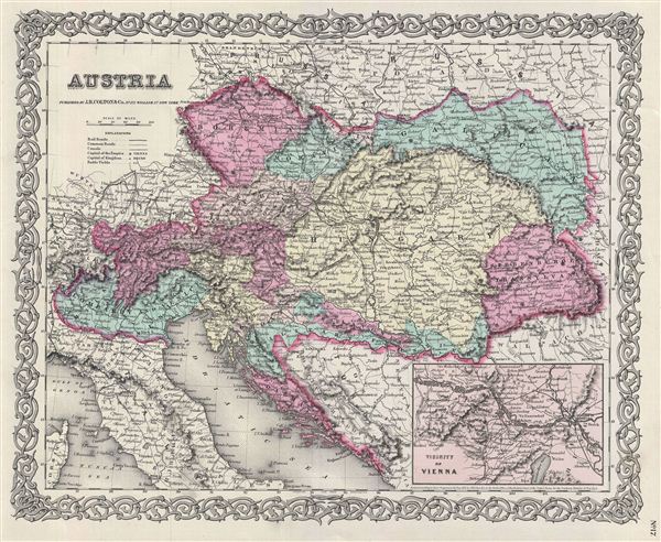
Austria.
sold
- Digital Map Information
- Suitable for large format printing
- File Size: 10.74 MB
- File Type: ZIP / TIFF
- ICC color profile embedded
- Delivered instantly via download link
A beautiful 1855 first edition example of Colton's map of the Austrian empire. Like most of Colton's europe maps, this map was derived from an earlier wall map of the world produced by Colton and D. Griffing Johnson. Covers the ... (more details)

Germany No. 3.
sold
- Digital Map Information
- Suitable for large format printing
- File Size: 9.34 MB
- File Type: ZIP / TIFF
- ICC color profile embedded
- Delivered instantly via download link
A beautiful 1855 first edition example of Colton's map of southern Germany. Like most of Colton's europe maps, this map was derived from an earlier wall map of the World produced by Colton and D. Griffing Johnson. Covers the ... (more details)

Germany No. 2.
sold
- Digital Map Information
- Suitable for large format printing
- File Size: 10.68 MB
- File Type: ZIP / TIFF
- ICC color profile embedded
- Delivered instantly via download link
A beautiful 1855 first edition example of Colton's map of western Germany. Like most of Colton's europe maps, this map was derived from an earlier wall map of the World produced by Colton and D. Griffing Johnson. Covers the ... (more details)

Denmark.
sold
- Digital Map Information
- Suitable for large format printing
- File Size: 9.25 MB
- File Type: ZIP / TIFF
- ICC color profile embedded
- Delivered instantly via download link
This is a beautiful 1855 first edition example of Colton's map of Denmark and depicts all of Denmark inclusive of the Duchy of Holstein. Like most of Colton's Europe maps, this map was derived from an earlier wall map of the world produced by Colton and D. Griffing Johnson. Three inset maps add even more detail and focus on Iceland, the Faroe Islands, and Bornholm. An index situated along the upper left border identifies Iceland's twenty-one counties. At this point in history, Scandinavia was in the midst of a prolonged period of peace and prosperity that led to a cultural and population boom. Cities, towns, forts, rivers, rapids, mountain passes, fjords, and an assortment of additional topographical details appear throughout. The whole is surrounded by Colton's iconic spiral motif border. (more details)

Holland and Belgium.
sold
- Digital Map Information
- Suitable for large format printing
- File Size: 9.84 MB
- File Type: ZIP / TIFF
- ICC color profile embedded
- Delivered instantly via download link
A beautiful 1855 first edition example of Colton's map of Holland and Belgium. Like most of Colton's europe maps, this map was derived from an earlier wall map of the World produced by Colton and D. Griffing Johnson. The ... (more details)

Spain and Portugal.
sold
- Digital Map Information
- Suitable for large format printing
- File Size: 9.74 MB
- File Type: ZIP / TIFF
- ICC color profile embedded
- Delivered instantly via download link
A beautiful 1855 first edition example of Colton's map of Spain and Portugal. Like most of Colton's europe maps, this map was derived from an earlier wall map of the World produced by Colton and D. Griffing Johnson. The ... (more details)

France.
sold
- Digital Map Information
- Suitable for large format printing
- File Size: 11.23 MB
- File Type: ZIP / TIFF
- ICC color profile embedded
- Delivered instantly via download link
An excellent 1855 first edition example of Colton's map of France. Like most of Colton's europe maps, this map was derived from an earlier wall map of the World produced by Colton and D. Griffing Johnson. The map covers ... (more details)
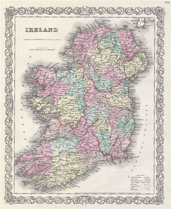
Ireland.
sold
- Digital Map Information
- Suitable for large format printing
- File Size: 9.12 MB
- File Type: ZIP / TIFF
- ICC color profile embedded
- Delivered instantly via download link
An excellent 1855 first edition example of Colton's map of Ireland. Like most of Colton's Europe maps, this map was derived from an earlier wall map of the World produced by Colton and D. Griffing Johnson. The map ... (more details)

Scotland.
sold
- Digital Map Information
- Suitable for large format printing
- File Size: 10.92 MB
- File Type: ZIP / TIFF
- ICC color profile embedded
- Delivered instantly via download link
An excellent 1855 first edition example of Colton's map of Scotland. Like most of Colton's europe maps, this map was derived from an earlier wall map of the World produced by Colton and D. Griffing Johnson. The ... (more details)
A fine map of London at the outset of the Victorian Epoch.

The Environs of London.
sold
- Digital Map Information
- Suitable for large format printing
- File Size: 10.74 MB
- File Type: ZIP / TIFF
- ICC color profile embedded
- Delivered instantly via download link
An excellent 1855 first edition example of Colton's map of London and the immediate vicinity. Includes parts of Surrey, Kent, Middlesex and essex. extends north to Southgate, east to Chadwell Heath, south to ... (more details)
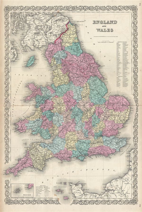
England and Wales.
sold
- Digital Map Information
- Suitable for large format printing
- File Size: 17.33 MB
- File Type: ZIP / TIFF
- ICC color profile embedded
- Delivered instantly via download link
An excellent 1855 first edition example of Colton's map of england and Wales. Like most of Colton's europe maps, this map was derived from an earlier wall map of The World produced by Colton and D. Griffing ... (more details)

Europe.
sold
- Digital Map Information
- Suitable for large format printing
- File Size: 10.25 MB
- File Type: ZIP / TIFF
- ICC color profile embedded
- Delivered instantly via download link
An excellent 1855 first edition example of Colton's map of europe. Like most of Colton's europe maps, this map was derived from an earlier wall map of the World produced by Colton and D. Griffing Johnson. ... (more details)