

Preliminary Chart of Entrance to Koos Bay Oregon.
sold
- Digital Map Information
- Suitable for large format printing
- File Size: 7.93 MB
- File Type: ZIP / TIFF
- ICC color profile embedded
- Delivered instantly via download link
An uncommon 1862 U.S. Coast Survey nautical chart or maritime map of Coos Bay (Koos Bay), Oregon. The map covers the entrance to Coos Bay from Cape Gregory to South Slough and north beyond Pigeon Point along the Coos River. The map offers fine detail both along ... (more details)

Harbor of Refuge Dutch Island Harbor Narragansett Bay Rhode Island.
sold
- Digital Map Information
- Suitable for large format printing
- File Size: 7.92 MB
- File Type: ZIP / TIFF
- ICC color profile embedded
- Delivered instantly via download link
An uncommon 1862 U.S. Coast Survey nautical chart or maritime map of Dutch Island Harbor, Narragansett Bay, Rhode Island. Dutch Island, which lies to the west of the much larger Conanicut Island, lies at the entrance to Rhode Island's Narragansett Bay. The ... (more details)
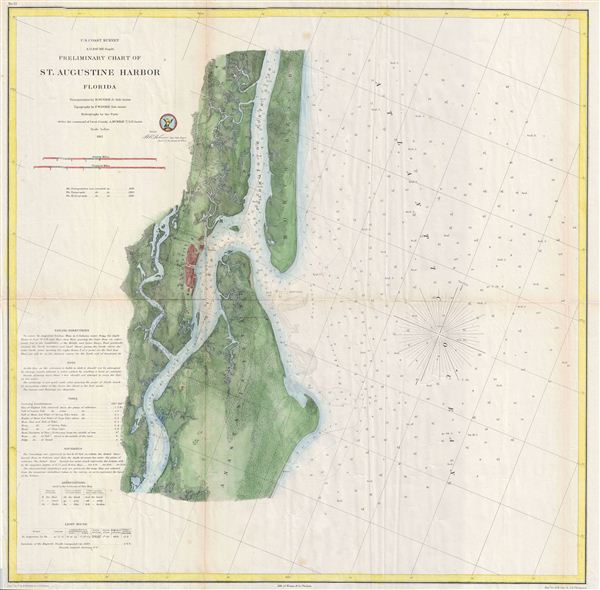
Preliminary Chart of St. Augustine Harbor Florida.
sold
- Digital Map Information
- Suitable for large format printing
- File Size: 12.31 MB
- File Type: ZIP / TIFF
- ICC color profile embedded
- Delivered instantly via download link
A highly uncommon U.S. Survey nautical chart or maritime map of St. Augustine Harbor, Florida. Centered on the city of St. Augustine (in red), the map covers from North Beach and the Tolomato or North River south to the Matanzas River and Anastasia Island. ... (more details)
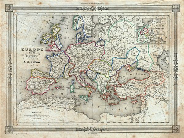
Europe a la fin du X.me Siecle.
sold
- Digital Map Information
- Suitable for large format printing
- DPI: 300
- File Size: 17.42 MB
- File Type: ZIP / TIFF
- ICC color profile embedded
- Delivered instantly via download link
An uncommon and extremely attractive 1852 map of europe at the end of the tenth Century. The map covers europe and parts of Asia as they appeared in the Middle Ages – roughly 900 A.D. An inset map in the top right corner details France under Hugues Capet ... (more details)
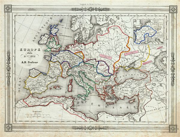
Europe a la fin du V.me Siecle.
sold
- Digital Map Information
- Suitable for large format printing
- DPI: 300
- File Size: 17.2 MB
- File Type: ZIP / TIFF
- ICC color profile embedded
- Delivered instantly via download link
An uncommon and extremely attractive 1852 map of europe at the end of the fifth Century. The map covers from modern day United Kingdom to Russia, and south to include part of egypt, and the Barbary Coast. The map includes parts of what are today Turkey, ... (more details)
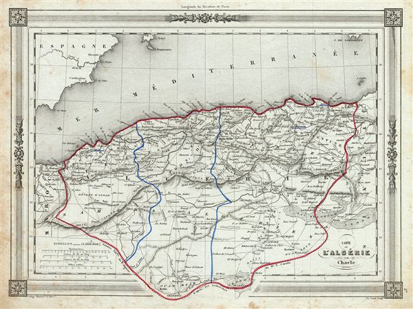
Carte l'Algerie.
sold
- Digital Map Information
- Suitable for large format printing
- DPI: 300
- File Size: 16.26 MB
- File Type: ZIP / TIFF
- ICC color profile embedded
- Delivered instantly via download link
An uncommon and extremely attractive 1852 map of Algeria. The French colony of Algeria is depicted divided into the administrative districts of Oran, Alger and Constantine. The map also includes adjacent portions of Morocco in the west and Tunis in the ... (more details)
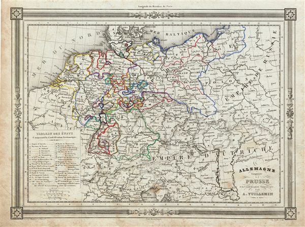
Allemagne Comprenant la Prusse et la Confederation Germanique.
sold
- Digital Map Information
- Suitable for large format printing
- DPI: 300
- File Size: 15.97 MB
- File Type: ZIP / TIFF
- ICC color profile embedded
- Delivered instantly via download link
An uncommon and extremely attractive 1852 map of Germany and Prussia. Covers the German states from the border with Holland and Belgium eastward as far as Poland and Russia; and extends south to include Bavaria. This map also shows parts of the empire ... (more details)

Empire de Charlemagne.
sold
- Digital Map Information
- Suitable for large format printing
- DPI: 300
- File Size: 16.56 MB
- File Type: ZIP / TIFF
- ICC color profile embedded
- Delivered instantly via download link
An uncommon and extremely attractive 1852 map of the empire of Charlemagne. The map covers Charlemagne's empire from modern day Germany to Italy. It also includes parts of the United Kingdom, Ireland, Greece, Spain and Portugal. Throughout, the map ... (more details)

La Greece et ses Colonies.
sold
- Digital Map Information
- Suitable for large format printing
- DPI: 300
- File Size: 16.4 MB
- File Type: ZIP / TIFF
- ICC color profile embedded
- Delivered instantly via download link
An uncommon and extremely attractive 1852 map of Greece and its colonies. The map covers from the southern part of Italy, including Sicily, to the western part of Asia Minor and from Macedonia to Crete. Throughout, the map identifies various cities, ... (more details)
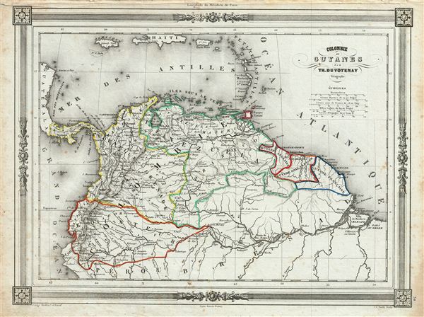
Colombie et Guyanes.
sold
- Digital Map Information
- Suitable for large format printing
- DPI: 300
- File Size: 16.52 MB
- File Type: ZIP / TIFF
- ICC color profile embedded
- Delivered instantly via download link
An uncommon and extremely attractive 1852 map of Colombia and Guyana. The map covers Gran Colombia (modern day Colombia, Venezuela, ecuador, Panama, northern Peru and northwest Brazil) and the British, Dutch and French Guyana from the Caribbean Sea ... (more details)
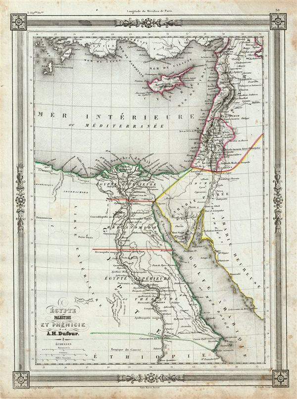
Egypte Palestine et Phenicie.
sold
- Digital Map Information
- Suitable for large format printing
- DPI: 300
- File Size: 15.77 MB
- File Type: ZIP / TIFF
- ICC color profile embedded
- Delivered instantly via download link
An uncommon and extremely attractive 1852 map of egypt and Palestine. Covers from Syria to ethiopia. Includes egypt, Cyprus, Arabia, Palestine and part of Syria. The title identifies Phoenicia, an ancient civilization which covered most of what ... (more details)
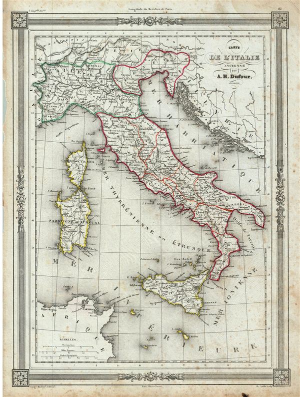
Carte de l'Italie Ancienne.
sold
- Digital Map Information
- Suitable for large format printing
- DPI: 300
- File Size: 16.88 MB
- File Type: ZIP / TIFF
- ICC color profile embedded
- Delivered instantly via download link
An uncommon and extremely attractive 1852 map of Italy during ancient Roman times. The map coves from Cisalpine Gaul to Sicily. Also includes the islands of Corsica and Sardinia. Throughout, the map identifies various cities, towns, rivers and ... (more details)

Empire Romain.
sold
- Digital Map Information
- Suitable for large format printing
- DPI: 300
- File Size: 16.23 MB
- File Type: ZIP / TIFF
- ICC color profile embedded
- Delivered instantly via download link
An uncommon and extremely attractive 1852 map of the Roman empire. The map shows the extent of the Roman empire at its height, and covers most of europe, the Middle east, Persia and parts of north Africa. Throughout, the map identifies ... (more details)
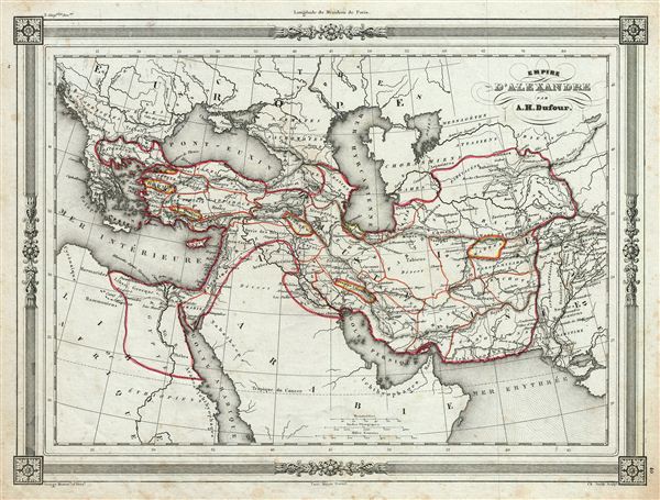
Empire d'Alexandre.
sold
- Digital Map Information
- Suitable for large format printing
- DPI: 300
- File Size: 15.67 MB
- File Type: ZIP / TIFF
- ICC color profile embedded
- Delivered instantly via download link
An uncommon and extremely attractive 1852 map of the empire of Alexander the Great. The map covers from Alexander's homeland in Macedonia eastwards past Asia Minor and Persia as far as India and south to include egypt. Both the Caspian ... (more details)
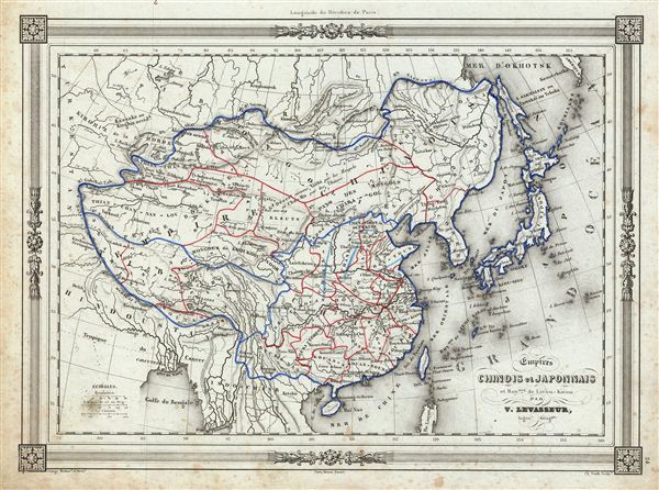
Empires Chinois et Japonnais et Roy.me de Lieou-Kieou.
sold
- Digital Map Information
- Suitable for large format printing
- DPI: 300
- File Size: 15.7 MB
- File Type: ZIP / TIFF
- ICC color profile embedded
- Delivered instantly via download link
An uncommon and extremely attractive 1852 map of China and Japan. The map covers all of Japan and covers China from Kachgar east to Korea and north as far as Siberia. extends south to include the island of Hainan. Formosa or Taiwan is ... (more details)

Royaumes de Perse Herat & Kaboul Confed.on des Baloutchis Principaute de Sindhy Conf.on des Seikhs ou Roy.me de Lahore et la partie la plus peuplee du Turkestan Independ.
sold
- Digital Map Information
- Suitable for large format printing
- DPI: 300
- File Size: 15.4 MB
- File Type: ZIP / TIFF
- ICC color profile embedded
- Delivered instantly via download link
An uncommon and extremely attractive 1852 map of Persia by Victor Levasseur. Set between the Caspian Sea and the Persian Gulf, this map covers all of modern day Iran and Afghanistan as well as parts of adjacent Pakistan, India and ... (more details)
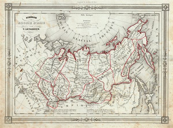
Siberie de Russie d'Asie.
sold
- Digital Map Information
- Suitable for large format printing
- DPI: 300
- File Size: 16.34 MB
- File Type: ZIP / TIFF
- ICC color profile embedded
- Delivered instantly via download link
An uncommon and extremely attractive 1852 map of the Russian in Asia by Victor Levasseur. Covers the Russian empire in Asia from european Russia the Pacific and from the Arctic Circle south as far as the Chinese empire. ... (more details)
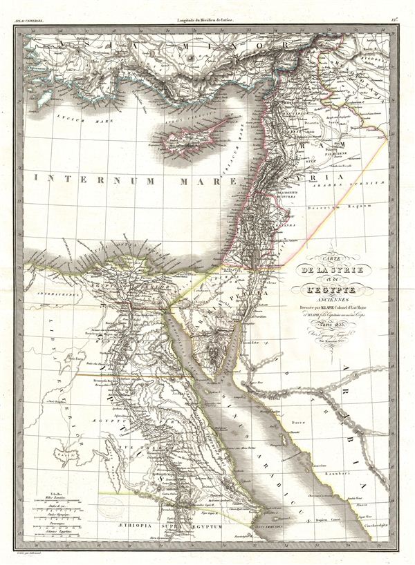
Carte de la Syrie et de l'Egypte.
sold
- Digital Map Information
- Suitable for large format printing
- DPI: 300
- File Size: 10.15 MB
- File Type: ZIP / TIFF
- ICC color profile embedded
- Delivered instantly via download link
A fine first edition example of M. Lapie's 1833 map of Syria and Ancient egypt. The map covers all of Syria and egypt from Asia Minor to the Red Sea and Arabia. This map belongs to the time when egypt was ruled by ... (more details)
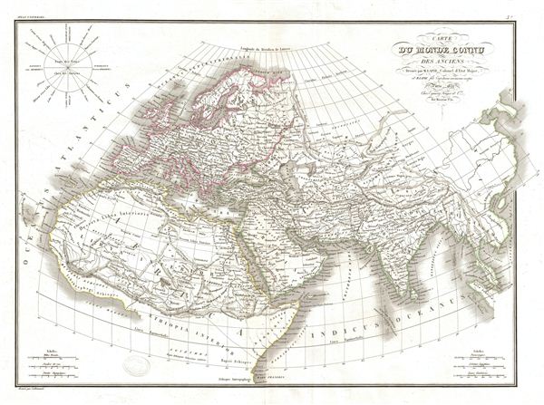
Carte du Monde Connu des Anciens.
sold
- Digital Map Information
- Suitable for large format printing
- DPI: 300
- File Size: 10.29 MB
- File Type: ZIP / TIFF
- ICC color profile embedded
- Delivered instantly via download link
A fine first edition example of M. Lapie's 1832 map of The Ancient World, including Asia, europe and Africa. The map shows the Ancient World from the Atlantic Ocean to Burma in Asia and from the Indian Ocean to the ... (more details)

Carte de la Plata de Chili et de la Patagonie.
sold
- Digital Map Information
- Suitable for large format printing
- DPI: 300
- File Size: 9.11 MB
- File Type: ZIP / TIFF
- ICC color profile embedded
- Delivered instantly via download link
A fine first edition example of M. Lapie's 1829 map of the plate of Chile and Patagonia. Centered on the United Provinces of La Plata, the map covers all of Chile, Patagonia, Paraguay and parts of Brazil and Upper ... (more details)