
The best early map of Yellowstone Park!

Yellowstone National Park and Portion of Yellowstone Forest Reserve. Geology Sheet XVII.
sold
- Digital Map Information
- Suitable for large format printing
- File Size: 23.43 MB
- File Type: ZIP / TIFF
- ICC color profile embedded
- Delivered instantly via download link
A fine example of Arnold Hague's 1904 geological survey map of the spectacular Yellowstone National Park, Wyoming. Centered on Yellowstone Lake, the map covers the entire park as well as the adjacent parts of the Yellowstone Forest Reserve. This particular map ... (more details)
The best early map of Yellowstone Park!
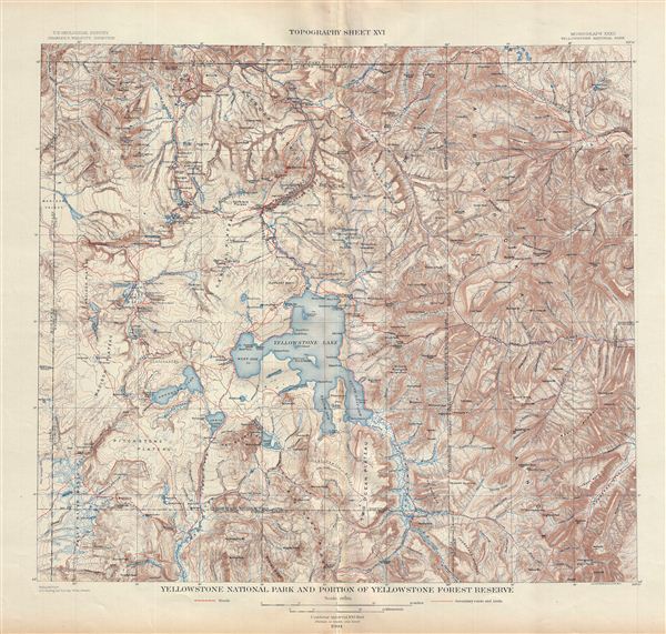
Yellowstone National Park and Portion of Yellowstone Forest Reserve. Topography Sheet XVI.
sold
- Digital Map Information
- Suitable for large format printing
- File Size: 23.1 MB
- File Type: ZIP / TIFF
- ICC color profile embedded
- Delivered instantly via download link
A fine example of Arnold Hague's 1904 topographical survey map of the spectacular Yellowstone National Park, Wyoming. Centered on Yellowstone Lake, the map covers the entire park as well as the adjacent parts of the Yellowstone Forest Reserve. This particular ... (more details)
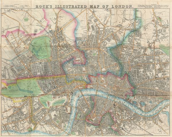
Rock's Illustrated Map of London.
sold
- Digital Map Information
- Suitable for large format printing
- DPI: 300
- File Size: 18.89 MB
- File Type: ZIP / TIFF
- ICC color profile embedded
- Delivered instantly via download link
An appealing map of Victorian London issued by William Henry Rock in 1845. Centered on the River Thames River, Rock's beautifully produced map covers central London from Kensington Palace and Kensington Gardens to Victoria Park, the Grand Surrey Inner Dock, ... (more details)
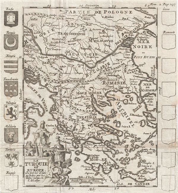
La Turquie en Europe, ou la Turquie en Europe ou font, les Etats pofedez par les Tures Jusqu en l'An 1690.
sold
- Digital Map Information
- Suitable for large format printing
- DPI: 300
- File Size: 2.64 MB
- File Type: ZIP / TIFF
- ICC color profile embedded
- Delivered instantly via download link
An uncommon c. 1700 map of Greece and the Balkans. Centered on modern day Greece this map covers from Poland to Crete (Candie) and from the Gulf of Venice to the Black Sea, inclusive of Greece, Bulgaria, Romania, Macedonia, Albania, Serbia, and Dalmatia, ... (more details)

La France Moderne.
sold
- Digital Map Information
- Suitable for large format printing
- DPI: 300
- File Size: 2.27 MB
- File Type: ZIP / TIFF
- ICC color profile embedded
- Delivered instantly via download link
An uncommon map of France issued in 1700. The map is surrounded by thirty-six armorial crests representing various French provinces. A decorative allegorical title cartouche appears in the lower left quadrant. At the opening of the 18th century France ... (more details)
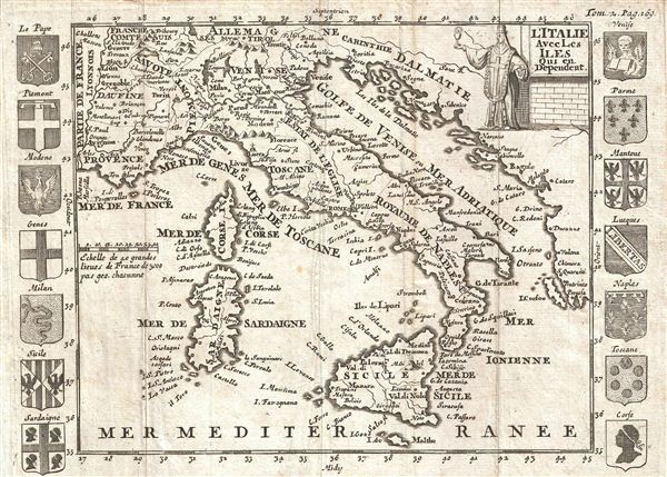
l'Italie Avec Les Iles qui en Dependent.
sold
- Digital Map Information
- Suitable for large format printing
- DPI: 300
- File Size: 1.93 MB
- File Type: ZIP / TIFF
- ICC color profile embedded
- Delivered instantly via download link
An uncommon map of Italy issued in 1700. Centered on peninsular Italy, this map covers from Provence to Corfu and from Tyrol to Malta, inclusive of Corsica, Sardinia, and Sicily. The map is surrounded by sixteen armorial crests representing various ... (more details)
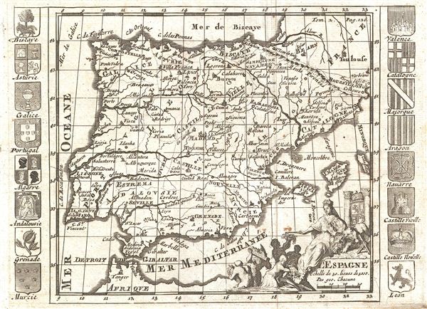
l'Espagne.
sold
- Digital Map Information
- Suitable for large format printing
- DPI: 300
- File Size: 1.96 MB
- File Type: ZIP / TIFF
- ICC color profile embedded
- Delivered instantly via download link
An uncommon c. 1700 map of Spain and Portugal. The map covers the entirety of Iberia as well as adjacent portions of Frances and Africa, and the disproportionally outsized Balearic Islands of Ibiza, Majorca, and Minorca. An elaborate allegorical ... (more details)
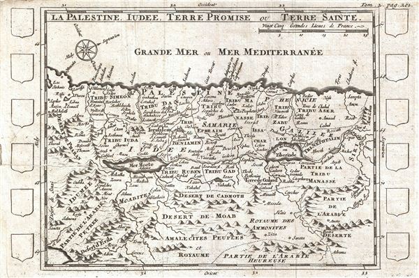
La Palestine, Iudee, Terre Promise ou Terre Sainte.
sold
- Digital Map Information
- Suitable for large format printing
- DPI: 300
- File Size: 1.95 MB
- File Type: ZIP / TIFF
- ICC color profile embedded
- Delivered instantly via download link
An uncommon c. 1700 map of Israel, Palestine, or the Holy Land. Centered on the Jordan River Valley, this map covers from the Mediterranean to the Biblical deserts of Moab and the Amalekites. Israel is divided according to the Biblical Tribes of ... (more details)
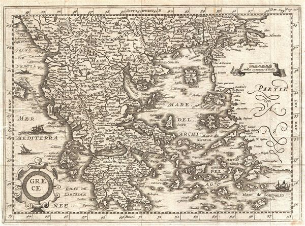
Grece.
sold
- Digital Map Information
- Suitable for large format printing
- DPI: 300
- File Size: 3.38 MB
- File Type: ZIP / TIFF
- ICC color profile embedded
- Delivered instantly via download link
An uncommon early map of Greece issued for Martineau du Plessis in 1700. Centered on the Negroponte, this map covers from the Gulf of Venice to Asia Minor and From Romania and the Sea of Marmara to Morea. Beautifully details the many island and ... (more details)

Tartarie.
sold
- Digital Map Information
- Suitable for large format printing
- DPI: 300
- File Size: 3.25 MB
- File Type: ZIP / TIFF
- ICC color profile embedded
- Delivered instantly via download link
An uncommon and unusual map of Tartary issued for Martineau du Plessis in 1700. Covering from the Caspian Sea and Moscow (Moskua) eastward to Alaska, Korea, and the Pacific and from the Arctic Sea and Nova Zembla south to Tibet. Cartographically ... (more details)
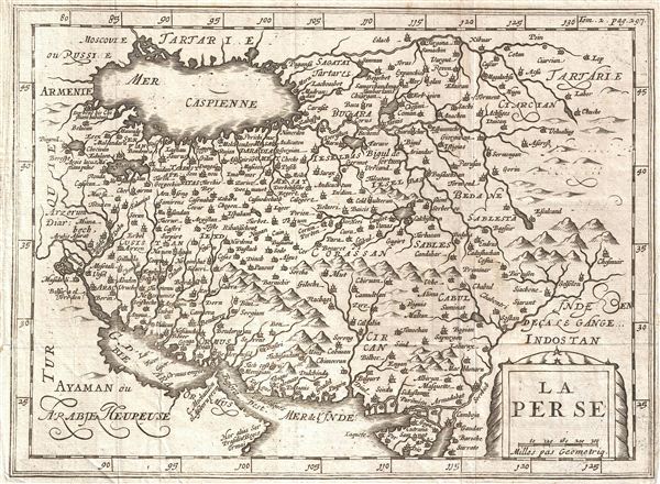
La Perse.
sold
- Digital Map Information
- Suitable for large format printing
- DPI: 300
- File Size: 2.94 MB
- File Type: ZIP / TIFF
- ICC color profile embedded
- Delivered instantly via download link
An uncommon and unusual map of Persia issued for Martineau du Plessis in 1700. Covering from the Capsian Sea to the Persian Gulf and from Armenia to India and Tartary, this is most likes a re-engraving of Kaerius' c. 1628 map of the region. ... (more details)
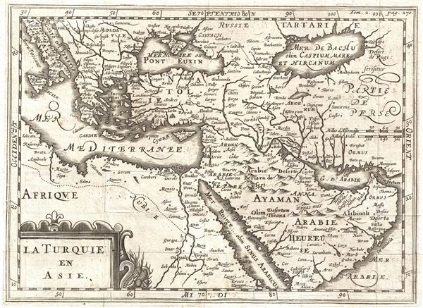
La Turquie en Asie.
sold
- Digital Map Information
- Suitable for large format printing
- DPI: 300
- File Size: 2.94 MB
- File Type: ZIP / TIFF
- ICC color profile embedded
- Delivered instantly via download link
An uncommon c. 1700 map of the Middle east issued for Maretineau du Plessis. The map covers from Italy to the Caspian Sea and from the Arabian Sea to Russia, inclusive of Arabia, egypt, Persia, Greece, Italy, and Turkey. A decorative title ... (more details)
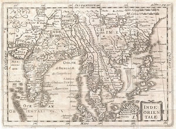
Inde Orientale.
sold
- Digital Map Information
- Suitable for large format printing
- DPI: 300
- File Size: 3.58 MB
- File Type: ZIP / TIFF
- ICC color profile embedded
- Delivered instantly via download link
An uncommon c. 1700 map of India and Southeast Asia most likely drawn by Phillip Cluver. Centered on Siam (Thailand), Cluver's map covers from western India and the Indus Valley eastward as far as China, the Philippines, and Borneo, ... (more details)
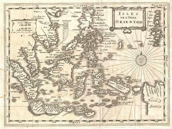
Isles de l'Inde Orientale.
sold
- Digital Map Information
- Suitable for large format printing
- DPI: 300
- File Size: 3.08 MB
- File Type: ZIP / TIFF
- ICC color profile embedded
- Delivered instantly via download link
An uncommon c. 1700 map of the east Indies by Phillip Cluver. Centered on Borneo and The Celebes, Cluver's map covers from Sumatra to New Guinea and the Mariana Islands (Larrons), and from Luzon in the Philippines and Halong Bay ... (more details)
Korea represented as an Island.

Iapon.
sold
- Digital Map Information
- Suitable for large format printing
- DPI: 300
- File Size: 2.93 MB
- File Type: ZIP / TIFF
- ICC color profile embedded
- Delivered instantly via download link
A rare map of Japan and Korea drawn by Johannus Cloppenburgh and engraved by Pieter van den Keere (Kaerius) in 1700. Cartographically this map is a reduced form Hondius' of Japan from the same period. This is second edition ... (more details)
Florida just after the outbreak of the American Civil War.

Johnson's Florida.
sold
- Digital Map Information
- Suitable for large format printing
- File Size: 7.61 MB
- File Type: ZIP / TIFF
- ICC color profile embedded
- Delivered instantly via download link
A beautiful example of A. J. Johnson and Ward's 1863 map of Florida. This rare map offers a fascinating snapshot of this secessionist state shortly following the outbreak of the American Civil War. Map shows Florida in ... (more details)
Florida on the cust of the American Civil War.

Johnson's Florida.
sold
- Digital Map Information
- Suitable for large format printing
- File Size: 7.68 MB
- File Type: ZIP / TIFF
- ICC color profile embedded
- Delivered instantly via download link
A beautiful example of A. J. Johnson and Ross C. Browning's 1861 map of Florida. This rare map offers a fascinating snapshot of this secessionist state on the cusp of the American Civil War. Map shows the FLorida in ... (more details)
Pair of Celestial Maps depicting the Northern and Southern Hemispheres.
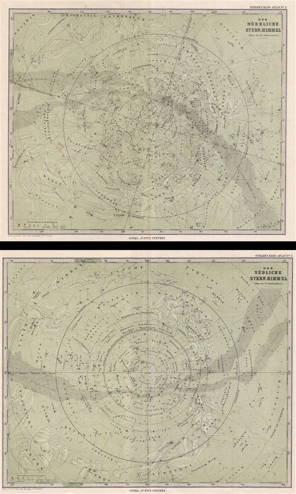
Der Nordliche Stern.Himmel. Der Sudliche Stern.Himmel.
sold
- Digital Map Information
- Suitable for large format printing
- File Size: 13.44 MB
- File Type: ZIP / TIFF
- ICC color profile embedded
- Delivered instantly via download link
A desirable set of two celestial maps depicting the stars, constellations, and comets of the northern and southern hemispheres. Both maps illustrate the night sky on a blue-green field with the constellations of the ... (more details)
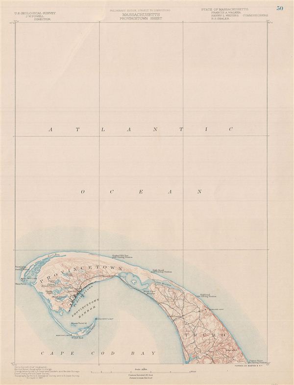
Massachusetts Provincetown Sheet.
sold
- Digital Map Information
- Suitable for large format printing
- File Size: 9.59 MB
- File Type: ZIP / TIFF
- ICC color profile embedded
- Delivered instantly via download link
A fine first edition example of the 1887 U.S. Geological Survey's map Cape Cod, Massachusetts. Covers from Gull Pamet River and Smalls Hill north along the cape as far as Provincetown Harbor and Race Point. Offers ... (more details)

Panorama of the New York Zoological Park.
sold
- Digital Map Information
- Suitable for large format printing
- File Size: 26.12 MB
- File Type: ZIP / TIFF
- ICC color profile embedded
- Delivered instantly via download link
A rare 1913 chromolithograph view of the Bronx Zoo by William Adickes. Oriented to the east, this extraordinary view offers super detail such that individual animals, from birds to elk, elephants, bison and men, ... (more details)