
1638 Jan van Linschoten Itinerario in its full French Folio Edition

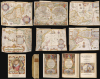
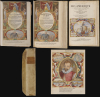
Histoire de la Navigation. / Le Grand Routier de Mer. / Description de l'Amerique.
揭开葡萄牙人眼中的东方秘密。
揭开葡萄牙人眼中的东方秘密。
这是一部精美绝伦、插图丰富、色彩绚丽的1638年法文版著作,收录了扬·惠根·范·林斯霍滕(Jan Huygen van Linschoten)的《航海记》(Itinerario) ,这部著作是地理学史上最具影响力的重要作品之一。林斯霍滕汇集了海图、航海指南和社会观察,其著作比任何其他文献都更能揭示通往东印度香料群岛的航线——首先是为荷兰人,然后是为整个欧洲。这本书在打破葡萄牙对东印度贸易的垄断方面发挥了关键作用,并直接促成了荷兰在世界贸易中的霸主地位。它的重要性立即得到认可,荷兰贸易公司向每一艘东行的船只都提供了这本书。荷兰的17世纪黄金时代,正是得益于林斯霍滕在这部著作中揭示的秘密。仔细观察
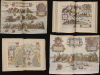
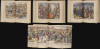
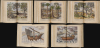
这套法文版由三卷装订而成:林斯霍滕的《航海史》(Histoire de la Navigation) 、《海上航线》 (Routier de Mer )和《美洲描述》(Description de l'Amerique )。每卷均有独立的雕版扉页和页码。此版本的一个重要特点是,它没有采用1610年法文版所用的缩小尺寸的雕版,而是采用了更受欢迎的对开本,与该书最初的荷兰语版本相同,由杜特丘姆家族(Doetechum family)雕版。《航海史》(Histoire de la Navigation)第一卷收录了林斯霍滕(Linschoten)的《航海记》(Itinerario)的法文译本。书中描述了林斯霍滕往返果阿的旅程,并着重描绘了远东地区的人民、风俗、服饰、动植物。作品的丰富细节主要源于林斯霍滕作为果阿大主教书记员的亲身经历,果阿是葡萄牙在东方的权力中心。本卷还收录了林斯霍滕的36幅版画、全景图和城镇地图——其中许多出自作者本人之手。这些作品主要描绘了果阿居民和游客的生活方式和习俗,以及印度贸易中使用的各种船只;此外,还有一些插图专门描绘了东方的香料和水果及其种植方式。
第二卷——虽然视觉效果不如第一卷那样引人注目,但历史意义更为重大——是林斯霍滕收集的前往东印度群岛的航海指南。尽管本书将其装订为第二卷,但实际上它是1595年出版的第一卷。它源自葡萄牙皇家领航员迭戈·阿方索的航海日志,其中包含从葡萄牙抵达印度,再从印度航行至东印度群岛的实用航海指南。林斯霍滕在其《航海记》(Itinerario)中的个人观察虽然具有重要的社会学价值(以及娱乐价值),但这套航海指南才是荷兰人打破葡萄牙对东印度贸易控制的关键。
第三卷《美洲描述》介绍了美洲和非洲海岸的情况。
地图
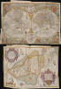
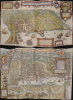
林斯霍滕的书中最为人称道的是六幅精美的大型折叠地图,这些地图穿插在正文中:- 世界: Orbis terrarum typepus de integro multis in locis emendatus。 - Petrus Plancius 1594。这是一部开创性的作品,是第一张带有寓言装饰的印刷地图。由荷兰大师 Jan van Doetecum 雕刻。
- 南美洲和加勒比海: DelineatioomniumorarumtotiusAustralispartisAmericae、dictaePeruvianae、àR.delaPlata、Brasiliam、Pariam、etCastellamauream… - 迄今为止 16 世纪出现的最佳南美洲地图。由 Arnold Florent van Langren 雕刻和设计。
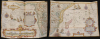
- 东亚和东南亚:精确和准确地描绘了中国、高钦纳、占城、Syao、马六甲、阿拉坎和勃固等地区的精确描绘。 - 中国、日本、韩国、东南亚、菲律宾、马六甲海峡、婆罗洲、爪哇和海滩的开创性海图。由 Henricus Van Langren(阿诺德·弗洛里斯·范·朗格伦之子)雕刻。
- 西非和南大西洋: Typus orarum maritimarum Guineae, Manicongo, et Angolae ultra promontorium Bonae Spei… - 这幅地图涵盖了从几内亚到南非的非洲,是16世纪非洲大陆最伟大的地图之一。由阿诺德·弗洛伦特·范·朗格伦以佛兰德斯风格雕刻而成。
- 东非、马达加斯加和西印度洋: Delineatio orarum maritimarum, terrae vulgo indigetatae Terra do Natal, item Sofalae, Mozambicae, et Melindae… - 这是16世纪非洲大陆最伟大的地图之一。由阿诺德·弗洛伦特·范·朗格伦以佛兰德斯风格雕刻而成。
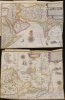
- 阿拉伯、波斯和印度: Deliniantur in hac tabula, orae maritimae Abexiae, freti Mecani; al. Maris Rubri; Arabiae, Ormi, Persiae… - 这幅地图涵盖了从阿拉伯半岛到苏门答腊的广大区域,是近代早期印度洋贸易路线最详尽的地图之一。由亨利克斯·范·朗格伦(阿诺德·弗洛里斯·范·朗格伦之子)雕刻。
无与伦比的访问权限
林斯霍滕于1583年至1589年间担任果阿大主教的秘书,凭借其独特的优势,他得以收集与葡萄牙帝国相关的各种信息,并在返回荷兰后迅速将其出版。他的《游记》(Itinerario)详细描述了东方的土地,以及他雇主遇到的不同民族,包括他们的服饰、宗教和习俗,这构成了他著作的主要部分。然而,他抄录的葡萄牙海图、航海指南和港口间航行指南对荷兰人来说犹如晴天霹雳,荷兰人迅速利用这些新信息夺取了利润丰厚的香料贸易的控制权。林斯霍滕的著作在历史上的影响几乎无人能及。如果没有《游记》 ,荷兰人将很难打破葡萄牙对东印度贸易的垄断,荷兰的黄金时代也可能就不会到来。出版历史和人口普查
这本1638年版的林斯霍滕著作由埃弗特·克洛彭堡在阿姆斯特丹出版。书中的插图和地图由约翰内斯·范·多特胡姆及其子小约翰内斯和约翰内斯·巴普蒂斯塔,以及阿诺德·弗洛里斯·范·朗格伦及其子亨利克斯·范·朗格伦雕刻,并收录于1596年荷兰语版的林斯霍滕《游记》(Itinerario, voyage ofte schipvaert van Jan Huygen Van Linschoten naer Oost ofte Portugaels Indien)中。这些插图和地图在林斯霍滕著作的所有后续版本中均有保留。这是一部精美绝伦、色彩丰富的1638年法文版著作,收录了扬·惠根·范·林斯霍滕最重要的地理著作之一—— 《游记》 。林斯霍滕汇编的海图、航海指南和社会学观察,比任何其他文献都更能揭示通往东印度香料群岛的道路——这条道路首先被荷兰人知晓,随后又被欧洲其他国家所熟知。这本书在打破葡萄牙对东印度贸易的垄断方面发挥了至关重要的作用,并直接促成了荷兰在世界贸易中的霸主地位。它的重要性立即得到认可,荷兰贸易公司向每一艘东行的船只都提供了副本。荷兰的17世纪黄金时代,正是得益于林斯霍滕在这部著作中揭示的秘密。Cartographers
Jan Huyghen van Linschoten (1563 - February 8, 1611) was a Dutch merchant, cartographer, and historian active in the late 16th century. He was born in Haarlem, the son of a public notary, but moved to Enkhuizen shortly thereafter. In 1576, at 14, Linschoten relocated to Spain to apprentice as a merchant under his older brother, Willem van Linschoten, then active in Seville. He remained until 1580, when he took work in Lisbon, Portugal, under another merchant. He held this position only briefly before Willem introduced him to the Archbishop of Portuguese Goa, Dominican Vicente da Fonseca, who appointed him secretary. Accompnying Vicente da Fonseca, Linschoten arrived in Goa in September of 1583. He remained under Vicente da Fonseca for the next four years, often traveling with the Archbishop to far of locations such as China and Japan. During that time, he became fascinated with Asian cultures and their interaction with Europeans. With access at the highest level, he copied numerous maps and other documents, as well as records on sea routes to and from Goa, and trade agreements. When Vicente da Fonseca died in 1587, Jan Huyghen boarded a ship back to Holland, but was waylaid en route by a pirate attack and shipwreck in the Azores, where he remained until 1592. Back in Holland, Jan Huyghen joined the 1594 expedition of Willem Barentsz to the Kara Sea, north of Russia, in search of the fabled Northeast Passage to Asia. The Barentsz expedition was a failure, but Jan Huyghen survived and back in Holland with the support of Cornelius Claesz, he published an account the voyage. He also published a journal of his travels in Asia, in the process revealing a wealth of Portuguese trade secrets which ultimately influenced Dutch and English attempts to take over the East Asia trade. Among these he revealed was the ‘key’ to unlocking the Portuguese grip on passage through the Malacca Strait. He suggested traders approach the East Indies through the Sunda Strait, thereby circumventing Portuguese patrols in Malacca. This passage eventually became the main VOC thoroughfare into Southeast Asia and led to the Dutch colonization of the East Indies. In 1595 he married Reynu Meynertsdr Seymens, also of Enkhuizen. He remained with his family in Linschoten died in Enkhuizen, where he had worked as town treasurer until his death in 1611. Further Details...
Joannes van Doetecum the Elder (1530 - 1605) was a Dutch engraver and cartographer, known for his etchings after Breughel, and an array of maps engraved on his own behalf and that of an array of cartographers. He was born in Deventer, and moved to Haarlem in 1578. He was the start of a dynasty of Dutch map engravers whose work appears on the maps of Gerard De Jode, Abrahanm Ortelius, Jan van Linschoten, Plancius, Plantin, Waghanaer, Jansson, and Visscher. His engraver family included his brother Lucas (fl. 1558 - 1593,) and his sons Johannes II )(fl. 1592-1630) Peter, and Baptista. Despite their prolific work, very little is known about the Doetecum family. Further Details...
Source
Linschoten, J. H., Histoire de la Navigation, (Amsterdam: Cloppenburgh) 1638.
Condition
Very good. Folio [12.5 x 8.5 inches], engraved title, (4) ff. including portrait. 206 pp.; (2) ff. including second title, 181 pp.; (1) f. engraved title, 79 pp. (numbered1-60; 67-86) 36 plates and 6 folding maps. Contemporary vellum over pasteboards, rebound. Mends to a few plates; occasional separation at junctures of folds. Else an excellent example.
References
OCLC 8064775. Rumsey 12236.000. Borba, R., Bibliographia Brasiliana: A Bibliographical Essay on Rare Books About Brazil Published from 1504 to 1900 490. Tiele, P. A., Nederlandsche bibliographie 686-88. Lach D. F., Asia in the Making of Europe 1.1.196-204 and 482-90. Burnell and Tiele, The Voyage of John Huyghen van Linschoten to the East Indies Hakluyt Society. Sabin, J., A dictionary of books relating to America: from its discovery to the present time, 41366. Bagrow, L., History of Cartography, fig. 59. Shirley, R.W., The Mapping of the World, p. 187.