
1840 Daussy Nautical Map of the Philippines, Celebes, and Maluku Islands


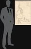
Carte des Iles Philippines, Célèbes et Moluques.
French colonial interest in the Philippines. Also, rectification of charts.
- Digital Map Information
- Suitable for large format printing
- Full resolution TIFF file
- ICC color profile embedded
- Delivered instantly via download link
French colonial interest in the Philippines. Also, rectification of charts.
A spectacular 1840 / 1852 map of the Philippines by Pierre Daussy and the French Dépot-général de la Marine. This map is significant as it reflects growing French interest in the Far East and coincides with the first French attempt to seize the Philippine island of Basilan as a base to counterbalance British power in Hong Kong. It is also part of the French Bureau des Longitudes' ongoing effort to revise its Table des Positions Géographiques des Principaux Lieux du Globe to conform to the most up-to-date measurements made possible by advances in hydrography, including widespread early 19th century adoption in the marine chronometer. Daussy published dozens of new charts, including this one, to reflect the significant corrections.A Closer Look
Centered on the Philippine archipelago, coverage embraces from the southernmost tip of Taiwan to Australia's Cape York, including the Celebes, in full, and parts of adjacent Borneo and New Guinea. The Philippines are central, reflecting their longstanding centrality to regional trade as the crossroads of the Pacific and Southeast Asia.This map was issued in the context of growing French interest in the Far East following the First Opium War (1839 - 1842). Wary of allowing Britain free rein in the China Trade, France moved quietly to establish a presence in the region, sending Admiral Jean-Baptiste Cécille (1787 - 1873) with a fleet of warships. Cécille was ostensibly in the region to protect French Catholic missionaries, traders, and whalers, but his true objectives were to establish a French foothold in East Asia. In 1843, Cécille ordered an attack on Vietnam, marking the beginning of French intervention in Indochina. He next attempted to seize the Philippine island of Basilan, believing it was well-suited to counterbalance the growing British presence in Hong Kong, but the attempt was rebuffed by Spain and indigenous Filipinos.
In the words of map collector Peter Geldart,
In 1844, the French Foreign Minister François Guizot decided to send a plenipotentiary to China to negotiate a treaty comparable to the 1842 Anglo-Chinese Treaty of Nanking, and the creation of a naval station. The Lagrené Mission, named after its head Joseph Théodose de Lagrené, obtained its principal objectives with the signing of the 1844 Treaty of Whampoa. The mission was also tasked with gathering information on Singapore, Java, and Cochin China, and the search for a territory to occupy in Southeast Asia. Guizot instructed Lagrené to use 'the naval resources at his disposal to find a favorable spot satisfying the following requirements: near the Chinese Empire, a vast enclosed port, an isolated position that is easy to defend, a healthy climate, and abundant good water'. (Geldart, Peter, 'The French in Basilan')
Publication History and Census
This map was designed by Pierre Daussy for the Dépot-général de la Marine in 1840. The present example bears updates and revisions to 1852. It was engraved by Chassant, with lettering by J. M. Hacq. It is rare and not cataloged in Quirino. We see only one example in OCLC, located at the Universiteitsbibliotheek Utrecht, and one additional example at the David Rumsey Collection.Cartographers
Pierre Daussy (October 8, 1792 - September 5, 1860) was a French astronomer and hydrographic engineer with the Bureau des Longitudes and later the Dépôt des Cartes et Plans de la Marine, which he led as Director in the years prior to his death. Daussy was born in Paris, the son of hydrographer Magloire Thomas Daussy (1758 - 1826). He followed in his father's footsteps, studying at the École des Ingénieurs Hydrographes before undertaking hydrographic work in the North Sea under the command of Charles-François Beautemps-Beaupré. He graduated to the rank of engineer in 1819 and chief engineer in 1829. In 1833, he began work with the Bureau des Longitudes correcting the French Table des Positions Géographiques des Principaux Lieux du Globe to conform with the most recent measurements made possible by new hydrographic instruments and methodologies. He was elected Director of the Dépôt des Cartes et Plans de la Marine in 1855. He also served as the President of the Société de Géographie de Paris in his later years and published several works on hydrography and navigation, particularly relating to the coasts of the Ottoman Empire and Persia. Further Details...
Dépôt des Cartes et Plans de la Marine (fl. 1720 - present), often called the Dépôt Général de la Marine, was a French hydrographic mapping organization founded in 1720 under Charles-Hercule of Albert de Luynes (1674 - 1734). Much like the U.S. Coast Survey, the British Admiralty, and the Spanish Deposito Hydrografico, the Dépôt was initiated as a storehouse and distribution center of existing nautical and marine charts. Eventually the Dépôt initiated its own mapping activities in an attempt to improve and expand upon existing material. Some of the more prominent cartographers and hydrographers associated with the of Dépôt Générale des Cartes were, Philippe Buache, Jacques-Nicholas Bellin, Giovanni Rizzi-Zannoni, Rigobert Bonne, and Jean Nicolas Buache. Further Details...
Jacques-Marie Hacq (September 22, 1785 – 18??) was a French letter and line engraver, and historian, active in Paris during the middle part of the 19th century. Hacq was born in Paris and trained under J. P. Besançon, who he succeeded at the Dépôt de la Guerre in 1830. He engraved for the Dépôt de la Guerre as early as 1830 and for the Dépôt des Cartes et Plans de la Marine from, at least, 1840 to 1852. In addition to his work for the French Government, he also completed maps and engravings for Lesage, Lapie, Dufour, Duperrez, Gouvion St. Cyr, and Dumont d'Urville. His historical works include a history of the Napoleonic Wars and a history of Paris under the reign of Louis XIII. During most of his career in Paris he lived at 58 Rue de la Harpe. Further Details...
Chassant (fl. c. 1830 - 1860) was a French line and chart engraver active in Paris in the middle part of the 19th century. Chassant was active with the French Dépôt de Marine from the 1830s into the 1860s. He was a master engraver and, some have argued, his dramatic hachuring work to illustrate topography suggests he may have been wasted on nautical charts. Most of his engraving was completed in partnerships with Jacques-Marie Hacq (September 22, 1785 – 18??). Chassant did not sign any of his engravings with a first name or other identifier, so it is difficult to track him down. He may be Alphonse Antoine Louis Chassant (August 1, 1808 - September 7, 1907), who in later life was an art historian and librarian of the city of Évreux. He wrote several books, including works on engraving. We cannot alas verify the connection and it may be pure guesswork. Further Details...
Condition
Very good. Spot of expert restoration in the Sulu Sea. Else very clean.
References
OCLC 902603729. Rumsey 14392.024.