
1840 Daussy Nautical Map of the Philippines, Celebes, and Maluku Islands


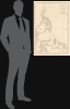
Carte des Iles Philippines, Célèbes et Moluques.
法國對菲律賓的殖民興趣。此外,還有海圖校正工作。
- Digital Map Information
- Suitable for large format printing
- Full resolution TIFF file
- ICC color profile embedded
- Delivered instantly via download link
法國對菲律賓的殖民興趣。此外,還有海圖校正工作。
這是一幅由皮埃爾·多西和法國海軍總局於1840/1852年繪製的精美菲律賓地圖。這張地圖意義非凡,因為它反映了法國對遠東日益增長的興趣,並且恰逢法國首次試圖佔領菲律賓巴西蘭島,以此作為制衡英國在香港勢力的基地。此外,它也是法國經度局持續修訂其《全球主要地點地理表》(Table des Positions Géographiques des Principaux Lieux du Globe)的一部分,旨在使其符合水文測量學進步帶來的最新測量數據,包括19世紀早期航海鐘的廣泛應用。多西出版了數十幅新海圖,包括這張地圖,以反映這些重要的修正。仔細觀察
以菲律賓群島為中心,涵蓋範圍從台灣最南端延伸至澳洲約克角,包括整個蘇拉威西島以及鄰近的婆羅洲和新幾內亞的部分地區。菲律賓位於中心位置,這反映了其作為太平洋和東南亞十字路口,在區域貿易中長期以來的核心地位。這張地圖的繪製背景是第一次鴉片戰爭(1839-1842)後法國對遠東日益增長的興趣。法國擔心英國在對華貿易中肆意妄為,於是悄悄地在該地區建立勢力,派遣海軍上將讓-巴蒂斯特·塞西爾(1787-1873)率領一支艦隊。塞西爾表面上是為了保護法國天主教傳教士、商人和捕鯨者,但他真正的目的是在東亞建立法國的立足點。 1843年,塞西爾下令進攻越南,標誌著法國對印度支那的干預正式開始。隨後,他試圖佔領菲律賓的巴西蘭島,認為該島能夠有效地制衡英國在香港日益增長的影響力,但這一企圖遭到了西班牙和菲律賓土著居民的抵抗。
用地圖收藏家彼得‧格爾達特的話來說,
1844年,法國外交部長弗朗索瓦·基佐決定派遣一名全權代表前往中國,談判一項類似1842年《南京條約》的條約,並建立海軍基地。拉格雷內使團以其團長約瑟夫·泰奧多斯·德·拉格雷內的名字命名,並於1844年透過簽署《黃埔條約》實現了其主要目標。該使團還負責收集有關新加坡、爪哇和交趾支那的情報,並在東南亞尋找可佔領的領土。基佐指示拉格雷內「利用其所掌握的海軍資源,尋找一個符合以下條件的理想地點:靠近中華帝國、擁有廣闊的封閉式港口、位置偏僻易於防守、氣候宜人、水源充足。」(彼得·蓋爾達特,《法國人在巴西蘭島》)
出版歷史和人口普查
這張地圖由皮埃爾·多西 (Pierre Daussy) 於 1840 年為法國海軍總局 (Dépot-général de la Marine) 設計。現存版本包含 1852 年的更新和修訂。地圖由沙桑 (Chassant) 雕刻,文字由 J.M. 哈克 (J.M. Hacq) 標註。此地圖極為罕見,奎裡諾 (Quirino) 的目錄中未收錄。我們在 OCLC 中僅找到一份,藏於烏特勒支大學圖書館 (Universiteitsbibliotheek Utrecht);此外,大衛·拉姆西 (David Rumsey) 收藏中也藏有一份。Cartographers
Pierre Daussy (October 8, 1792 - September 5, 1860) was a French astronomer and hydrographic engineer with the Bureau des Longitudes and later the Dépôt des Cartes et Plans de la Marine, which he led as Director in the years prior to his death. Daussy was born in Paris, the son of hydrographer Magloire Thomas Daussy (1758 - 1826). He followed in his father's footsteps, studying at the École des Ingénieurs Hydrographes before undertaking hydrographic work in the North Sea under the command of Charles-François Beautemps-Beaupré. He graduated to the rank of engineer in 1819 and chief engineer in 1829. In 1833, he began work with the Bureau des Longitudes correcting the French Table des Positions Géographiques des Principaux Lieux du Globe to conform with the most recent measurements made possible by new hydrographic instruments and methodologies. He was elected Director of the Dépôt des Cartes et Plans de la Marine in 1855. He also served as the President of the Société de Géographie de Paris in his later years and published several works on hydrography and navigation, particularly relating to the coasts of the Ottoman Empire and Persia. Further Details...
Dépôt des Cartes et Plans de la Marine (fl. 1720 - present), often called the Dépôt Général de la Marine, was a French hydrographic mapping organization founded in 1720 under Charles-Hercule of Albert de Luynes (1674 - 1734). Much like the U.S. Coast Survey, the British Admiralty, and the Spanish Deposito Hydrografico, the Dépôt was initiated as a storehouse and distribution center of existing nautical and marine charts. Eventually the Dépôt initiated its own mapping activities in an attempt to improve and expand upon existing material. Some of the more prominent cartographers and hydrographers associated with the of Dépôt Générale des Cartes were, Philippe Buache, Jacques-Nicholas Bellin, Giovanni Rizzi-Zannoni, Rigobert Bonne, and Jean Nicolas Buache. Further Details...
Jacques-Marie Hacq (September 22, 1785 – 18??) was a French letter and line engraver, and historian, active in Paris during the middle part of the 19th century. Hacq was born in Paris and trained under J. P. Besançon, who he succeeded at the Dépôt de la Guerre in 1830. He engraved for the Dépôt de la Guerre as early as 1830 and for the Dépôt des Cartes et Plans de la Marine from, at least, 1840 to 1852. In addition to his work for the French Government, he also completed maps and engravings for Lesage, Lapie, Dufour, Duperrez, Gouvion St. Cyr, and Dumont d'Urville. His historical works include a history of the Napoleonic Wars and a history of Paris under the reign of Louis XIII. During most of his career in Paris he lived at 58 Rue de la Harpe. Further Details...
Chassant (fl. c. 1830 - 1860) was a French line and chart engraver active in Paris in the middle part of the 19th century. Chassant was active with the French Dépôt de Marine from the 1830s into the 1860s. He was a master engraver and, some have argued, his dramatic hachuring work to illustrate topography suggests he may have been wasted on nautical charts. Most of his engraving was completed in partnerships with Jacques-Marie Hacq (September 22, 1785 – 18??). Chassant did not sign any of his engravings with a first name or other identifier, so it is difficult to track him down. He may be Alphonse Antoine Louis Chassant (August 1, 1808 - September 7, 1907), who in later life was an art historian and librarian of the city of Évreux. He wrote several books, including works on engraving. We cannot alas verify the connection and it may be pure guesswork. Further Details...
Condition
Very good. Mended centerfold split to the right with no loss. Spot of expert restoration in the Sulu Sea. Else very clean.
References
OCLC 902603729. Rumsey 14392.024.