
1845 Depot de Marine Set of 5 Maps / Charts of Singapore and Malacca

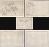
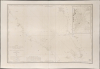
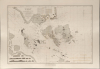
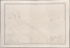
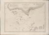
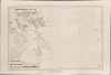
Carte des Atterrages de Singapore. / Carte Particulière des détroits de Singapore, Durian et Rhio. / Carte des Détroits de Singapore, Durian et Rhio et des Parages Environnants. / Carte du Détroit del Malacca Partie Septentrionale. / Carte du Détroit de Malacca Partie Méridionale.
The French set their eyes on Singapore.
- Digital Map Information
- Suitable for large format printing
- Full resolution TIFF file
- ICC color profile embedded
- Delivered instantly via download link
The French set their eyes on Singapore.
An exceptional set of five rare 1840s nautical maps/charts detailing Singapore, Malaya, and the Straits of Malacca and Singapore compiled by Urban Dortet de Tessan for the French Dépôt-Général de la Marine. The charts correspond to the Lagrené Mission, a French attempt to establish a colonial presence in East and Southeast Asia that challenged British regional hegemony.Historical Context
In the words of map collector Peter Geldart,In 1844, the French Foreign Minister François Guizot decided to send a plenipotentiary to China to negotiate a treaty comparable to the 1842 Anglo-Chinese Treaty of Nanking, and the creation of a naval station. The Lagrené Mission, named after its head Joseph Théodose de Lagrené, obtained its principal objectives with the signing of the 1844 Treaty of Whampoa. The mission was also tasked with gathering information on Singapore, Java, and Cochin China, and the search for a territory to occupy in Southeast Asia. Guizot instructed Lagrené to use 'the naval resources at his disposal to find a favorable spot satisfying the following requirements: near the Chinese Empire, a vast enclosed port, an isolated position that is easy to defend, a healthy climate, and abundant good water'. (Geldart, Peter, 'The French in Basilan')
A Closer Look
The collection consists of five maps, going from specific to general:- Carte des Atterrages de Singapore - At roughly half the size of the other charts, this is the smallest but largest-scale chart of the group, focusing on the southern part of Singapore Island, Singapore City, and the immediate environs of the Strait of Singapore. The map clearly shows Singapore City's street grid, government offices, areas cordoned off for Chinese, and surrounding rice fields and mangrove swamps. We see only a digital example of this at the National Library of Singapore (Maps H.F.SEC.18.(1163.)) that references the British Library, which likely holds the only other known physical example.
- Carte Particulière des détroits de Singapore, Durian et Rhio - This chart covers the southern tip of Malaya, including the Island of Singapore and the islands to the immediate south: Batam, Bintang (Bintan), Bulan, Sugi, and Moro, as well as parts of Sumatra. It details the Singapore Strait and the Johor Straits. Many of the islands to the south of Singapore and west of Batam are tenuously charted. In the lower left, in Sumatra, there are 11 coastal profiles.
- Carte des Détroits de Singapore, Durian et Rhio et des Parages Environnants... - This more general chart extends from southern Malaya and the Straits of Johor south to roughly modern-day Paritbawoeng, Sumatra. It includes the islands of Lingin (Lingga) and Sinkep (Singkep), and reaches east as far as the Badas Islands and Pulau Tambelan Besar.
- Carte du Détroit del Malacca Partie Septentrionale... - This general chart covers the northern parts of the Strait of Malacca between Sumatra and Malaya. Coverage extends from Penang (Georgetown is labeled simply as “ville”) to the River Colong (Klang) in the vicinity of modern-day Kuala Lumpur (founded 1857). It includes a detailed inset ascribed to one Lieut. T. Woore (1832), covering the eastern part of Penang Island in the vicinity of Georgetown, Malaya, and the River Prya (Perai / Butterworth), and features dense soundings throughout the intervening strait, including the Grand Plateau de Kra.
- Carte du Détroit de Malacca Partie Méridionale... - This general chart covers the southern parts of the Strait of Malacca, from the vicinity of modern-day Kuala Lumpur south to include parts of Malaya, Sumatra, and Singapore. Soundings are most dense in the vicinity of Singapore City and the Strait of Singapore.
Publication History and Census
The three specific charts engraved are based on earlier British charts and new cartography compiled by Dortet de Tessan. They were engraved by Chassant and Jacques Marie Hacq. The two general charts of the Strait of Malacca are derived from British Admiralty charts and were engraved by Stanislas Jacobs and Hacq. The present examples, dated 1843-48, are first editions.These charts are rare individually and may be considered otherwise unobtainable as a set. We are aware of occasional examples of the Durian et Rhio to appear on the market, and likewise, the two Malacca Strait charts, but the detail chart of Singapore Island, Carte des Atterrages de Singapore, is known in only one other example, held at the British Library. The National Library Board of Singapore has a digitized version that is likely a copy of the BL map. No market history individually or as a set.
Cartographers
Urbain Dortet de L'Espigarié de Tessan (August 25, 1804 - September 30, 1879) was a French physicist and Hydrographer Engineer active in Paris during the early to middle part of the 19th century. Tessan was considered among the most scientific of cartographers active at the time, and his work is notable for its meticulousness and precision. Tessan was born in Vigan, the scion of an old Languedoc family. He graduated from the École Polytechnique in 1825. On graduation, he was placed in the command of Beautemps-Beaupré (1824), under whom he participated in the Gironde estuary campaigns (surveying shifting sandbanks) and Bayonne (1825 - 26), before conducting seabed surveys at Saint-Malo and Saint-Brieuc. He was then reassigned to Lieutenant Commander A. Bérard of the brig Le Loiret; with whom he mapped the Algerian coast, devising in the process a new technique for offshore surveying (1831 - 33). From 1836 to 1839, he participated as expedition meteorlogist on the Abel Aubert Dupetit-Thouars (1793 - 1864) expedition, a scientific-naval westward circumnavigation of the globe on the frigate Vénus. After the circumnavigation, he worked mostly in and around France, retiring in 1852 as a first-class engineer. In 1861, he was voted a full member of l'Académie des Sciences. Tessan published several important works on physics, hydrography, astronomy, and more. Some of his more significant research presaged the invention of sonar over one hundred years later. Further Details...
Dépôt des Cartes et Plans de la Marine (fl. 1720 - present), often called the Dépôt Général de la Marine, was a French hydrographic mapping organization founded in 1720 under Charles-Hercule of Albert de Luynes (1674 - 1734). Much like the U.S. Coast Survey, the British Admiralty, and the Spanish Deposito Hydrografico, the Dépôt was initiated as a storehouse and distribution center of existing nautical and marine charts. Eventually the Dépôt initiated its own mapping activities in an attempt to improve and expand upon existing material. Some of the more prominent cartographers and hydrographers associated with the of Dépôt Générale des Cartes were, Philippe Buache, Jacques-Nicholas Bellin, Giovanni Rizzi-Zannoni, Rigobert Bonne, and Jean Nicolas Buache. Further Details...
Jacques-Marie Hacq (September 22, 1785 – 18??) was a French letter and line engraver, and historian, active in Paris during the middle part of the 19th century. Hacq was born in Paris and trained under J. P. Besançon, who he succeeded at the Dépôt de la Guerre in 1830. He engraved for the Dépôt de la Guerre as early as 1830 and for the Dépôt des Cartes et Plans de la Marine from, at least, 1840 to 1852. In addition to his work for the French Government, he also completed maps and engravings for Lesage, Lapie, Dufour, Duperrez, Gouvion St. Cyr, and Dumont d'Urville. His historical works include a history of the Napoleonic Wars and a history of Paris under the reign of Louis XIII. During most of his career in Paris he lived at 58 Rue de la Harpe. Further Details...
Chassant (fl. c. 1830 - 1860) was a French line and chart engraver active in Paris in the middle part of the 19th century. Chassant was active with the French Dépôt de Marine from the 1830s into the 1860s. He was a master engraver and, some have argued, his dramatic hachuring work to illustrate topography suggests he may have been wasted on nautical charts. Most of his engraving was completed in partnerships with Jacques-Marie Hacq (September 22, 1785 – 18??). Chassant did not sign any of his engravings with a first name or other identifier, so it is difficult to track him down. He may be Alphonse Antoine Louis Chassant (August 1, 1808 - September 7, 1907), who in later life was an art historian and librarian of the city of Évreux. He wrote several books, including works on engraving. We cannot alas verify the connection and it may be pure guesswork. Further Details...
Stanislas Joseph Jacobs (18?? – July 5, 1867) was a French line engraver active in Paris during the middle part of the 19th century. Jacobs did work for the both the Dépôt de la Guerre ad Dépôt de la Guerre and the Dépôt des Cartes et Plans de la Marine. He often worked with Jacques-Marie Hacq. His most important publication is most likely the Eugène Duflot de Mofras map of the American west, published in 1844. Stanislas was a member of the French Société de Géographie from 1842. In 1862 Stanislas' son, Alfred Joseph Jacobs (December 15, 1827 - July 16, 1889), also an engraver, descended into mental illness and was consigned the Charenton hospice. His son's illness apparently catapulted Stanislas into a deep unremitting despair. Stanislas retired in 1862. He was married to Thérèse Alexandrine Outrequin (January 28, 1804 – February 20, 1873). He lived in Paris at Rue De Condé, 1. Further Details...
Condition
Very good. Slight offsetting. Measurement is for the largest charts. The smaller chart is 20 x 27.5 in. Scales vary.