
1845 Depot de Marine Set of 5 Maps / Charts of Singapore and Malacca

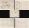
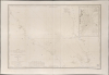
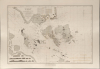
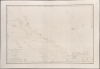
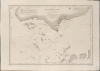
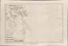
Carte des Atterrages de Singapore. / Carte Particulière des détroits de Singapore, Durian et Rhio. / Carte des Détroits de Singapore, Durian et Rhio et des Parages Environnants. / Carte du Détroit del Malacca Partie Septentrionale. / Carte du Détroit de Malacca Partie Méridionale.
法国人将目光投向了新加坡。
- Digital Map Information
- Suitable for large format printing
- Full resolution TIFF file
- ICC color profile embedded
- Delivered instantly via download link
法国人将目光投向了新加坡。
一套极为珍贵的五幅19世纪40年代航海地图/海图,详细描绘了新加坡、马来亚以及马六甲海峡和新加坡海峡的海域,由乌尔班·多尔泰·德·泰桑为法国海军部绘制。这些海图与拉格雷内使团的行动相符,该使团是法国试图在东亚和东南亚建立殖民统治,挑战英国在该地区的霸权地位的一次尝试。历史背景
用地图收藏家彼得·格尔达特的话来说,1844年,法国外交部长弗朗索瓦·基佐决定派遣一名全权代表前往中国,谈判一项类似于1842年《南京条约》的条约,并建立海军基地。拉格雷内使团以其团长约瑟夫·泰奥多斯·德·拉格雷内的名字命名,并于1844年通过签署《黄埔条约》实现了其主要目标。该使团还负责收集有关新加坡、爪哇和交趾支那的情报,并在东南亚寻找可占领的领土。基佐指示拉格雷内“利用其所掌握的海军资源,寻找一个符合以下条件的理想地点:靠近中华帝国、拥有广阔的封闭式港口、位置偏僻易于防守、气候宜人、水源充足。”(彼得·盖尔达特,《法国人在巴西兰岛》)
仔细观察
该系列地图包含五张地图,由具体到概括依次排列:- 新加坡地图——这张地图的尺寸约为其他地图的一半,是该组地图中最小但比例尺最大的,主要描绘了新加坡岛南部、新加坡市以及新加坡海峡周边地区。地图清晰地展现了新加坡市的街道格局、政府办公楼、华人隔离区以及周围的稻田和红树林沼泽。目前,我们仅在新加坡国家图书馆(地图编号HFSEC.18.(1163.))找到一份该地图的电子版,该电子版地图引用了大英图书馆的馆藏,而大英图书馆很可能收藏着目前已知的唯一一份实物版地图。
- 新加坡、杜里安和里奥海峡专用海图- 此海图涵盖马来亚半岛南端,包括新加坡岛及其南部紧邻的岛屿:巴淡岛、民丹岛、布兰岛、苏吉岛和摩洛岛,以及苏门答腊岛的部分地区。海图详细标示了新加坡海峡和柔佛海峡。新加坡以南和巴淡岛以西的许多岛屿海图绘制较为简略。左下角苏门答腊岛部分有11条海岸线剖面图。
- 新加坡、榴莲、犀牛及周边海域地图…… - 这张更通用的海图从马来亚南部和柔佛海峡向南延伸至大致相当于今天的苏门答腊岛巴里巴翁。它包括林金岛(Lingga)和辛克普岛(Singkep),并向东延伸至巴达斯群岛和塔姆贝兰岛。
- 马六甲海峡北部海图…… - 此总图涵盖苏门答腊和马来亚之间的马六甲海峡北部海域。覆盖范围从槟城(乔治市仅标注为“ville”)延伸至吉隆坡(建于1857年)附近的科隆河(巴生河)。海图包含一幅据称由T. Woore中尉(1832年)绘制的详细插图,涵盖了马来亚乔治市附近的槟城岛东部以及北海(北赖河/巴特沃斯河),并标注了海峡各处的密集水深,包括克拉大高原。
- 马六甲海峡南部海图…… - 此总图涵盖马六甲海峡南部海域,从今吉隆坡附近向南延伸至马来亚、苏门答腊和新加坡的部分地区。新加坡市附近及新加坡海峡海域的测深数据最为密集。
出版历史和人口普查
这三幅特定海图以早期英国海图和多尔泰·德·泰桑(Dortet de Tessan)编纂的新地图为基础,由沙桑(Chassant)和雅克·玛丽·哈克(Jacques Marie Hacq)雕刻。两幅马六甲海峡总图则源自英国海军部海图,由斯坦尼斯拉斯·雅各布斯(Stanislas Jacobs)和哈克雕刻。现存的这几幅海图均为1843年至1848年间的首版。这些海图单独来看就十分罕见,成套收藏更是难得一见。我们偶尔会在市场上见到“榴莲与犀牛”(Durian et Rhio)海图,马六甲海峡的两张海图也同样如此,但新加坡岛的详细海图“新加坡海图”( Carte des Atterrages de Singapore )目前仅存一张,藏于大英图书馆。新加坡国家图书馆管理局藏有一张数字化版本,很可能是大英图书馆藏图的副本。无论是单独收藏还是成套收藏,均无市场交易记录。
Cartographers
Urbain Dortet de L'Espigarié de Tessan (August 25, 1804 - September 30, 1879) was a French physicist and Hydrographer Engineer active in Paris during the early to middle part of the 19th century. Tessan was considered among the most scientific of cartographers active at the time, and his work is notable for its meticulousness and precision. Tessan was born in Vigan, the scion of an old Languedoc family. He graduated from the École Polytechnique in 1825. On graduation, he was placed in the command of Beautemps-Beaupré (1824), under whom he participated in the Gironde estuary campaigns (surveying shifting sandbanks) and Bayonne (1825 - 26), before conducting seabed surveys at Saint-Malo and Saint-Brieuc. He was then reassigned to Lieutenant Commander A. Bérard of the brig Le Loiret; with whom he mapped the Algerian coast, devising in the process a new technique for offshore surveying (1831 - 33). From 1836 to 1839, he participated as expedition meteorlogist on the Abel Aubert Dupetit-Thouars (1793 - 1864) expedition, a scientific-naval westward circumnavigation of the globe on the frigate Vénus. After the circumnavigation, he worked mostly in and around France, retiring in 1852 as a first-class engineer. In 1861, he was voted a full member of l'Académie des Sciences. Tessan published several important works on physics, hydrography, astronomy, and more. Some of his more significant research presaged the invention of sonar over one hundred years later. Further Details...
Dépôt des Cartes et Plans de la Marine (fl. 1720 - present), often called the Dépôt Général de la Marine, was a French hydrographic mapping organization founded in 1720 under Charles-Hercule of Albert de Luynes (1674 - 1734). Much like the U.S. Coast Survey, the British Admiralty, and the Spanish Deposito Hydrografico, the Dépôt was initiated as a storehouse and distribution center of existing nautical and marine charts. Eventually the Dépôt initiated its own mapping activities in an attempt to improve and expand upon existing material. Some of the more prominent cartographers and hydrographers associated with the of Dépôt Générale des Cartes were, Philippe Buache, Jacques-Nicholas Bellin, Giovanni Rizzi-Zannoni, Rigobert Bonne, and Jean Nicolas Buache. Further Details...
Jacques-Marie Hacq (September 22, 1785 – 18??) was a French letter and line engraver, and historian, active in Paris during the middle part of the 19th century. Hacq was born in Paris and trained under J. P. Besançon, who he succeeded at the Dépôt de la Guerre in 1830. He engraved for the Dépôt de la Guerre as early as 1830 and for the Dépôt des Cartes et Plans de la Marine from, at least, 1840 to 1852. In addition to his work for the French Government, he also completed maps and engravings for Lesage, Lapie, Dufour, Duperrez, Gouvion St. Cyr, and Dumont d'Urville. His historical works include a history of the Napoleonic Wars and a history of Paris under the reign of Louis XIII. During most of his career in Paris he lived at 58 Rue de la Harpe. Further Details...
Chassant (fl. c. 1830 - 1860) was a French line and chart engraver active in Paris in the middle part of the 19th century. Chassant was active with the French Dépôt de Marine from the 1830s into the 1860s. He was a master engraver and, some have argued, his dramatic hachuring work to illustrate topography suggests he may have been wasted on nautical charts. Most of his engraving was completed in partnerships with Jacques-Marie Hacq (September 22, 1785 – 18??). Chassant did not sign any of his engravings with a first name or other identifier, so it is difficult to track him down. He may be Alphonse Antoine Louis Chassant (August 1, 1808 - September 7, 1907), who in later life was an art historian and librarian of the city of Évreux. He wrote several books, including works on engraving. We cannot alas verify the connection and it may be pure guesswork. Further Details...
Stanislas Joseph Jacobs (18?? – July 5, 1867) was a French line engraver active in Paris during the middle part of the 19th century. Jacobs did work for the both the Dépôt de la Guerre ad Dépôt de la Guerre and the Dépôt des Cartes et Plans de la Marine. He often worked with Jacques-Marie Hacq. His most important publication is most likely the Eugène Duflot de Mofras map of the American west, published in 1844. Stanislas was a member of the French Société de Géographie from 1842. In 1862 Stanislas' son, Alfred Joseph Jacobs (December 15, 1827 - July 16, 1889), also an engraver, descended into mental illness and was consigned the Charenton hospice. His son's illness apparently catapulted Stanislas into a deep unremitting despair. Stanislas retired in 1862. He was married to Thérèse Alexandrine Outrequin (January 28, 1804 – February 20, 1873). He lived in Paris at Rue De Condé, 1. Further Details...
Condition
Very good. Slight offsetting. Measurement is for the largest charts. The smaller chart is 20 x 27.5 in. Scales vary.