
Bateman, John (sold)

John Bateman (fl. 1804 – 1825) was a British copperplate printer, map, and chart engraver active in London during the early part of the 19th century. Bateman is best known for his maps and charts, especially of the East Indies engraved for James Horsburgh and published between 1804 and 1825. He appears to have spent time in the East Indies with records documenting him in Calcutta as early in 1799 and may have befriended Horsburgh there. Some have speculated that John Bateman is related to Richard Bateman, another map and chart engraver active during roughly the same period.
The earliest functional chart of the Maldives.
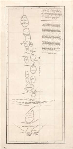
To Capt. W.F.W. Owen R.N. this chart of the Maldiva Islands, exhibiting the safe channels between the southern attollons.
sold
- Digital Map Information
- Suitable for large format printing
- DPI: 600
- File Size: 8.24 MB
- File Type: ZIP / TIFF
- ICC color profile embedded
- Delivered instantly via download link
This is a rare 1814 James Horsburgh nautical map of the central part of the Maldives or Maldivian Archipelago around Malé. Although seemingly simplistic, Horsburgh's chart marks a major advance in Europeans' geographical and hydrological knowledge of the archipelago. The dangerous, near impassible reefs, had long served as the archipelago's most effective and only line of defense against foreign imperialistic interests. This chart partially opened the islands to foreign navigation and marked the beginning of a long period of European influence. This Horsburgh chart served as the definitive mapping of the Maldives until the Robert Moresby surveys of 1834 - 1836. (more details)
Horsburgh chart of Singapore as the epicenter of British Power in east Asia.
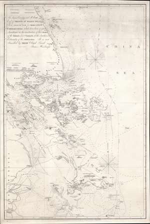
To James Carnegy and R. Scott Esqrs. of Prince of Wales Island As a Tribute due for their valuable Communications which have been of great Assistance in the construction of this chart of the Islands and Channels at the Southwest Extremity of the China Sea. It is not Inscribed by their Obliged Friend James Horsburgh.
sold
- Digital Map Information
- Suitable for large format printing
- DPI: 600
- File Size: 1154.6 MB
- File Type: ZIP / TIFF
- ICC color profile embedded
- Delivered instantly via download link
The rare 1850 final edition of the James Horsburgh nautical map of Singapore and the surrounding waters when it was the epicenter of British power in the East Indies. The chart covers the southern extreme of the Malay Peninsula, including all of Singapore Island and Singapore Strait, as well as adjacent islands and parts of eastern Sumatra. It was Horsburgh's first chart of the dangerous waters surrounding the Strait of Singapore and was the definitive mapping of these seas for nearly 30 years. (more details)
Best early nautical chart of Singapore.
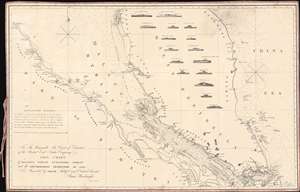
To The Honourable The Court of Directors of the United East India Company This Chart of Malacca Strait Singapore Strait and the Southernmost Promontory of Asia, is Inscribed by their Faithful and Obedient Servant James Horsburgh.
sold
- Digital Map Information
- Suitable for large format printing
- File Size: 27.57 MB
- File Type: ZIP / TIFF
- ICC color profile embedded
- Delivered instantly via download link
This 1857 nautical chart or maritime map of the Strait of Singapore and the southern part of the Malacca Strait is considered to be James Horsburgh's most desirable chart. Made for the British East India Company, this is one of the first charts to accurately map these heavily trafficked but treacherous straits. The chart covers the Malay peninsula roughly from Penang (Prince of Wales Island) to the island of Singapore and from the Sumatran coast to the China Sea. It features sixteen profile views as well as countless depth soundings, especially around the dangerous southern part of the Malacca Strait in the vicinity of Singapore. (more details)