
Bemporat, Aquiles (sold)

Aquiles Bemporat (1869 - September 22, 1957) was an Argentine-Italian cartographer and map publisher based in Buenos Aires. He was born in Trieste, Italy and emigrated to Buenos Aires sometime in the late 1870-80s, when he was a child. His firm, Oficina Cartográfica Bemporat, was founded around 1910 and remained active until at least 1960. Bemporat himself is elusive, despite a significant publication corpus. His map c. 1915 map of Buenos Aires won a gold medal at the 1915 San Francisco Exposition Universal. A 1949 CIA analysis of his work suggested that most of the map compilation was done in house by Bemporat himself, then over 70, and printed locally by network of small independent printers. The CIA report ultimately dismissed his maps as 'insufficiently accurate for intelligence use.' Nonetheless, Bemporat's work was highly decorative and enjoyed a strong local and international following, particularly in Latin America and Europe. He was widely admired for his longevity and continued to publish until his death at age 88.
Territorial dispute in Central America.
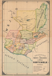
Coleccion de Mapas Billiken por A. Bemporat, Guatemala.
sold
- Digital Map Information
- Suitable for large format printing
- File Size: 8.89 MB
- File Type: ZIP / TIFF
- ICC color profile embedded
- Delivered instantly via download link
An attractive, colorful c. 1930 map of Guatemala produced by the Argentinian map publisher Bemporat as part of its Coleccion de Mapas Billiken. Aside from its aesthetic qualities, it is notable for referring implicitly the ongoing territorial dispute with Great Britain over British Honduras, future Belize. (more details)
Striking city map of Montevideo, Uruguay.
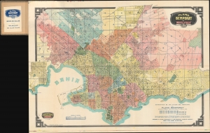
Plano Bemporat de Montevideo.
sold
- Digital Map Information
- Suitable for large format printing
- File Size: 101.73 MB
- File Type: ZIP / TIFF
- ICC color profile embedded
- Delivered instantly via download link
This is a beautiful large-format 1934 Oficina Cartográfica Bemporat folding city plan or map of Montevideo, Uruguay. (more details)
Striking city map of Montevideo, Uruguay.
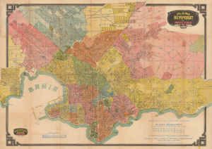
Plano Bemporat de Montevideo.
sold
- Digital Map Information
- Suitable for large format printing
- Full resolution TIFF file
- ICC color profile embedded
- Delivered instantly via download link
This is a c. 1939 large-format folding city plan or map of Montevideo, Uruguay, produced by Oficina Cartográfica Bemporat. It captures the city at a time when the politics and economy of the country were in flux, but Montevideo itself was a growing, cosmopolitan, charming, and thriving metropolis. (more details)
Striking city map of Montevideo, Uruguay.
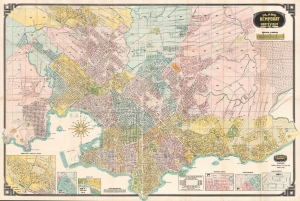
This is a beautiful large-format 1952 Oficina Cartográfica Bemporat folding city plan or map of Montevideo, Uruguay. Streets and avenues are labeled throughout, along with hospitals, schools, cemeteries, and parks. Beaches all along the coastline are identified. The Fortaleza General Artigas, the Frigorifico Uruguayo, and the Arsenal de Marina also are labeled. Six insets along the bottom border focus on the Casas Economicas, the Frigorifico Artigas, the Rambla Sud, Nuevo Paris, and Saint Bois - Toblada - Colon. (more details)