
Bishop, William (sold)

William Bishop (fl. c. 1855 - 1877) was the on-and-off city clerk of Brooklyn from about 1860 to the early 1870s. Bishop's primary opponent for the position was newspaperman Henry McCloskey. One of the duties of the city clerk was to publish an annual report detailing the government, progress, urban planning and development of the city. The resulting Manual of the Common Council of the City of Brooklyn was published each year of Bishop's tenure as city clerk. The first Brooklyn Manual was published in 1855 following the consolidation of the city. The Manual was published under various names and in various forms until 1888.
Vaux and Olmstead's 1867 redesign of Fort Green Park, Brooklyn
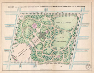
Design for the Laying Out of the Grounds known as Fort Green or Washington Park, in the City of Brooklyn.
sold
- Digital Map Information
- Suitable for large format printing
- File Size: 2.86 MB
- File Type: ZIP / TIFF
- ICC color profile embedded
- Delivered instantly via download link
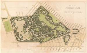
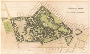
A rare 1867 example Vaux and Olmsted's map of Washington Park or, as it is now known, Fort Greene Park, Brooklyn. Oriented to the east, the map depicts the park as a whole and includes pathways, lakes, buildings, individual trees, rocks, and elevation measurements. The streets and avenues surrounding the park are also noted. The layout of Fort Greene Park shown here reflects Vaux and Olmsted's 1867 redesign. (more details)
One of the most decorative maps of Brooklyn to appear in the 19th century.
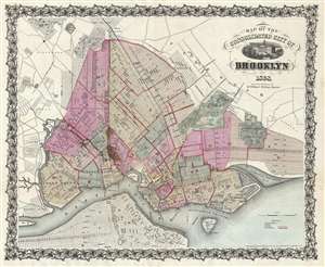
Map of the Consolidated City of Brooklyn.
sold
- Digital Map Information
- Suitable for large format printing
- File Size: 19.14 MB
- File Type: ZIP / TIFF
- ICC color profile embedded
- Delivered instantly via download link
An extremely edition of William Bishop's 1868 map of the city of Brooklyn, New York. In the mid-19th century, fueled by the advent of the steam ferry, which made crossing the East River practical, Kings County experienced a massive population burst. Wealthy and ... (more details)
One of the most decorative maps of Brooklyn to appear in the 19th century.
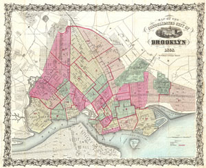
Map of the Consolidated City of Brooklyn.
sold
- Digital Map Information
- Suitable for large format printing
- File Size: 19.43 MB
- File Type: ZIP / TIFF
- ICC color profile embedded
- Delivered instantly via download link
An extremely rare first edition of William Bishop's 1868 pocket map of the city of Brooklyn, New York. In the mid-19th century, fueled by the advent of the steam ferry, which made crossing the East River practical, Kings County experienced an massive population ... (more details)
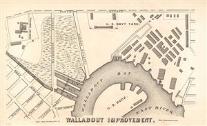
Wallabout Improvement.
sold
- Digital Map Information
- Suitable for large format printing
- File Size: 1.29 MB
- File Type: ZIP / TIFF
- ICC color profile embedded
- Delivered instantly via download link
An uncommon 1868 map of the newly improved Wallabout Bay, home to the U.S. Navy Yard in Brooklyn, New York (also pictured, along with the Marine Hospital). Today the Brooklyn Navy Yard hosts an assortment of film studios and art spaces. This map was engraved by ... (more details)
Possibly the first published map of Prospect Park.
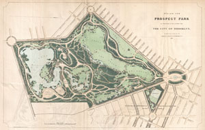
Design for Prospect Park as Proposed to be Laid Out for The City of Brooklyn.
sold
- Digital Map Information
- Suitable for large format printing
- File Size: 6.87 MB
- File Type: ZIP / TIFF
- ICC color profile embedded
- Delivered instantly via download link
A rare 1868 first edition of Vaux & Olmsted's map of Prospect Park, Brooklyn. Issued just months after its October 1867 completion, this is one of the first published maps to depict the design of Prospect Park. Depicts the park as a whole and includes pathways, ... (more details)
Possibly the first published map of Prospect Park.
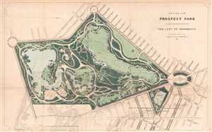
Design for Prospect Park as Proposed to be Laid Out for The City of Brooklyn.
sold
- Digital Map Information
- Suitable for large format printing
- File Size: 4.71 MB
- File Type: ZIP / TIFF
- ICC color profile embedded
- Delivered instantly via download link
A rare 1868 first edition of Vaux and Olmsted's map of Prospect Park, Brooklyn. Issued just months after its October 1867 completion, this is one of the first published maps to depict the design of Prospect Park. Depicts the park as a whole and includes ... (more details)
Map of Brooklyn's Eastern Parkway - the world's first Parkway.
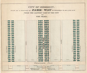
City of Brooklyn. Plan of a Portion of Park Way as Proposed to be Laid out From the Eastern Part of the City to The Plaza.
sold
- Digital Map Information
- Suitable for large format printing
- File Size: 1.77 MB
- File Type: ZIP / TIFF
- ICC color profile embedded
- Delivered instantly via download link
A rare 1868 example Vaux & Olmsted's preliminary plan for Eastern Parkway, Brooklyn. This may well be the first published plan of Eastern Parkway, which began construction about 2 years after this initial layout was published. According to the New ... (more details)
The first map of any parkway, anywhere - in this case Brookln's Eastern Parkway.
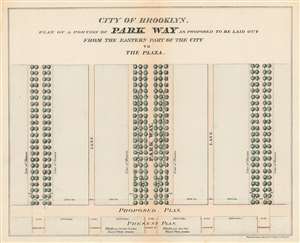
City of Brooklyn. Plan of a Portion of Park Way as Proposed to be Laid out From the Eastern Part of the City to The Plaza.
sold
- Digital Map Information
- Suitable for large format printing
- File Size: 2.9 MB
- File Type: ZIP / TIFF
- ICC color profile embedded
- Delivered instantly via download link
A rare 1868 example Vaux and Olmsted's preliminary plan for Eastern Parkway, Brooklyn. This may well be the first published plan of Eastern Parkway, and indeed any parkway anywhere, which began construction about 2 years after this initial layout was published. (more details)
Possibly the first published map of the Prospect Park Parade Ground.
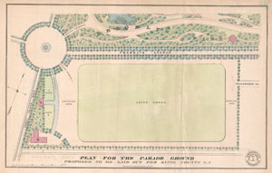
Plan for the Parade Ground Proposed to be Laid out for Kings County L. I.
sold
- Digital Map Information
- Suitable for large format printing
- File Size: 2.08 MB
- File Type: ZIP / TIFF
- ICC color profile embedded
- Delivered instantly via download link
An extremely scarce example of Vaux and Olmsted's map of the King County Parade Ground (today known as the Prospect Park Parade Ground, or the Prospect Park Base Ball Grounds). The Parade Ground is bounded by Parade Place, Franklin Avenue (now ... (more details)
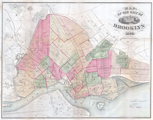
Map of the Consolidated City of Brooklyn.
sold
- Digital Map Information
- Suitable for large format printing
- File Size: 8.74 MB
- File Type: ZIP / TIFF
- ICC color profile embedded
- Delivered instantly via download link
An extremely rare example of William G. Bishop's pocket map of the city of Brooklyn, New York. In the mid 19th century, fueled by the advent of the steam ferry, which made crossing the East River practical, Kings County experienced a massive ... (more details)
Remarkable 1869 map or plan of Prospect Park, Brooklyn.
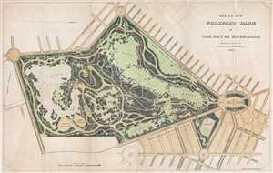
Design for Prospect Park in the City of Brooklyn.
sold
- Digital Map Information
- Suitable for large format printing
- File Size: 5.63 MB
- File Type: ZIP / TIFF
- ICC color profile embedded
- Delivered instantly via download link
This is a rare 1869 edition of Calvert Vaux and Frederick Law Olmsted's map of Prospect Park, Brooklyn. The map depicts the park as a whole and includes pathways, lakes, buildings, individual trees, rocks, and elevation measurements. The ... (more details)
Remarkable 1869 map or plan of Prospect Park, Brooklyn.
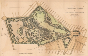
Design for Prospect Park in the City of Brooklyn.
sold
- Digital Map Information
- Suitable for large format printing
- File Size: 11.59 MB
- File Type: ZIP / TIFF
- ICC color profile embedded
- Delivered instantly via download link
This is a rare 1869 edition of Calvert Vaux and Frederick Law Olmsted's map of Prospect Park, Brooklyn. The map depicts the park as a whole and includes pathways, lakes, buildings, individual trees, rocks, and elevation measurements. The streets and avenues surrounding the park are also noted. (more details)
A very early planning map of Prospect Park.
Design for Prospect Park in the City of Brooklyn.
sold
- Digital Map Information
- Suitable for large format printing
- File Size: 17.86 MB
- File Type: ZIP / TIFF
- ICC color profile embedded
- Delivered instantly via download link
This is a rare 1870 edition of Calvert Vaux and Frederick Law Olmsted's map of Prospect Park, Brooklyn. The map depicts the park as a whole and includes pathways, lakes, buildings, individual trees, rocks, and elevation measurements. The streets and avenues surrounding the park are also noted. (more details)
Planning map of Prosepct Park, Brooklyn's finest park.
Design for Prospect Park in the City of Brooklyn.
sold
- Digital Map Information
- Suitable for large format printing
- File Size: 3.46 MB
- File Type: ZIP / TIFF
- ICC color profile embedded
- Delivered instantly via download link
This is a rare 1870 edition of Calvert Vaux and Frederick Law Olmsted's map of Prospect Park, Brooklyn. The map depicts the park as a whole and includes pathways, lakes, buildings, individual trees, rocks, and elevation measurements. The streets and avenues surrounding the park are also noted. (more details)
Olmsted's greatest park.
Design for Prospect Park in the City of Brooklyn.
sold
- Digital Map Information
- Suitable for large format printing
- File Size: 32.05 MB
- File Type: ZIP / TIFF
- ICC color profile embedded
- Delivered instantly via download link
This is the 1870 edition of Calvert Vaux and Frederick Law Olmsted's map of Prospect Park, Brooklyn. The map presents a comprehensive overview of the park during its initial construction phases. Although operable by 1870, Prospect Park was not officially finished until 1895. (more details)
One of the most decorative maps of Brooklyn to appear in the 19th century.
Map of the City of Brooklyn.
sold
- Digital Map Information
- Suitable for large format printing
- Full resolution TIFF file
- ICC color profile embedded
- Delivered instantly via download link
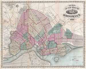
An extremely attractive example of William Bishop's 1871 map of the city of Brooklyn, New York. In the mid-19th century, fueled by the advent of the steam ferry, which made crossing the east River practical, Kings County experienced a ... (more details)
One of the most decorative maps of Brooklyn to appear in the 19th century.
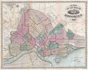
Map of the City of Brooklyn.
sold
- Digital Map Information
- Suitable for large format printing
- File Size: 17.18 MB
- File Type: ZIP / TIFF
- ICC color profile embedded
- Delivered instantly via download link
An extremely example of William Bishop's 1871 pocket map of the city of Brooklyn, New York. In the mid-19th century, fueled by the advent of the steam ferry, which made crossing the east River practical, Kings County experienced a ... (more details)
A very early planning map of Prospect Park.
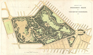
Design for Prospect Park as Proposed to be Laid Out for The City of Brooklyn.
sold
- Digital Map Information
- Suitable for large format printing
- File Size: 7.27 MB
- File Type: ZIP / TIFF
- ICC color profile embedded
- Delivered instantly via download link
A rare 1871 example of Vaux & Olmsted's map of Prospect Park, Brooklyn. Issued shortly after its 1867 completion, this is one of the first published maps to focus on the design of Prospect Park. Depicts the park as a whole and ... (more details)
Rare early planning map of the Wollman Rink and Concert Grove part of Prospect Park, Brooklyn.
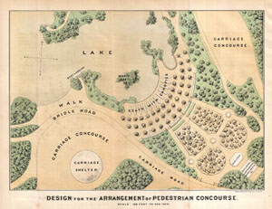
Design for the Arrangement of Pedestrian Concourse.
sold
- Digital Map Information
- Suitable for large format printing
- File Size: 2.72 MB
- File Type: ZIP / TIFF
- ICC color profile embedded
- Delivered instantly via download link
A rare 1871 example Vaux & Olmsted's map of part of Prospect Park, Brooklyn. His map focuses on the section of Prospect Park now occupied by Wollman Rink and the adjacent Concert Grove. Pathways, individual trees, pavilions, ... (more details)
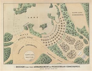
Design for the Arrangement of Pedestrian Concourse.
sold
- Digital Map Information
- Suitable for large format printing
- Full resolution TIFF file
- ICC color profile embedded
- Delivered instantly via download link
This is a rare 1871 example Vaux & Olmsted's map of part of Prospect Park, Brooklyn. His map focuses on the section of Prospect Park now occupied by Wollman Rink and the adjacent Concert Grove. Pathways, individual trees, ... (more details)
An early plannin map of Von King Park, Brooklyn.
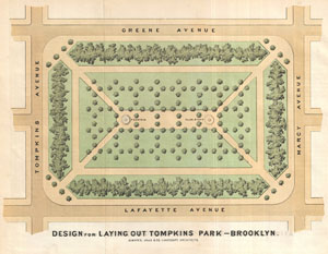
Design for the Laying Out Tompkins Park - Brooklyn.
sold
- Digital Map Information
- Suitable for large format printing
- File Size: 1.87 MB
- File Type: ZIP / TIFF
- ICC color profile embedded
- Delivered instantly via download link
A rare 1871 example Vaux & Olmsted's map of Tompkins Park or, as it is now known, Herbert von King Park, Bedford-Stuyvesant, Brooklyn. Von King Park is one of Brooklyn's earliest parks. This map depicts the park as a whole ... (more details)