
Bufford, John Henry (sold)
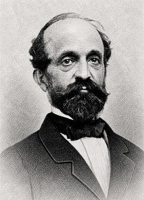
John Henry Bufford (July 27, 1810 - October 8, 1870) was a Boston based lithographer and printer. Bufford was born in Portsmouth, New Hampshire. He apprenticed as an artist and lithographer at Pendleton Lithography (1825 - 1836) of Boston. In 1835 he relocated to New York where he took independent commissions from George Endicott and Nathaniel Currier, among others. Returning to his hometown of Boston in 1839, he took a position of chief artist with the firm of Benjamin W. Thayer, heir to Pendleton Lithography. He probably married Thayer's sister, Anna Melora Tufts Thayer (1808-1878). Bufford has been highly criticized as an engraver, with one historian, David Tatham, stating he had 'a mediocre sort of craftsmanship at best' and 'no very special skills as an original artist.' We, however, find no justification for this harsh criticism. Instead Bufford gravitated toward business and management. By 1844 Thayer's shop was renamed J. H. Bufford and Company. The firm specialized in decorative sheet music, panoramic views, illustrations for books, retractions of paintings, and commercial printing. Bufford is credited with being one of the first employers and mentors of the important artist and engraver Winslow Homer. Bufford died in 1870, passing on the business to his sons Frank G. Bufford and John Henry Bufford Jr. These young men, operating under the imprint of 'J.H. Bufford's Sons, Manufacturing Publishers of Novelties in Fine Arts', expanded the firm with offices in New York and Chicago. A possibly related lithographic printing firm named Bufford Chandler was incorporated in Boston in 1893. It later relocated to Concord, New Hampshire but closed in 1925 when its state business charter was repealed.
A rare view illustrating one of the most tragic steamboat disasters in American history.
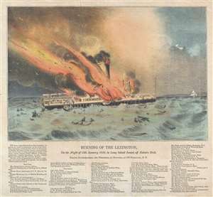
Burning of the Lexington, on the Night of 13th January, 1840, in Long Island Sound, off Eaton's Neck.
sold
- Digital Map Information
- Suitable for large format printing
- DPI: 300
- File Size: 6.29 MB
- File Type: ZIP / TIFF
- ICC color profile embedded
- Delivered instantly via download link
This is a rare 1840 John Henry Bufford view of the tragic burning of the steamboat Lexington on the Long Island Sound, New York. The burning of the Lexington was one of the greatest steamboat disasters in American history and captured the popular interest in a ... (more details)
Bustling but bucolic capital city.
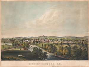
City of Concord. N.H. From the High Bluff about 80 Rods North East of Free Bridge, by Henry P. Moore, Concord.
sold
- Digital Map Information
- Suitable for large format printing
- File Size: 28 MB
- File Type: ZIP / TIFF
- ICC color profile embedded
- Delivered instantly via download link
This is a rare 1855 Henry P. Moore / John H. Bufford bird's-eye view of Concord, New Hampshire. The view looks on Concord from a high point to the east, across the Merrimack River. The former covered bridge, what is now Loudon Road, crosses the Merrimack to intersect with the train station. Several churches and the old city hall are evident in the mid-ground, while in the background, the rolling foothills of the White Mountains are just discernible. Several smokestacks and large mills hint at economic prosperity despite the idyllic setting. (more details)
The oldest secondary school in the United States.
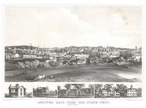
Andover Mass. from the North-West.
sold
- Digital Map Information
- Suitable for large format printing
- File Size: 31.83 MB
- File Type: ZIP / TIFF
- ICC color profile embedded
- Delivered instantly via download link
A striking bird's-eye view of Andover, Massachusetts, highlighting the town's commitment to secondary education with illustrations of Phillips Andover Academy, Abbott's Female School, Stone Academy, and the Andover Theological Seminary. The view overlooks Andover from the northwest. A low stone wall and fields in the foreground highlight Andover's idyllic small-town setting. In the mid-ground, a factory and train steaming out of town suggest prosperity. In the background, the buildings of the Theological Seminary and Phillips Andover are prominent. (more details)
First edition of Boardman's important map.
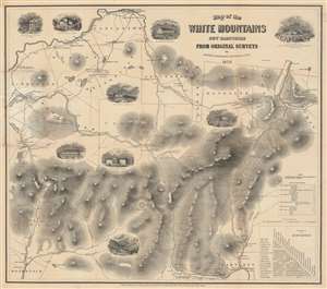
Map of the White Mountains New Hampshire from Original Surveys.
sold
- Digital Map Information
- Suitable for large format printing
- Full resolution TIFF file
- ICC color profile embedded
- Delivered instantly via download link
This is a first edition of Harvey Boardman's 1858 map of the White Mountains, New Hampshire. The remarkably useful map features roads, carriage ways, and summit trails throughout the presidential range as well as Mount Moriah, Mount Lafayette, Mount Willard, and Cannon Mountain. It notes the locations of public buildings, churches, mills, and hotels. It is attractively decorated with vignettes of public houses and hotels throughout the region, naming their proprietors. Two tables in the lower right allow easy calculation of distances between lodgings, making it relevant to the traveler. While Boardman is known to have surveyed the distances of the roads on his maps personally - contemporary reports have him trekking about the mountains with an odometer - he relied on the 1853 work of George Bond for elevations. (more details)
A Beautifully Engraved, Practical Tourists Map of New Hampshire's White Mountains
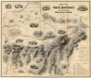
Map of the White Mountains New Hampshire from Original Surveys.
sold
- Digital Map Information
- Suitable for large format printing
- File Size: 33.25 MB
- File Type: ZIP / TIFF
- ICC color profile embedded
- Delivered instantly via download link
This is Harvey Boardman's 1859 map of the White Mountains, New Hampshire. The remarkably useful map features roads, carriage ways and summit trails throughout the presidential range as well as Mount Moriah, Mount Lafayette, Mount Willard and Cannon Mountain. It notes the locations of public buildings, churches, mills and hotels. It is attractively decorated with vignettes of public houses and hotels throughout the region, naming their proprietors. Two tables in the lower right-hand corner allow easy calculation of distances between lodgings in the area, making it particularly relevant to the tourist traveler relying on such dwellings. While Boardman is known to have surveyed the distances of the roads on his maps personally - contemporary reports have him trekking about the mountains with an odometer - he relied on the 1853 work of George Bond for the mountain elevations marked on the map, with few deviations. (more details)
Boardman's important map of the White Mountains - with striking arsenic-green covers.
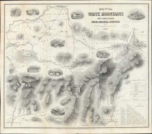
Map of the White Mountains New Hampshire from Original Surveys.
sold
- Digital Map Information
- Suitable for large format printing
- Full resolution TIFF file
- ICC color profile embedded
- Delivered instantly via download link
This is a first edition of Harvey Boardman's 1858 map of the White Mountains, New Hampshire. The remarkably useful map features roads, carriage ways, and summit trails throughout the presidential range as well as Mount Moriah, Mount Lafayette, Mount Willard, and Cannon Mountain. It notes the locations of public buildings, churches, mills, and hotels. It is attractively decorated with vignettes of public houses and hotels throughout the region, naming their proprietors. Two tables in the lower right allow easy calculation of distances between lodgings, making it relevant to the traveler. While Boardman is known to have surveyed the distances of the roads on his maps personally - contemporary reports have him trekking about the mountains with an odometer - he relied on the 1853 work of George Bond for elevations. (more details)
Inundated Meadowlands of the Concord River.
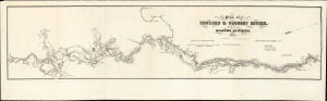
Plan of Concord and Sudbury Rivers, with the Meadows Adjoining. 1861. (with) Profile of the Concord and Sudbury Rivers 1861.
sold
- Digital Map Information
- Suitable for large format printing
- Full resolution TIFF file
- ICC color profile embedded
- Delivered instantly via download link
This is J. H. Bufford's 1861 map of the Concord, Sudbury, and Assabet Rivers in Massachusetts, drawn from surveys made to assess the combined effects of various hydrographic projects on the meadowlands of those rivers. While the politician and lawyer D. W. Alvord oversaw the project, the work was undertaken by the renowned civil engineers Charles Storer Storrow and Joel Herbert Shedd.
While nowhere credited, it is very probable that Storrow and Shedd's surveys were built upon the locally - produced surveys of Henry David Thoreau, (1817 - 1862) famed American essayist, poet, naturalist, and erstwhile surveyor. (more details)
While nowhere credited, it is very probable that Storrow and Shedd's surveys were built upon the locally - produced surveys of Henry David Thoreau, (1817 - 1862) famed American essayist, poet, naturalist, and erstwhile surveyor. (more details)
One of the first lithograph views produced from a photograph.
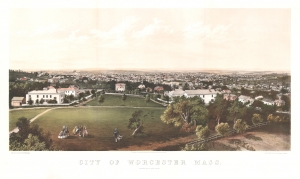
City of Worcester Mass.
sold
- Digital Map Information
- Suitable for large format printing
- File Size: 42.24 MB
- File Type: ZIP / TIFF
- ICC color profile embedded
- Delivered instantly via download link
This is a rare, unusual, and significant 1864 chromolithograph bird's-eye view of Worcester, Massachusetts. The view is unique as being one of the first bird's-views produced from a photograph, as well as a pioneering example of balloon-based aerial photography - the image being taken by 'Black and Bachelder,' the photographers responsible for the first balloon photographs in the United States. It is worth noting that the 'Bachelder' attributed is not the more famous viewmaker John Badger Bachelder, but rather the important photographer Perez Mann Bachelder. (more details)
Behind the lines in a Civil War battle.
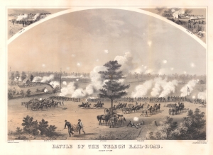
Battle of Weldon Rail-Road. August 21st, 1864.
sold
- Digital Map Information
- Suitable for large format printing
- File Size: 70.18 MB
- File Type: ZIP / TIFF
- ICC color profile embedded
- Delivered instantly via download link
This is a c. 1864 Richard Holland view of the American Civil War Battle of Weldon Railroad. The view is distinctive among Civil War prints for providing a rarely-seen view of events behind the lines of battle. Part of the Petersburg Campaign, the Battle of Weldon Railroad resulted in Union forces successfully severing the last railroad linking Petersburg and Richmond with Wilmington, North Carolina, the Confederacy's last remaining Atlantic port. (more details)
Highlights the five different horse-drawn streetcar companies operating in Boston in 1865.
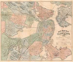
Rail Road Map of All Street and Steam Railroads in Boston and Vicinity.
sold
- Digital Map Information
- Suitable for large format printing
- File Size: 41.68 MB
- File Type: ZIP / TIFF
- ICC color profile embedded
- Delivered instantly via download link
This is an 1865 Josiah G. Chase railroad map of Boston and vicinity. The map depicts the region from Cambridge and Brighton to East Boston and from Chelsea to Roxbury and Dorchester Bay. Railroad lines in and out of central Boston are illustrated in different colors, allowing the viewer to more easily differentiate between steam railroads and streetcars and between the five different streetcar companies. Major intercity railway lines are labeled, such as the Boston and Maine Railroad, the Fitchburg Railroad, and the Old Colony Railroad. Streetcar companies, known as the Metropolitan, Cambridge, Middlesex, Broadway, and Lynn and Boston Railroads, are all illustrated as well, each of which operated streetcars pulled by horses. Electric streetcars would not arrive in Boston until near the turn of the century. Incredibly detailed, individual streets throughout the region are illustrated and labeled, and churches, public school and buildings, and railroads stations are also indicated. These four different types of structures correspond to a key situated along the right border. Other buildings, such as the lunatic asylum, the Navy Yard, and Harvard University, are labeled on the map itself. Red concentric circles emanating from central Boston mark quarter-mile intervals from the intersection of Tremont, Court, and Cornhill Streets. City wards in both Boston and Cambridge are labeled and shaded different colors to allow for easy differentiation. (more details)
Overlooking Boston Common to the east.
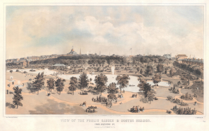
View of the Public Garden and Boston Common. From Arlington Street.
sold
- Digital Map Information
- Suitable for large format printing
- File Size: 81.98 MB
- File Type: ZIP / TIFF
- ICC color profile embedded
- Delivered instantly via download link
This is an 1866 Edwin Whitefield view of Boston Common and the Public Garden. It represents one of the finest lithograph views of the Boston Common to appear in the mid-19th century. (more details)
Unusual early locally produced view of Swampscott, Massachusetts.
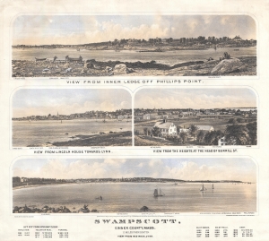
Swampscott, Essex County Mass., 11 Miles from Boston.
sold
- Digital Map Information
- Suitable for large format printing
- File Size: 9.49 MB
- File Type: ZIP / TIFF
- ICC color profile embedded
- Delivered instantly via download link
This is a rare 1871 locally produced view of Swampscott, Essex County, Massachusetts. The view was issued by John L. Robinson, likely to promote his Swampscott real estate interests. The views are two-color lithograph versions of photographs taken by Frederick M. Smith of Boston. The piece consists of four views on a single sheet:
- View from Inner Ledge of Phillips Point
- View from Lincoln House towards Lynn
- View from the Heights at the head of Burrill St.
- View from Red Rock, Lynn
Original promotion for Cape Cod's Falmouth Heights.
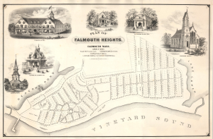
Plan of Falmouth Heights. Falmouth Mass.
sold
- Digital Map Information
- Suitable for large format printing
- File Size: 37.04 MB
- File Type: ZIP / TIFF
- ICC color profile embedded
- Delivered instantly via download link
This is a striking 1873 J. H. Bufford promotional broadside map advertising Falmouth Heights, Cape Cod, Massachusetts. Unlike many towns developed as investment schemes, Falmouth Heights was a great success, and some of the buildings illustrated here survive - including the charming Cottage No. 3 (Tower House). (more details)
Early promotional broadside map advertising a development in Oak Bluffs, Martha's Vineyard.
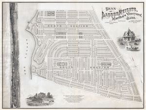
PLAN OF LAGOON HEIGHTS, Martha’s Vineyard, MASS.
sold
- Digital Map Information
- Suitable for large format printing
- File Size: 34.89 MB
- File Type: ZIP / TIFF
- ICC color profile embedded
- Delivered instantly via download link
A beautiful 1873 promotional map of Lagoon Height, the area of present day Oak Bluffs, Martha's Vineyard, Massachusetts. The map consists of a detailed street plan with housing lots and parks, as well as wonderful vignettes of Victorian era summer homes. ... (more details)
Early promotional broadside map advertising a development in Oak Bluffs, Martha's Vineyard.
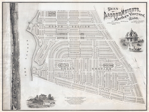
PLAN OF LAGOON HEIGHTS, Martha’s Vineyard, MASS.
sold
- Digital Map Information
- Suitable for large format printing
- Full resolution TIFF file
- ICC color profile embedded
- Delivered instantly via download link
A beautiful 1873 promotional map of Lagoon Height, the area of present day Oak Bluffs, Martha's Vineyard, Massachusetts. The map consists of a detailed street plan with housing lots and parks, as well as wonderful vignettes of Victorian era summer homes. ... (more details)