
Crow, Carl (sold)

Carl Crow (1884 - 1945) was a born in Missouri and is known for, among several achievements, opening the first Western advertising agency in Shanghai, China. Crow arrived in Shanghai in 1911, where he lived for 25 years. He worked as a journalist, newspaper proprietor, and advertising agent, while also spending time as a hostage negotiator, police sergeant, farmer, and a liaison for the U.S. government. He was also a celebrated author whose book, 400 Million Customers, won several awards when it came out in the 1930s and has been reprinted at least twice during the 21st century. During his time in China he met and interviewed most of the major figures of the day, including Chiang Kai-shek and Mao Zedong's second-in-command Zhou En-lai. Fearing retribution because of his anti-Japanese sentiments, he left Shanghai in 1937, only a couple of days after the Japanese attacked during the Second Sino-Japanese War. He worked for American intelligence during the Second World War and became one of the first westerners to journey up the Burma Road. He died in Manhattan in 1945.
Intriguing city map or plan of Victoria, Hong Kong, the de facto capital during the British colonial period.

Plan of Hong Kong. City of Victoria. Drawn for Crow's 'Handbook for China.'
sold
- Digital Map Information
- Suitable for large format printing
- File Size: 1.65 MB
- File Type: ZIP / TIFF
- ICC color profile embedded
- Delivered instantly via download link
This is a 1921 Carl Crow city map or plan of Victoria, Hong Kong. The map depicts Victoria from Kennedy Road, Bowen Road, and the Navy Yard to Hollywood Road and the Western Market and from the public gardens and Robinson Road to Connaught Road and the port. All ... (more details)
Intriguing city map or plan of Victoria, Hong Kong, the de facto capital during the British colonial period.
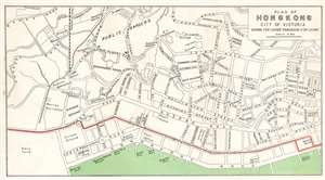
Plan of Hong Kong. City of Victoria. Drawn for Crow's 'Handbook for China.'
sold
- Digital Map Information
- Suitable for large format printing
- File Size: 3.33 MB
- File Type: ZIP / TIFF
- ICC color profile embedded
- Delivered instantly via download link
This is a 1921 Carl Crow city map or plan of Victoria, Hong Kong. The map depicts Victoria from Kennedy Road, Bowen Road, and the Navy Yard to Hollywood Road and the Western Market and from the public gardens and Robinson Road to Connaught Road and the port. All the streets are labeled, as well as several cathedrals, churches, and colleges. The government house is labeled in big block lettering. The Peak Tramway, which scales Victoria Peak, is depicted on the left side of the map, along with the tram station. Victoria was the de facto capital of Hong Kong during the British colonial period. Per Crow, 'outside of official documents, one rarely hears the name Victoria, the city being commonly given the name of the island,' Hong Kong. (more details)
Attractive city map or plan of Suzhou (Soochow), China, 'The Venice of the Far East.'
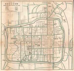
Plan of Soochow. Drawn for Crow's 'Handbook for China.'
sold
- Digital Map Information
- Suitable for large format printing
- File Size: 2 MB
- File Type: ZIP / TIFF
- ICC color profile embedded
- Delivered instantly via download link
This is a 1921 Carl Crow city map or plan of Suzhou (Soochow), China. The map depicts the city and some of the surrounding area. Soochow, per Crow, lies '53 miles from Shanghai, on the Shanghai-Nanking Railway', which is depicted and labeled on the map. Due to ... (more details)
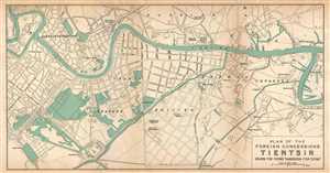
Plan of the Foeign Concessions. Tientsin. Drawn for Crow's 'Handbook for China.'
sold
- Digital Map Information
- Suitable for large format printing
- File Size: 1.87 MB
- File Type: ZIP / TIFF
- ICC color profile embedded
- Delivered instantly via download link
This is a 1921 Carl Crow city map or plan of the foreign concessions in Tianjin (Tientsin), China. The map, which is bisected by the Hai River, depicts the sector of the city in which the international concessions were located, from the Austria-Hungarian ... (more details)
Detailed map of China labeling numerous cities and illustrating transportation routes.
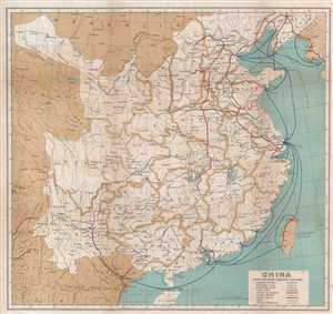
China.
sold
- Digital Map Information
- Suitable for large format printing
- File Size: 4.94 MB
- File Type: ZIP / TIFF
- ICC color profile embedded
- Delivered instantly via download link
This is a 1921 Carl Crow map of China. The map depicts the region from Central Asia to the Korean Peninsula and Taiwan (Formosa) and from Mongolia and Manchuria to Hainan and Southeast Asia (Vietnam, Laos, Thailand). China itself is divided into ... (more details)
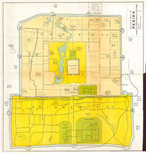
Sketch Map of Peking drawn for Crows “Handbook for China”.
sold
- Digital Map Information
- Suitable for large format printing
- Full resolution TIFF file
- ICC color profile embedded
- Delivered instantly via download link
This rare map is a plan of Beijing (Peking) China. Published for Carl Crows 'Handbook for China.' Text in ... (more details)