
Dapper, Olfert (sold)

Olfert Dapper (1636 - December 29, 1689) was a Dutch geographer, polyglot, and historian. Born in Amsterdam, he attended the University of Utrecht, where he was registered as a student in 1658. Two years later he began signing doctor medicinæ, but there in no evidence that he ever received any medical training or education. Dapper published a five-volume book about the history of Amsterdam entitled, Historische Beschrijving der Stadt Amsterdam and in 1665 published a Dutch translation from the Greek of the Histories of Herodotus. His best-known work, Naukeurige Beschrijvingen der Afrikaensche gewesten (Description of Africa), was published in 1668 and subsequently published in English by John Ogilby in 1670 and in French in 1686. Although Dapper never traveled to Africa, he took advantage of numerous reports from adventurers in order to compile this authoritative work over the course of three years.
Labels the Pyramids and the Holy Land.
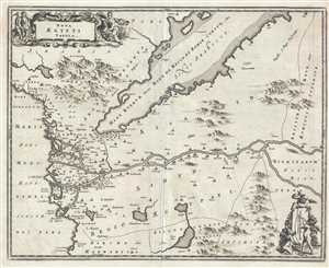
Nova Ægypti Tabula.
sold
- Digital Map Information
- Suitable for large format printing
- DPI: 300
- File Size: 4.31 MB
- File Type: ZIP / TIFF
- ICC color profile embedded
- Delivered instantly via download link
This is a 1686 Olfert Dapper map of Egypt and the western Middle East. Oriented towards the east, the map depicts the region from the Mediterranean Sea to Abyssinia, or approximately modern-day Ethiopia, and from the Arabian Peninsula past the Red Sea and the Sinai ... (more details)
From the French edition of one of the foundational works of African studies.
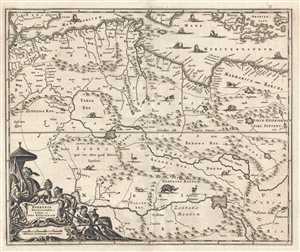
Barbaria Biledulgerid o: Libye et pars Nigritarum Terra.
sold
- Digital Map Information
- Suitable for large format printing
- DPI: 300
- File Size: 4.02 MB
- File Type: ZIP / TIFF
- ICC color profile embedded
- Delivered instantly via download link
This is a 1686 Olfert Dapper map of North Africa. The map depicts the region from the Strait of Gibraltar to Libya and Crete and from southern Spain, Sicily, and the Mediterranean Sea to the Niger River. Highly detailed, myriad locations, particularly along the ... (more details)
Incredible map of West Africa including a depiction of the apocryphal Lake Aquilunda.
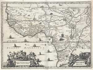
Nigritarum Regio.
sold
- Digital Map Information
- Suitable for large format printing
- DPI: 300
- File Size: 4.93 MB
- File Type: ZIP / TIFF
- ICC color profile embedded
- Delivered instantly via download link
This is a 1686 Olfert Dapper map of Central and West Africa. The map depicts the continent from the southern Sahara Desert to Angola and from the Pacific Ocean to the center of the continent, approximately where the Democratic Republic of the Congo and the ... (more details)
Napoleon would be exiled here almost 130 years later.
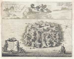
St. Helene.
sold
- Digital Map Information
- Suitable for large format printing
- DPI: 300
- File Size: 4.29 MB
- File Type: ZIP / TIFF
- ICC color profile embedded
- Delivered instantly via download link
This is a 1686 Olfert Dapper view of St. Helena. The view depicts the entirety of the island, illustrating its topography and rivers. Eight locations are numerically identified, with an index in Dutch in the lower left corner, and a French index in the ... (more details)
Amazing illustration of Tripoli's Red Castle.
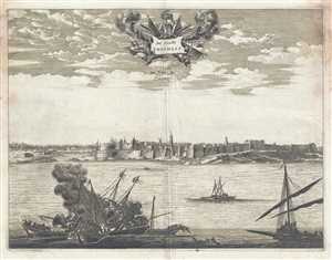
De Stadt Tripolis. La Ville de Tripoli.
sold
- Digital Map Information
- Suitable for large format printing
- DPI: 300
- File Size: 5.28 MB
- File Type: ZIP / TIFF
- ICC color profile embedded
- Delivered instantly via download link
This is a 1686 Olfert Dapper view of Tripoli, the capital of Libya. The view depicts the city from the sea, highlighting its formidable coastal fortifications. In the foreground, two ships appear to have collided with each other and are burning, while ... (more details)