
Ewer, Ferdinand Cartwright (sold)

Ferdinand Cartwright Ewer (1826 - 1883) was born on May 22nd of 1926 in town of Nantucket on the Massachusetts island of the same name. Ewer's father, a prominent Nantucket businessman, moved his family to Providence Rhode Island when Ferdinand was three and then, further afield, to New York City. It was not until his 13th year that Ewer returned to Nantucket where he would remain until 1844 when was matriculated at Harvard. There he grew intellectually and strayed from his religiously ideological upbringing, embracing atheism. Shortly following his graduation in 1848, Ewer, like many others, was drawn westward by the lure of the California Gold Rush. "I have no gold fever," he says pathetically in his diary, "I only desire not to starve." In San Francisco he worked as a clerk in the claims office and later as newspaper reporter with The Alta Californian. In a tale typical of the Wild West, a bar room conversation in a mining town inspired Ewer to change his life, abandon his atheism, and became a Reverend of the Episcopal Church. As Reverend, Ewer generated a popular following in San Francisco. Nonetheless, in time he decided to move back to the east coast and, eventually, became the rector of New York City's Christ's Church. A highly educated man, Ferdinand devoted much of his intellectual energy in reconciling the positions of science with religion. To the chagrin of his Episcopalian superiors, Ewer believed that the premises of Darwinism, astronomy, and medicine were in fact compatible his faith. Eventually, Ewer's scientific leanings drove him from the Christ Church, at which point he established the New York church of St. Ignatius of Antioch, where he remained to his death in 1883. It was sometime during his tenure in New York that Ewer composed his famous map of Nantucket.
Rare map of Nantucket printed in Nantucket!
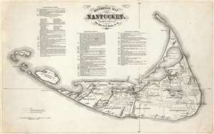
Historical Map of Nantucket.
sold
- Digital Map Information
- Suitable for large format printing
- File Size: 12.64 MB
- File Type: ZIP / TIFF
- ICC color profile embedded
- Delivered instantly via download link
This attractive c. 1869 map is a reduced version of Reverend F. C. Ewers groundbreaking, 1869 wall map of Nantucket. This variant - by an unknown printer, likely in Boston was published shortly after the first edition. Three columns of text provide the highlights of of Nantucket's history from its discovery by Bartholomew Gosnold in 1602 to the momentous 1865 organization of the island's high school Alumni Association. (more details)
'The largest, best-known and most useful Nantucket map.' -Crosby
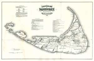
Historical Map of Nantucket.
sold
- Digital Map Information
- Suitable for large format printing
- File Size: 30.56 MB
- File Type: ZIP / TIFF
- ICC color profile embedded
- Delivered instantly via download link
An impressive c. 1886 large scale wall map of Nantucket, Massachusetts. This map is a later, much-enlarged Joseph B. Swain issue of Reverend Ferdinand Cartwright Ewer's (1826 - 1883), seminal 1869 map of Nantucket. It was likely made to promote the Nantucket Hotel, which opened 2 years earlier. According to Nantucket historian, Everett U. Crosby, this is 'The largest, best-known and most useful Nantucket map.' The map is richly detailed and expressive of Nantucket's topography, road system, railroad lines, and even political breakdown. It shows swamps, ponds, important hotels and lighthouses, hills, and more. Some references are dated and correspond to a table located at center. (more details)
Opening of The Nantucket.
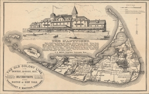
The Nantucket.
sold
- Digital Map Information
- Suitable for large format printing
- File Size: 145.01 MB
- File Type: ZIP / TIFF
- ICC color profile embedded
- Delivered instantly via download link
A most unusual c. 1886 variant on the Ewer map of Nantucket, published to jointly promote the opening of 'The Nantucket', the island's first grand hotel, and the Old Colony Line's Nantucket / Martha's Vineyard service. (more details)
Rare map of Nantucket printed in Nantucket!
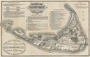
Historical Map of Nantucket.
sold
- Digital Map Information
- Suitable for large format printing
- File Size: 3.66 MB
- File Type: ZIP / TIFF
- ICC color profile embedded
- Delivered instantly via download link
This attractive 1889 map is a reduced version of Reverend F. C. Ewers important 1869 map of Nantucket. Printed in Nantucket, this variant was issued by the Old Colony Rail Line in various formats from roughly 1872 to 1889. Covers the island of Nantucket in superb detail focusing on transportation and communities. Advertises the 'Old Colony Line' as the 'Shortest, Quickest, Best, and Only Direct Route between Boston or New York and Nantucket and Martha's Vineyard.' Also notes Native American claims to the Island. Features three columns of text breaking down the history of Nantucket from its discovery by Bartholomew Gosnold in 1602 to the laying of the first communications cables between Nantucket and the mainland in 1886. (more details)
Rare map of Nantucket printed in Nantucket!
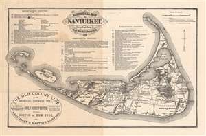
Historical Map of Nantucket.
sold
- Digital Map Information
- Suitable for large format printing
- Full resolution TIFF file
- ICC color profile embedded
- Delivered instantly via download link
This attractive c. 1886 map is a reduced version of Reverend F. C. Ewers important 1869 map of Nantucket. Printed in Nantucket, this variant was issued by the Old Colony Line in various formats from roughly 1872 to 1889. A medallion in the lower-left promotes the 'Old Colony Line' as the 'Shortest, Quickest, Best, and Only Direct Route between Boston or New York and Nantucket and Martha's Vineyard.' Features three columns of text breaking down the history of Nantucket from its discovery by Bartholomew Gosnold in 1602 to the laying of the first communications cables between Nantucket and the mainland in 1886 - hence our dating. (more details)
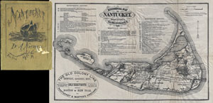
Historical Map of Nantucket.
sold
- Digital Map Information
- Suitable for large format printing
- File Size: 5.94 MB
- File Type: ZIP / TIFF
- ICC color profile embedded
- Delivered instantly via download link
This attractive map is a reduced version of Reverend F. C. Ewers important 1869 map of Nantucket. This variant was issued by the Old Colony Rail Line in various formats from roughly 1872 to 1889. Covers the island of Nantucket in superb detail focusing on transportation and communities. Advertises the 'Old Colony Line' as the 'Shortest, Quickest, Best, and Only Direct Route between Boston or New York and Nantucket and Martha's Vineyard.' Also notes Native American claims to the Island. Features three columns of text breaking down the history of Nantucket from its discovery by Bartholomew Gosnold in 1602 to the laying of the first communications cables between Nantucket and the mainland in 1886. (more details)