
Hooghe, Romeyn de (sold)
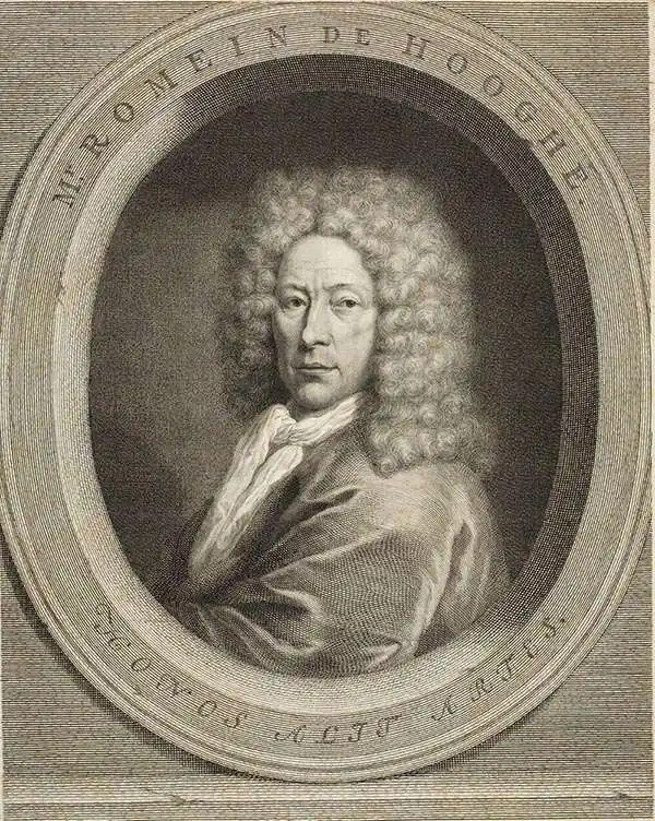
Romeyn de Hooghe (Septemer 10, 1645 – June 10, 1708) was a Dutch engraver, portrait artist, caricaturist, painter, and sculptor active in Amsterdam during the second half of the 17th century and opening years of the 18th century. De Hooghe was born in Amsterdam and revealed an early talent for all forms of visual arts. He became known caricaturist and is admired today as one of the first great graphic satirists. During his life he was criticized for his proclivity towards humorous tongue-in-cheek subjects. He nonetheless developed a following and produced a prolific amount of work, some 5000 engravings. He was a member of the Confrerie Pictura in 1662 and 1683. Cartographically he is best known for his decorative border work. His disciples were Filibert Bouttats (1654-after 1731), Filibertus Bouttats (1635–1707), Frans Decker, François Harrewijn, Jacobus Harrewijn, Aernout Naghtegael, Laurens Scherm, and Adriaen Schoonebeek. De Hooghe died in Haarlem on June 10, 1708. Much of his work continued to be republished posthumously.
Unique First State.
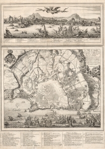
Candie/ La Ville de Candie pour la 3e. sois attaquee de L'armée Ottomane, et deffendue par Celle de la Serenissime Rep: de Venise... 1667, 68 et 69.
sold
- Digital Map Information
- Suitable for large format printing
- DPI: 600
- File Size: 109.01 MB
- File Type: ZIP / TIFF
- ICC color profile embedded
- Delivered instantly via download link
This is an extremely rare, likely unique, separately published 1668 broadsheet plan of the port of Heraklion / Candia, Crete, incorporating a striking panoramic view of the city. This broadsheet illustrates Venetian-controlled Heraklion during the final years of its 21-year-long Ottoman siege. It was privately commissioned and engraved to lionize the efforts of French nobleman Alphonse-Louis, Chevalier d’Harcourt, who perceived himself not only a defender of Crete, but as a latter-day crusader defending Christianity itself. (more details)
De Wit's masterful sea chart of the West Indies during the Golden Age of Caribbean Piracy.
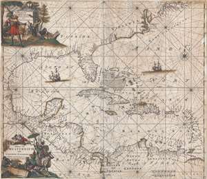
Indiarum Occidentalium Tractus Littorales cum Insulis Caribicis. / Pascaert van Westindien ende Caribise Eylanden.
sold
- Digital Map Information
- Suitable for large format printing
- DPI: 300
- File Size: 12.56 MB
- File Type: ZIP / TIFF
- ICC color profile embedded
- Delivered instantly via download link
A fine and rare old color example of the second edition of Frederick de Wit's 1680 nautical chart or maritime map of the West Indies, Central America, Gulf of Mexico, and Florida. Printed during the Golden Age of Caribbean Piracy, this sea chart covers the eastern ... (more details)
A beautiful maritime chart of southern England.
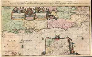
Carte Nouvelle des Costes d'Angleterre depuis la Riviere de la Tamise jusques à Portland, et des Isles Voisines: Ou l'on voit tous les Ports de Mer, Bancs de Sable et Rochers. A l'Usage des Armées de sa Majesté Britannique.
sold
- Digital Map Information
- Suitable for large format printing
- Full resolution TIFF file
- ICC color profile embedded
- Delivered instantly via download link
This is a 1693 Romeyn de Hooghe map of the southern coast of England including the Thames estuary and London. The map depicts from the Isle of Portland east to the Thames estuary and from London to Aldernay, including the Isle of Wight. Cities and towns are labeled throughout. An inset along the bottom border focuses on southeastern England and the North Sea along with northeastern France around Calais and Dunkirk. A decorative cartouche appears in the upper left quadrant and includes views of Portsmouth and Rochester. Wonderfully decorated with compass roses and rhumb lines, this chart is part of a group of nine charts created by de Hooghe and published by Mortier, all of which are regarded as the most decorative sea charts of the 17th century. (more details)
Graphically stunning Dutch map of the Bible Lands.
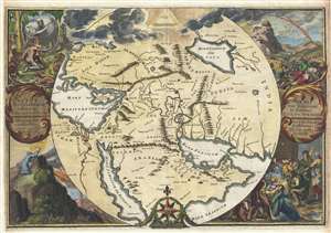
Orbis Per Creationem Institutus. / Orbis Per Diluvium De Stitutus. /Per Legem Constitutus. / Per Christum Restitutus.
sold
- Digital Map Information
- Suitable for large format printing
- DPI: 300
- File Size: 30.02 MB
- File Type: ZIP / TIFF
- ICC color profile embedded
- Delivered instantly via download link
A remarkable 1705 map of the Biblical lands by Romeyln de Hooghe. Centered on Babylon, then thought to be the center of creation, the map extends from the Bosporus to the Arabian Sea and from the Nile valley to the Caspian Sea. It names important Biblical ... (more details)