
Lucas Jr., Fielding (sold)
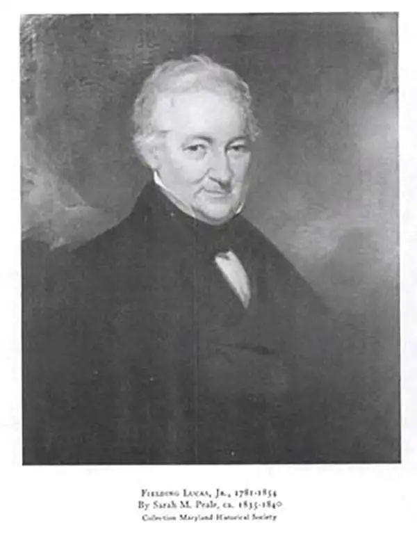
Fielding Lucas Jr. (September 3, 1781 - March 12, 1854) was an American cartographer, chartmaker, and publisher active in Baltimore during the first half of the 19th century. Born in Fredericksburg, Virginia, little is known of Lucas's family and early life, but his lineage seems to have been established in Fredericksburg from at least the mid-1700s. Lucas founded Lucas Brothers, one of America's first stationers located at 116 East Baltimore Street, in 1804 and later, in 1806, he became the Baltimore manager of the Philadelphia based publishing firm Conrad, Lucas, and Company. Lucas is also known to have worked with the Matthew Carey firm in Philadelphia. Lucas entered the map trade around 1814, when he published an atlas of the United States - similar to, but in direct competition with, Matthew Carey, a matter which soured an otherwise profitable friendship. In 1825, Lucas also produced a world atlas. Over the course of his career, Lucas published several smaller atlases and numerous independent issue maps, including an important nautical chart of the Chesapeake and Delaware Bays. Many of his maps were engraved by H. S. Tanner, but he also worked with Robert Mills (Atlas of South Carolina) and others. Lucas attained considerable social prominence as a patron of the arts and philanthropist. He was a member of the committee that helped build Baltimore's Washington Monument and was one of the founding members of the Boston Harmonic Society and the Maryland Institute for the Promotion of Mechanical Arts. During the War of 1812, Lucas enlisted in Captain John Kanes' Company, 27th Maryland Regiment, although little is known of his actual service. From 1827 he served as a director of the Baltimore and Ohio Railroad and, later, as director of the Baltimore and Rappahannock Steam Packet Company. He died in Baltimore on March 12, 1854. (Foster, J. W., Fielding Lucas, Jr., Early 19th Century American Publisher of Fine Books and Maps, 'American Antiquarian Society', October 1955, Volume 64, Part 2, 162-212)
The Monumental City, soon after the War of 1812.
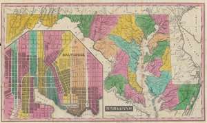
Maryland.
sold
- Digital Map Information
- Suitable for large format printing
- Full resolution TIFF file
- ICC color profile embedded
- Delivered instantly via download link
This is a rare and brilliantly colored example of Fielding Lucas' 1819 map of Maryland, with a large inset of Baltimore. It was made in the aftermath of the War of 1812, when Baltimore had been the site of a critical American victory in 1814. (more details)
A map of Florida published only two years after Florida became a U.S. territory.
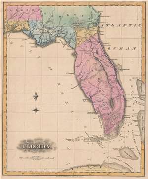
Florida.
sold
- Digital Map Information
- Suitable for large format printing
- DPI: 300
- File Size: 2.49 MB
- File Type: ZIP / TIFF
- ICC color profile embedded
- Delivered instantly via download link
This is an 1823 Fielding Lucas, Jr. map of Florida published only two years after Florida's incorporation into the United States as a territory. The map depicts the region from the Perdido River to the Great Bahama Bank and from Georgia and Alabama to Cuba. Reminiscent of the 1823 map of Florida by H.S. Tanner, Florida's coastline is illustrated in significant detail, with numerous inlets and capes labeled, including Cape Canaveral. Tampa Bay is also illustrated, although here it is labeled as Spirito Santo Bay. Pensacola, Jacksonville, and St. Augustine are identified, as are numerous smaller settlements. (more details)
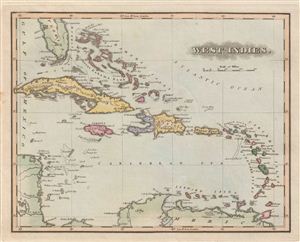
West Indies.
sold
- Digital Map Information
- Suitable for large format printing
- Full resolution TIFF file
- ICC color profile embedded
- Delivered instantly via download link
A fine example of the 1823 F. Lucas Jr.'s map of the West Indies and Caribbean. Centered on Hispaniola, covers from Florida and the Bahamas south through the Caribbean islands of Cuba and Hispaniola to the northern Part of South America and east to the Caribbean ... (more details)
Features the Chesapeake and Delaware Canal, which remains a vital link in North Atlantic trade to this day.
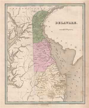
Delaware.
sold
- Digital Map Information
- Suitable for large format printing
- DPI: 300
- File Size: 5.22 MB
- File Type: ZIP / TIFF
- ICC color profile embedded
- Delivered instantly via download link
This is an 1846 Thomas G. Bradford map of Delaware. The map depicts the region from the Susquehanna River and Chesapeake Bay to New Jersey and from Pennsylvania and New Jersey to Maryland and the Atlantic Ocean. Transportation in 1840s Delaware A common feature ... (more details)
The only significant map of the Chesapeake Bay to be issued between the early 19th century Admiralty Charts and the Coast Survey Charts of the 1860s.
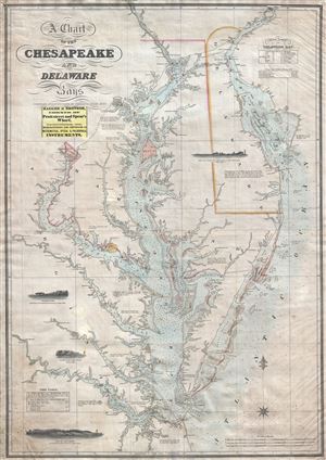
A Chart of the Chesapeake and Delaware Bays.
sold
- Digital Map Information
- Suitable for large format printing
- DPI: 300
- File Size: 40.07 MB
- File Type: ZIP / TIFF
- ICC color profile embedded
- Delivered instantly via download link
A scarce, important, and highly desirable 1852 nautical chart or maritime map of the Chesapeake and Delaware Bays by Fielding Lucas Jr. This chart covers the entirety of the Chesapeake Bay from Wrightsville (on the Susquehanna River) and Philadelphia (on the ... (more details)