
Melish, John (sold)

John Melish (June 13, 1771 - 1822) was an early 19th century American writer, publisher and mapmaker based at 209 Chestnut Street, Philadelphia. Many historians consider John Melish to be the first truly great American commercial cartographer and responsible for some of the most influential maps in the history of North America. Melish was born in Scotland in 1771. As a young man he apprenticed to a Glasgow cotton merchant and in this capacity visited America no less than four times between 1798 and 1809. In 1806 Melish attempted to create his own cotton important-export company based in Glasgow, Scotland and Savannah, Georgia. Unfortunately, deteriorating relations between the United States and Great Britain resulted in the 1807 trade embargo, which all but destroyed Melish's fledgling company. In 1811 Melish finally left Scotland to permanently relocate in Philadelphia. Melish had never been truly satisfied with the quality of travel writing available regarding the new republic and so, in 1812, published his own contribution to the genre. Melish based his first major publication, the cartographically rich, Travels in the United States of America in the Years 1806 & 1807, and 1809, 1810 and 1811, on the copious notes taken during his own travels as a cotton merchant. Travels enjoyed an immediate success and even caught the eye of Thomas Jefferson, then President, who sent copies of the work to friends in France and Italy. Partially in an attempt to illustrate his own travels and partly in response to a general need for good cartographic materials, Melish turned to map publishing. By 1814 he was styling himself as a "Geographer and Map Seller" and had published several independent maps, geographies and gazetteers. Melish's most important work is most likely his iconic representation of the United States first published in 1816, Map of the United States with the contiguous British and Spanish Possessions. This visionary large format map was the first American commercial map to show the United States extending from coast-to-coast in a remarkably prescient expression of the Doctrine of Manifest Destiny. Melish died suddenly of unknown causes in December of 1822. He is buried in Philadelphia. (Carter, E. C., Surveying the Record, pages 40 - 49. Ristow, W., American Maps and Map Makers, pages 110-115. 143, 154, 166-168, 191, 246, 281, 446. Wolfgang, M.E., "John Melish: An Early American Demographer." Pennsylvania Magazine 82 (1958): pages 65-81.)
One of the earliest works of a seminal American mapmaker.
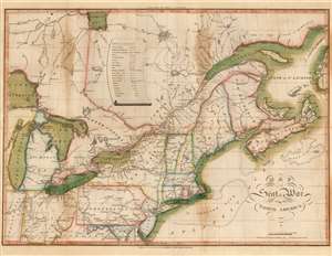
Map of the Seat of War in North America.
sold
- Digital Map Information
- Suitable for large format printing
- Full resolution TIFF file
- ICC color profile embedded
- Delivered instantly via download link
This John Melish's 1815 map of the northeastern United States and Canada, one of the earliest works by the first American publisher to concentrate specifically on maps. It is moreover one of the earliest maps specifically relating to the War of 1812 (1812 - 1815), and is one of the few maps pertinent to the war that was printed while it was still underway. It is, moreover, one of the best Federal Period maps available to the collector. Melish drew the map prior to the declaration of the war, and published it in conjunction with his 1812 A description of the British possessions in North America. So successful was that work that the plate swiftly wore out. This second edition of the map - 'with additions and improvements' - was engraved to accompany Melish's 1813 Military and Topographical Atlas of the United States. The identical second edition appeared in the 1815 second edition of the work. Both editions were engraved by Henry Schenck Tanner, and in this respect the map represents the work of two definitive figures in American map publishing. (more details)
The first large scale trigonometric survey of the Boston vicinity since Des Barres.
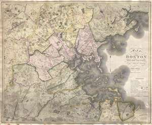
Map of Boston and its vicinity from Actual Survey.
sold
- Digital Map Information
- Suitable for large format printing
- Full resolution TIFF file
- ICC color profile embedded
- Delivered instantly via download link
An exceptional 1819 first edition wall map of Boston, Massachusetts jointly published by John Groves Hales and John Melish. Centered on Boston, Hales' map covers some 720 square miles from Acton to Scituate and from Beverly to Walpole. Hales offers exceptional ... (more details)
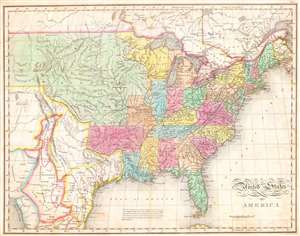
United States of America
sold
- Digital Map Information
- Suitable for large format printing
- Full resolution TIFF file
- ICC color profile embedded
- Delivered instantly via download link
One of the most important American maps of the United States to appear in the early 19th century. Depicts the United States and Mexico roughly from the Atlantic to the region immediately west of the Rocky Mountains, including the massive Missouri Territory, Texas ... (more details)
The last edition of Melish's iconic 'Manifest Destiny' map of the United State to be published in his lifetime.
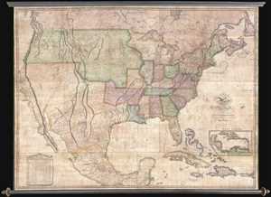
Map of the United States with the Contiguous British & Spanish Possessions Compiled from the latest & best authorities by John Melish . . . Improved to 1822.
sold
- Digital Map Information
- Suitable for large format printing
- DPI: 300
- File Size: 92.78 MB
- File Type: ZIP / TIFF
- ICC color profile embedded
- Delivered instantly via download link
An example of John Melish's important 1822 map of the United States. Melish's map is considered the most influential map of American published in the 19th century and is rivaled only by John Mitchell's 1755 map of North America as the single most influential map ... (more details)