
Montanus, Arnoldus (sold)

Arnoldus Montanus (c. 1625 - 1683) was a Dutch scholar, publisher, schoolmaster and author active in Amsterdam during the latter half of the 17th century. Montanus is a Latinized form of van den Berg or van Bergen. He studied theology at Leiden University and was ordained a minister in 1653. In 1667 he became headmaster of the Latin School of Schoonhoven, where he died in 1683. Most of Montanus's work was published in conjunction with engraver Jacob van Meurs and focused on travel narratives to Asia and the Americas. His most famous book, De Nieuwe en Onbekende Weereld, contains what is arguably the first view of New York City, the New Amsterdam. His other works offer up some of the earliest known descriptions of China and Japan. Much of Montanus' work was translated and published in English by John Ogilby.
One of the earliest known maps to identify the 'Sea of Korea'.
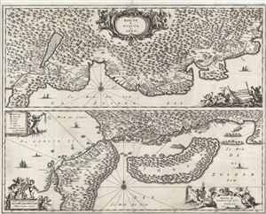
Route d'Osacca a Iedo. / Route de Nangasacqui a Osacca.
sold
- Digital Map Information
- Suitable for large format printing
- DPI: 300
- File Size: 16.01 MB
- File Type: ZIP / TIFF
- ICC color profile embedded
- Delivered instantly via download link
An extremely uncommon 1669 map of parts of Japan between Osaka and Yedo (Tokyo), and between Osaka and Nagasaki. This map was drawn by Arnoldus Montanus to illustrate the travel route taken by an official Dutch trade delegation to the emperor of Japan in the early ... (more details)
The first map in the Visscher-Jansson Series to identify New York, New Jersey, and Albany.
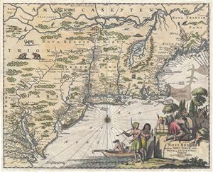
Novi Belgii quod nunc Novi Jorck vocatur, Novae Qe. Angliae & Partis Virginiae Accuratissima et Novissima Delineatio.
sold
- Digital Map Information
- Suitable for large format printing
- DPI: 300
- File Size: 6.84 MB
- File Type: ZIP / TIFF
- ICC color profile embedded
- Delivered instantly via download link
A very attractive example of Arnoldus Montanus and John Ogilby's 1671 important map of New York, Virginia, New Jersey, and New England - the first in the Jansson-Visscher series to use British nomenclature. Part of the Jansson-Visscher Series (maps derived from ... (more details)
Employs a mountain range to separate the Amazon and Paraguay Rivers - unlike most other maps of South America from this era.
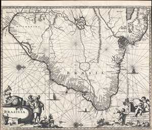
Brasilia.
sold
- Digital Map Information
- Suitable for large format printing
- DPI: 300
- File Size: 5.85 MB
- File Type: ZIP / TIFF
- ICC color profile embedded
- Delivered instantly via download link
This is a 1671 Arnoldus Montanus map of Brazil. Oriented toward the west, the map depicts the region from the Rio de la Plata to Guiana and the Atlantic Ocean and from two mythical lakes (Lake Parima and Lake Xarayes) to the Atlantic Ocean. As was common for maps ... (more details)
Employs a mountain range to separate the Amazon and Paraguay Rivers - unlike most other maps of South America from this era.
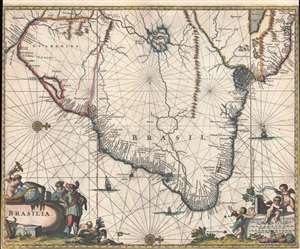
Brasilia.
sold
- Digital Map Information
- Suitable for large format printing
- DPI: 300
- File Size: 4.6 MB
- File Type: ZIP / TIFF
- ICC color profile embedded
- Delivered instantly via download link
This is a 1671 Arnoldus Montanus map of Brazil. Oriented toward the west, the map depicts the region from the Rio de la Plata to Guiana and the Atlantic Ocean and from two mythical lakes (Lake Parima and Lake Xarayes) to the Atlantic Ocean. As was common for maps ... (more details)
The hunt for El Dorado.
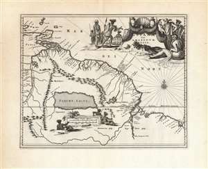
Guiana sive Amazonum Regio.
sold
- Digital Map Information
- Suitable for large format printing
- DPI: 600
- File Size: 35.21 MB
- File Type: ZIP / TIFF
- ICC color profile embedded
- Delivered instantly via download link
This beautiful engraving is a 1673 Arnold Montanus map of the northwestern parts of South America, including Lake Parima (Parime Lacus), revealing the hoped-for route to El Dorado. Coverage embraces from Isla Margarita and the Orinoco Delta eastward as far as Tampico and southwards as far as the Amazon River. Geographically, the map is a faithful copy of a map of the same title engraved by Jodocus Hondius Jr. in 1629, and published by the Blaeu and Hondius firms throughout the 17th century. This whole lineage of maps derives from Hessel Gerritz' seminal Guaiana ofte de Provincien tusschen Rio de las Amazonas ende Rio de Yuiapari ofte Orinoque, a map based equally on Gerritz' own travels to the West Indies and the firm belief of travelers and geographers alike in the existence of El Dorado. This example appeared in Montanus' 1673 Unbekannte Neue Welt, having been engraved by Montanus for John Ogilby's America in 1671 (there is no alteration to the plate between these two issues, and no clear distinction to be made between them). (more details)