
NEW ACQUISITIONS
Considered by British clubbers to be the clubbing capital of the world.
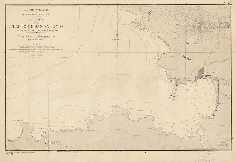
Mar Mediterráneo. Islas Baleares. Ibiza. Plano del Puerto de San Antonio.
$175.00
Acquire
This is a 1956 Depósito Hidrográfico nautical chart or maritime map of San Antonio Port on Ibiza in the Balearic Islands. Today known as Sant Antoni de Portmany, the city of San Antonio is situated along the map's right side, offering mariners an unobstructed depiction of the port's approaches. Depth soundings in meters occupy the innermost parts of the bay. Lines across the bay, and the Balearic Sea mark off ten-meter increments of open ocean. A handful of locations are noted in the region, including a house and group of huts. Manuscript notations indicate a pier that moved slightly to the west since one is marked by dashed lines and the other by solid lines. Other manuscript additions illustrate buildings and the extension of a road. The cemetery has also been crossed out in manuscript. (more details)
Identifies many of the ancient ruins surrounding the bay!
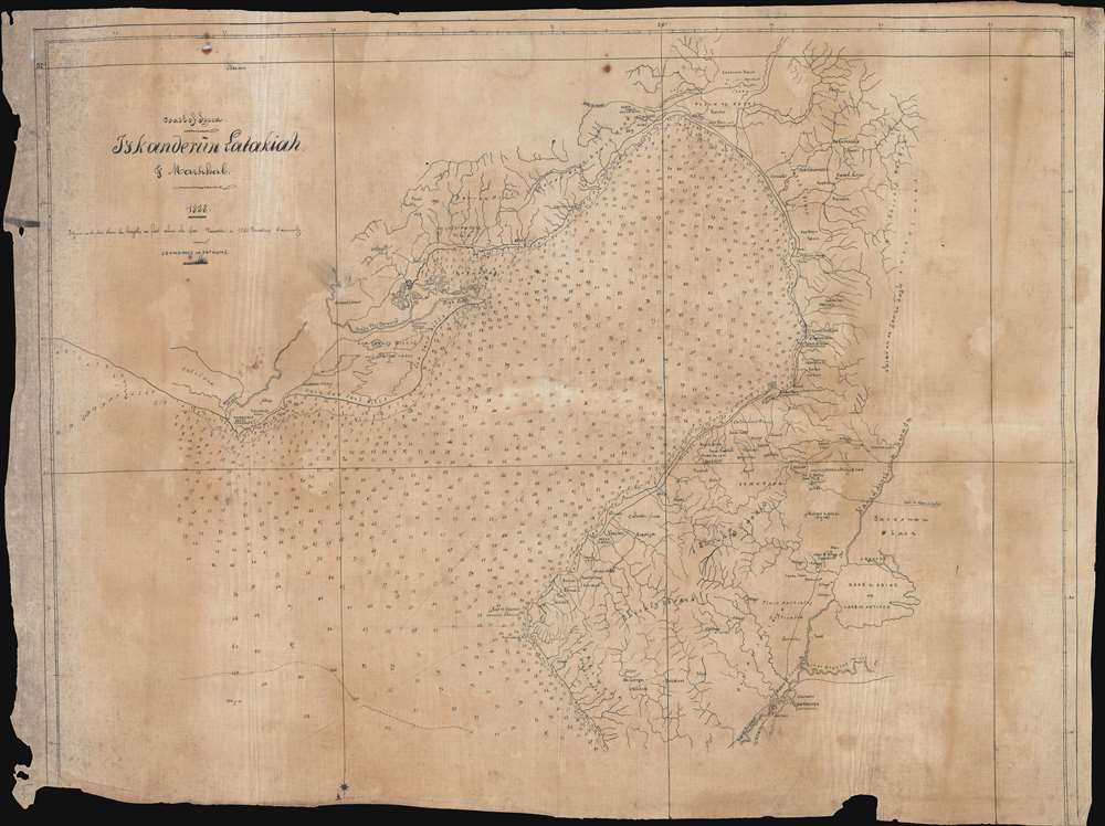
Coast of Syria. Iyskanderin Latakiah and Markhab.
$1,500.00
Acquire
- Digital Map Information
- Suitable for large format printing
- File Size: 32.45 MB
- File Type: ZIP / TIFF
- ICC color profile embedded
- Delivered instantly via download link
This is a c.1858 manuscript nautical chart or maritime map of the Bay of Iskenderun in modern-day Turkey. Copied by hand from a British Admiralty chart, this map's creator exhibits extreme care and attention to detail, positioning nearly every depth sounding almost precisely where it appears on the printed version. Notes along the coastline provide landmarks and understanding and identify various landscapes, including 'very low sand hills,' 'cultivated and uncultivated plains', 'low swampy ground and shallow lakes,' and 'barren hills covered with brush wood.' Alexandretta, also known as Iskenderun, appears on the right side of the bay. Villages are labeled all around the bay, and the areas extensive river and stream network is depicted in detail. (more details)
A Beautiful and Accurate View of Gloucester and her Cathedral
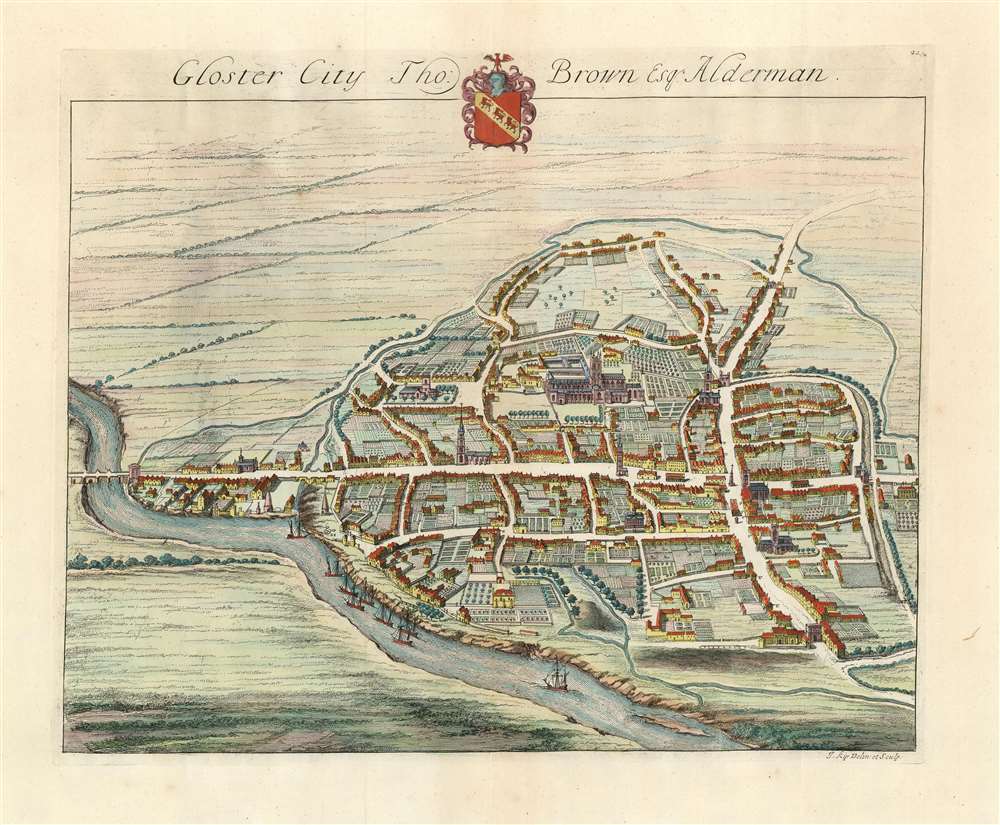
Gloster City Tho: Brown Esq. Alderman.
$350.00
Acquire
- Digital Map Information
- Suitable for large format printing
- DPI: 600
- File Size: 16.99 MB
- File Type: ZIP / TIFF
- ICC color profile embedded
- Delivered instantly via download link
This is an attractive 1724 bird's-eye view of Gloucester in the United Kingdom, by Johannes Kip. The northwest-oriented view is centered on the city's unmistakeable cathedral. Westgate Street, Southgate Street and the London Road can all be clearly seen, as well as the gates after which these streets were clearly named. Ships can be seen sailing the River Severn in the foreground. Though not named, St. Mary de Lode Church is identifiable as well. Not only these, but also the great manors of the city are shown, revealing their grounds and formal gardens in detail. Kip made a specialty of documenting England's noble estates, so the detail available here is unsurprising. (more details)
Depicts a great African kingdom that was slowly dismantled by civil war and Portuguese colonial interests.
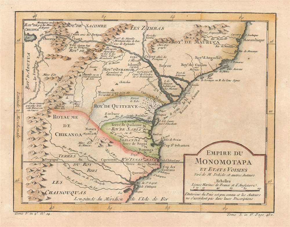
Empire du Monomotapa et Etats Voisins.
$250.00
Acquire
- Digital Map Information
- Suitable for large format printing
- DPI: 600
- File Size: 4.88 MB
- File Type: ZIP / TIFF
- ICC color profile embedded
- Delivered instantly via download link
This is a 1780 Jacques-Nicolas Bellin map of southeastern Africa. Centered on modern-day Mozambique, the map depicts part of the Kingdom of Mutapa, a vast empire that dominated parts of southern Africa from 1430 - 1760. Smaller kingdoms, the Kingdom of Quiterve, the Kingdom of Sabia, and the Kingdom of Chikanga, are also identified. The Zambezi River and its delta, also labeled here as the Cuama River, dominates the upper portion of the map. Short comments provide some context and label certain peoples as being 'friends of the Portuguese,' the region's gold mines, and a castle built by the Portuguese at Tete. (more details)
Traces part of Gmelin's expedition across Siberia to join Vitus Bering.
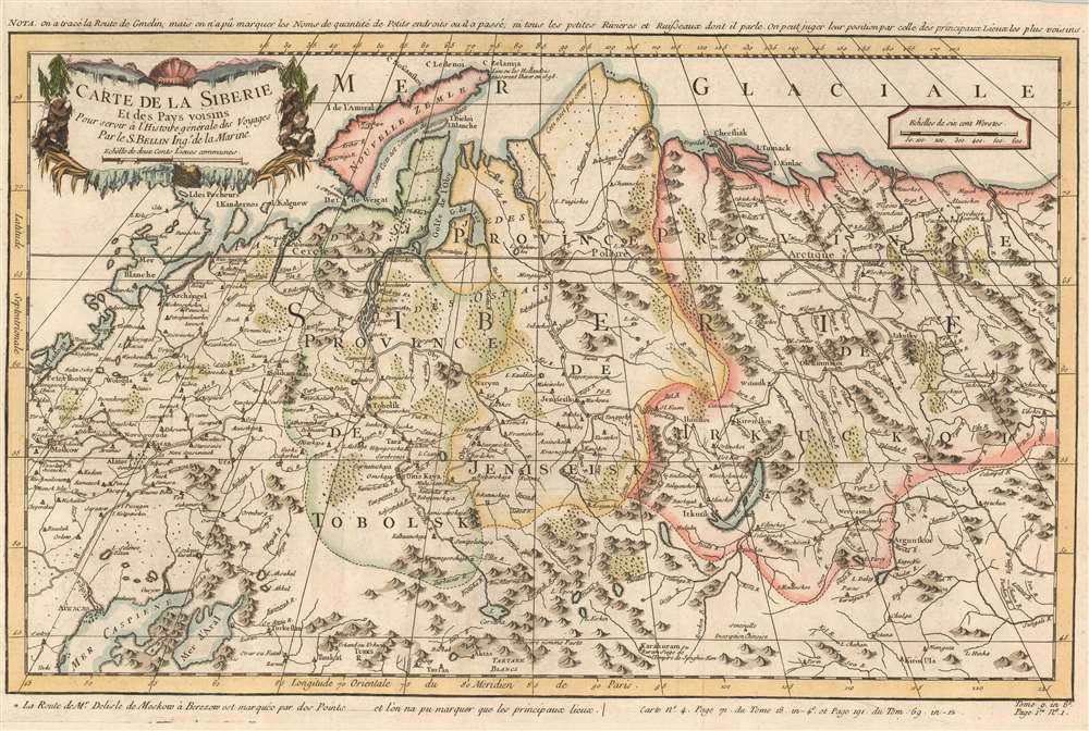
Carte de la Siberie et des Pays voisins.
$200.00
Acquire
- Digital Map Information
- Suitable for large format printing
- DPI: 600
- File Size: 12.08 MB
- File Type: ZIP / TIFF
- ICC color profile embedded
- Delivered instantly via download link
This is a 1780 Jacques-Nicolas Bellin map of Siberia. Depicting the region from Moscow and St. Petersburg to central Asia, numerous cities, towns, and villages are labeled. The region's rivers are illustrated in detail, along with its many mountain ranges. (more details)
Captures Portuguese colonial ambitions in Angola.
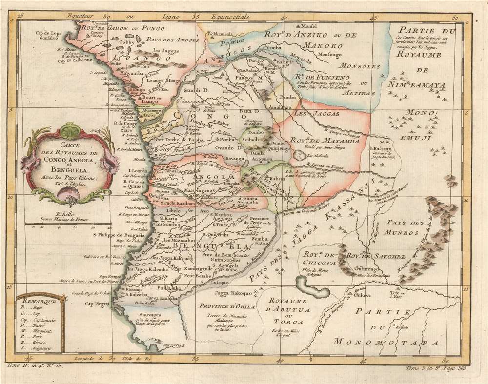
Carte des Royaumes de Congo, Angola, et Benguela. Avec les Pays Voisins.
$350.00
Acquire
- Digital Map Information
- Suitable for large format printing
- DPI: 600
- File Size: 6.1 MB
- File Type: ZIP / TIFF
- ICC color profile embedded
- Delivered instantly via download link
This is a 1780 Jacques-Nicolas Bellin map of west-central Africa. Focusing on the kingdoms surrounding the Congo River, Bellin provides a snapshot of Portuguese colonial dominance in the region. Numerous towns and villages are labeled, some of them Portuguese, some of them African. Short comments provide some information where it was available, such as, concerning the Royaume de Dongo, 'destroyed by the Portuguese.' Or, just below Benguela, where savages or sauvages apparently live, 'it is said that language is not used here.' (more details)
Will stoke your desire to visit this beautiful region.
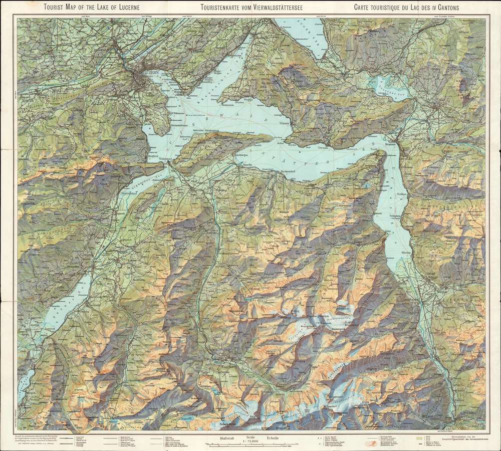
Tourist Map of the Lake of Lucerne. Touristenkarte vom Vierwaldstättersee. Carte Touristique du Lac des IV Cantons.
$200.00
Acquire
- Digital Map Information
- Suitable for large format printing
- Full resolution TIFF file
- ICC color profile embedded
- Delivered instantly via download link
This is a 1948 Orell Füssli tourist map of Lake Lucerne in Switzerland. Lake Lucerne's unmistakable shape, with its several sharp bends, acts as the focal point. Switzerland's incredible topography compliments the lake's 'negative space' well, and color and contour lines emphasize the impressive changes in altitude. Lucerne, Altdorf, and other large towns are clearly labeled, and myriad smaller towns and villages dot the landscape. The region's other rivers and lakes appear as well, completing an incredible aesthetic bound to entice both Swiss and foreign tourists, to spend their vacation admiring Lake Lucerne's natural beauty. (more details)
The state of the art of Western Cartography in Russia during the Time of Troubles.
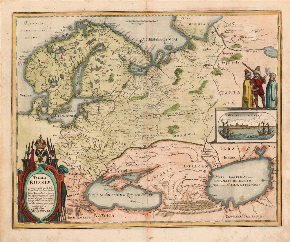
Tabula Russiae ex autographo, quod delineandum curavit Foedor filius Tzaris Boris desumta et ad fluvios Dwinam, Zuchanaw aliaque loca quandum ex tabulis et notitijs ad nos delatis fieri potuit amplificaca alias dicta Moscovia.
$850.00
Acquire
- Digital Map Information
- Suitable for large format printing
- DPI: (600.12890625, 600.12890625)
- File Size: 10.05 MB
- File Type: ZIP / TIFF
- ICC color profile embedded
- Delivered instantly via download link
This is a scarce 1638 Matthias Merian map of Russia. Though an intermediary source may have been Hessel Gerritz, the map is believed to have been ultimately derived from a Russian survey prepared at the orders of the Czar of Muscovy, Boris Godunov. Although this map's information dates to the end of the 16th century, the onset of the Time of Troubles following the death of Boris Godunov would curtail much reliable contact with this part of the world, and so well into the 17th century this map would remain the most up-to-date mapping of Muscovy available. (more details)
A scarce pictorial city map of Saint Paul, the capital of Minnesota.
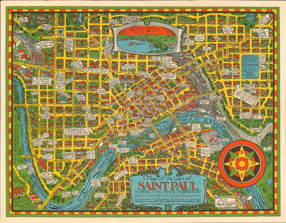
Map of the City of Saint Paul. Capital of the State of Minnesota. Done in the Old Style for Your Education and Enjoyment. Showing all Points of Interest.
$600.00
Acquire
- Digital Map Information
- Suitable for large format printing
- Full resolution TIFF file
- ICC color profile embedded
- Delivered instantly via download link
This is a 1931 Richard H. Burbank pictorial city map or plan of Saint Paul, Minnesota. The map depicts from Minneapolis to Indian Mounds Regional Park and from Wheelock Parkway to South Saint Paul. It is likely that Burbank was inspired by Macdonald Gill's legendary 1914 Wonderground map of London, which this map stylistically resembles. Burbank even hints at this, stating that he composed the map 'in the Old Style for Your Education and Enjoyment'. The yellow streets and the city's buildings drawn in profile all echo Gill's work. Text bubbles appear throughout town, some of which identify landmarks, such as Henry Ford's St. Paul Plant, the State Agricultural College, factory and meatpacking districts, and the Minnesota Freight Transfer, the second largest rail yard in the world. Others include amusing comments, which scattered throughout the work also harken back to Gill. Many of these have educational elements and recall Saint Paul's importance as a railroad and academic hub. The Mississippi River, or 'Ole Man River' flows through town, and separates Saint Paul from Minneapolis and South Saint Paul. (more details)
Highlights the world's air routes, a critical part of World War II.
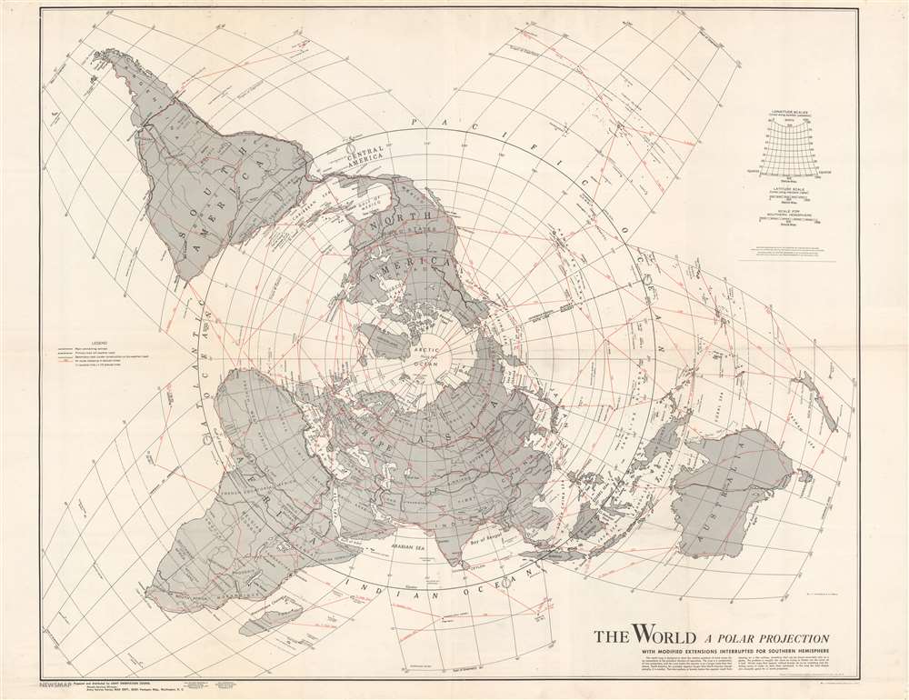
The World. A Polar Projection. With Modified Extensions Interrupted for Southern Hemisphere.
$450.00
Acquire
- Digital Map Information
- Suitable for large format printing
- Full resolution TIFF file
- ICC color profile embedded
- Delivered instantly via download link
This is a two-sided 1943 Army Orientation Course NEWSMAP with a map of the world on a polar projection created by L. F. Vaucher and A. P. Pirola on one side. A global transportation map, Vaucher, and Pirola employ a hybrid projection to most accurately depict worldwide air routes. Red lines highlight these air routes between major cities (which were of extreme importance during World War II) and provide distances in miles. Dashed black and white lines mark significant highways, including recently constructed Alaska Highway, which was completed in 1942. Other depicted highways include a Pan American Highway, depicted here as connecting New York City with Valparaiso and Santiago, Chile, and Buenos Aires, Argentina. Traditionally, the Pan American Highway is illustrated as connecting Buenos Aires and points farther west in the United States, such as Dallas or Denver. The deviation from convention likely comes from the world war and the U.S. government's desire to make it appear that the world is as interconnected as possible. Major roads and highways are also illustrated in northern and central Africa and Asia. The Trans-Siberian Railway and a railway connecting Darwin and Melbourne in Australia are also shown. (more details)
A panoramic tourist road map of Turkey.
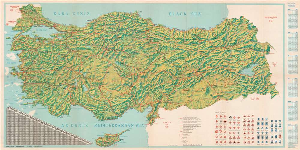
Turkey Panoramic Map.
$300.00
Acquire
This is a 1966 Turkish Ministry of Tourism and Information bilingual English and Turkish panorama tourist map of Turkey. The country's mountainous terrain takes center stage, allowing the viewer a brief but comprehensive view of Turkey's topography. Three different types of red lines illustrate three different road grades, from hard-surfaced roads to 'loose surfaced roads of low standards,' which snake their way from one end of the country to the other and. The black lines represent railroads. A table on the lower right presents Turkish traffic signs to foreign visitors. A chart on the lower left details distances between Turkish cities, while a series of tables along the right border provide average temperatures and humidity levels for eight Turkish cities. (more details)
Celebrates Japan's phoenix-like rise after the devastation of World War II.
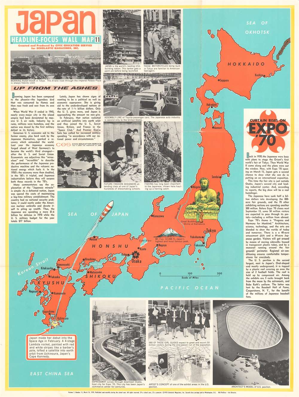
Japan. Headline Focus Wall Map 11.
$250.00
Acquire
This is a 1970 Civic Education Service wall map of Japan celebrating that nation's meteoric recovery after World War II and the recently-opened Expo '70 world's fair outside Osaka. Japan's home islands, colored orange, are flanked by two blocks of text. The text block on the left applauds Japanese economic successes and their sensational rise 'up from the ashes' of World War II. When this map was printed, Japan had recently passed West Germany to become the world's third-strongest economic power. The photographs printed along the right reinforce Japan's economic power and highlight its auto industry, dressmaking schools, and its shipyards. Japan's generosity toward 'underdeveloped nations' is also promoted. The successful launch of a satellite into space, illustrated here by a rocket 'painted with red and white stripes like a barber's pole,' gained Japan entry into the exclusive 'Space Club' alongside the U.S., the Soviet Union, France, and Britain. (more details)
An ominous look at Japan's expansionism during the 1930s.
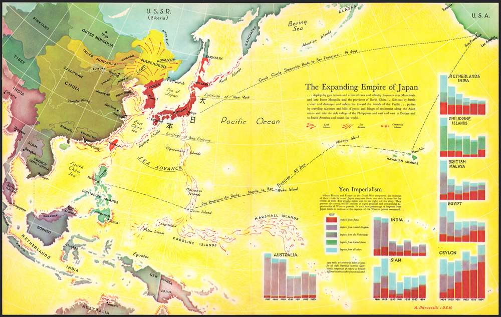
The Expanding Empire of Japan.
$175.00
Acquire
- Digital Map Information
- Suitable for large format printing
- File Size: 14.65 MB
- File Type: ZIP / TIFF
- ICC color profile embedded
- Delivered instantly via download link
This is a 1936 Antonio Petruccelli and Richard Edes Harrison map of the world highlighting the advance of the Japanese Empire in the Pacific. Depicting from Calcutta to San Francisco and from Alaska to Australia, Petruccelli and Harrison paint Japan and Korea (then occupied by the Japanese) deep red. Petruccelli and Harrison then use red to indicate areas of land and sea military advance, along with areas of increased economic activity and control. The Japanese established the puppet state of Manchukuo in 1932, after invading northeastern China. Within a year of this map's publication, Imperial Japan would launch the Second Sino-Japanese War, which would expand into the Pacific War with the United States after the surprise attack on Pearl Harbor on December 7, 1941.
Red arrows emphasize Japan's advance through Manchukuo into northern China, while designs that look like ship's wakes, spread in every direction from Japan and overtake Formosa, the Marianas Islands, Caroline, Islands, and Marshall Islands, among others. No country in the region is immune from an increase in Japanese economic influence, as is evident by the starburst patterns along their coastlines. Bar graphs in the lower right corner visually present this 'yen imperialism', as it is referred to here. Petruccelli and Harrison make Japan's economic and expansionist ambitions immediately apparent, and it likely created feelings of foreboding in its viewers when it was published. (more details)
Red arrows emphasize Japan's advance through Manchukuo into northern China, while designs that look like ship's wakes, spread in every direction from Japan and overtake Formosa, the Marianas Islands, Caroline, Islands, and Marshall Islands, among others. No country in the region is immune from an increase in Japanese economic influence, as is evident by the starburst patterns along their coastlines. Bar graphs in the lower right corner visually present this 'yen imperialism', as it is referred to here. Petruccelli and Harrison make Japan's economic and expansionist ambitions immediately apparent, and it likely created feelings of foreboding in its viewers when it was published. (more details)
Piracy in China!
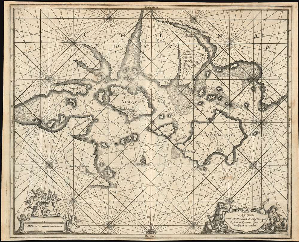
On these Islands whith are now becom a Kingdom used the famous Pyrates; Yquon and Kocksinga to Resort.
$1,200.00
Acquire
- Digital Map Information
- Suitable for large format printing
- DPI: 600
- File Size: 14.75 MB
- File Type: ZIP / TIFF
- ICC color profile embedded
- Delivered instantly via download link
This is a c. 1675 Olfert Dapper piracy map of Xiamen (Amoy), Kinmen (Quemoy), and the Fujian coast in southeastern China. With Xiamen just to the left of center, this map represents the most detailed mapping of the region by the end of the 17th century. Myriad rhumb lines crisscross the map, aiding in navigation, and numerous depth soundings appear as well - something absent in all previous printed maps of the region. Illustrations mark settlements on Xiamen and Kinmen and a bridge crosses the Anhay River, whose modern-day equivalent is unclear. As the map's title suggests, Xiamen and Kinmen were havens for the pirates known in the West as Iquan and Koxinga. (more details)
Air of an old west saloon.
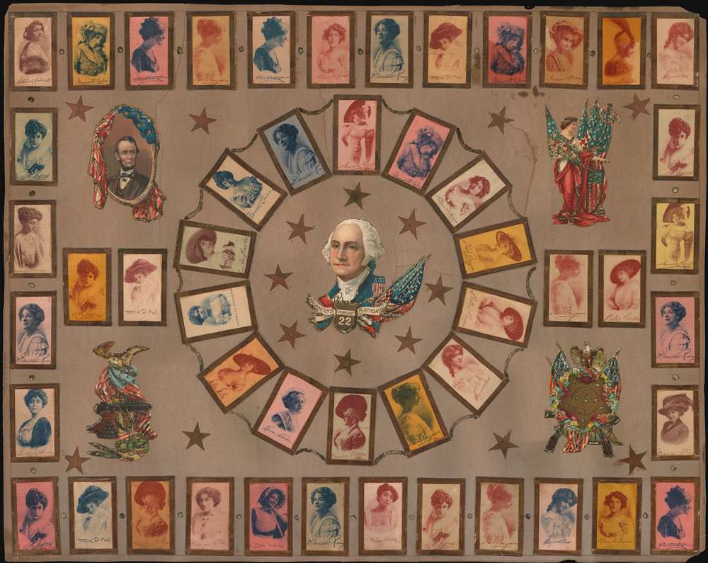
[Folk Art Actress Paste Board].
$1,000.00
Acquire
- Digital Map Information
- Suitable for large format printing
- File Size: 28.9 MB
- File Type: ZIP / TIFF
- ICC color profile embedded
- Delivered instantly via download link
An unusual c. 1920 folk art piece featuring cigarette silk pastedowns along with an assortment of patriotic images. The cigarette silks illustrate famous early 20th century radio and stage actresses, all of roughly the same generation. Most are illustrated at the peak of their fame, roughly 1920. Among the stars featured are Billie Burke (1884 - 1970), Blanche Ring (1871 - 1961), Julia Sanderson (1887 - 1975), Elsie Louise Ferguson (1885 - 1961), Helen Marguerite Clark (1883 - 1940). The photos have a vintage flair that evokes the wild west. (more details)
A first edition!
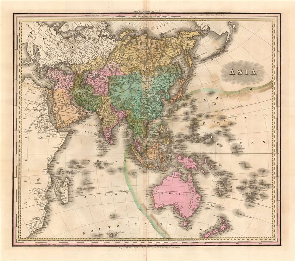
Asia.
$750.00
Acquire
- Digital Map Information
- Suitable for large format printing
- DPI: 600
- File Size: 21.58 MB
- File Type: ZIP / TIFF
- ICC color profile embedded
- Delivered instantly via download link
This is an 1823 first edition Henry Shenk Tanner map of Asia. The map depicts from continental Europe and Africa (though both are uncolored) to Alaska and from the Arctic Ocean to Australia, South Africa, and the Southern Ocean. A few cartographic oddities create intriguing questions. One such abnormality is Hokkaido not being included in the Islands of Japan. Another concerns Luzon, in the Philippines, which is bisected in such a way that it resembles two peninsulas - probably in an attempt to represent the Cagayan River. Myriad locations throughout the region are identified, including Singapore, Persia, Tibet (Thibet), and Nepal (Napaul). The coasts, which had been known to European traders and explorers for hundreds of years, exhibit the most detail, while some inland regions, such as the Gobi Desert, New Guinea, and most of Australia, bear very little detail. (more details)
Illustrates the Israelites crossing the Red Sea.
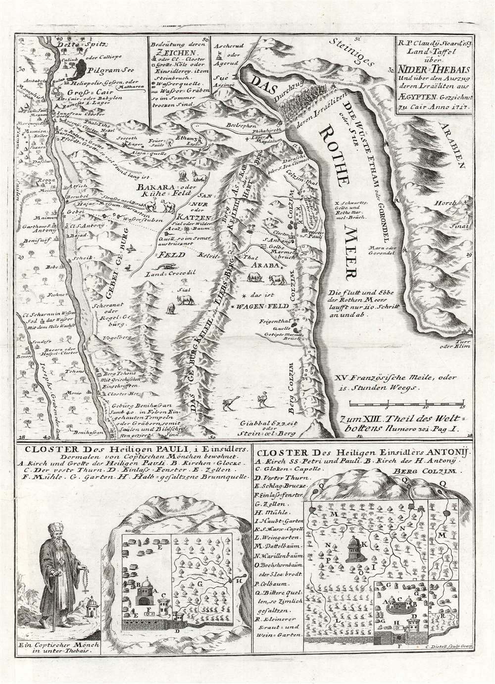
Land-Taffel über NIder-Thebais und über den Auszug deren Israëliten aus AEgypten.
$450.00
Acquire
- Digital Map Information
- Suitable for large format printing
- DPI: 600
- File Size: 11.42 MB
- File Type: ZIP / TIFF
- ICC color profile embedded
- Delivered instantly via download link
This is a c. 1728 Joseph Stocklein map of northeastern Egypt and the Red Sea. This beautifully engraved map illustrates the course followed by the Israelites as they fled captivity in Egypt. The tale, as recounted in Exodus, is one of the most dramatic in the Bible, including such events as Moses' parting of the Red Sea, illustrated at top center. The map's coverage extends from Nile River east to the Red Sea. Cities and oases are identified, including Cairo, Memphis, and Heliopolis. Vignettes of African animals, including crocodiles and ostriches, adorn the map as well. The route the Israelites traveld in their trek to the Red Sea is noted. In the lower quadrants supplementary maps illustrate the 'Cloister of St. Pauli' and the 'Cloister of Saint Einsidles Antonij. (more details)
Features a visually arresting border highlighting American air, land, and sea power to be used in the coming war.
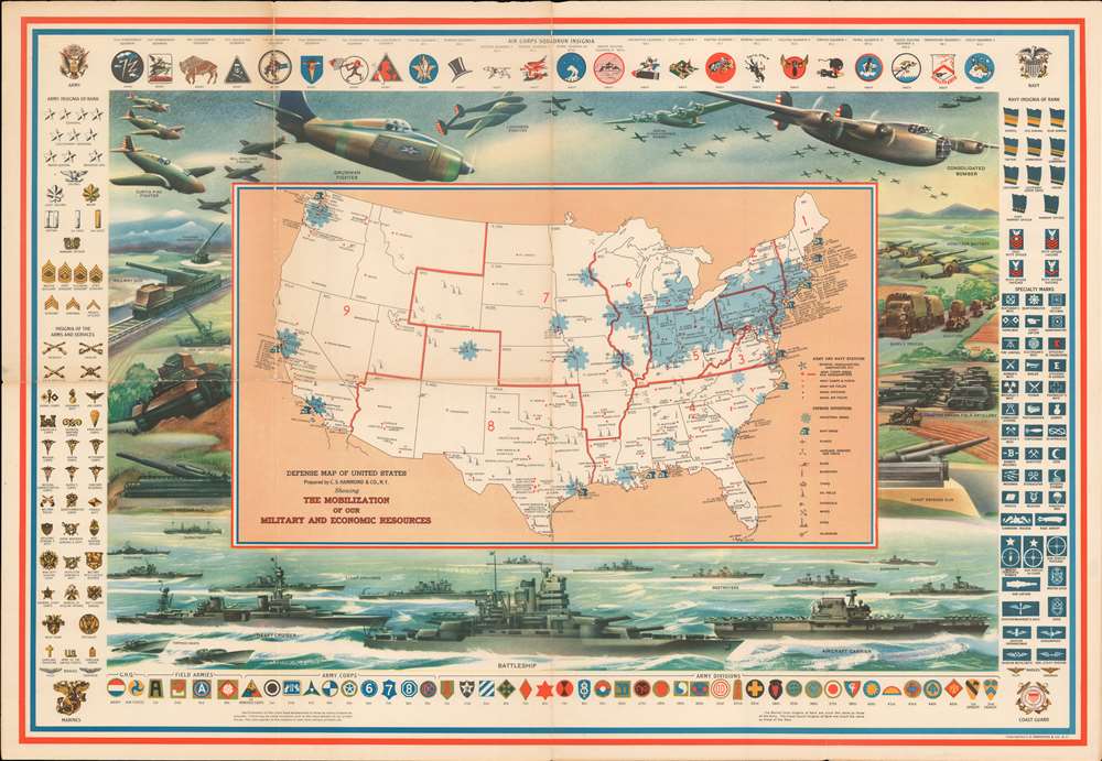
Defense Map of the United States Prepared by C.S. Hammond and Company, N.Y. Showing the Mobilization of our Military and Economic Resources.
$450.00
Acquire
- Digital Map Information
- Suitable for large format printing
- File Size: 68.33 MB
- File Type: ZIP / TIFF
- ICC color profile embedded
- Delivered instantly via download link
This is a c. 1941 C. S. Hammond and Company pictorial map of the United States highlighting the military and economic resources available on the brink of World War II. Blue-colored cogs highlight industrial areas around the country to illustrate the manufacturing might that could be brought to bear. Other defense industries are marked on the map by icons, including shipyards, factories for making planes, airplane engines, munitions, tanks, guns, steel, and aluminum. Army and navy bases are identified as well, as are army and navy airfields. (more details)
Stationery promoting Aberdeen, South Dakota with a handwritten letter to Smith and Wesson on the verso.
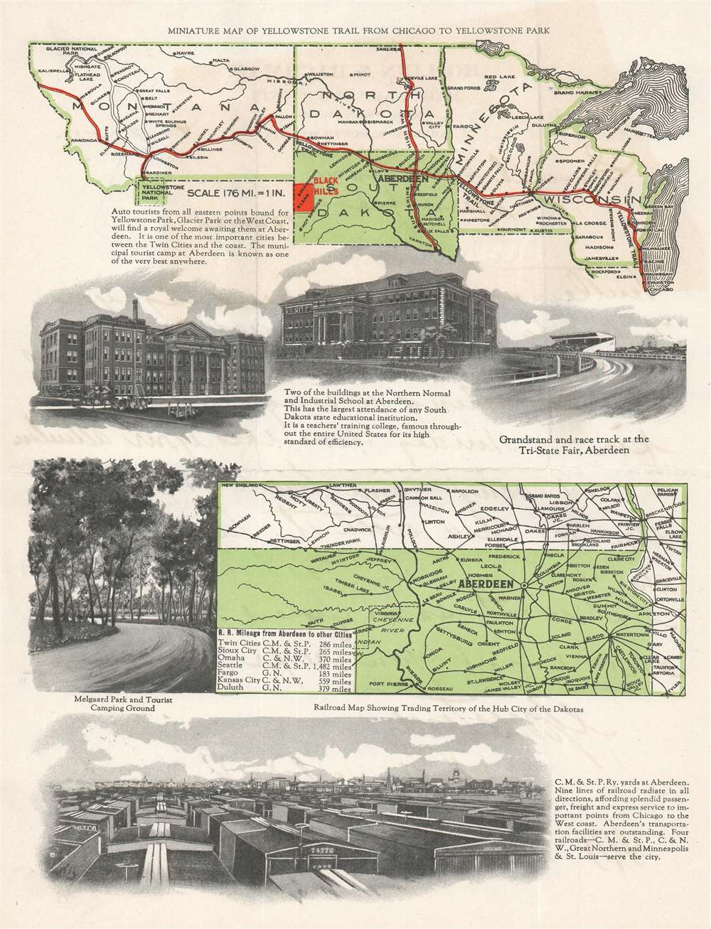
Miniature Map of Yellowstone Trail from Chicago to Yellowstone Park.
$175.00
Acquire
- Digital Map Information
- Suitable for large format printing
- Full resolution TIFF file
- ICC color profile embedded
- Delivered instantly via download link
This is a 1925 stationery map of Aberdeen, South Dakota and the Yellowstone Trail from Chicago to Yellowstone Park. Printed on a piece of stationery, a map stretching from Montana to Chicago, Illinois is situated at the top of the page, with red overprinting marking the route from Chicago to Yellowstone. Major cities are identified along the way, with several other slightly out of the way labeled as well. Of course, Aberdeen is marked by big bold block lettering. The Black Hills are also marked in red. Below this map are views of buildings around Aberdeen, including the grandstand and racetrack at the Tri-State Fair, both buildings of the Northern Normal and Industrial School in Aberdeen, and a view of Melgaard Park and tourist camping ground. A railroad map of North and South Dakota is printed next to the view of Melgaard Park and is meant to illustrate the importance of Aberdeen as a rail hub in the Dakotas, likely to try and promote businesses to relocate to their city. Finally, along the bottom of the sheet, a view of the Chicago, Milwaukee, and St. Paul Railway yards in Aberdeen reinforce its importance within the rail network, with a caption stating that no less than nine rail lines 'radiate' from the city 'in all directions'. (more details)
The single greatest bovine image of all time.
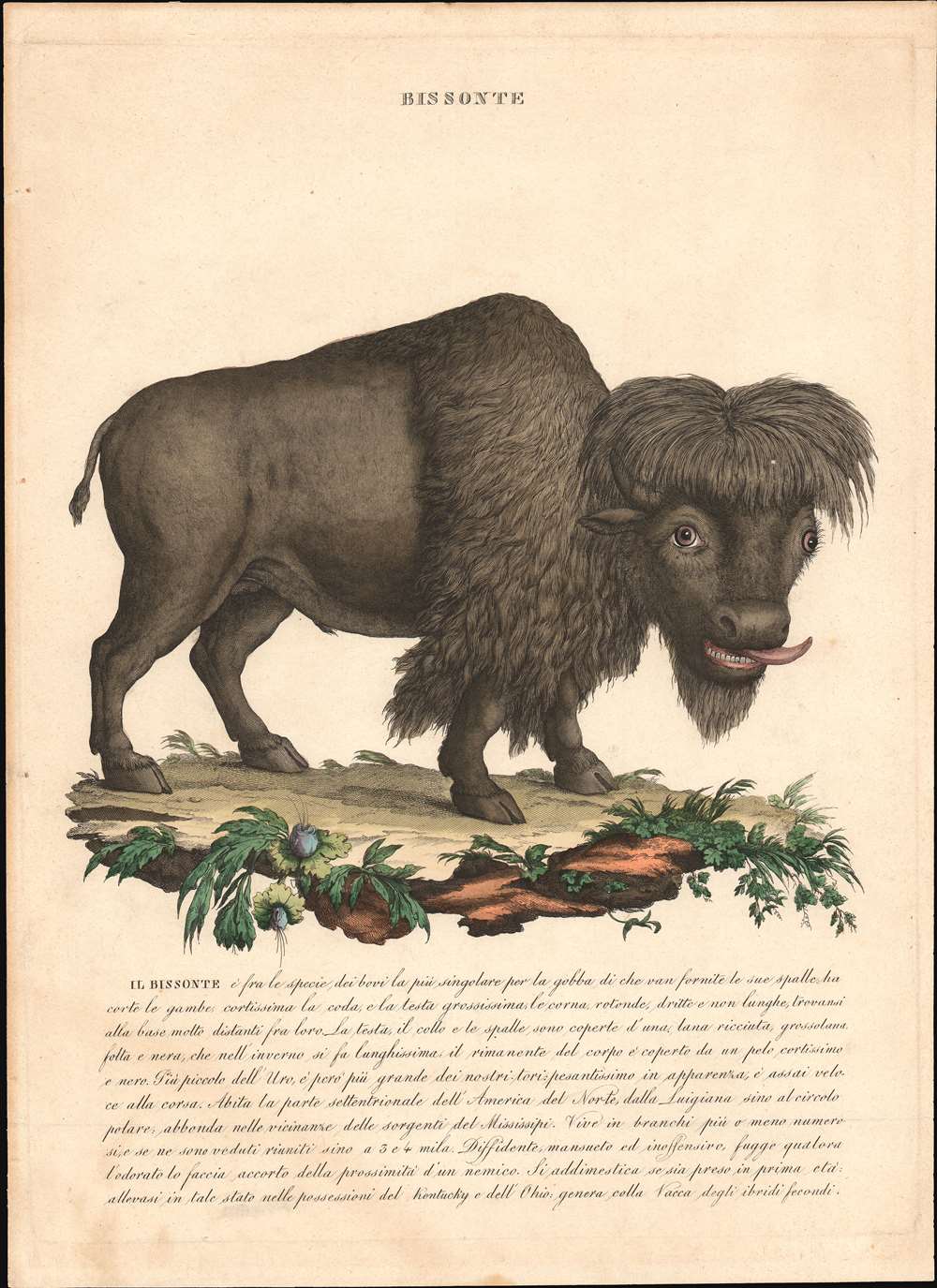
Bissonte.
$1,000.00
Acquire
- Digital Map Information
- Suitable for large format printing
- DPI: 600
- File Size: 8.39 MB
- File Type: ZIP / TIFF
- ICC color profile embedded
- Delivered instantly via download link
This is a c. 1750 zoological print of an American bison by an unknown artist. The bison itself, while remaining reasonably accurate in its overall appearance, bears what can only be described as a goofy expression on its face and has its tongue sticking out of its mouth. The fur on its head is parted down the center and is rather shaggy. This combination of goofy expression and center-parted shaggy hair led us to compare this bison with a member of one of the greatest comedy trios of all time, the Three Stooges, and we have nicknamed him 'Moe' after Moe Howard. The Italian text below the image presents many of the bison's unique attributes and states that it lives in the western portions of North America from Louisiana to the Arctic Circle. (more details)