
NEW ACQUISITIONS
Mitchell's beautiful map featuring the Iberian peninsula.
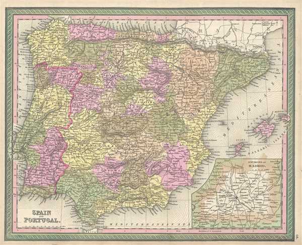
Spain and Portugal.
$150.00
Acquire
- Digital Map Information
- Suitable for large format printing
- DPI: 300
- File Size: 9.03 MB
- File Type: ZIP / TIFF
- ICC color profile embedded
- Delivered instantly via download link
This is a fine example of S. A. Mitchell's 1849 map of Spain and Portugal. Political and topographical features are noted and color coded with elevation rendered by hachure. An inset map of the Environs of Madrid is featured in the map's lower right quadrant. ... (more details)
Mid 19th century map of the European continent.
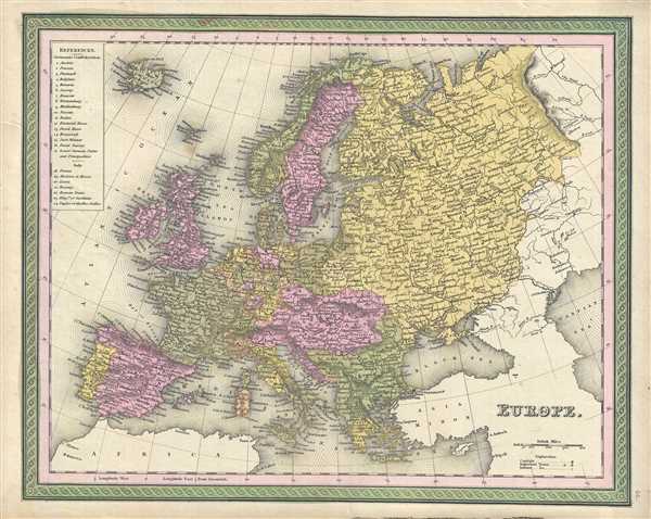
Europe.
$150.00
Acquire
- Digital Map Information
- Suitable for large format printing
- DPI: 300
- File Size: 9.06 MB
- File Type: ZIP / TIFF
- ICC color profile embedded
- Delivered instantly via download link
This is a nice example of Samuel Augustus Mitchell’s 1849 map of Europe. Covers the whole of Europe from Iceland to the Caspian Sea and Ural Mountains and from North Cape toe Sicily. This map is beautifully detailed in full hand-color by country. Political ... (more details)
Argentina a year before its independence from Spain.
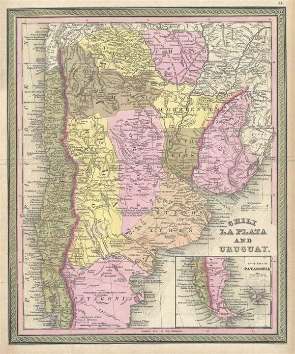
Chili La Plata and Uruguay.
$150.00
Acquire
- Digital Map Information
- Suitable for large format printing
- DPI: 300
- File Size: 8.43 MB
- File Type: ZIP / TIFF
- ICC color profile embedded
- Delivered instantly via download link
This is a lovely example of S. A. Mitchell's 1849 map of Chile, Argentina (La Plata) and Uruguay. Aconcagua, Chuapa, Santiago, and a number of other Andes volcanoes are noted. Shows Bolivia with an outlet to the Sea. Mostly depicts modern day Argentina. ... (more details)
Shows Bolivia with access to the Pacific Ocean through the province of Potosi
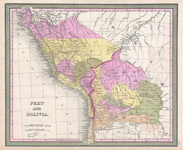
Peru and Bolivia.
$150.00
Acquire
- Digital Map Information
- Suitable for large format printing
- DPI: 300
- File Size: 6.6 MB
- File Type: ZIP / TIFF
- ICC color profile embedded
- Delivered instantly via download link
This is a beautiful 1849 map of Peru and Bolivia by S. A. Mitchell. Centered on Lake Titicaca, on the Peru-Bolivia border, this map covers the whole of both countries following the South American Wars of Independence. Bolivia at this controlled the ... (more details)
Includes inset of Rio de Janeiro.
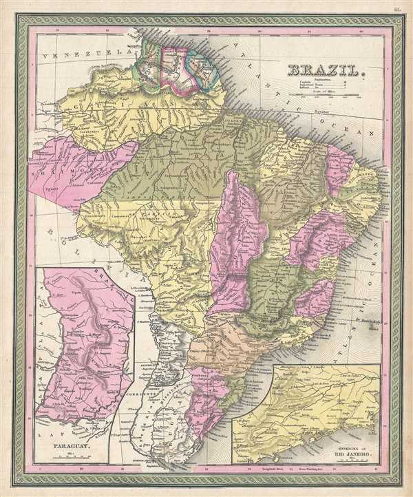
Brazil.
$150.00
Acquire
- Digital Map Information
- Suitable for large format printing
- DPI: 300
- File Size: 8.18 MB
- File Type: ZIP / TIFF
- ICC color profile embedded
- Delivered instantly via download link
A fine example of S. A. Mitchell's 1849 map of Brazil. Covers all of modern day Brazil from Guiana and Venezuela in the north to Uruguay in the south and from Bolivia in the west to the Atlantic. Depicts Brazil divided into its constituent states ... (more details)
Beautiful early map of the continent of South America.
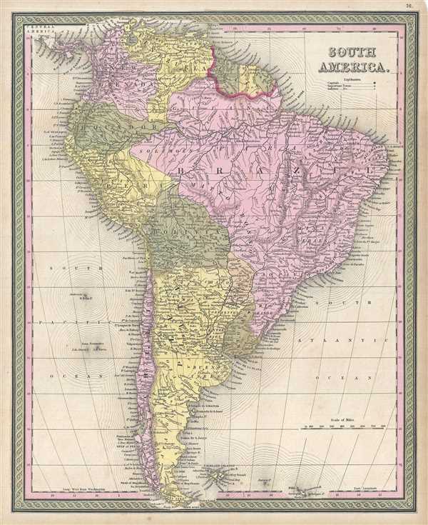
South America.
$150.00
Acquire
- Digital Map Information
- Suitable for large format printing
- DPI: 300
- File Size: 8.02 MB
- File Type: ZIP / TIFF
- ICC color profile embedded
- Delivered instantly via download link
This is an attractive 1849 example of Samuel Augustus Mitchell’s map of South America. The map depicts the whole of South America inclusive of Panama and the Falkland Islands. Ecuador is depicted extending well into central South America along ... (more details)
Showing European possessions.
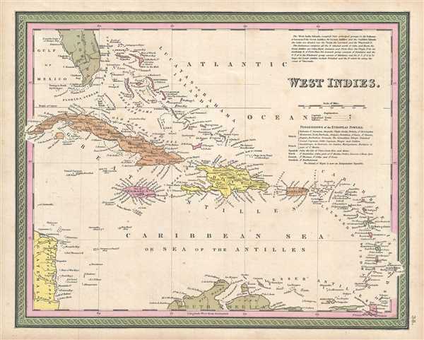
West Indies.
$225.00
Acquire
- Digital Map Information
- Suitable for large format printing
- DPI: 300
- File Size: 5.66 MB
- File Type: ZIP / TIFF
- ICC color profile embedded
- Delivered instantly via download link
This is a fine example of Mitchell’s 1849 map of the West Indies. It covers from Florida and the Bahamas south through the Caribbean islands of Cuba and Hispaniola (Haiti & the Dominican Republic) to the northern Part of South America and east ... (more details)
The earliest obtainable map of San Diego Bay.
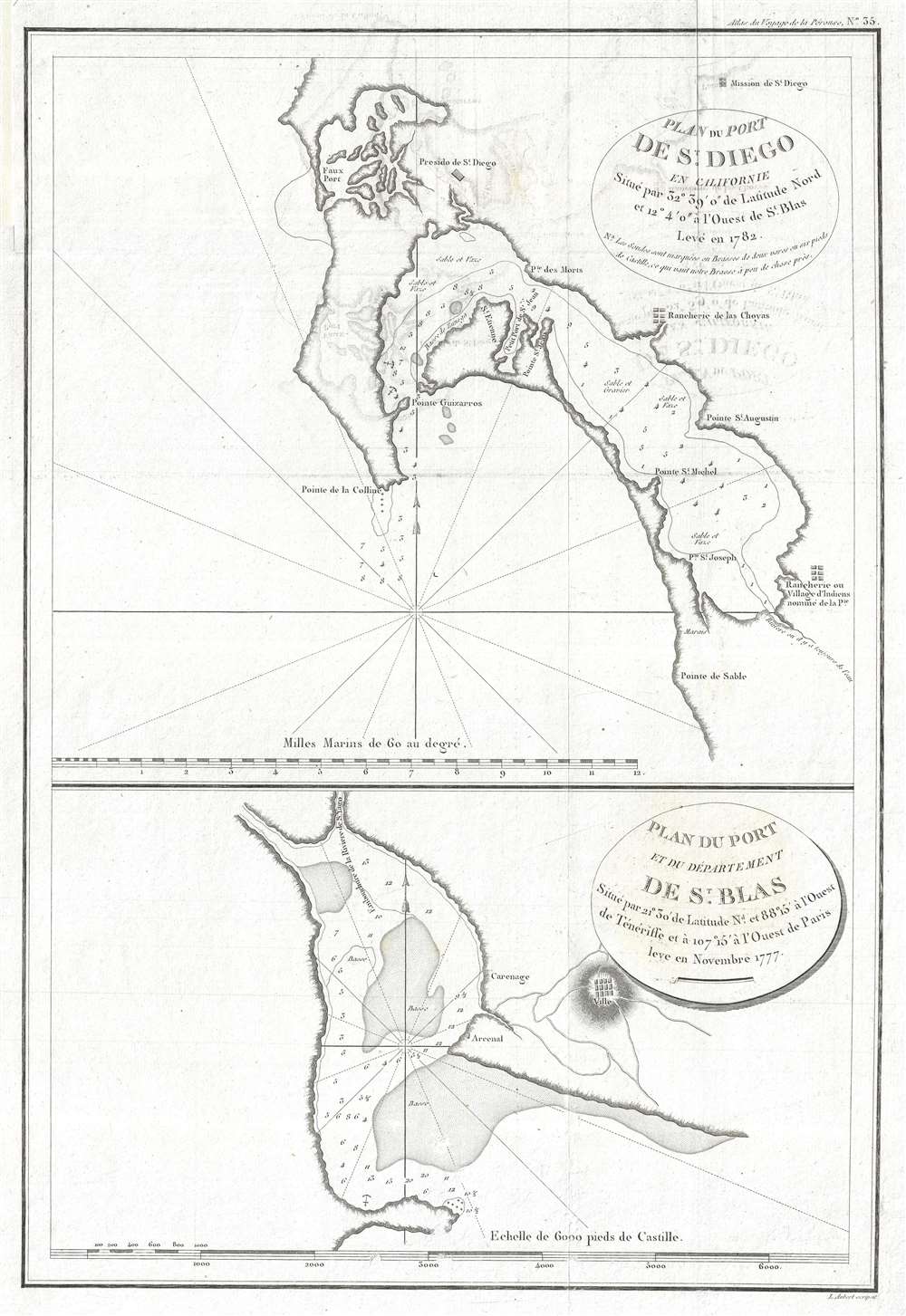
Plan du Port de St. Diego en Californie situe par 32°39'0 de latitude nord et 12°4'0 a l'ouest de St. Blas. Leve en 1782. / Plan du Port de du Departement de St. Blas situe par 21°30' de latitude nd. et 88°15' a l'ouest de Teneriffe et a 107°15' a l'ouest de Paris.
$650.00
Acquire
- Digital Map Information
- Suitable for large format printing
- Full resolution TIFF file
- ICC color profile embedded
- Delivered instantly via download link
The earliest obtainable printed map of San Diego, preceded only by rare maps by Dalyrmple and a few other equally unobtainable works. This map of San Diego was issued for the atlas of Jean-François de Galaup, Comte de La Pérouse's, voyages. The image consists of two maps on a single sheet. The upper map focuses on San Diego Bay, covering from Mission Bay to roughly the Tijuana River, although that river is not shown. The Presidio de St. Diego is identified roughly on the site of the modern-day city of San Diego. Further south, near National City, the Ranchiere de las Choyas is noted. Further south still, near the modern-day Otay River, an American Indian village is noted. Cartographically, this map is derived from the maps of Don Juan Pantoja y Arriola, a Spanish sea captain active on the Acapulco-Manila route in the late 18th century. In addition to crossing the Pacific, he made several coastal runs to San Diego, Monterey, and San Francisco, among other locations on the California coast – where he also completed surveys. Somewhere along this route he must have met La Perouse, who was then surveying the western coast of America, and passed on manuscript versions of his surveys. These found their way into La Perouse's journals and were subsequently published posthumously in Paris. La Perouse probably never actually entered San Diego Bay and relied solely on Pantoja's manuscript charts for his information. (more details)
Uncommon early Mitchell map of Missouri.
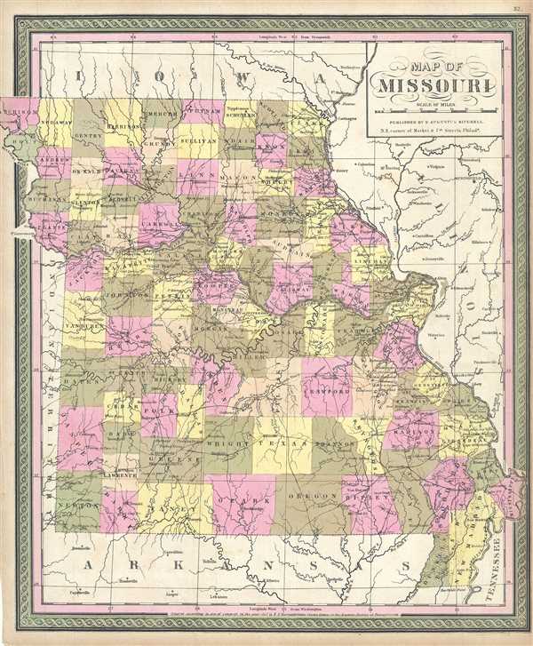
Map of Missouri.
$225.00
Acquire
- Digital Map Information
- Suitable for large format printing
- DPI: 300
- File Size: 7.5 MB
- File Type: ZIP / TIFF
- ICC color profile embedded
- Delivered instantly via download link
This is an uncommon 1849 example of S. A. Mitchell’s map of Missouri. Based upon the Tanner/Burroughs map of 1847, this map covers all of Missouri in beautiful detail. Notes towns, roads, counties, rivers, and other topographic features. The ... (more details)
Mitchell's early map of Kentucky featuring large insets.
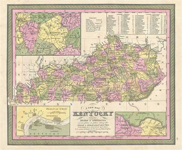
A New Map of Kentucky with its Roads & Distances from Place to Place along the Stage & Steam Boat Routes.
$225.00
Acquire
- Digital Map Information
- Suitable for large format printing
- DPI: 300
- File Size: 6.66 MB
- File Type: ZIP / TIFF
- ICC color profile embedded
- Delivered instantly via download link
This is a nice example of S. A. Mitchell’s 1849 map of Kentucky with three inset maps: environs of Lexington in the upper left quadrant, Falls of the Ohio River in the lower left, and the route between Washington and Clarksburg in the lower ... (more details)
Mitchell's depiction of the state of Arkansas.
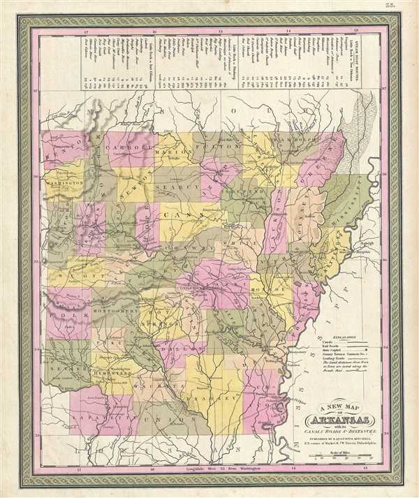
A New Map of Arkansas with its Canals Roads and Distances.
$250.00
Acquire
- Digital Map Information
- Suitable for large format printing
- DPI: 300
- File Size: 5.93 MB
- File Type: ZIP / TIFF
- ICC color profile embedded
- Delivered instantly via download link
This is a beautiful 1849 map of Arkansas by Samuel Augustus Mitchell. The whole is engraved and colored in Mitchell's distinctive style with green border work and vivid pastels. Political and topographical features are noted and color coded ... (more details)
Mid 19th century map depicting Maryland and Delaware.
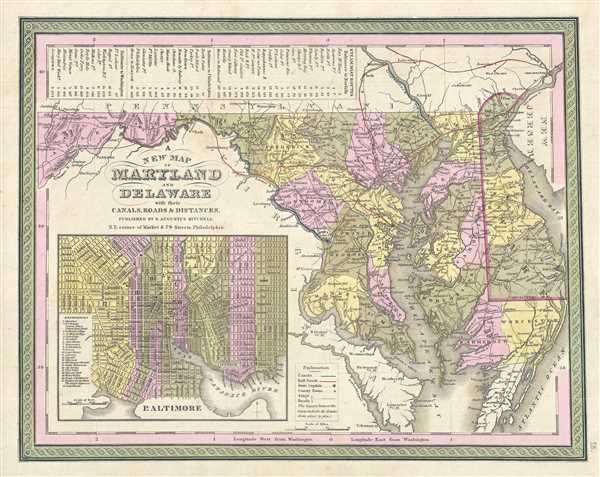
A New Map of Maryland and Delaware with their Canals, Roads and Distances.
$250.00
Acquire
- Digital Map Information
- Suitable for large format printing
- Full resolution TIFF file
- ICC color profile embedded
- Delivered instantly via download link
This is a beautiful 1849 Mitchell Map of Maryland and Delaware. Centered on Washington D.C., this map extends eastward from Maryland to New Jersey and the Delaware Bay. The Chesapeake Bay is rendered in full. In the upper left quadrant of ... (more details)
Mid 19th century map of Connecticut.
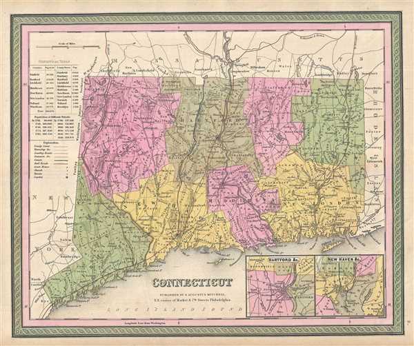
Connecticut.
$250.00
Acquire
- Digital Map Information
- Suitable for large format printing
- DPI: 300
- File Size: 7.15 MB
- File Type: ZIP / TIFF
- ICC color profile embedded
- Delivered instantly via download link
An elegant example of S. A. Mitchell's detailed 1849 map of Connecticut. Centered on Hartford and Middlesex, this map covers the entire state of Connecticut extending eastward from Fairfield to Windham and New London. Two insets in the ... (more details)
Early map of New Hampshire and Vermont.
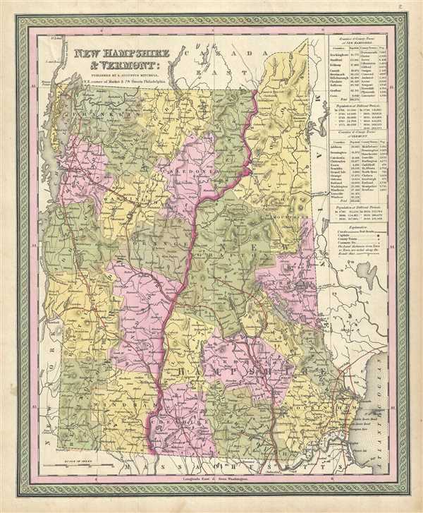
New Hampshire and Vermont.
$150.00
Acquire
- Digital Map Information
- Suitable for large format printing
- DPI: 300
- File Size: 8.26 MB
- File Type: ZIP / TIFF
- ICC color profile embedded
- Delivered instantly via download link
This is an attractive 1849 map of New Hampshire and Vermont by Samuel Augustus Mitchell. Centered on the Connecticut River, which forms the border between New Hampshire and Vermont, this map covers both states as well as adjacent parts ... (more details)
Show disputed northern boundary of Maine.
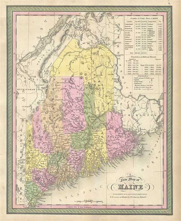
A New Map of Maine.
$150.00
Acquire
- Digital Map Information
- Suitable for large format printing
- DPI: 300
- File Size: 7.07 MB
- File Type: ZIP / TIFF
- ICC color profile embedded
- Delivered instantly via download link
This is a beautiful 1849 map of Maine by Samuel Augustus Mitchell. It covers the entire state of Maine from the New Hampshire border to Passamaquoddy Bay, and northwards as far as the St. John's River. In the upper right quadrant an ... (more details)
Mitchell's map of the United States during a period of westward expansion.
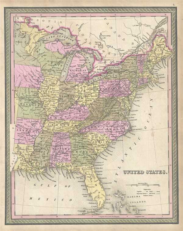
United States.
$450.00
Acquire
- Digital Map Information
- Suitable for large format printing
- DPI: 300
- File Size: 7.92 MB
- File Type: ZIP / TIFF
- ICC color profile embedded
- Delivered instantly via download link
A beautiful example of the 1849 edition of Mitchell’s map of the United States. It covers the United States east of the Mississippi as well as the Trans-Mississippi territories of Louisiana, Arkansas, Missouri, and Iowa. The whole ... (more details)
Beautiful map of Quebec, Canada.
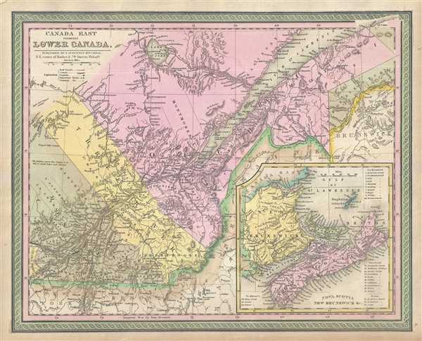
Canada East formerly Lower Canada.
$150.00
Acquire
- Digital Map Information
- Suitable for large format printing
- DPI: 300
- File Size: 8.2 MB
- File Type: ZIP / TIFF
- ICC color profile embedded
- Delivered instantly via download link
This is a beautiful example of Samuel Augustus Michell’s 1849 map of Lower Canada or Quebec, Canada. Centered on the St. Lawrence River Valley, this map covers from Montreal to the mouth of the St. Lawrence, north as far as Lake ... (more details)
18th century map depicting the Imperial Circles of the Holy Roman Empire.
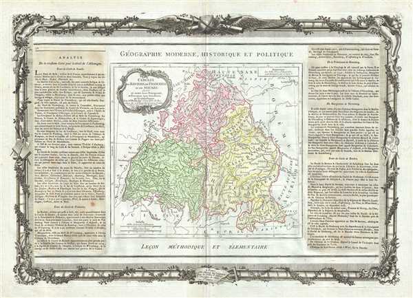
Cercles de Baviere de Franconie et de Souabe.
$250.00
Acquire
- Digital Map Information
- Suitable for large format printing
- DPI: 300
- File Size: 12.48 MB
- File Type: ZIP / TIFF
- ICC color profile embedded
- Delivered instantly via download link
This is a beautifully detailed 1786 map of Bavaria, Swabia and Franconia, Germany by the French Cartographer Louis Brion de la Tour. Renders the entire region in extraordinary detail offering both topographical and political ... (more details)
Beautiful map depicting the Holy Roman Empire's Circle of Austria.

Cercle D'Autriche : divise en toutes ses Provinces, tant Civiles qu'Ecclesiastiques.
$300.00
Acquire
- Digital Map Information
- Suitable for large format printing
- DPI: 300
- File Size: 14.74 MB
- File Type: ZIP / TIFF
- ICC color profile embedded
- Delivered instantly via download link
This is a lovely 1786 map by the French Cartographer Louis Brion de la Tour detailing the counties and duchies of Austria. It covers from Lake Constance eastward to Hungary and south as far as the Adriatic Sea. The Circle of ... (more details)
Striking map of the Czech Republic.
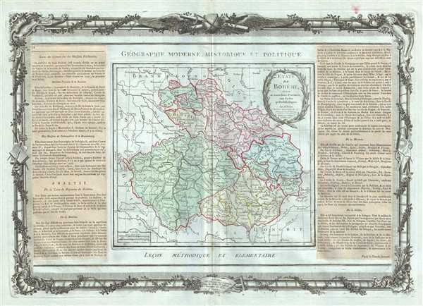
Etats de Boheme, divises en toutes leurs Provinces, tant Civiles qu'Ecclesiastiques.
$250.00
Acquire
- Digital Map Information
- Suitable for large format printing
- DPI: 300
- File Size: 11.75 MB
- File Type: ZIP / TIFF
- ICC color profile embedded
- Delivered instantly via download link
This is an appealing 1786 of Bohemia or modern day Czech Republic by Brion de la Tour and Louis Charles Desnos. It covers all of modern day Czech Republic and parts of Germany and Poland from Frankfurt in Germany to Linz in ... (more details)