
NEW ACQUISITIONS (sold)
Traditional Batik interprets colonial cartography.
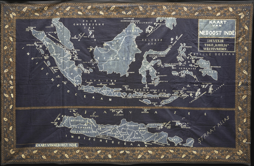
Kaart van Ned. Oost-Indie.
sold
- Digital Map Information
- Suitable for large format printing
- Full resolution TIFF file
- ICC color profile embedded
- Delivered instantly via download link
A rare, possibly unique, c. 1925 map of the Dutch East Indies (Indonesia), remarkable for its fusion of Western cartography with the traditional Indonesian art of batik. Measuring an impressive 60 x 39.5 inches, the map was rendered on cotton using the wax-resist dyeing techniques for which Indonesian textile arts are celebrated, transforming a conventionally Western cartographic image into an unmistakably Indonesian material object. This extraordinary meeting of two visual traditions - European mapmaking and indigenous textile production - emerged at a pivotal moment in the history of the archipelago, when Dutch colonial rule was near an apogee even as Indonesian nationalism gathered momentum. (more details)
Accomplished Self-Published Map, called 'the most detailed and accurate map of the area ever printed.'
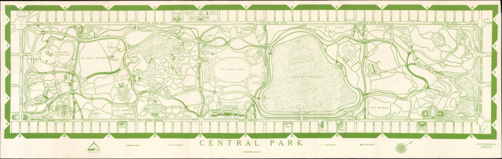
Central Park. / Central Park Map and Guide.
sold
This remarkable 1961 map of Central Park in New York City was independently surveyed, drawn, and self-published by artist and park enthusiast Laura Jacobs. Frustrated by the inadequacy of existing maps, including those issued by the New York City Parks Department, Jacobs set out to map the park herself, documenting its labyrinth of walking paths, bridle trails, playgrounds, statues, ponds, historic sites, and hidden corners. The result was an extraordinarily detailed portrait of Central Park, hailed upon publication as 'the most detailed and accurate map of the area ever printed.' (more details)
Defeat is inevitable; resistance is futile.
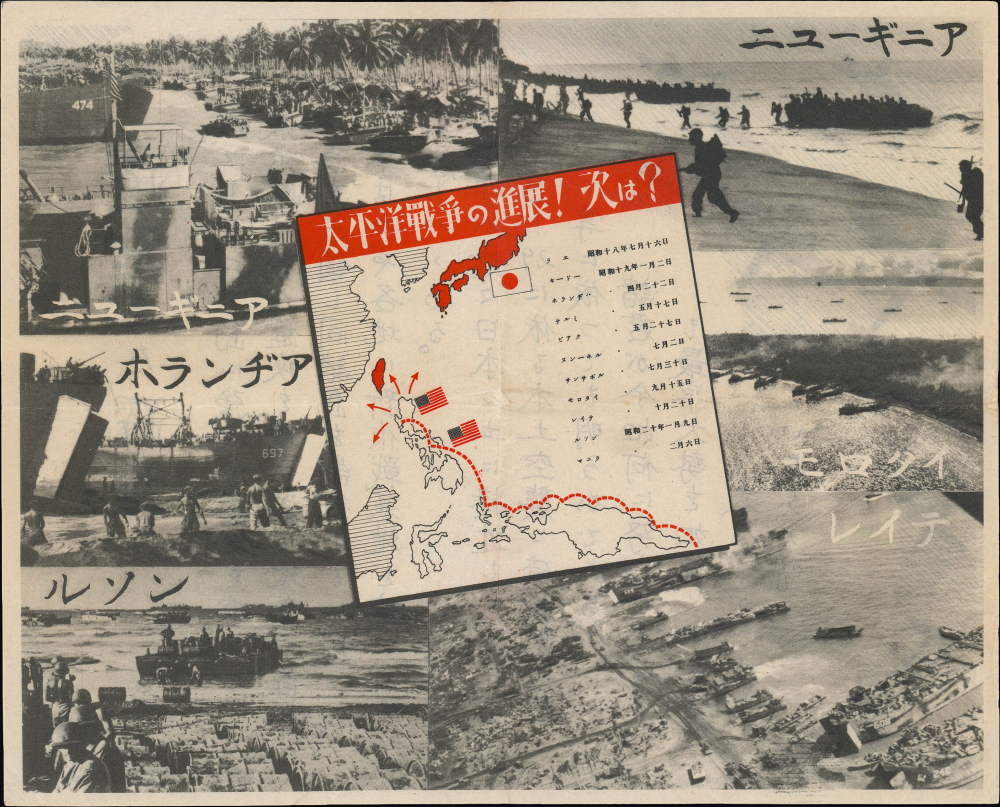
太平戰爭の進展!次は? / [The Progression of the Pacific War! What's Next?]. / 31-J-1.
sold
- Digital Map Information
- Suitable for large format printing
- Full resolution TIFF file
- ICC color profile embedded
- Delivered instantly via download link
A 1945 American airdrop propaganda leaflet and map produced by the U.S. Army's Psychological Warfare Branch in the final months of World War II (1939 - 1945). Issued on the eve of the Battle of Okinawa, it transforms the relentless Allied advance across the Pacific into a stark psychological weapon, tracing the island-hopping campaign ever closer to the Japanese home islands. Combining cartography, battlefield photography, and carefully calculated messaging, the leaflet delivers an unmistakable warning to its Japanese audience: defeat is inevitable, and further resistance is futile. (more details)
Biblical Tourism and the Jewish State
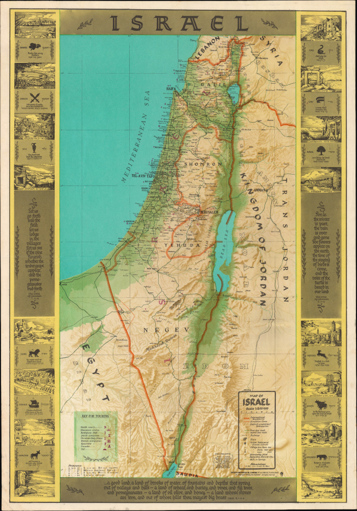
Israel / Map of Israel.
sold
A visually engaging 1963 Joseph Shapiro map of Israel, blending the geography of the modern state with the Biblical landscape of antiquity. Issued during the brief period between Israel's establishment and the territorial transformations of 1967, it depicts the country within the 1949 Armistice Lines while overlaying modern roads, settlements, and infrastructure with ancient place names, archaeological sites, Biblical quotations, and pictorial views. Its English text and extensive visitor guidance suggest the map was designed for the growing Anglo-American tourist market, presenting Israel as both a young modern nation and the setting of Biblical history. (more details)
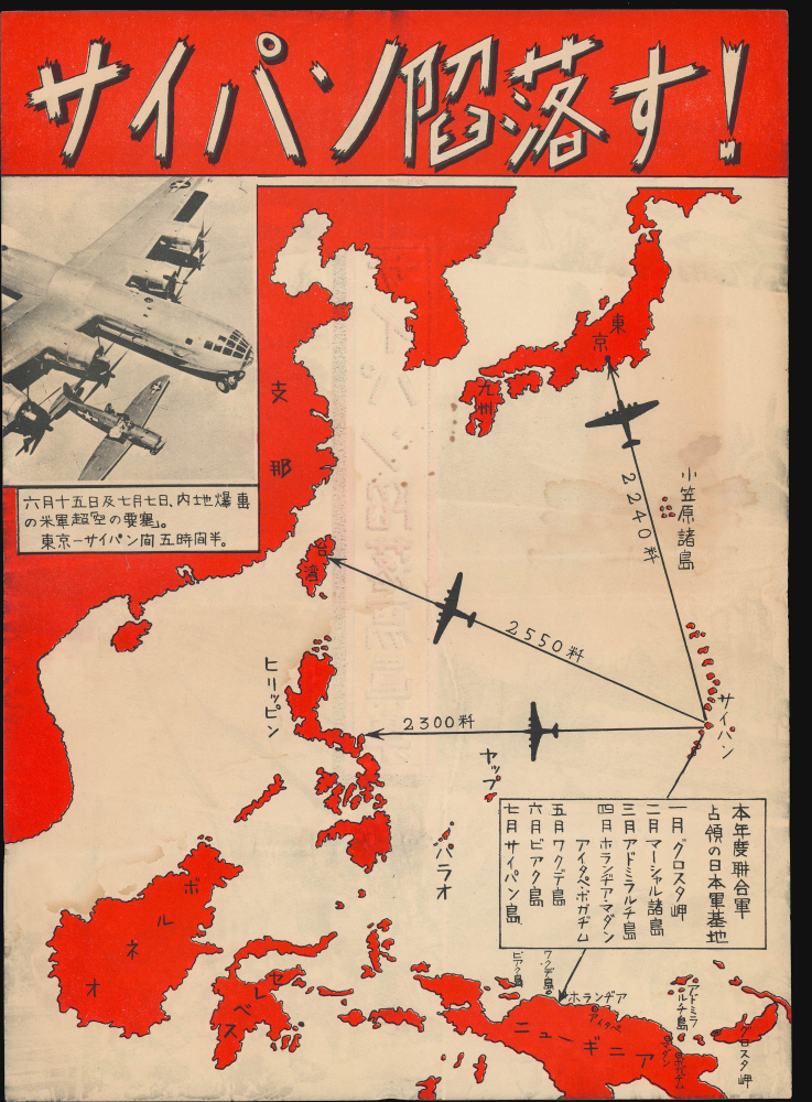
サイパン陷落す!/ [Saipan Falls!].
sold
- Digital Map Information
- Suitable for large format printing
- Full resolution TIFF file
- ICC color profile embedded
- Delivered instantly via download link
This is a 1944 airdrop propaganda leaflet produced by the U.S. Army's Psychological Warfare Branch. Meant to demoralize Japanese troops, it trumpets the Allies' seizure of Saipan and emphasizes the island's proximity to the Japanese home islands and other Japanese possessions, well within range of the devastating new B-29 Superfortress bombers. (more details)
The New British Frontier
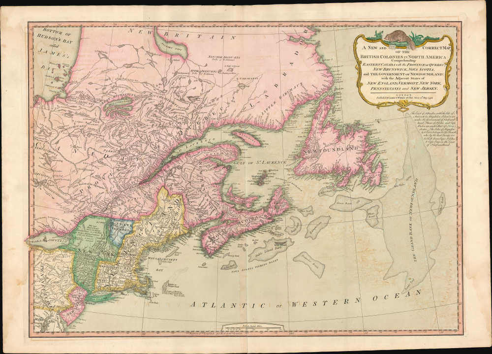
A New And Correct Map Of The British Colonies In North America.
sold
- Digital Map Information
- Suitable for large format printing
- Full resolution TIFF file
- ICC color profile embedded
- Delivered instantly via download link
A significant 1794 Laurie and Whittle map of the northeastern United States and eastern Canada, capturing North America at a pivotal moment between the American Revolutionary War (1775 - 1783) and the War of 1812 (1812 - 1815). The map reflects the geopolitical order created by American Independence: the 1783 Treaty of Paris boundary divides the United States from British Canada, while Vermont, admitted to the Union only three years earlier, appears in one of its earliest dated cartographic representations. The map offers a striking cartographic portrait of redrawn political boundaries that remained far from settled. (more details)
An Extremely Rare Early Subway Image.
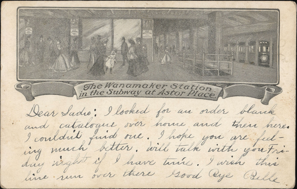
The Wanamaker Station in the Subway at Astor Place.
sold
- Digital Map Information
- Suitable for large format printing
- Full resolution TIFF file
- ICC color profile embedded
- Delivered instantly via download link
This 1904-07 Wanamaker postcard presents one of the few known surviving examples of one of the first printed images of the New York City subway, specifically the platform of the Astor Place Station - which provided entry to the famed Wanamaker's department store. It was printed in 1904 by Wanamaker's to promote their expanded New York City location, whose underground entrance was touted as a unique modern convenience. (more details)
Hawaii as the nexus of Japanese WWII Pacific strategy. California as the target!
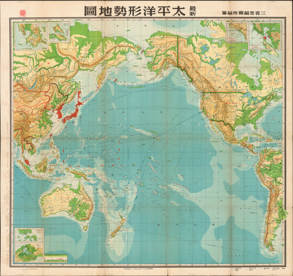
Newest Pacific Situation Map. / 最新太平洋形勢地圖
sold
- Digital Map Information
- Suitable for large format printing
- Full resolution TIFF file
- ICC color profile embedded
- Delivered instantly via download link
This is a rare 1943 (Showa 18) large-format Japanese map of the Pacific, North and South America, and East Asia. Issued at the height of World War II, this map highlights Hawaii's significance to Japan's Pacific strategy as a nexus for all traffic, military and otherwise, between Asia and America. (more details)
Geological Foundation for Long Island’s Development in the Second Half of the 19th Century.
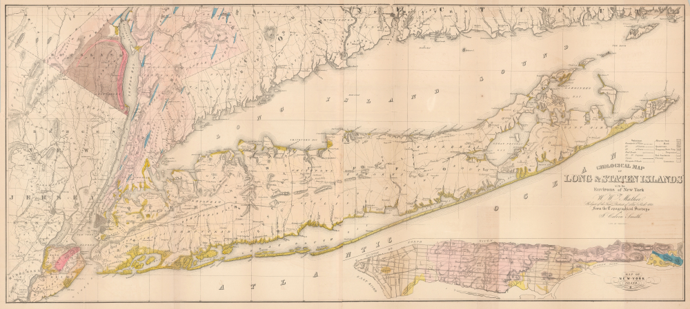
Geological Map of Long and Staten Islands with the Environs of New York.
sold
- Digital Map Information
- Suitable for large format printing
- Full resolution TIFF file
- ICC color profile embedded
- Delivered instantly via download link
The influential 1842 William W. Mather map of Long Island is considered the first comprehensive geological study of the island. Published while the Long Island Rail Road was still under construction, Mather's map captures a landscape that was still overwhelmingly rural, agricultural, and geographically remote from New York City, but whose soils, resources, transportation corridors, and development potential were becoming subjects of intense scientific and commercial interest. Within little more than a decade, the railroad would open vast portions of the island to easier settlement and speculation, initiating a land rush and a process of development that would ultimately transform Long Island into an extension of metropolitan New York. (more details)
Premier Great Lakes Map of the Mid-18th Century.
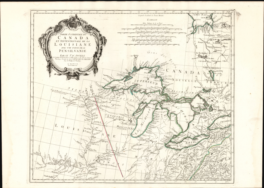
Partie Occidentale du Canada et Septentrionale de la Louisiane avec une partie de Pensilvanie.
sold
- Digital Map Information
- Suitable for large format printing
- Full resolution TIFF file
- ICC color profile embedded
- Delivered instantly via download link
This is Paolo Santini's 1775 map of the western part of Canada, the Upper Mississippi, and the Great Lakes Region. Produced to satisfy European interest in the American Revolutionary War (1775 - 1783), it drew on D'Anville's map, the best French mapping of the region produced during the French and Indian War (1754 - 1763). (more details)
Occupied Hong Kong during World War II.
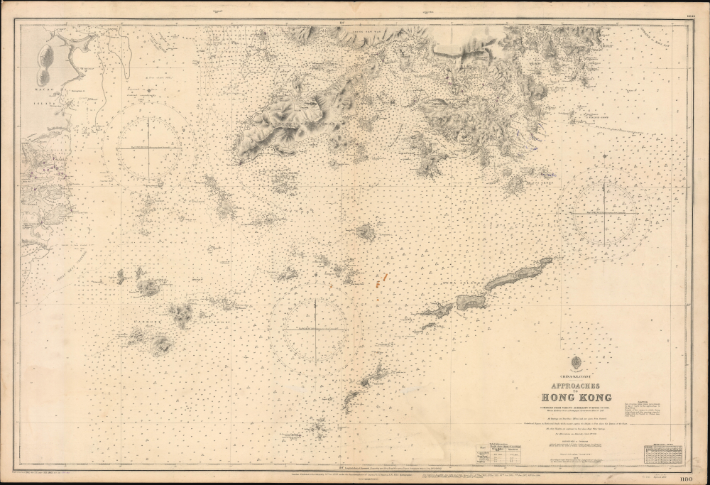
China-S.E. Coast Approaches to Hong Kong.
sold
- Digital Map Information
- Suitable for large format printing
- Full resolution TIFF file
- ICC color profile embedded
- Delivered instantly via download link
This is an 1888 / 1945 British Admiralty World War II nautical chart or map of Hong Kong and the mouth of the Pearl River. Originally prepared in 1888, at the height of British imperial power, this edition, updated in print and manuscript, was the product of more challenging times, when the Japanese occupied Hong Kong during World War II (1939 - 1945). (more details)
Best 19th century map of the Nile Valley near Aswan.
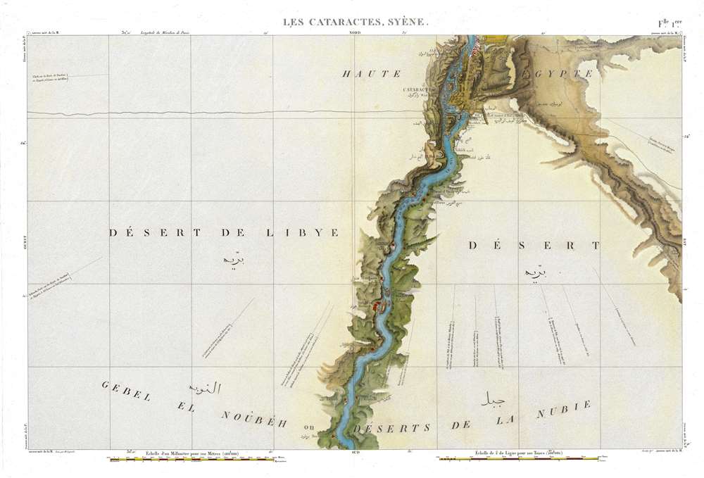
Flle. 1ere. Cataractes Syene Aswan (Carte topographique de l'Egypte et de plusieurs parties des pays limitrophes...)
sold
- Digital Map Information
- Suitable for large format printing
- Full resolution TIFF file
- ICC color profile embedded
- Delivered instantly via download link
This is a stunning 1817 map of the Nile Valley at Aswan, Egypt, one of the great achievements of Napoleonic scientific cartography and the first sheet of the monumental survey prepared for the Description de l'Égypte. Based upon fieldwork undertaken during Napoleon's Egyptian Campaign (1798 - 1801), it records in extraordinary detail the Nile cataracts, the Temple of Philae, ancient ruins, villages, roads, and battle sites. Beyond its significance as one of the earliest scientific surveys of Upper Egypt, the map preserves a landscape that has largely ceased to exist: much of the territory mapped south of Aswan, including the ancient cataracts and countless archaeological sites, disappeared beneath the waters of Lake Nasser following the construction of the Aswan High Dam. (more details)
World's richest archeological landscape.
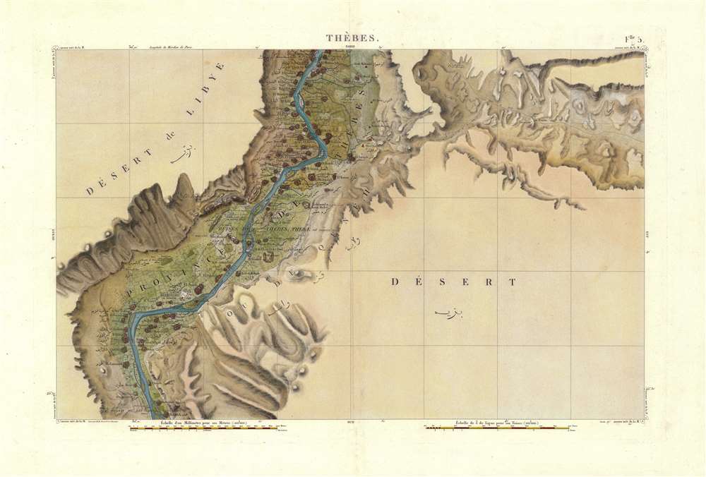
Flle. 5. Thebes. Carte topographique de l'Egypte et de plusieurs parties des pays limitrophes...)
sold
- Digital Map Information
- Suitable for large format printing
- Full resolution TIFF file
- ICC color profile embedded
- Delivered instantly via download link
An exceptionally detailed 1817 map of the Nile Valley at Luxor, ancient Thebes, documenting one of the richest archaeological landscapes in Egypt at the dawn of modern Egyptology. Centered on Luxor and the great monuments of Thebes, the map embraces both banks of the Nile, identifying ancient ruins, villages, roads, cultivated lands, and desert approaches with remarkable precision. It was compiled from surveys undertaken during Napoleon Bonaparte's Egyptian Campaign (1798 - 1801), when French military engineers and the celebrated Savants conducted the first systematic scientific survey of Egypt. Published as Sheet 5 of the monumental Description de l'Égypte, this map represents both a landmark of scientific cartography and an extraordinary record of the Theban landscape before nearly two centuries of excavation, development, and archaeological transformation. (more details)
Winding down the Philippine Campaign.
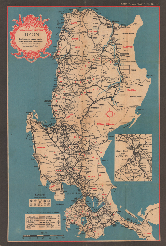
Mapa de las Yslas Philipinas. Luzon. Here's a prewar highway map for roving jeep drivers. You may even discover a road or two that the map doesn't show.
sold
- Digital Map Information
- Suitable for large format printing
- Full resolution TIFF file
- ICC color profile embedded
- Delivered instantly via download link
This is a 1945 YANK Magazine map of Luzon, issued for U.S. Army personnel stationed in the Philippines during World War II. As this map went to press, the Philippine Campaign was ongoing, with Japanese forces doggedly holding out in Luzon's central highlands. (more details)
Canadian WWI military achievement!
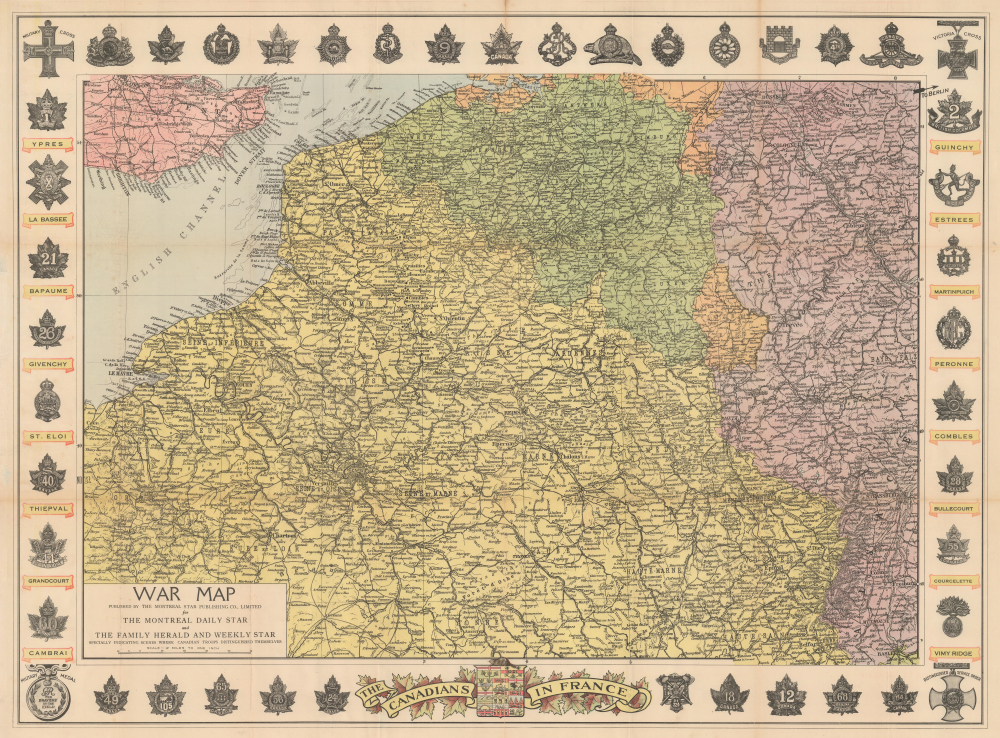
War Map Specially Indicating Scenes Where Canadian Troops Distinguished Themselves.
sold
- Digital Map Information
- Suitable for large format printing
- Full resolution TIFF file
- ICC color profile embedded
- Delivered instantly via download link
This is a striking c. 1918 Montreal Star commemorative map of the Western Front, celebrating the extraordinary contribution of Canadian forces to the First World War (1914 - 1918). Published for a domestic Canadian audience, it identifies the battlefields where Canadian troops distinguished themselves while surrounding the theater of war with regimental insignia, battle honors, and the highest decorations awarded for military valor. More than a record of Canadian participation in the war, the map reflects a pivotal moment in the formation of Canadian national identity, when the shared sacrifice and battlefield reputation of the Canadian Corps - particularly at Ypres, the Somme, Vimy Ridge, and Passchendaele - helped transform Canada from a British dominion into an increasingly self-conscious nation. (more details)
Northeastern limits of Ptolemy's landlocked Indian Ocean.
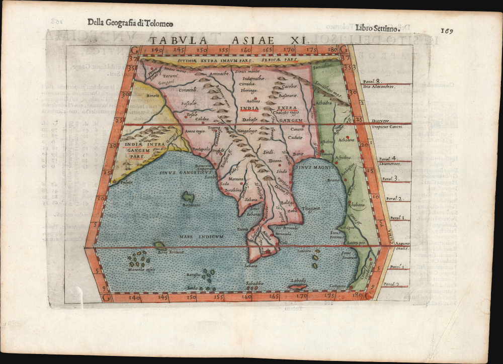
Tabula Asiae XI.
sold
- Digital Map Information
- Suitable for large format printing
- Full resolution TIFF file
- ICC color profile embedded
- Delivered instantly via download link
This is Girolamo Ruscelli's 1561 / 1598 map of Southeast Asia and the Malay Peninsula. The region was known to ancient geographers as 'India Extra Gangem,' or 'India Beyond the Ganges'. (more details)
Follow the 7th Armored Division as it marches across Europe.
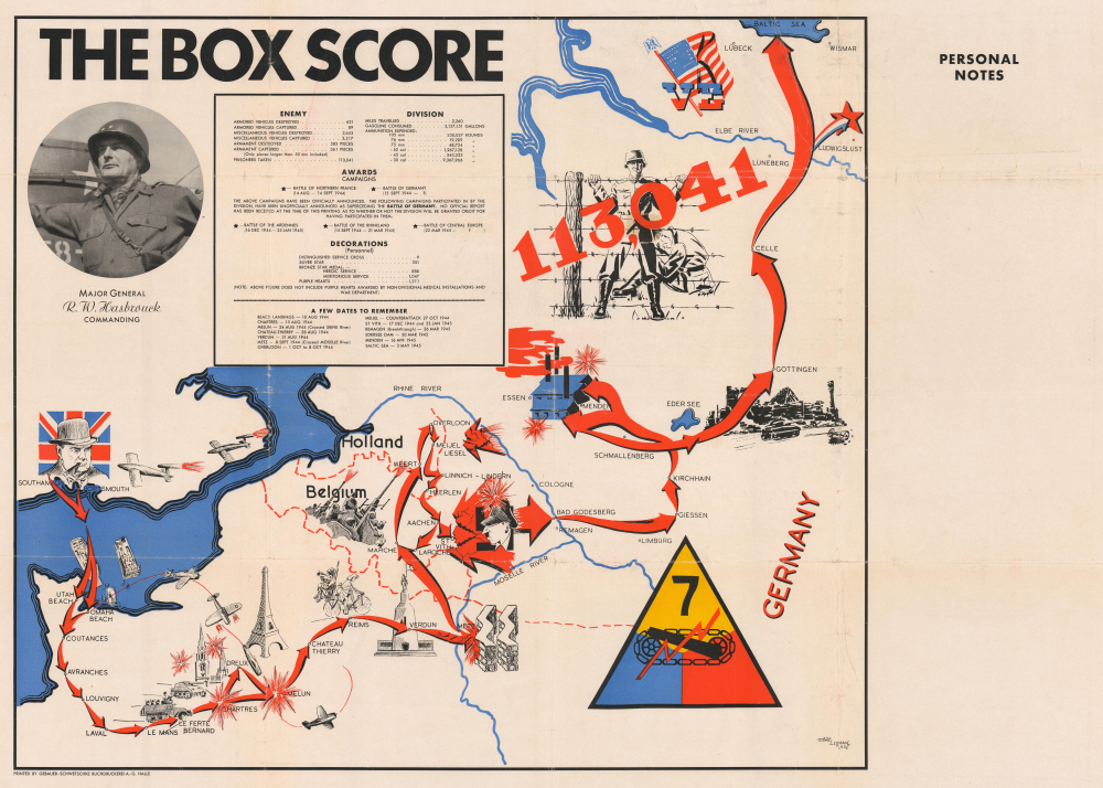
The Box Score.
sold
- Digital Map Information
- Suitable for large format printing
- Full resolution TIFF file
- ICC color profile embedded
- Delivered instantly via download link
This is a 1945 Lerman World War II pictorial route map of the 7th Armored Division in Europe. Illustrations, information, and geography combine to create a stunning visual summary of the 7th Armored's march across the continent. (more details)
One of the earliest issues of Mercator's Asia.
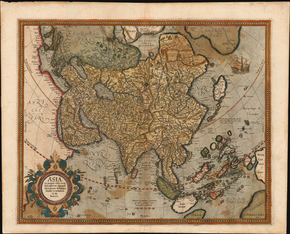
Asia ex magna orbis terre. descriptione Gerardi Mercatoris desumpta studio et industria G. M. Iunioris.
sold
- Digital Map Information
- Suitable for large format printing
- Full resolution TIFF file
- ICC color profile embedded
- Delivered instantly via download link
This is an original color, early example of Gerard Mercator's 1595 map of Asia, the second map of the continent to appear in an atlas. It presents Asia as it was understood at the beginning of the Dutch effort to extend power into the Spice Islands, and at the dawn of the drive to discover alternative routes to the East Indies that would bypass the Portuguese stranglehold on the Asia trade. This map exhibits a fine early strike, with strong, clear lines and bold paper/ink contrast. (more details)
Unrecorded Pictorial Map of the U.S. Naval Academy and Annapolis.
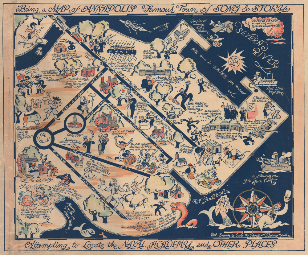
Being a Map of Annapolis Famous Town of Song and Story Attempting to Locate the Naval Academy and Other Places.
sold
- Digital Map Information
- Suitable for large format printing
- Full resolution TIFF file
- ICC color profile embedded
- Delivered instantly via download link
This is a rare c. 1932 hand-colored Peggy and Richard Q. Yardley pictorial map of Annapolis, Maryland, with a focus on the U.S. Naval Academy. It celebrates the history and character of both the institution and the city in humorous fashion. (more details)
Shelter from the communist storm.
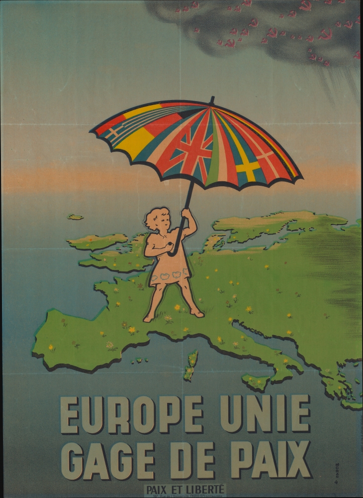
Europe Unie Gage de Paix. [Europe United Guarantee of Peace.]
sold
- Digital Map Information
- Suitable for large format printing
- Full resolution TIFF file
- ICC color profile embedded
- Delivered instantly via download link
This is a c. 1951 Paix et Liberté propaganda broadside map of Europe presaging European unification. The map reflects both optimism and threat in the post-World War II (1939 - 1945) Era. Western Europe enjoyed a post-war flowering of cross-national solidarity, as well as industrial, cultural, and trade booms. Eastern Europe, at the same time, languished under Communism. (more details)