
Norstedt, Per Adolf (sold)
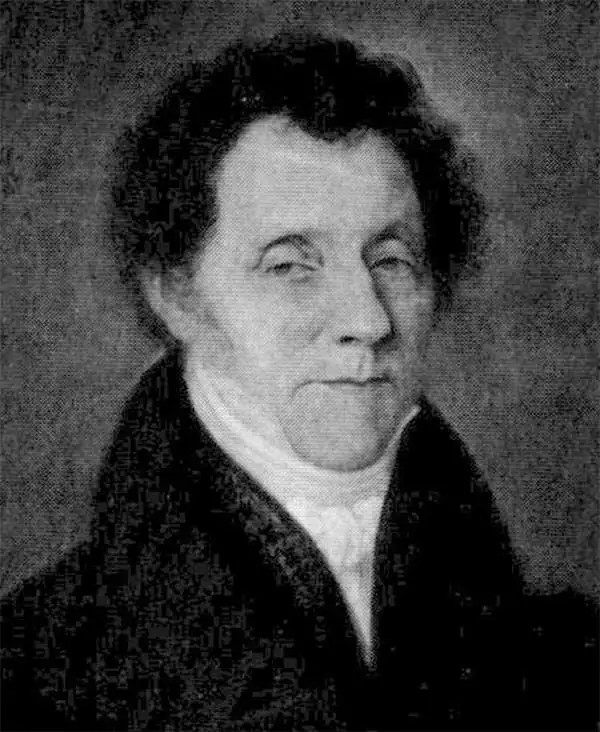
Per Adolf Norstedt (January 28, 1763 - September 20, 1840) was Swedish merchant and publisher based in Stockholm, Sweden. Per Adolf founded Norstedt in 1821 with the acquisition of the Lindhska Publishing concern. He brought his sons, Carl and Adolf, into the business in 1823, renaming it P. A. Norstedt och Söner. In 1833, the firm took over all publications for the Royal Family, becoming the de facto state publisher. When Carl and Adolf died, both without an heir, the company fell to Emilia Norstedt, a nice of Per Adolf, who brought her husband, Gustaf Philip Laurin (1808–1859), and three children, Gösta Laurin (1836–1879), Carl Laurin (1840–1917) and Albert Laurin (1842–1878), into the business. Carl, who was trained as a civil engineer, upgraded the printing processes with advanced lithographic presses and modernized the overall operations. Today Norstedt it is the oldest and one of the largest continuously active publishers in Sweden.
Australian wildlife - including koalas! Plus a Lockheed Constellation.
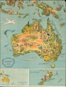
Australien i bilder.
sold
- Digital Map Information
- Suitable for large format printing
- File Size: 225.93 MB
- File Type: ZIP / TIFF
- ICC color profile embedded
- Delivered instantly via download link
This is a c. 1947 B. Lindblad pictorial map of Australia, New Zealand, and Indonesia. (more details)
Spectacular pictorial world map illustrating Post-WII situation in Europe and America.
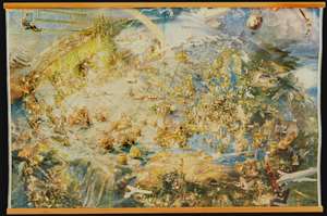
[Oliver Neerlands Bildkarta]
sold
- Digital Map Information
- Suitable for large format printing
- Full resolution TIFF file
- ICC color profile embedded
- Delivered instantly via download link
This is an utterly stunning 1949 pictorial color lithograph wall map of the northern part of the western world by the Norwegian artist Oliver Neerland. The map covers all of North America, the North Atlantic, and Europe as far east as the Caspian Sea, as well as from the North Pole to the Amazon River and Liberia. Lavish illustration depicts historic figures, monuments, art and architecture, animals, airplanes, dirigibles, sailing ships of all types, aircraft characters, and more. (more details)
Optimism and danger in Post-WWII Europe and America.
[Oliver Neerlands Bildkarta].
sold
- Digital Map Information
- Suitable for large format printing
- Full resolution TIFF file
- ICC color profile embedded
- Delivered instantly via download link
This is an utterly stunning 1949 pictorial color lithograph wall map of the northern part of the western world by the Norwegian artist Oliver Neerland. The map covers all of North America, the North Atlantic, and Europe as far east as the Caspian Sea, as well as from the North Pole to the Amazon River and Liberia. Lavish illustration depicts historic figures, monuments, art and architecture, animals, airplanes, dirigibles, sailing ships of all types, aircraft adventurers, and more. (more details)
A gorgeous pictorial map of Africa featuring illustrations of African wildlife.
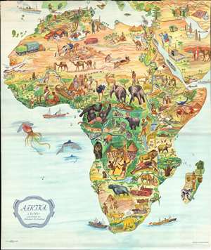
Afrika i bilder.
sold
- Digital Map Information
- Suitable for large format printing
- File Size: 48.65 MB
- File Type: ZIP / TIFF
- ICC color profile embedded
- Delivered instantly via download link
This is a stunning c. 1955 B. Lindblad pictorial map of Africa. The map depicts the region from the Atlantic Ocean to the Persian Gulf and the Indian Ocean and from Spain, Sicily, and Greece to the Cape of Good Hope. Beautifully illustrated, the incredible biodiversity of this vast continent is on full display. The relative prosperity of French Colonial Africa along the Mediterranean is highlighted by green hills, mountains, and buildings meant to denote cities. The ruins of Carthage are illustrated in Tunisia, as are the Pyramids at Giza in Egypt. The artist emphasized the life-giving power of the Nile River by making the river valley a blue and green channel through the brown wasteland of the Sahara. The nomadic lifestyle of the people living in the Sahara is shown, complete with camels and horses.
Sub-Saharan Africa is verdantly colored, with West Africa featuring a native village and locals fashioning ivory into trinkets. The wildlife of the region is, of course, the map's focus. Elephants, gazelles, gorillas, leopards, hippos, lions, and giraffes are only a few of the species illustrated. The duality of native existence up against modern technology and the constant drive to exploit Africa's seemingly infinite natural resources also take center stage, with a large tractor and a diamond mine drawn next to local villages and livestock.
The Middle East and the Arabian Peninsula are also illustrated in the upper right corner, complete with an illustration of the Great Mosque of Mecca in profile. Oil derricks are depicted along the Persian Gulf, along with a tanker plying the Gulf's waters to take the 'black gold' to market. (more details)
Sub-Saharan Africa is verdantly colored, with West Africa featuring a native village and locals fashioning ivory into trinkets. The wildlife of the region is, of course, the map's focus. Elephants, gazelles, gorillas, leopards, hippos, lions, and giraffes are only a few of the species illustrated. The duality of native existence up against modern technology and the constant drive to exploit Africa's seemingly infinite natural resources also take center stage, with a large tractor and a diamond mine drawn next to local villages and livestock.
The Middle East and the Arabian Peninsula are also illustrated in the upper right corner, complete with an illustration of the Great Mosque of Mecca in profile. Oil derricks are depicted along the Persian Gulf, along with a tanker plying the Gulf's waters to take the 'black gold' to market. (more details)