
Preuss, Charles (sold)
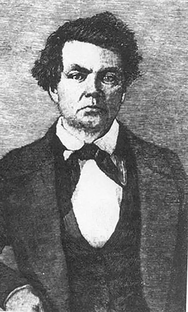
Charles Preuss (1803 - September 2, 1854), or as he was born George Karl Ludwig Preuss, was a German-born lithographer and cartographer who produced several important maps of the American West in the middle part of the 19th Century. Preuss was born in Hohscheid, Germany, where grew up and studied the science of Geodesy. There he also studied lithography with its inventor, Aloys Snefleder. After mastering the art, he worked under the Prussian Government as a mapmaker and surveyor. Preuss immigrated to the United States with his wife and children in 1834. In the United States, he worked at a few minor drafting positions before taking work under Ferdinand Hassler and the U.S. Coast Survey. Hassler introduced Preuss to Captain John Charles Fremont, who was then planning his landmark surveying expedition to the American West. Impressed with Preuss' work, Fremont hired him as the expedition's cartographer. Preuss seems to have been singularly unimpressed with Fremont and the American West, complaining bitterly in his journals about both. He considered Fremont "childish" and the scenery "dull" and "lackluster." Nonetheless, he was convinced to participate in one expedition after another, and the maps he produced, both under Fremont and under Stansbury, were among the most important maps of the region ever drafted. These include, among many others, the first map of the Oregon Trail, the first accurate mapping of the Great Salt Lake, the naming of the Golden Gate, and the first identification of the California Gold region. Preuss's maps influenced North American cartography for the next two decades. Kemble Warren, who assembled Preuss' maps as well as the work of many others into his "General Map" of the American West, said of Preuss, "his skill in sketching topography in the field and in representing it on the map has never been surpassed in this country." Ultimately, despite his many successes, the admiration of his peers, and a life of adventure, Preuss seems to have suffered from chronic depression, apparently the result of sunstroke in California. In September of 1854, he hung himself from a tree limb in Washington, D.C.
'...radically and permanently altered western cartography.' - Wheat
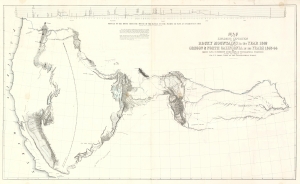
Map of an Exploring Expedition to the Rocky Mountains in the Year 1842 and to Oregon and North California in the Years 1843-44.
sold
- Digital Map Information
- Suitable for large format printing
- File Size: 56.14 MB
- File Type: ZIP / TIFF
- ICC color profile embedded
- Delivered instantly via download link
This is a seminal 1845 map of the American West by Carl Preuss and John C. Frémont charting the vast region between the Missouri River and the Pacific Ocean. Based on Frémont's 1843-44 Second Expedition, this map played a pivotal role in shaping westward expansion, guiding emigrants along the Oregon Trail and California Trail, and influencing cartography for decades. Wheat hailed this map as 'radically and permanently altering western cartography.' Featuring the first accurate mapping of the Great Salt Lake, detailed topographical features, and overland migration routes, this was the most comprehensive map of the American West. (more details)
Foundational Map of the American West.
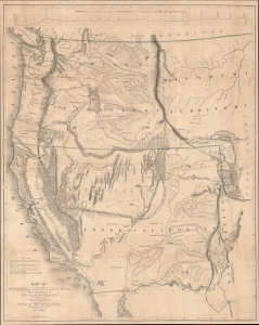
Map of Oregon and Upper California From the Surveys of John Charles Frémont.
sold
- Digital Map Information
- Suitable for large format printing
- File Size: 51.39 MB
- File Type: ZIP / TIFF
- ICC color profile embedded
- Delivered instantly via download link
A landmark 1848 map of the American West by John C. Frémont and Carl Preuss. In the words of Carl Wheat,
More than any other persons, John Charles Fremont and Charles Preuss dominate the cartography of the American West during the three years before the Gold Rush and brought a human tide surging into that land which had so long lain beyond the ken of most Americans. (Wheat, C. I., Mapping of the Transmississippi West, 1540 - 1861, 523).(more details)
Foundational Map of the American West.
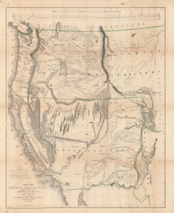
Map of Oregon and Upper California From the Surveys of John Charles Frémont.
sold
- Digital Map Information
- Suitable for large format printing
- DPI: 600
- File Size: 128 MB
- File Type: ZIP / TIFF
- ICC color profile embedded
- Delivered instantly via download link
A landmark 1848 map of the American West by John C. Frémont and Carl Preuss. In the words of Carl Wheat,
More than any other persons, John Charles Fremont and Charles Preuss dominate the cartography of the American West during the three years before the Gold Rush and brought a human tide surging into that land which had so long lain beyond the ken of most Americans. (Wheat, C. I., Mapping of the Transmississippi West, 1540 – 1861, 523).(more details)
Foundational Map of the American West.
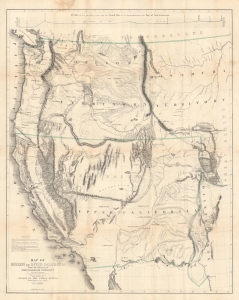
Map of Oregon and Upper California From the Surveys of John Charles Frémont.
sold
- Digital Map Information
- Suitable for large format printing
- File Size: 46.06 MB
- File Type: ZIP / TIFF
- ICC color profile embedded
- Delivered instantly via download link
A landmark 1848 map of the American West by John C. Frémont and Carl Preuss. In the words of Carl Wheat,
More than any other persons, John Charles Fremont and Charles Preuss dominate the cartography of the American West during the three years before the Gold Rush and brought a human tide surging into that land which had so long lain beyond the ken of most Americans. (Wheat, C. I., Mapping of the Transmississippi West, 1540 - 1861, 523).(more details)
1852 Stansbury Map of the Great Salt Lake to Fort Leavenworth Route (Colorado, Utah, Wyoming, Kansas
A seminal mapping of the emigrant roads west.
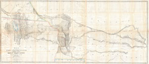
Map of a Reconnoissance between Fort Levenworth and the Missouri River, and the Great Salt Lake in the Territory of Utah, made in 1849 and 1850 …
sold
- Digital Map Information
- Suitable for large format printing
- DPI: 300
- File Size: 51.86 MB
- File Type: ZIP / TIFF
- ICC color profile embedded
- Delivered instantly via download link
It had been a daring feat of exploration, succeeding where the mountain men had all failed, and by means of his map ... Stansbury had painted at least one more bold stroke into the unfinished portrait of the national landscape. - William Goetzmann This ... (more details)
“Scientific cartography of the Territory of Utah may be said to date from the appearance of this map”-C. I. Wheat
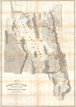
Map of the Great Salt Lake and Adjacent Country in the Territory of Utah.
sold
- Digital Map Information
- Suitable for large format printing
- DPI: 300
- File Size: 41.47 MB
- File Type: ZIP / TIFF
- ICC color profile embedded
- Delivered instantly via download link
It had been a daring feat of exploration, succeeding where the mountain men had all failed, and by means of his map of the western portion of the lake, Stansbury had painted at least one more bold stroke into the unfinished portrait of the national ... (more details)
“Scientific cartography of the Territory of Utah may be said to date from the appearance of this map”-C. I. Wheat
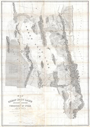
Map of the Great Salt Lake and Adjacent Country in the Territory of Utah.
sold
- Digital Map Information
- Suitable for large format printing
- Full resolution TIFF file
- ICC color profile embedded
- Delivered instantly via download link
It had been a daring feat of exploration, succeeding where the mountain men had all failed, and by means of his map of the western portion of the lake, Stansbury had painted at least one more bold stroke into the unfinished portrait of the national ... (more details)
Surveying the Great Salt Lake.
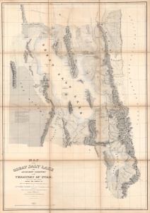
Map of the Great Salt Lake and Adjacent Country in the Territory of Utah.
sold
- Digital Map Information
- Suitable for large format printing
- Full resolution TIFF file
- ICC color profile embedded
- Delivered instantly via download link
An iconic map of the American West, this is a beautiful presentation edition of Howard Stansbury's crucial mapping of the Great Salt Lake, the earliest accurate survey of the region. Originally published in 1852 as part of the Stansbury Report presented to the U.S. Congress that year, the present example is mounted on linen and folds into a case, as it was intended for a member of Congress. This is, hands down, the finest example we've seen of this map, and if you're considering it for your collection, this is the one you want. (more details)
Early surveying expedition to the American West.
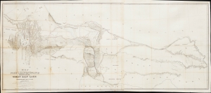
Map of a Reconnaissance between Fort Leavenworth and the Missouri River, and the Great Salt Lake in the Territory of Utah, made in 1849 and 1850…
sold
- Digital Map Information
- Suitable for large format printing
- File Size: 35.01 MB
- File Type: ZIP / TIFF
- ICC color profile embedded
- Delivered instantly via download link
This is Howard Stansbury's seminal 1852 map of the lands between Fort Leavenworth, Kansas, and Pilot Peak (now Nevada), west of the Great Salt Lake. It was published as part of the Stansbury Report presented to the U.S. Congress. (more details)
Early surveying expedition to the American West.
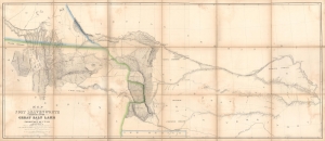
Map of a Reconnaissance between Fort Leavenworth and the Missouri River, and the Great Salt Lake in the Territory of Utah, made in 1849 and 1850…
sold
- Digital Map Information
- Suitable for large format printing
- Full resolution TIFF file
- ICC color profile embedded
- Delivered instantly via download link
A monumental map, matching the landscape it depicts, this is Howard Stansbury's seminal map of the lands between Fort Leavenworth, Kansas, and Pilot Peak (now Nevada), west of the Great Salt Lake. Originally published in 1852 as part of the Stansbury Report presented to the U.S. Congress that year, the present example is mounted on linen and folds into a case, as it was intended for a member of Congress. This is hand-down the finest example we've seen of this map, and if you are considering it for your collection, this is the one you want. (more details)
A seminal mapping of the emigrant roads west.
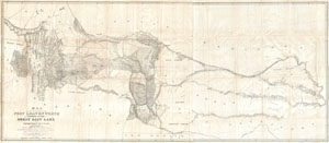
Map of a Reconnoissance between Fort Levenworth and the Missouri River, and the Great Salt Lake in the Territory of Utah, made in 1849 and 1850 …
sold
- Digital Map Information
- Suitable for large format printing
- DPI: 300
- File Size: 55.59 MB
- File Type: ZIP / TIFF
- ICC color profile embedded
- Delivered instantly via download link
It had been a daring feat of exploration, succeeding where the mountain men had all failed, and by means of his map ... Stansbury had painted at least one more bold stroke into the unfinished portrait of the national landscape. - William ... (more details)