
Rennell, James (sold)
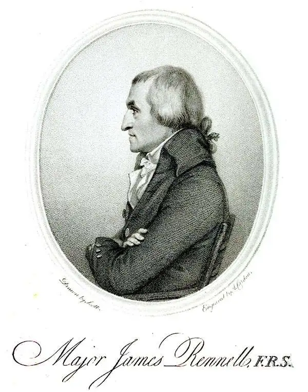
James Rennell (December 3, 1742 - March 29, 1830) was an English geographer, historian and seminal oceanographer, known as 'the Father of Indian Geography'. He would become, in 1830, one of the founders of the Royal Geographical Society in London. Rennell was born near Chudleigh in Devon, England. At 14 he joined the British Navy as a midshipman and served in the Seven Years' War. During his time in the Navy he mastered marine surveying; when his ship, HMS Grafton, saw service in India, he began lending his services to the East India company, accompanying hydrographer Alexander Dalrymple and drawing charts between 1759 and 1764. Following the Seven Years' War, seeing no prospect of advancement in the Navy he left the navy and joined the British East India company's sea service, where he continued survey work. Eventually he would be commissioned with the Bengal Engineers, and his surveys in India proper began in earnest. He would become surveyor-general for the EIC in Bengal, remaining in service until 1777. He would retire from active duty with the rank of Major in the Bengal Engineers. From London, he published extensively: his 1779 Bengal Atlas, and his 1783 map of India set the standard for the mapping of the subcontinent. He set his career to paper in the 1788 book Memoir of a map of Hindoostan.
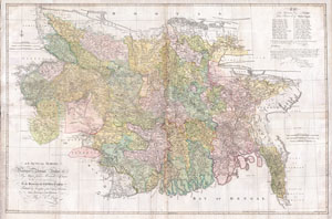
An Actual Survey, of the Provinces of Bengal, Bahar & c. by Major James Rennell Esq. Engineer to the Honorable the East India Company. Published by Permission of the Court of Directors from a Drawing in their Possession by A. Dury.
sold
- Digital Map Information
- Suitable for large format printing
- DPI: 300
- File Size: 117.03 MB
- File Type: ZIP / TIFF
- ICC color profile embedded
- Delivered instantly via download link
An altogether spectacular wall sized map of those parts of Bengal and Bihar, India. Follows the course of the Ganges River from Varanasi (Benares) eastward to the Ganges Delta and the Bay of Bengal. Includes Varanasi (Benares), Dacca (Dahka, Bengladesh), and ... (more details)
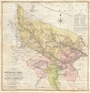
A Map of the Provinces of Delhi, Agrah, Oude, and Ellahabad, comprehending the Countries lying between Delhi, and the Bengal-Provinces, Surveyed by Major James Rennell, Surveyor General to the Honorable East-India Company, and Published by order of the Court of Directors of the said Company. By Andrew Dury, MDCCXXVII.
sold
- Digital Map Information
- Suitable for large format printing
- DPI: 300
- File Size: 82.56 MB
- File Type: ZIP / TIFF
- ICC color profile embedded
- Delivered instantly via download link
An altogether spectacular wall sized map of those parts of India near Delhi, Agra and Varanasi. Covers from Delhi in the northwest as far east along the Ganges River as Bihar and as far south as Sohagepour. Includes Varanasi (Benares), Lucknow, Gorakhpur and ... (more details)
Exceptional map from the First and Finest Austrian Atlas.
Neueste Karte von Hindostan Bengalen etc. etc. Mit der Anzeige der Strassen, Paesse, und genauester Eintheitung der britischen Besilzungen in Ostindien Verfasst von Herrn Jakob Rennell Ingenieur Major Neu herausgegeben von Herrn F.A. Schraembl. MDCCLXXXVIII.
sold
- Digital Map Information
- Suitable for large format printing
- DPI: 600
- File Size: 148.91 MB
- File Type: ZIP / TIFF
- ICC color profile embedded
- Delivered instantly via download link
This is Franz Anton Schrämbl's 1788 map of India. This scarce, magnificently-engraved map is a faithful rendition of James Rennell's masterful 1782 Map of Hindoostan, the finest 18th century map of the subcontinent, capturing the best surveys of India available during the period in which the British East India Company held sway. Rennell's work, based on the first scientific surveys of India, presented the region in a matchless degree of detail. By adopting this map as his source, Schrämbl was choosing the absolute state-of-the-art of India mapping. One of the first Austrian world atlases, Schrämbl's Allgemeiner Grosser Atlas presented the works of the best cartographers of the day: D'Anville, Kitchin, the Berlin Academy of Sciences and the St. Petersburg Academy of Sciences all shared the pages of this monumental work with Rennell. (more details)
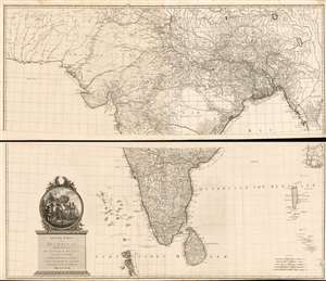
Iconic wall sized map of India by Faden.

Iconic wall sized map of India chronicling the British military campaign in the subcontinent against Tipu Sultan of Mysore.
sold
- Digital Map Information
- Suitable for large format printing
- DPI: 300
- File Size: 43.81 MB
- File Type: ZIP / TIFF
- ICC color profile embedded
- Delivered instantly via download link
This is Faden's magnificent mapping of the Indian subcontinent, one of the largest and most impressive maps of India to appear in the 18th century. Highly desirable third edition. Presented in two panels, as issued. This chart depicts the subcontinent from ... (more details)
Extremely scarce German edition of Rennell's map of India.
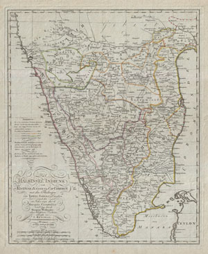
Die Halbinsel Indiens vom Kistnah Flusse bis Cap Comorin mit den Theilungen von Tippo Sahebs Landern nach den in Jahre 1782 durch Marquis Cornwallis und 1799 durch Marquis Wellesley abgeschloffenen, Tractaten, entworfenvon I. Rennell.
sold
- Digital Map Information
- Suitable for large format printing
- DPI: 300
- File Size: 13.78 MB
- File Type: ZIP / TIFF
- ICC color profile embedded
- Delivered instantly via download link
An extremely obscure German edition of Rennell's important late 18th century mapping of India. Covers the subcontinent roughly from Hyderabad and Goa south to Comorin and Ceylon (Sri Lanka). Shows the region divided into various princely states noting ... (more details)