
Roberts, Mike (sold)

Mike Roberts (19xx - 1989) was an American photographer and publisher, and was known as 'America's Postcard King'. Roberts left home at sixteen with twenty-five dollars, a box camera, and his Harley. Roberts arrived in the Bay Area in 1934 and began working as a photographer in Berkeley. By 1941 he was a partner in the Litho Screen Company in Oakland, which was also likely his first venture into the printing trade. Robert's first traceable postcard is postmarked June 12, 1945, and bears one of his photographs of the Yosemite Valley. Roberts used a handful of different publishers before he founded 'Mike Roberts Color Productions' in 1949, which marks his move into the world of commercial postcard production. Over the course of his career, Roberts used numerous different logos and his postcards were published by several different publishers. Roberts died in 1989 and his company continued operating until 1998.
Haven of peace and beauty during the Vietnam War.
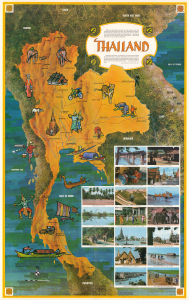
This is a 1966 Mike Roberts pictorial map of Thailand, published near the height of the Vietnam War (1955 - 1975), when Americans had a growing interest in Southeast Asia. Throughout the war, the U.S. Air Force and Navy used Thai bases, and American servicemen became enamored of the beautiful country as a destination for Rest and Recreation. (more details)
Vietnam War Pictorial Propaganda.
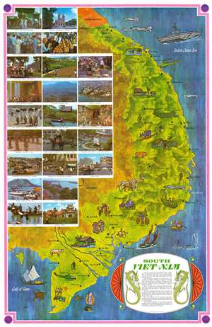
This is a 1966 Mike Roberts pictorial map of South Vietnam published during the Vietnam War. Striking pastel colors convey the country's tropical climate and reinforce the stereotypical view of the villages as illustrated in the vignettes and photographs. Other vignettes highlight farmers going about their daily lives, and vendors taking their wares to market. Vietnam's animals also appear. An ox plows a field and illustrations of a tiger and elephants are situated near the Laotian border. Printed photographs dominate almost the entire left half of the map and present views of life in Saigon, rural Vietnam, and cultural sites around the country. There are, inevitably vignettes referencing the American military presence and the Vietnam War. Huey helicopters appear near the Mekong Delta and not far from Chu Lai. A CH-47 Chinook helicopter (the one with two rotors) dominates the area between Pleiku and An Khe. An aircraft carrier plies the waters of the South China Sea just off the coast of Da Nang, and F-4 Phantom fighter jets are illustrated off the coast of Dong Ha and just above Da Lat. (more details)
The Philippines in the Early Marcos Era
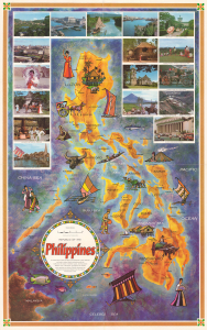
This is a colorful, large-format 1966 pictorial map of the Philippines by Mike Roberts. Produced as the U.S. ramped up its involvement in the Vietnam War (1955 - 1975), it presents the magnificent diversity of the archipelago to an American audience. (more details)
Vietnam War Pictorial Propaganda likely bought by a soldier in Vietnam.
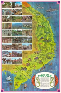
This is a c. 1970 Mike Roberts pictorial map of South Vietnam published during the Vietnam War. The map emphasizes the region's bucolic terrain and peaceful history - a striking contrast to the war then ravaging these lands. (more details)