
Smith, Courtland (sold)

Courtland Elmer Smith (December 3, 1907 - March 4, 2005) was an American architect, illustrator, and designer. He was born in Southampton, New York, the son of Elmer Smith, then village mayor. Smith studied at the University of Pennsylvania, attaining a degree in architecture in 1929, just in time for Black Tuesday. Smith worked on and off during Great Depression. In 1933, he worked with friend Richard 'Dick' Foster to compile a pictorial map of Long Island. As the Great Depression eased, Smith got more and more architecture work, becoming known for a clean uncluttered style. His work took him all over the world, and includes Houston Astrodome, the Distant Early Warning (DEW Line) radar defense system in the Arctic, and foreign aid projects for the U.S. Agency for International Development. After living abroad for many years, he returned to his native Southampton in 1966. He remained there in his family home until his death in 2005. (The Southampton Press, March 10, 2005)
First edition of an iconic pictorial map.
A Map of Long Island.
sold
- Digital Map Information
- Suitable for large format printing
- File Size: 32.28 MB
- File Type: ZIP / TIFF
- ICC color profile embedded
- Delivered instantly via download link
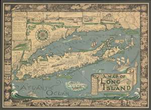
This is a charming 1933 first edition pictorial map of Long Island by Courtland Smith. This historical map covers from New London in Connecticut and Fishers Island south as far as the Lower New York Bay and Staten Island. Long Island is depicted in its entirety from Brooklyn and Queens east to Montauk. Throughout, the map notes cities, towns, beaches, radio stations, parks, ferry lines, lighthouses and several other important landmarks, scenes and activities. Several landmarks have been attractively illustrated, including the Montauk Point Light, Fire Island Light, Southampton, Coney Island, etc. Gardiner's Island - 'here Capt. Kidd buried loot' and Oyster Park -'Burial Place of Theodore Roosevelt' are noted. (more details)
First edition of an iconic pictorial map.
A Map of Long Island.
sold
- Digital Map Information
- Suitable for large format printing
- File Size: 39.69 MB
- File Type: ZIP / TIFF
- ICC color profile embedded
- Delivered instantly via download link
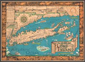
This is a charming 1933 first edition pictorial map of Long Island by Courtland Smith. This historical map covers from New London in Connecticut and Fishers Island south as far as the Lower New York Bay and Staten Island. Long Island is depicted in its entirety from Brooklyn and Queens east to Montauk. Throughout, the map notes cities, towns, beaches, radio stations, parks, ferry lines, lighthouses and several other important landmarks, scenes, and activities. Several landmarks have been attractively illustrated, including the Montauk Point Light, Fire Island Light, Southampton, Coney Island, etc. Gardiner's Island - 'here Capt. Kidd buried loot' and Oyster Park - 'Burial Place of Theodore Roosevelt' are noted. When Smith died, the mayor of Southampton remarked about this map:
That map has had a significant impact on the development of not only Southampton, but all the other towns on Long Island that it features.(more details)
First edition of an iconic pictorial map.
A Map of Long Island.
sold
- Digital Map Information
- Suitable for large format printing
- File Size: 56.89 MB
- File Type: ZIP / TIFF
- ICC color profile embedded
- Delivered instantly via download link
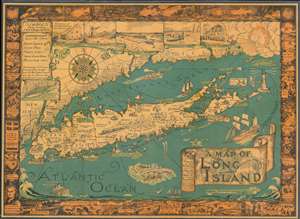
This is a charming 1933 first Gerson edition pictorial map of Long Island by Courtland Smith. This historical map covers from New London in Connecticut and Fishers Island south as far as the Lower New York Bay and Staten Island. Long Island is depicted in its entirety from Brooklyn and Queens east to Montauk. Throughout, the map notes cities, towns, beaches, radio stations, parks, ferry lines, lighthouses and several other important landmarks, scenes, and activities. Several landmarks have been attractively illustrated, including the Montauk Point Light, Fire Island Light, Southampton, Coney Island, etc. Gardiner's Island - 'here Capt. Kidd buried loot' and Oyster Park –'Burial Place of Theodore Roosevelt' are noted. When Smith died, the mayor of Southampton remarked about this map:
That map has had a significant impact on the development of not only Southampton, but all the other towns on Long Island that it features.(more details)
An exemplar. The true Miller-printed first edition in a rare large-format variant.
A Map of Long Island.
sold
- Digital Map Information
- Suitable for large format printing
- File Size: 62.98 MB
- File Type: ZIP / TIFF
- ICC color profile embedded
- Delivered instantly via download link
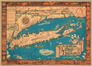
The exemplar example of Courtland Smith's 1933 pictorial map of Long Island - here in the first large-format George Miller edition. This is the first time in more than 25 years that we have seen this larger format variant of this iconic and much-reproduced map (all other known examples measure 20 x 27, this example is 26.5 x 36.5 inches). This historical map covers from New London in Connecticut and Fishers Island south as far as the Lower New York Bay and Staten Island. Long Island is depicted in its entirety from Brooklyn and Queens east to Montauk. Throughout, the map notes cities, towns, beaches, radio stations, parks, ferry lines, lighthouses and several other important landmarks, scenes, and activities. Several landmarks have been attractively illustrated, including the Montauk Point Light, Fire Island Light, Southampton, Coney Island, etc. Gardiner's Island - 'here Capt. Kidd buried loot' and 'Oyster Bay - Burial Place of Theodore Roosevelt' are noted. When Smith died, the mayor of Southampton remarked about this map:
That map has had a significant impact on the development of not only Southampton, but all the other towns on Long Island that it features.(more details)
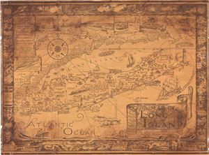
A Map of Long Island.
sold
- Digital Map Information
- Suitable for large format printing
- Full resolution TIFF file
- ICC color profile embedded
- Delivered instantly via download link
This is a charming 1961 pictorial map of Long Island by Courtland Smith. This historical map covers from New London in Connecticut and Fishers Island south as far as the Lower New York Bay and Staten Island. Long Island is depicted in its entirety from Brooklyn and ... (more details)
Iconic pictorial map of Long Island, New York.
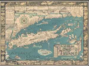
A Map of Long Island.
sold
- Digital Map Information
- Suitable for large format printing
- File Size: 13.55 MB
- File Type: ZIP / TIFF
- ICC color profile embedded
- Delivered instantly via download link
This is a charming 1961 pictorial map of Long Island by Courtland Smith. This historical map covers from New London in Connecticut and Fishers Island south as far as the Lower New York Bay and Staten Island. Long Island is depicted in its entirety from Brooklyn and ... (more details)
Iconic pictorial map of Long Island, New York.
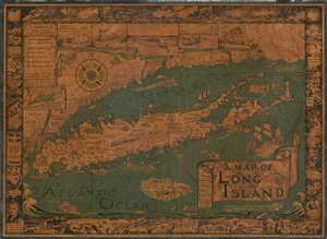
A Map of Long Island.
sold
- Digital Map Information
- Suitable for large format printing
- File Size: 50.71 MB
- File Type: ZIP / TIFF
- ICC color profile embedded
- Delivered instantly via download link
This is a charming 1961 pictorial map of Long Island by Courtland Smith. This historical map covers from New London in Connecticut and Fishers Island south as far as the Lower New York Bay and Staten Island. Long Island is depicted in its entirety from Brooklyn and Queens east to Montauk. Throughout, the map notes cities, towns, beaches, radio stations, parks, ferry lines, lighthouses and several other important landmarks, scenes and activities. Several landmarks have been attractively illustrated, including the Montauk Point Light, Fire Island Light, Southampton, Coney Island, etc. Facts about Gardiner's Island - 'here Capt. Kidd buried loot' and Oyster Park 'Burial Place of Theodore Roosevelt' are noted.
The top left quadrant of the map includes the note, 'The backbone of L.I. was formed by debris brought from the New England Mountains by two glaciers about forty thousand years ago' as well as an inset featuring a 'Diagram showing how far the two Stages of Ice Advance covered L.I.' Five beautiful illustrated views along the top border include the Birthplace of John Howard Payne East Hampton, a Typical Windmill, Jones Beach, Coast Guard and Old Manor House. A decorative compass rose and an art deco style wind figure are also featured. In Long Island Sound and the Atlantic Ocean, pictorial illustrations of Boston Boat, ships, striped bass, a swordfish, whale fishing, and the Sag Harbor Whalers that 'sailed to the ends of the Earth' can be seen. The map is surrounded by an elaborate border, with underwater scenes at the top and historic events and places along the remaining three sides, including the '13 Tribes of Indians when First Settlers Arrived,' 'First Settled at Brooklyn in 1614,' 'First Rail Road 1836,' 'Brooklyn Bridge 1867-1883,' etc. (more details)
The top left quadrant of the map includes the note, 'The backbone of L.I. was formed by debris brought from the New England Mountains by two glaciers about forty thousand years ago' as well as an inset featuring a 'Diagram showing how far the two Stages of Ice Advance covered L.I.' Five beautiful illustrated views along the top border include the Birthplace of John Howard Payne East Hampton, a Typical Windmill, Jones Beach, Coast Guard and Old Manor House. A decorative compass rose and an art deco style wind figure are also featured. In Long Island Sound and the Atlantic Ocean, pictorial illustrations of Boston Boat, ships, striped bass, a swordfish, whale fishing, and the Sag Harbor Whalers that 'sailed to the ends of the Earth' can be seen. The map is surrounded by an elaborate border, with underwater scenes at the top and historic events and places along the remaining three sides, including the '13 Tribes of Indians when First Settlers Arrived,' 'First Settled at Brooklyn in 1614,' 'First Rail Road 1836,' 'Brooklyn Bridge 1867-1883,' etc. (more details)
Dramatic, Pictorial Long Island with Nautical and Historical Vignettes.
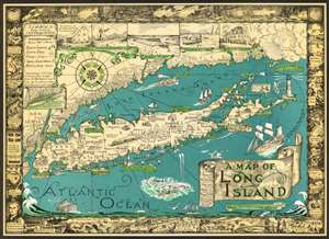
This is a charming 1961 pictorial map of Long Island by Courtland Smith. This historical map covers from New London in Connecticut and Fishers Island south as far as the Lower New York Bay and Staten Island. Long Island is depicted in its entirety from Brooklyn and Queens east to Montauk. Throughout, the map notes cities, towns, beaches, radio stations, parks, ferry lines, lighthouses and several other important landmarks,scenes and activities. Several landmarks have been attractively illustrated, including the Montauk Point Light, Fire Island Light, Southampton, Coney Island, etc. Facts about Gardiner's Island - 'here Capt. Kidd buried loot' and Oyster Park 'Burial Place of Theodore Roosevelt' are noted.
The top left quadrant of the map includes the note, 'The backbone of L.I. was formed by debris brought from the New England Mountains by two glaciers about forty thousand years ago' as well as an inset featuring a 'Diagram showing how far the two Stages of Ice Advance covered L.I.' Five beautiful illustrated views along the top border include the Birthplace of John Howard Payne East Hampton, a Typical Windmill, Jones Beach, Coast Guard and Old Manor House. A decorative compass rose and an art deco style wind figure are also featured. In Long Island Sound and the Atlantic Ocean, pictorial illustrations of Boston Boat, ships, striped bass, a swordfish, whale fishing, and the Sag Harbor Whalers that 'sailed to the ends of the Earth' can be seen. The map is surrounded by an elaborate border, with underwater scenes at the top and historic events and places along the remaining three sides, including the '13 Tribes of Indians when First Settlers Arrived,' 'First Settled at Brooklyn in 1614,' 'First Rail Road 1836,' 'Brooklyn Bridge 1867-1883,' etc. (more details)
The top left quadrant of the map includes the note, 'The backbone of L.I. was formed by debris brought from the New England Mountains by two glaciers about forty thousand years ago' as well as an inset featuring a 'Diagram showing how far the two Stages of Ice Advance covered L.I.' Five beautiful illustrated views along the top border include the Birthplace of John Howard Payne East Hampton, a Typical Windmill, Jones Beach, Coast Guard and Old Manor House. A decorative compass rose and an art deco style wind figure are also featured. In Long Island Sound and the Atlantic Ocean, pictorial illustrations of Boston Boat, ships, striped bass, a swordfish, whale fishing, and the Sag Harbor Whalers that 'sailed to the ends of the Earth' can be seen. The map is surrounded by an elaborate border, with underwater scenes at the top and historic events and places along the remaining three sides, including the '13 Tribes of Indians when First Settlers Arrived,' 'First Settled at Brooklyn in 1614,' 'First Rail Road 1836,' 'Brooklyn Bridge 1867-1883,' etc. (more details)
Dramatic, Pictorial Long Island with Nautical and Historical Vignettes.
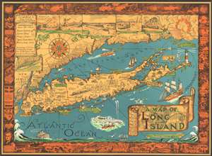
This is a charming 1961 pictorial map of Long Island by Courtland Smith, depicting from New London in Connecticut and Fishers Island south as far as the Lower New York Bay and Staten Island. Long Island is depicted in its entirety from Brooklyn and Queens east to Montauk. Throughout, the map notes cities, towns, beaches, radio stations, parks, ferry lines, lighthouses and several other important landmarks, scenes, and activities. Several landmarks have been attractively illustrated, including the Montauk Point Light, Fire Island Light, Southampton, Coney Island, etc. Facts about Gardiner's Island - 'here Capt. Kidd buried loot' and Oyster Park 'Burial Place of Theodore Roosevelt' are noted.
The top left quadrant of the map includes the note, 'The backbone of L.I. was formed by debris brought from the New England Mountains by two glaciers about forty thousand years ago' as well as an inset featuring a 'Diagram showing how far the two Stages of Ice Advance covered L.I.' Five beautiful illustrated views along the top border include the Birthplace of John Howard Payne East Hampton, a Typical Windmill, Jones Beach, Coast Guard and Old Manor House. A decorative compass rose and an art deco style wind figure are also featured. In Long Island Sound and the Atlantic Ocean, pictorial illustrations of Boston Boat, ships, striped bass, a swordfish, whale fishing, and the Sag Harbor Whalers that 'sailed to the ends of the Earth' can be seen. The map is surrounded by an elaborate border, with underwater scenes at the top and historic events and places along the remaining three sides, including the '13 Tribes of Indians when First Settlers Arrived,' 'First Settled at Brooklyn in 1614,' 'First Rail Road 1836,' 'Brooklyn Bridge 1867-1883,' etc. (more details)
The top left quadrant of the map includes the note, 'The backbone of L.I. was formed by debris brought from the New England Mountains by two glaciers about forty thousand years ago' as well as an inset featuring a 'Diagram showing how far the two Stages of Ice Advance covered L.I.' Five beautiful illustrated views along the top border include the Birthplace of John Howard Payne East Hampton, a Typical Windmill, Jones Beach, Coast Guard and Old Manor House. A decorative compass rose and an art deco style wind figure are also featured. In Long Island Sound and the Atlantic Ocean, pictorial illustrations of Boston Boat, ships, striped bass, a swordfish, whale fishing, and the Sag Harbor Whalers that 'sailed to the ends of the Earth' can be seen. The map is surrounded by an elaborate border, with underwater scenes at the top and historic events and places along the remaining three sides, including the '13 Tribes of Indians when First Settlers Arrived,' 'First Settled at Brooklyn in 1614,' 'First Rail Road 1836,' 'Brooklyn Bridge 1867-1883,' etc. (more details)