
Stoner, Joseph John (sold)

Joseph John Stoner (December 21, 1829 - May 1917) was a Madison, Wisconsin based publisher of bird's-eye city views active in the late 19th and early 20th centuries. Stoner was born in Highspire, Pennsylvania and apprenticed as a carver of ornamental chairs before turning to publishing. He partnered with the bookseller Ephraim T. Kellogg of Madison, Wisconsin, for whom he was a traveling agent. His career in views began around 1867 when he met and befriended the bird's-eye view artist Albert Ruger, who was sketching Madison that year. Ruger and Stoner partnered and began publishing city views under the imprint 'Ruger & Stoner.' The partners traveled extensively through the Midwest publishing some 11 city views under their joint imprint - although there may be as many as 62 others unattributed. The partnership partially dissolved in 1872 although they continued to work together on a contractual basis. Stoner subsequently traveled even more extensively, hiring young artists to sketch city views in such wide ranging destinations as Texas, Maine, and Oregon, among others. He produced a total of some 314 views with various artists including: Albert Ruger, Herman Brosius, Thaddeus M. Fowler, Augustus Koch, Albert F. Poole, Henry Wellge, Joseph Warner, and Camille N. Drie (Dry). Stoner died in Berkeley, California in 1917.
Shingling the World.
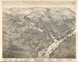
Bird's Eye View of the City of Bangor Penobscot County, Maine, 1875.
sold
- Digital Map Information
- Suitable for large format printing
- File Size: 1019.87 MB
- File Type: ZIP / TIFF
- ICC color profile embedded
- Delivered instantly via download link
An exceptional 1875 chromolithograph bird's-eye view map of Bangor, Maine, by Augustus Koch and J. J. Stoner. The view illustrates Bangor at its height as one of the world's foremost lumber towns. (more details)
Very rare Bird's-Eye View of Bangor Maine. Only 3 known examples.
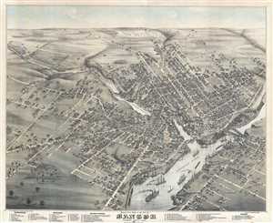
Bird's Eye View of the City of Bangor Penobscot County, Maine, 1875.
sold
- Digital Map Information
- Suitable for large format printing
- Full resolution TIFF file
- ICC color profile embedded
- Delivered instantly via download link
An exceptional 1875 Bird's-Eye View Map of Bangor, Maine, by Augustus Koch. Koch presents Bangor as seen from the south, looking north, with the Franklin, Central , and State Street Bridges over the Kenduskaeg Stream forming a central focal point. Some 57 civic ... (more details)
Rare bird's eye view of Jefferson, Wisconsin.
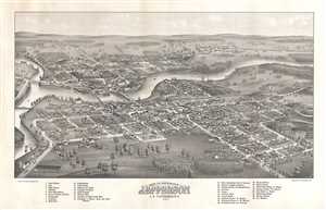
Bird's Eye View of The City of Jefferson C. S. F Jefferson Co. Wis.
sold
- Digital Map Information
- Suitable for large format printing
- File Size: 12.39 MB
- File Type: ZIP / TIFF
- ICC color profile embedded
- Delivered instantly via download link
This is a beautiful 1880 bird’s eye view of the city of Jefferson County, Wisconsin by Henry Wellge. The view depicts Jefferson from the east, looking westward, with the Rock River flowing in the center of the view. The Crawfish River is seen on the left of ... (more details)
Very rare Bird's-Eye View of Portland, Maine. Only 4 known examples.
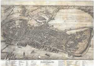
Bird's Eye View of the City of Portland Maine, 1876.
sold
- Digital Map Information
- Suitable for large format printing
- Full resolution TIFF file
- ICC color profile embedded
- Delivered instantly via download link
An exceptional 1876 Bird's-Eye View Map of Portland, Maine, by Joseph Warner. One of only three known views by Warner, this is a dramatic aerial view of Portland as seen from the east looking west. The cartographer has identified some 90 locations, ... (more details)
Very rare Bird's-Eye View of Portland, Maine. Only 4 known examples.
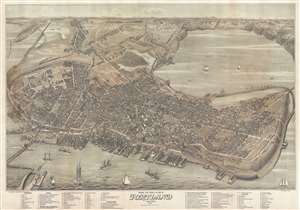
Bird's Eye View of the City of Portland Maine, 1876.
sold
- Digital Map Information
- Suitable for large format printing
- File Size: 40.22 MB
- File Type: ZIP / TIFF
- ICC color profile embedded
- Delivered instantly via download link
An exceptional 1876 Bird's-Eye View Map of Portland, Maine, by Joseph Warner. One of only three known views by Warner, this is a dramatic aerial view of Portland as seen from the east looking west. The cartographer has identified some 90 locations, ... (more details)
Stunning highly detailed bird's-eye view of Portsmouth, New Hampshire.
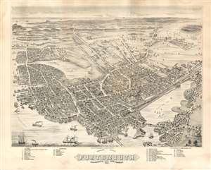
Bird's Eye View of Portsmouth Rockingham Co. New Hampshire, 1877.
sold
- Digital Map Information
- Suitable for large format printing
- File Size: 46.36 MB
- File Type: ZIP / TIFF
- ICC color profile embedded
- Delivered instantly via download link
A rare and highly-detailed Albert Ruger and Joseph Stoner bird's-eye view map of Portsmouth, New Hampshire. The view looks south on Portsmouth from an imaginary high point above Badger's Island. The map centers on the juncture of the Piscatuaqua River and the North Mill Pond. The South Mill Pond (Sagamore Creek) is visible in the distance, as is the Atlantic. Streets are named and individual buildings rendered. Of note are some 36 alphanumerically associated locations, among them civic offices, churches, academies, breweries, churches, lumber yards, and more. The W. F. Fernald Shipyard where is large sailboat is under constructions. Other notable commercial buildings depicted include the Frank Jones Brewery, the Eldridge Brewing Company, and the Kearsarge Mills. Ships, both sail and steam, ply the busy harbor which is connected by the Eastern and Concord Rail Road to locations inland. (more details)
Rare view of one of Vermont's most beautiful and historic cities.
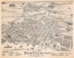
Birds Eye View of Burlington and Winooski VT.
sold
- Digital Map Information
- Suitable for large format printing
- File Size: 59.96 MB
- File Type: ZIP / TIFF
- ICC color profile embedded
- Delivered instantly via download link
A beautiful 1877 bird's-eye view and map of Burlington and Winooski, Vermont by Joseph J. Stoner and E. Meilbek. The view looks on Burlington from a point to the southwest high above Lake Champlain, with Main Street at the center of the map eastward proceeding from the lake.. In the distance, to the northeast, the neighboring town of Winooski is well drawn across the Winooski River. Even farther, the forested Green Mountains are prominent. The view is based on artwork by E. Meilbek, of whom almost nothing is known. (more details)
Cedar Key at the height of its prosperity.
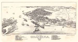
Bird's Eye View of Cedar-Key, Fla. Levy Co.
sold
- Digital Map Information
- Suitable for large format printing
- File Size: 5.42 MB
- File Type: ZIP / TIFF
- ICC color profile embedded
- Delivered instantly via download link
This is an 1884 Joseph John Stoner bird's-eye view of Cedar Key, Florida. Depicting the city at its height, when Cedar Key was a boomtown and thriving port servicing Florida's lumber industry. Thirty-three locations are numerically identified and correspond with an index on either side of the view's title. Churches, hotels, sawmills, cedar mills, and general stores, rank among these locations. The Florida Transit and Peninsular Railroad curves through the view, its depot in the foreground on the right. Steamships, ferries, and sailing ships ply the waters around Cedar Key, reinforcing its economic importance and prosperity. Just two years after this view was published, Henry Plant's 'Plant System' railroad reached Tampa. This move took shipping away from Cedar Key and began the region's economic decline. (more details)
Florida Citrus Boom.
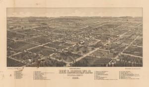
Bird's Eye View of De Land, Fla. Volusia County 1884.
sold
- Digital Map Information
- Suitable for large format printing
- File Size: 44.57 MB
- File Type: ZIP / TIFF
- ICC color profile embedded
- Delivered instantly via download link
A very rare 1884 Stoner / Wellge bird's-eye view of DeLand Florida at the height of the first Florida Citrus Boom and the Second Florida Land Boom - which centered around DeLand.The view looks northeast on Deland. Thirty-eight business, offices, hotels, and civic buildings rea named, as well as seven churches. Orange grows are evident throughout, underscoring DeLand's significance as a center of the Citrus Boom. (more details)