
Barker, William (sold)

William Barker (June 29, 1770 - April 19, 1805) was an engraver active in Philadelphia un the late 18th and early 19th centuries. Barker was born in Philadelphia, the son of Elihu Barker (17?? - 1792). Both father and son worked for the firm of Mathew Carey (1760 - 1839) and engraved maps for Carey's American Atlas, considered the first general atlas published in America. He appears in Philadelphia directories for 1795 - 1796 and 1800 - 1809. His business may have been carried on by a son of the same name, but it is unclear.
First map of Maine produced in the American Republic.
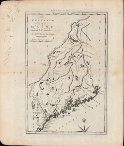
The province of Maine, from the best authorities.
sold
- Digital Map Information
- Suitable for large format printing
- Full resolution TIFF file
- ICC color profile embedded
- Delivered instantly via download link
A fascinating 1794 map of the 'Province of Maine' by Samuel Lewis and engraved by William Barker for Matthew Carey's American Edition of Guthrie's Geography improved, the first atlas published in the American Republic. It depicts the territory in the years just following independence, with borders that remained disputed and would later be shifted southwards as part of a compromise with Great Britain. (more details)
Earliest map of Georgia published in the American Republic.
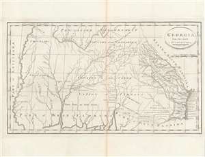
Georgia, from the latest authorities.
sold
- Digital Map Information
- Suitable for large format printing
- DPI: 600
- File Size: 24.43 MB
- File Type: ZIP / TIFF
- ICC color profile embedded
- Delivered instantly via download link
This is a significant map of Georgia from Carey's General Atlas, considered the first atlas published in the new American Republic. It demonstrates that much of the modern state of Georgia was still occupied primarily by Native Americans and little understood by white settlers. (more details)
One of the earliest obtainable maps of Kentucky.
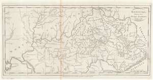
Kentucky, Reduced from Elihu Barker's Large Map.
sold
- Digital Map Information
- Suitable for large format printing
- Full resolution TIFF file
- ICC color profile embedded
- Delivered instantly via download link
An example of Matthew Carey's 1795 reduction of Elihu Barker's map of Kentucky - one of the earliest obtainable specific maps of Kentucky based upon actual observation and settlement. It also follows closely on Kentucky's admission to the Union. The map is a reduced version of the unobtainable Elihu Barker map of 1793, entitled A Map of Kentucky from Actual Survey, by Elihu Barker, also published by Carey in Philadelphia. The present map has less detail, given the reduced size, but closely adheres to Barker's important map, described as 'so well done it cold be used today with satisfaction'. Throughout, settlements, stations, salt licks, courthouses, furnaces, springs, planned settlements, and forts are noted - providing an invaluable insight into life in Kentucky when it was still the 'frontier'. (more details)
Poland and Lithuania, just after their partition.
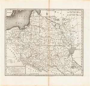
Poland, shewing the claims of Russia, Prussia and Austria until the late depredations, the extent of which cannot as yet be ascertained.
sold
- Digital Map Information
- Suitable for large format printing
- DPI: 600
- File Size: 33.06 MB
- File Type: ZIP / TIFF
- ICC color profile embedded
- Delivered instantly via download link
Here is Matthew Carey and William Barker's c. 1795 map, for Carey's General Atlas, of that lands that had composed the Polish-Lithuanian Commonwealth, which were broken up and distributed to Austria, Prussia, and Russia in the late 19th century. Aside from its cartographic qualities, this map is an instructive case study in knowledge production at a time of considerable change and instability. (more details)
Presenting Americans with the North Parts of the World.
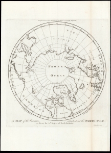
A Map of the Countries situate about the North Pole as far as the 50th Degree of North Latitude.
sold
- Digital Map Information
- Suitable for large format printing
- DPI: 600
- File Size: 13.01 MB
- File Type: ZIP / TIFF
- ICC color profile embedded
- Delivered instantly via download link
This is Mathew Carey's 1795 map of the North Pole and the surrounding seas. The map illustrates the extent of exploration, as well as the may uncertainties, of polar region to the date of publication. (more details)
A map of New Jersey from the first atlas produced in the American Republic.
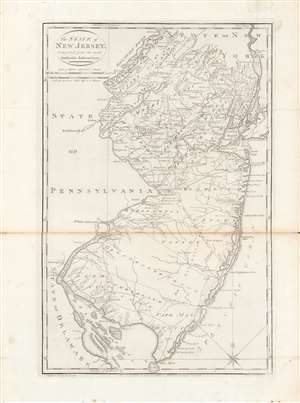
The state of New Jersey, compiled from the most authentic information.
sold
- Digital Map Information
- Suitable for large format printing
- DPI: 600
- File Size: 28 MB
- File Type: ZIP / TIFF
- ICC color profile embedded
- Delivered instantly via download link
Here is Mathew Carey and Samuel Lewis' c. 1796 map of New Jersey, made for Carey's General Atlas, the first atlas produced and published in the American Republic. It portrays the state in the years just after the American Revolution, in which it had played a central role. (more details)