
Bradley, Garretson and Co. (sold)

Bradley, Garretson and Co. (fl. c. 1880 - 1900) were prominent cartographic publishers active in the later part of the 19th century. Bradley acquired Samuel Augustus Mitchell Junior's atlas plates in the late 1880s which he used to publish his own version of Mitchell's atlas. The firm had offices both in Philadelphia, at 66 North Fourth Street, and in Brantford, Ontario.
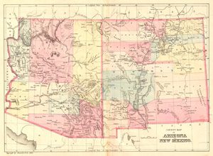
County Map of Arizona and New Mexico.
sold
- Digital Map Information
- Suitable for large format printing
- File Size: 5.08 MB
- File Type: ZIP / TIFF
- ICC color profile embedded
- Delivered instantly via download link
This is an attractive county map of Arizona and New Mexico showing counties in light pastels, roads, rivers, and relief shown by fine hachures. By William M. Bradley, from his Bradley's Alas of the World for Commercial and Library Reference , ... (more details)
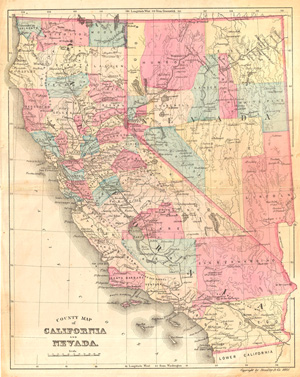
County Map of California and Nevada.
sold
- Digital Map Information
- Suitable for large format printing
- File Size: 5.84 MB
- File Type: ZIP / TIFF
- ICC color profile embedded
- Delivered instantly via download link
This is an attractive county map of California and Nevada, showing counties in light pastels, roads, rivers, and relief shown by fine hachures. By William M. Bradley, from his Bradley's Alas of the World for Commercial and Library Reference , ... (more details)
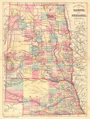
County Map of Dakota and Nebraska.
sold
- Digital Map Information
- Suitable for large format printing
- File Size: 5.85 MB
- File Type: ZIP / TIFF
- ICC color profile embedded
- Delivered instantly via download link
This is an attractive county map of what later become North and South Dakota, and Nebraska, showing counties in light pastels, roads, rivers, and relief shown by fine hachures. Predates the separation of Dakota into northern and southern ... (more details)
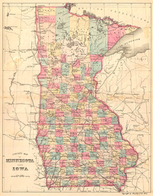
County Map of Minnesota and Iowa.
sold
- Digital Map Information
- Suitable for large format printing
- File Size: 5.43 MB
- File Type: ZIP / TIFF
- ICC color profile embedded
- Delivered instantly via download link
This is an attractive county map of Minnesota and Iowa, showing counties in light pastels, roads, rivers, and relief shown by fine hachures. By William M. Bradley, from his Bradley's Alas of the World for Commercial and Library Reference ... (more details)
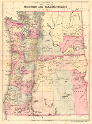
County Map of Texas and Indian Territory.
sold
- Digital Map Information
- Suitable for large format printing
- File Size: 5.08 MB
- File Type: ZIP / TIFF
- ICC color profile embedded
- Delivered instantly via download link
This is an attractive county map of Washington and Oregon, showing counties in light pastels, roads, rivers, and relief shown by fine hachures. By William M. Bradley, from his Bradley's Alas of the World for Commercial and Library ... (more details)
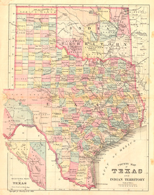
County Map of Texas and Indian Territory.
sold
- Digital Map Information
- Suitable for large format printing
- File Size: 5.83 MB
- File Type: ZIP / TIFF
- ICC color profile embedded
- Delivered instantly via download link
This is an attractive county map of Texas and the Indian Territory (Oklahoma), showing counties in light pastels, roads, rivers, and relief shown by fine hachures. An inset in the lower right focuses on the western part of Texas. ... (more details)
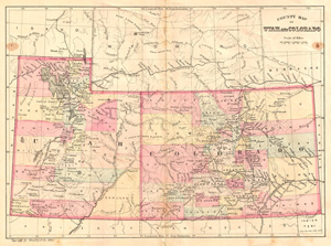
County Map of Utah and Colorado.
sold
- Digital Map Information
- Suitable for large format printing
- File Size: 5.01 MB
- File Type: ZIP / TIFF
- ICC color profile embedded
- Delivered instantly via download link
This is an attractive county map of Utah and Colorado featuring light pastels, roads, rivers, and relief shown by fine hachures. By William M. Bradley, from his Bradley's Alas of the World for Commercial and Library Reference , ... (more details)
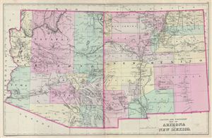
County and Township Map of Arizona and New Mexico.
sold
- Digital Map Information
- Suitable for large format printing
- File Size: 12.07 MB
- File Type: ZIP / TIFF
- ICC color profile embedded
- Delivered instantly via download link
A fine example of William M. Bradley's 1887 map of Arizona and New Mexico. The map covers both Arizona and New Mexico in excellent detail along with parts of neighboring California, Nevada, Utah and Colorado. Bradley further ... (more details)
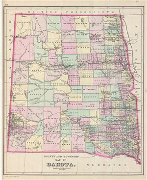
County and Township Map of Dakota.
sold
- Digital Map Information
- Suitable for large format printing
- File Size: 5.92 MB
- File Type: ZIP / TIFF
- ICC color profile embedded
- Delivered instantly via download link
A fine example of William M. Bradley's 1887 map of Dakota. It covers modern day North and South Dakota in before they were separated. The map also delineates survey grids referencing the work of the U.S. Land Survey. ... (more details)
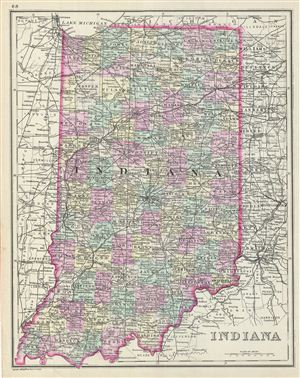
Indiana.
sold
- Digital Map Information
- Suitable for large format printing
- File Size: 7.29 MB
- File Type: ZIP / TIFF
- ICC color profile embedded
- Delivered instantly via download link
This is a fine example of William M. Bradley's 1887 map of Indiana. It covers the entire state in considerable detail. Parts of neighboring Illinois, Ohio and Michigan are also depicted. The map also delineates ... (more details)
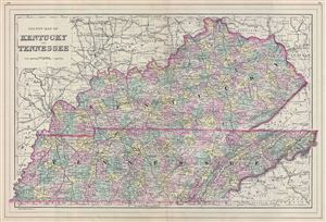
County Map of Kentucky and Tennessee.
sold
- Digital Map Information
- Suitable for large format printing
- File Size: 13.83 MB
- File Type: ZIP / TIFF
- ICC color profile embedded
- Delivered instantly via download link
A fine example of William M. Bradley's 1887 map of Kentucky and Tennessee. The map covers both states in fine detail along with parts of neighboring Missouri, Illinois, Ohio, Virginia. Bradley also delineates ... (more details)
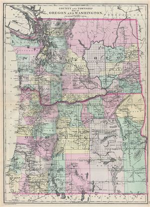
County and Township Map of Oregon and Washington.
sold
- Digital Map Information
- Suitable for large format printing
- File Size: 13.29 MB
- File Type: ZIP / TIFF
- ICC color profile embedded
- Delivered instantly via download link
A fine example of William M. Bradley's 1887 map of Washington and Oregon. The map covers both states in fine detail along with parts of neighboring California, Nevada and Idaho. The map also delineates survey ... (more details)
Natural resources of Guatemala along with its physical and political geography.
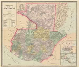
Commercial Map of Guatemala.
sold
- Digital Map Information
- Suitable for large format printing
- File Size: 29.42 MB
- File Type: ZIP / TIFF
- ICC color profile embedded
- Delivered instantly via download link
This is an 1891 F. Bianconi economic map of Guatemala. The map depicts the region from the Pacific Ocean and Mexico to Honduras, El Salvador, and the Caribbean Sea and from Mexico and the Caribbean Sea to El Salvador and the Pacific Ocean. As a commercial map, Guatemala's rich natural resources are extolled from Tikal to the Pacific Ocean. Small print in italics appear throughout the map in both French and Spanish indicate the different products produced, grown, harvested, or raised in a certain region, and these include sarsaparilla, vanilla, mahogany, cedar, pastureland, cotton, wheat, sugarcane, and other grains. 'Forests' is also indicated regularly, creating the presumption that these forests were used to export wood, but not a specific kind of wood, like cedar and mahogany, which are specifically named. (more details)
Natural resources of Guatemala along with its physical and political geography.
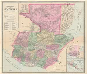
Commercial Map of Guatemala.
sold
- Digital Map Information
- Suitable for large format printing
- File Size: 25.5 MB
- File Type: ZIP / TIFF
- ICC color profile embedded
- Delivered instantly via download link
This is an 1891 F. Bianconi economic map of Guatemala. The map depicts the region from the Pacific Ocean and Mexico to Honduras, El Salvador, and the Caribbean Sea and from Mexico and the Caribbean Sea to El Salvador and the Pacific Ocean. As a commercial map, Guatemala's rich natural resources are extolled from Tikal to the Pacific Ocean. Small print in italics appear throughout the map in both French and Spanish indicate the different products produced, grown, harvested, or raised in a certain region, and these include sarsaparilla, vanilla, mahogany, cedar, pastureland, cotton, wheat, sugarcane, and other grains. 'Forests' is also indicated regularly, creating the presumption that these forests were used to export wood, but not a specific kind of wood, like cedar and mahogany, which are specifically named. (more details)