
Clüver, Philipp (sold)

Philipp Clüver (also Klüwer, Cluwer, or Cluvier, Latinized as Philippus Cluverius and Philippi Cluverii) (1580 - December 31, 1622) was a German geographer and historian active in Leiden in the late 16th and early 17th centuries. Clüver was born in the Royal Prussian city of Danzig (Gdansk), then a province of the Kingdom of Poland. He study of law at the University of Leiden before turning his attention to history and geography. Cluver traveled, mostly by foot, extensively throughout Europe, spending time in Germany, England, Scotland, Holland and Italy. On returning to Leiden he was given a special appointment as geographer and put in charge of the university's library. Cluver is best known for his general study of the geography of antiquity. A popular Enlightenment era field of study, antiquarian geography attempted to resolve place names known from classical literature but, by the time of the Renaissance, geographically confused. Cluver based his research not only on classical literary sources, but — and this was his primary contribution to the genre — also his extensive and local inspections of sites. Today he is considered one of the founding fathers of historical geography. Cartographically Cluver's most prominent works include his edition of Ptolemy's Geographia (based on Mercator's edition of 1578) and for miniature atlases that were reprinted for most of the 17thand 18th centuries. Cluver was also known as Klüwer, Cluwer, or Cluvier, Latinized as Philippus Cluverius and Philippi Cluverii. He died in Leiden in 1622.
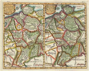
Populorum Germanium inter Rhenum et Albim descriptio ut inter Caesaris et Trajani imperia Incoluerunt. Populorum Germaniae inter Rhenum et Albim descriptio ut circa I. Caesaris aevum Incoluerunt.
sold
- Digital Map Information
- Suitable for large format printing
- DPI: 300
- File Size: 3.68 MB
- File Type: ZIP / TIFF
- ICC color profile embedded
- Delivered instantly via download link
This is a stunning 1661 map by Philipp Cluver depicting Germany during Roman times. Essentially two maps on a single sheet, both maps cover the same region in Germany, viz. between the Rhine and Elbe Rivers and from Denmark south as far as Switzerland and Austria. ... (more details)
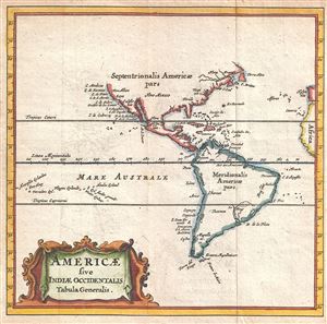
Americae sive Indiae Occidentalis Tabula Generalis.
sold
- Digital Map Information
- Suitable for large format printing
- DPI: 300
- File Size: 0.75 MB
- File Type: ZIP / TIFF
- ICC color profile embedded
- Delivered instantly via download link
A scarce and attractive 1661 miniature map of the the Americas by Philipp Cluver. A reduced version of the 1630 De Laet map, Cluver's map presents the Americas according to the geographical conventions of the time. The map offers primarily coastal details. On ... (more details)
Korea and California as Islands.
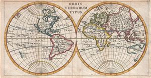
Orbis Terrarum Typus.
sold
- Digital Map Information
- Suitable for large format printing
- DPI: 300
- File Size: 1.76 MB
- File Type: ZIP / TIFF
- ICC color profile embedded
- Delivered instantly via download link
A scarce and attractive 1661 miniature map of the world by Philipp Cluver. Cluver presented the world according to the geographical conventions of the time with California and Korea appearing in insular form. In South America, Lake Parima, mythical site of El ... (more details)
Ancient and modern directional names explained.
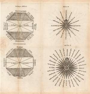
[Untitled diagrams of Compass Roses, Naming the Cardinal Directions.]
sold
- Digital Map Information
- Suitable for large format printing
- Full resolution TIFF file
- ICC color profile embedded
- Delivered instantly via download link
This is an attractively-engraved plate comparing four different conventions in naming the cardinal directions. It was printed in a 1661 Elzevir edition of Philipp Cluver's introduction to geography. Cluver's work appeared in editions by several different houses, and with maps of wildly differing characteristics. Presented here are four separate diagrams, each exemplifying a different, common convention for directional toponomy. (more details)
Attractively Engraved Map of the Northern Part of Europe.
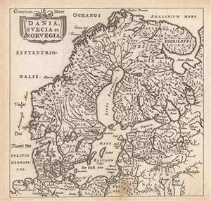
Dania, Suecia et Norvegia.
sold
- Digital Map Information
- Suitable for large format printing
- Full resolution TIFF file
- ICC color profile embedded
- Delivered instantly via download link
This is a finely-engraved miniature map of Scandinavia, printed in a 1661 Elzevir edition of Philipp Cluver's introduction to geography, appearing in editions produced by many different houses, and with maps of wildly differing characteristics. This map follows the model of Swedish mathematician and cartographer Anders Bure, whose 1624 map of Scandinavia - the first geodetically correct map of the region - provided the basis for virtually every general map of the region, including those by Goos, Hondius, and Blaeu, from whose work this one is almost certainly derived. (more details)
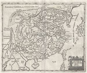
Imperii Sinarum Nova Descriptio.
sold
- Digital Map Information
- Suitable for large format printing
- DPI: 300
- File Size: 3.24 MB
- File Type: ZIP / TIFF
- ICC color profile embedded
- Delivered instantly via download link
This is an uncommon c.1680 map of China by Philip Cluver. The map covers China from Laos east as far as Japan and from the Great Wall south as far as Hainan and northern Philippines. Taiwan is also noted. Though based on an earlier map by Joan Blaeu with the ... (more details)
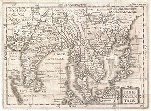
Inde Orientale.
sold
- Digital Map Information
- Suitable for large format printing
- DPI: 300
- File Size: 3.58 MB
- File Type: ZIP / TIFF
- ICC color profile embedded
- Delivered instantly via download link
An uncommon c. 1700 map of India and Southeast Asia most likely drawn by Phillip Cluver. Centered on Siam (Thailand), Cluver's map covers from western India and the Indus Valley eastward as far as China, the Philippines, and Borneo, inclusive of India, Ceylon, ... (more details)
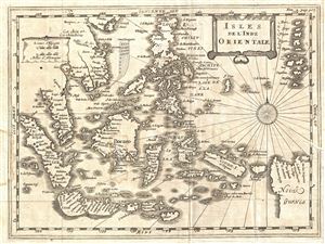
Isles de l'Inde Orientale.
sold
- Digital Map Information
- Suitable for large format printing
- DPI: 300
- File Size: 3.08 MB
- File Type: ZIP / TIFF
- ICC color profile embedded
- Delivered instantly via download link
An uncommon c. 1700 map of the east Indies by Phillip Cluver. Centered on Borneo and The Celebes, Cluver's map covers from Sumatra to New Guinea and the Mariana Islands (Larrons), and from Luzon in the Philippines and Halong Bay (Vietnam) to Java and Timor. ... (more details)