
Desilver, Charles (sold)

Charles Desilver (1815 - May 18, 1876) was an American book and map publisher active during the 19th century in Philadelphia. Desilver, the son of Thomas Desilver of the firm Desilver, Thomas and Co., began is cartographic career as a partner in the firm Thomas, Cowperthwait and Company, the publisher of Samuel Augustus Mitchell's popular New Universal Atlas. Thomas, Cowperthwait and Company was succeeded by Cowperthwait, Desilver and Butler. In 1856, when the previous firm dissolved, Desilver succeeded it by starting his own lithographic firm, acquired Mitchell's copyrights, and began publishing his own variant on the New Universal Atlas. Desilver revised Mitchell's maps with a new grillwork border, his own color scheme, new titles, and some updated political data. Despite a noble pedigree, Desilver's maps did not sell well - possibly because they followed the long and very popular run of Mitchell's own atlases. Desliver continued to publish his atlas until 1859 (though we have heard that he also published an 1862 edition). In 1859 he resold the Mitchell copyrights and printing plates to S. A. Mitchell's son S. A. Mitchell, Jr. The younger Mitchell again updated the plates with his own border and color scheme. He began publishing his own successful atlas in 1860. Desilver continued to operate his firm even after selling the Mitchell copyrights, and his sons Harry and Joseph T., joined the firm in 1875 which was renamed Desilver and Sons. Desilver married Caroline Hill on March 29, 1836, in Philadelphia, with whom he had several children.
Guide map for transcontinental emigrant travel in the antebellum period.
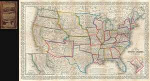
A New Map of the United States of America.
sold
- Digital Map Information
- Suitable for large format printing
- File Size: 16.94 MB
- File Type: ZIP / TIFF
- ICC color profile embedded
- Delivered instantly via download link
An unusual example of Charles Desilver's 1856 pocket map of the United States. The map covers the United States from coast to coast during the post-Mexican American War / pre-Civil War Period - a era of incredible national optimism, Indian Wars, the California ... (more details)
An early atlas map of the central western United Srtates.
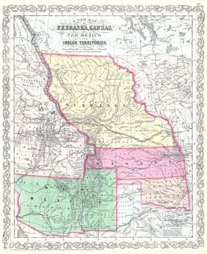
A New Map of Nebraska, Kansas, New Mexico and Indian Territories.
sold
- Digital Map Information
- Suitable for large format printing
- File Size: 14.32 MB
- File Type: ZIP / TIFF
- ICC color profile embedded
- Delivered instantly via download link
This is an 1856 Charles Desilver map of Nebraska, Kansas, New Mexico, and the Indian Territory. The map depicts the western United States from the 115th parallel, or roughly the Colorado River, to Independence, Missouri and from Canada (British America) to Texas and the Gadsden Treaty Line of 1854. Highly detailed, towns and other settlements are labeled throughout, particularly along the railroads and other routes through the region, including Omaha, Kansas City, Taos, Santa Fe, and Salt Lake City. Several forts are also identified, such as Bent's Fort and Fort Kearny.The ranges of numerous American Indian tribes are identified, although only a handful are restricted within set borders in Kansas and the Indian Territory. Myriad rivers and lakes are identified, along with individual peaks within the Rocky Mountains. (more details)
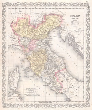
Italy. North Part.
sold
- Digital Map Information
- Suitable for large format printing
- File Size: 3.56 MB
- File Type: ZIP / TIFF
- ICC color profile embedded
- Delivered instantly via download link
This beautiful hand colored map is a lithographic engraving of Northern Italy, dating to 1856, by little known American map publisher Charles Desilver. Depicts Italy from Naples north to Lombardy. Dated and copyrighted '1856 by Charles ... (more details)
Map of the Crimean Peninsula by little known American Publisher.
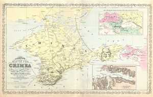
A Complete Map of the Crimea Showing the Military and Carriage Roads with Distances from Various Points of the Western Coast.
sold
- Digital Map Information
- Suitable for large format printing
- Full resolution TIFF file
- ICC color profile embedded
- Delivered instantly via download link
This is a scarce map of the Crimean Peninsula by little known American map publisher Charles Desilver. It depicts the Crimean Peninsula during the Crimean War. This highly detailed map notes military and carriage roads throughout with ... (more details)
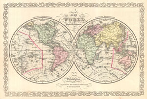
A New Map of the World on Globular Projection.
sold
- Digital Map Information
- Suitable for large format printing
- File Size: 5.55 MB
- File Type: ZIP / TIFF
- ICC color profile embedded
- Delivered instantly via download link
A fine example of Charles Desilver's 1856 double hemisphere map of the World. Covers the entire world with color coding according to continents. The map shows recent discoveries in the Antarctic as well as the routes of various ... (more details)
First edition of influential Texas map.
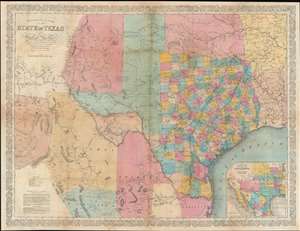
Richardson's New Map of the State of Texas including Part of Mexico.
sold
- Digital Map Information
- Suitable for large format printing
- Full resolution TIFF file
- ICC color profile embedded
- Delivered instantly via download link
This is the rare 1858 / 59 first edition of the large-format Willard Richardson / Charles DeSilver map of Texas. This is the most influential separately-issued map of Texas on the eve of the American Civil War (1861 - 1865). The map is noteworthy not only for its size and detail, but for its exception breakdown of railroads, both extant and under construction. An inset in the lower right details the proposed route of the Arkansas Railroad. (more details)