
Meyer, Joseph
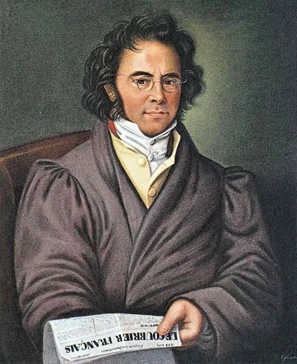
Joseph Meyer (May 9, 1796 - June 27, 1856) was a German industrialist, merchant, and publisher, active in Germany in the early to mid 19th century. He is best known for publishing the encyclopedia Meyers Conversation-Lexicon. Born in Gotha, Germany, Meyer was educated as a merchant in Frankfurt am Main. He moved to London in 1816, but returned to Germany in 1820 after his stock speculations and business adventures fell through. Once back in Germany, he began by investing in the textile trade (1820 - 24). Meyer began creating business plans concerning how to start railways soon after the first steam-hauled railway began operation in December 1835. He founded the Deutsche Eisenbahnschienen-Compangie auf Actien (German Railway Rail joint stock company) in 1845. Meyer also found great success as a publisher, utilizing the system of serial subscriptions to publications, a new idea for the time. He founded a company, Bibliographisches Institut in Gotha in 1825, which published several versions of the Bible, works of classical literature, atlases, the world in pictures on steel engravings, and an encyclopedia. He moved the Institut from Gotha to Hildburghausen in 1828. He published several atlases, including Meyer's Groẞer Hand-Atlas (1843 - 1860). In 1848, he supported the Springtime of the Peoples Revolutions that took place throughout Germany and much of Europe. When the revolutions failed in 1849, Meyer was briefly imprisoned for his support of revolutionary activities. The revolutions also began to take a toll on Meyer's business interests, and when he died, in 1856, the Bibliographisches Institut was struggling financially. His son, Herrmann Julius Meyer, took over the firm, spearheading a rapid recovery. This, and other businesses prospered under Herrmann Julius (April 4, 1826 - March 12, 1909) and when he died in 1909, he led the richest family in Saxony, with more total wealth than the King of Saxony
Canal, road, and railroad network in Arkansas.
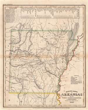
Neueste Karte von Arkansas mit seinen Canaelen Strassen und Entfernungen der Hauptpunkte.
$125.00
Acquire
- Digital Map Information
- Suitable for large format printing
- Full resolution TIFF file
- ICC color profile embedded
- Delivered instantly via download link
This is an 1845 Joseph Meyer map of Arkansas. The state's road, railroad, and canal network is illustrated in detail, with railroads and canals under construction depicted. Dotted lines separate counties. Cities, towns, and villages are labeled. Indian villages are marked as well, with a Delaware Village appearing just above La Grange. Arkansas's river system is detailed as well, with the Arkansas, Mississippi, and Red rivers all illustrated, along with numerous creeks and streams. Three distance tables situated along the top border provide itineraries and distances from Little Rock to New Orleans, Pittsburg, and Fort Gibson. (more details)
Beginning of the Oregon Trail.
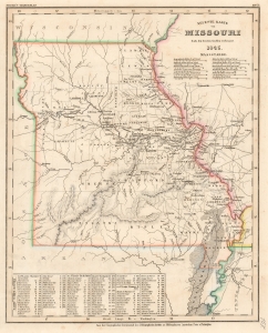
Neueste Karte von Missouri Nach den bessten Quellen verbessert.
$175.00
Acquire
- Digital Map Information
- Suitable for large format printing
- File Size: 8.23 MB
- File Type: ZIP / TIFF
- ICC color profile embedded
- Delivered instantly via download link
This is an 1845 Joseph Meyer map of Missouri, published near the height of Oregon-bound migration. Independence, Missouri, a city founded in western Missouri near the Missouri River, acted as the launching point for the Oregon Trail and the Santa Fe Trail, two important wagon routes across the western United States. (more details)
Labels the first railroad in New Jersey - the Camden and Amboy Railway.
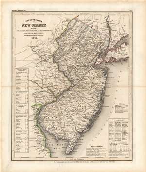
Neueste Karte von New Jersey mit seinen Strassen, Entfernung, der Hauptpunkte u. Routen fur Dampfschiffe.
$250.00
Acquire
- Digital Map Information
- Suitable for large format printing
- Full resolution TIFF file
- ICC color profile embedded
- Delivered instantly via download link
This is an 1846 Joseph Meyer map of New Jersey. A transportation map at its finest, Meyer focuses on the state's roads, railways, and canals. Three railroads traverse the state, but only the Camden and Amboy Railway is identified by name. The Camden and Amboy was the first railroad in operation in New Jersey and began running between Bordentown and Hightstown in 1831, only fifteen years before this map was published! Numerous cities, towns, and villages are labeled throughout, and distances between them are marked in miles. To complete the aesthetic of a transportation map, routes between Trenton and six regional cities (New York appears twice) provide an idea of how best to get from one place to the other and how long it will take. (more details)
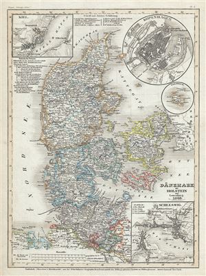
Danemark mit Holstein und Lauenburg.
$100.00
Acquire
- Digital Map Information
- Suitable for large format printing
- Full resolution TIFF file
- ICC color profile embedded
- Delivered instantly via download link
This is a scarce 1849 Joseph Meyer map of Denmark. It covers all of Denmark inclusive of the Duchies of Schleswig and Holstein. Numerous towns, rivers, roads, mountains and other important topographical features are noted throughout. An inset in the top left and ... (more details)
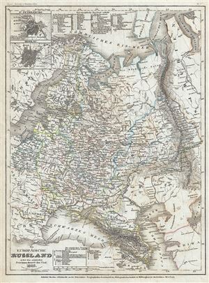
Das Europaische Russland nebst den asiatischen Provinzen diesseit des Ural.
$150.00
Acquire
- Digital Map Information
- Suitable for large format printing
- Full resolution TIFF file
- ICC color profile embedded
- Delivered instantly via download link
This is a lovely map of European Russia dating to 1849 by Joseph Meyer. It covers the European portions of Russia from the Gulf of Bothnia to the Ural Mountains and from the Arctic south as far as the Black Sea. The modern day nations of Russia, Ukraine, Belarus, ... (more details)
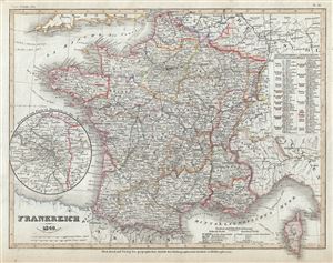
Frankreich.
$90.00
Acquire
- Digital Map Information
- Suitable for large format printing
- Full resolution TIFF file
- ICC color profile embedded
- Delivered instantly via download link
This is a fine 1849 map of France by Joseph Meyer. It covers the Kingdom of France showing its various provinces. It covers from the Flanders in the north to Roussillon in the south and from Brittany in the west to Alsace in the east. It covers from the Flanders ... (more details)
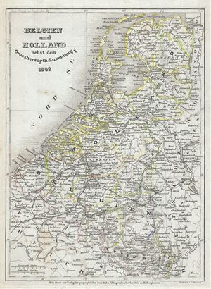
Belgien und Holland nebst dem Grossherzogth Luxemburg.
$90.00
Acquire
- Digital Map Information
- Suitable for large format printing
- Full resolution TIFF file
- ICC color profile embedded
- Delivered instantly via download link
This is a fine 1849 map of Holland (The Netherlands) and Belgium by Joseph Meyer. It covers from the North Sea south to include Luxembourg. Throughout, the map identifies numerous towns, rivers, railways, roads, mountains and an assortment of additional ... (more details)
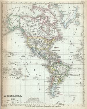
America.
$150.00
Acquire
- Digital Map Information
- Suitable for large format printing
- Full resolution TIFF file
- ICC color profile embedded
- Delivered instantly via download link
This is a scarce 1849 map of North America and South America by Joseph Meyer. The map covers all of North America as well as South America from the Arctic to Cape Horn. In North America, Russian and British territories in Alaska and Canada are clearly ... (more details)
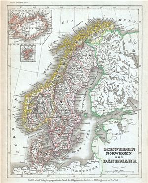
Schweden Norwegen und Danemark.
$125.00
Acquire
- Digital Map Information
- Suitable for large format printing
- Full resolution TIFF file
- ICC color profile embedded
- Delivered instantly via download link
This is a fine example of Joseph Meyer's 1852 map of Scandinavia, including Norway, Sweden and Denmark. It covers from the Arctic south to Holstein and east as far as Lake Ladoga, the largest lake in Europe. Two insets in the top left quadrant detail ... (more details)
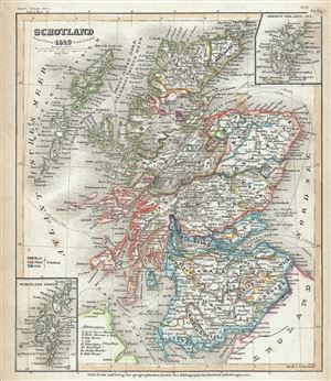
Schotland.
$125.00
Acquire
- Digital Map Information
- Suitable for large format printing
- Full resolution TIFF file
- ICC color profile embedded
- Delivered instantly via download link
This is a beautiful example of the 1849 map of Scotland by Joseph Meyer. It covers all of Scotland from the Orkney Islands to Wigtown in the south, including the Hebrides or Western Isles. The Shetland and Orkney Islands are detailed in insets in the ... (more details)
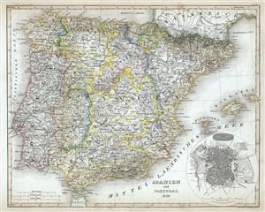
Spanien und Portugal.
$100.00
Acquire
- Digital Map Information
- Suitable for large format printing
- Full resolution TIFF file
- ICC color profile embedded
- Delivered instantly via download link
This is a beautiful 1849 map of Spain and Portugal by Joseph Meyer. It covers all of Spain and Portugal from the Pyrenees to the Strait of Gibraltar and includes the Balearic Islands of Ibiza, Majorca, and Minorca. An inset plan of Madrid is included ... (more details)
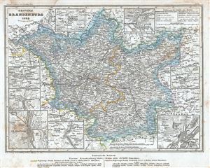
Provinz Brandenburg.
$90.00
Acquire
- Digital Map Information
- Suitable for large format printing
- Full resolution TIFF file
- ICC color profile embedded
- Delivered instantly via download link
This is a fine 1849 example of Joseph Meyer's map of the Province of Brandenburg. It covers from Perleberg, Germany to Sulechow, Poland. Throughout the map identifies various cities, towns, rivers and an assortment of additional topographical ... (more details)
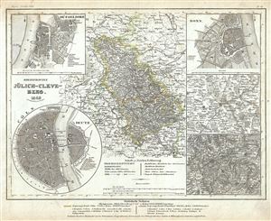
Rheinprovinze Julich-Cleve-Berg.
$120.00
Acquire
- Digital Map Information
- Suitable for large format printing
- Full resolution TIFF file
- ICC color profile embedded
- Delivered instantly via download link
This is a fine 1853 map of the Province of Julich-Cleves-Berg by Joseph Meyer. It covers the former province of the Kingdom of Prussia from Kleve to Koblenz and from Munster to Aachen. Five insets detailing the cities and vicinities of Bonne, ... (more details)
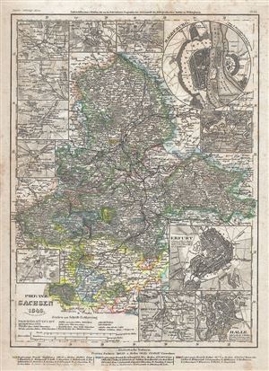
Provinz Sachsen.
$90.00
Acquire
- Digital Map Information
- Suitable for large format printing
- Full resolution TIFF file
- ICC color profile embedded
- Delivered instantly via download link
This is a fine 1849 map of the Province of Saxony by Joseph Meyer. It covers the former Prussian province from Hansestadt salzwedel south to Eisfeld, covering most of the modern German states of Saxony-Anhalt and Thuringia. Throughout the map ... (more details)
Der Freistaat.
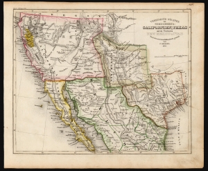
Vereinigte Staaten von Nord-America: Californien, Texas und die Territorien New Mexico u. Utah.
sold
- Digital Map Information
- Suitable for large format printing
- DPI: 600
- File Size: 15.96 MB
- File Type: ZIP / TIFF
- ICC color profile embedded
- Delivered instantly via download link
An uncommon and under-appreciated 1852 map of the American southwest and northern Mexico by Joseph Grassl and Joseph Meyer. It is most notable for its anachronistic and unusual presentation of the borders of New Mexico and Texas, and other cartographic oddities. (more details)
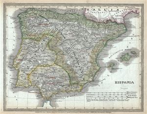
Hispania.
$100.00
Acquire
- Digital Map Information
- Suitable for large format printing
- Full resolution TIFF file
- ICC color profile embedded
- Delivered instantly via download link
This is a fine 1852 map of Hispania or Spain under the Roman Empire by Joseph Meyer. It depicts the Iberian Peninsula under the Roman Empire from the Atlantic Ocean to the Mediterranean Sea, including the Balearic Islands of Ibiza, Majorca and ... (more details)
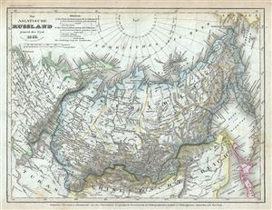
Das asiatische Russland jenseit des Ural.
$100.00
Acquire
- Digital Map Information
- Suitable for large format printing
- Full resolution TIFF file
- ICC color profile embedded
- Delivered instantly via download link
This is an attractive 1952 map of Russia in Asia by Joseph Meyer. It covers the Russian Empire in Asia east from the Ural Mountains as far as Kamchatka and Alaska, including parts of the Chinese Empire and European Russia. Throughout, the map ... (more details)
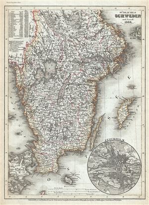
Sudliches Schweden.
$100.00
Acquire
- Digital Map Information
- Suitable for large format printing
- Full resolution TIFF file
- ICC color profile embedded
- Delivered instantly via download link
This is a scarce 1852 map of Sweden by Joseph Meyer. It covers the southern part of Sweden from Lake Siljan south to the Baltic Sea and west as far as Norway. It includes the islands of Gotland, Oland and Ronne. An inset in the bottom right ... (more details)
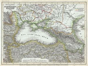
Kustenlander des Schwarzen Meeres.
$125.00
Acquire
- Digital Map Information
- Suitable for large format printing
- Full resolution TIFF file
- ICC color profile embedded
- Delivered instantly via download link
This is a scarce 1852 map of the Black Sea and adjacent regions by Joseph Meyer. Centered on the Black Sea, the map focuses on the area immediately surrounding it. Includes parts of what is modern day Ukraine, Moldova, Romania, Bulgaria, ... (more details)
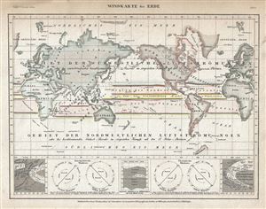
Windkarte der Erde.
$150.00
Acquire
- Digital Map Information
- Suitable for large format printing
- Full resolution TIFF file
- ICC color profile embedded
- Delivered instantly via download link
This is a charming 1852 map or chart or map of the World showing the trade winds by Joseph Meyer. Five inset maps are included along the lower border of the map and include diagrams of the barometric wind rose, a thermal wind rose and ... (more details)
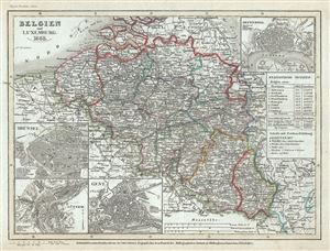
Belgien und Luxemburg.
$100.00
Acquire
- Digital Map Information
- Suitable for large format printing
- Full resolution TIFF file
- ICC color profile embedded
- Delivered instantly via download link
This is a beautiful 1852 example of Joseph Meyer's map of Belgium and Luxembourg. It covers from North Flanders to Luxembourg and includes parts of Holland (The Netherlands), Germany and France. Throughout, the map identifies various ... (more details)
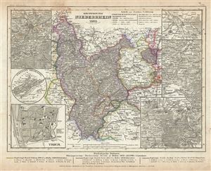
Rheinprovinz Niederrhein.
$100.00
Acquire
- Digital Map Information
- Suitable for large format printing
- Full resolution TIFF file
- ICC color profile embedded
- Delivered instantly via download link
This is a fine 1853 map of the Provincial Grand Duchy of the Lower Rhine by Joseph Meyer. It covers the former province of the Kingdom of Prussia from Heinsberg and Roermond south to Saarbrucken and east as far as Frankfurt. ... (more details)
Features an inset of the Isles of Scilly - a popular birdwatching destination.
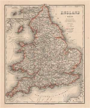
England und Wales.
$150.00
Acquire
- Digital Map Information
- Suitable for large format printing
- File Size: 22.67 MB
- File Type: ZIP / TIFF
- ICC color profile embedded
- Delivered instantly via download link
A lovely 1864 Joseph Meyer map of England and Wales that features an inset of the Isles of Scilly in the upper left corner. Popular with birders, Scilly is located twenty-five miles off the southwestern tip of Cornwall. As a whole, the map provides an extraordinary level of detail. Cities and towns are labeled throughout, and maritime trade routes throughout the world are illustrated and identified. (more details)