
Nostrand, George J. (sold)

George J. Nostrand (fl. 1920 - 1940) was an American lithographer and publisher of maps and views, primarily of New York City. He appears to have been in the employ of the Arthur Ohman Map Co. until the firm’s closing. It is unclear when this happened exactly as some publications use Nostrand's name in the title but retain the Ohman imprint (August Ohman, founder of the Ohman Map Co., died in 1934). Thereafter, Nostrand operated from the same location under his own name as late as 1939.
New York City of the Roaring Twenties.
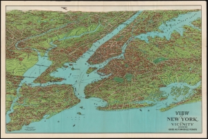
View of New York and Vicinity Showing Good Automobile Roads.
sold
- Digital Map Information
- Suitable for large format printing
- Full resolution TIFF file
- ICC color profile embedded
- Delivered instantly via download link
This is an engaging 1927 birds-eye view map of New York City and vicinity by George J. Nostrand. Brightly colored and evocative, the view presents New York City and its surrounds at the height of 'the Roaring Twenties.' As the title suggests, it was meant to highlight the most auto-friendly of New York City’s roads during an era in which the automobile was still a relative novelty and the outer boroughs were not yet fully developed. (more details)
Jazz Age Map of New York City in Vivid Color
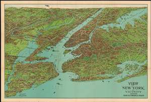
View of New York and Vicinity Showing Good Automobile Roads.
sold
- Digital Map Information
- Suitable for large format printing
- File Size: 54.93 MB
- File Type: ZIP / TIFF
- ICC color profile embedded
- Delivered instantly via download link
This is an exceptional 1928 birds-eye view map of New York City and vicinity by George J. Nostrand. Brilliantly colored and evocative, the view presents New York City and its surrounds at the height of “the Roaring Twenties.” As the title suggests, it was meant to highlight the most auto-friendly of New York City’s roads during an era in which the automobile was still a relative novelty and the outer boroughs not yet fully developed. Ferry routes are prominently shown, and the East River is spanned by the Brooklyn, Manhattan, Williamsburg and Queensboro Bridges. All five New York City Boroughs are represented, and the map encompasses Westchester County, Bergen County and Nassau County in Long Island. In addition to major roads, the map details specific neighborhoods, the character of their development and topography beautifully rendered. Individual landmarks, buildings and bridges are illustrated throughout, including the Statue of Liberty, Ellis Island, Grand Central, Madison Square Garden, Museum of Natural History, and Metropolitan Museum of Art. The harbor is full of ships while an airplane - in fact, Charles Lindbergh's Spirit of St. Louis - soars over Paterson. (more details)
New York City of the Roaring Twenties.
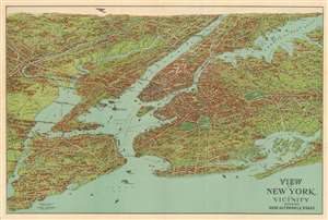
View of New York and Vicinity Showing Good Automobile Roads.
sold
- Digital Map Information
- Suitable for large format printing
- File Size: 59.06 MB
- File Type: ZIP / TIFF
- ICC color profile embedded
- Delivered instantly via download link
This is an engaging 1928 birds-eye view map of New York City and vicinity by George J. Nostrand. Brightly colored and evocative, the view presents New York City and its surrounds at the height of 'the Roaring Twenties.' As the title suggests, it was meant to highlight the most auto-friendly of New York City’s roads during an era in which the automobile was still a relative novelty and the outer boroughs not yet fully developed. Ferry routes are prominently shown, and the East River is spanned by the Brooklyn, Manhattan, Williamsburg and Queensboro Bridges. All five New York City Boroughs are represented, and the map encompasses Westchester County, Bergen County and Nassau County in Long Island. In addition to major roads, the map details specific neighborhoods, the character of their development and topography beautifully rendered. Individual landmarks, buildings and bridges are illustrated throughout, including the Statue of Liberty, Ellis Island, Grand Central, Madison Square Garden, Museum of Natural History, and Metropolitan Museum of Art. The harbor is full of ships while an airplane - in fact, Charles Lindbergh's Spirit of St. Louis - soars over Paterson. (more details)
New York City of the Roaring Twenties.
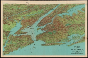
View of New York and Vicinity Showing Good Automobile Roads.
sold
- Digital Map Information
- Suitable for large format printing
- File Size: 111.67 MB
- File Type: ZIP / TIFF
- ICC color profile embedded
- Delivered instantly via download link
This is an engaging 1928 birds-eye view map of New York City and vicinity by George J. Nostrand. Brightly colored and evocative, the view presents New York City and its surrounds at the height of 'the Roaring Twenties.' As the title suggests, it was meant to highlight the most auto-friendly of New York City’s roads during an era in which the automobile was still a relative novelty and the outer boroughs not yet fully developed. Ferry routes appear prominently, and the East River is spanned by the Brooklyn, Manhattan, Williamsburg, and Queensboro Bridges. All five New York City Boroughs are represented, and the map encompasses Westchester County, Bergen County, and Nassau County in Long Island. In addition to major roads, the map details specific neighborhoods, with the character of their development and topography beautifully rendered. Individual landmarks, buildings, and bridges are illustrated throughout, including the Statue of Liberty, Ellis Island, Grand Central, Madison Square Garden, Museum of Natural History, and Metropolitan Museum of Art. The harbor is full of ships while an airplane - in fact, Charles Lindbergh's Spirit of St. Louis - soars over Paterson. (more details)
Jazz Age Map of New York City in Vivid Color
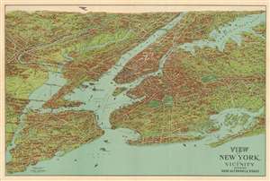
View of New York and Vicinity Showing Good Automobile Roads.
sold
- Digital Map Information
- Suitable for large format printing
- Full resolution TIFF file
- ICC color profile embedded
- Delivered instantly via download link
This is an engaging 1928 birds-eye view map of New York City and vicinity by George J. Nostrand. Brightly colored and evocative, the view presents New York City and its surrounds at the height of 'the Roaring Twenties.' As the title suggests, it was meant to highlight the most auto-friendly of New York City’s roads during an era in which the automobile was still a relative novelty and the outer boroughs not yet fully developed. Ferry routes are prominently shown, and the East River is spanned by the Brooklyn, Manhattan, Williamsburg and Queensboro Bridges. All five New York City Boroughs are represented, and the map encompasses Westchester County, Bergen County and Nassau County in Long Island. In addition to major roads, the map details specific neighborhoods, the character of their development and topography beautifully rendered. Individual landmarks, buildings and bridges are illustrated throughout, including the Statue of Liberty, Ellis Island, Grand Central, Madison Square Garden, Museum of Natural History, and Metropolitan Museum of Art. The harbor is full of ships while an airplane - in fact, Charles Lindbergh's Spirit of St. Louis - soars over Paterson. (more details)
New York City of the Roaring Twenties.
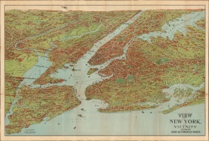
View of New York and Vicinity Showing Good Automobile Roads.
sold
- Digital Map Information
- Suitable for large format printing
- File Size: 43.07 MB
- File Type: ZIP / TIFF
- ICC color profile embedded
- Delivered instantly via download link
This is an engaging 1928 birds-eye view map of New York City and its vicinity by George J. Nostrand, in an unusual transitional state. Brightly colored and evocative, the view presents New York City and its surroundings at the height of 'the Roaring Twenties.' As the title suggests, it was meant to highlight New York City's auto-friendly roads during an era in which the automobile was still a novelty and the outer boroughs not fully urbanised. (more details)
Fairchild aerial photography promoting Robert Moses's ambitious highway infrastructure.
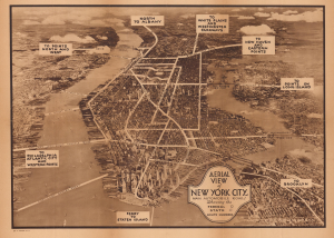
Aerial View of New York City, Main Automobile Roads / Nostrands Map of New York House Numbers Subway Guide / Visitors Map and Hotel Directory of New York.
sold
- Digital Map Information
- Suitable for large format printing
- Full resolution TIFF file
- ICC color profile embedded
- Delivered instantly via download link
This is a c. 1933 view of New York City, taken by aerial photography pioneer Sherman Fairchild, used here for the Hotel Association of New York City. It presents the city during the strange decade of the 1930s, when the Great Depression (1929 - 1939) gripped the country, but also when many of the city's distinctive buildings, bridges, and tunnels were built. (more details)
A Map for the Metropolis.
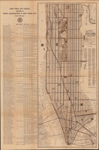
Nostrands Map of New York House Numbers Subway Guide / Visitors Map and Hotel Directory of New York.
sold
- Digital Map Information
- Suitable for large format printing
- Full resolution TIFF file
- ICC color profile embedded
- Delivered instantly via download link
An eminently useful map and guide, this work was produced c. 1933 by George Nostrand of the Ohman Map Co. for the Hotel Association of New York City. It presents the city during the strange decade of the 1930s, when economic depression gripped the country but also when many of the city's distinctive buildings, bridges, and tunnels were built. (more details)
No Sleep 'Til...
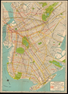
Nostrand's Indexed Brooklyn House Number Map.
sold
- Digital Map Information
- Suitable for large format printing
- Full resolution TIFF file
- ICC color profile embedded
- Delivered instantly via download link
This is George Nostrand's 1934 folding map of Brooklyn, New York. (more details)
The Jazz-Age New York City.
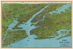
View of New York and Vicinity Showing Good Automobile Roads.
sold
- Digital Map Information
- Suitable for large format printing
- File Size: 67.62 MB
- File Type: ZIP / TIFF
- ICC color profile embedded
- Delivered instantly via download link
This is an engaging birds-eye view map of New York City and vicinity by George J. Nostrand. Initially printed in 1928, this is a later, and apparently scarcer edition printed between 1929 and 1936 featuring several material changes, including most notably the addition of the Triboro Bridge. Brightly colored and evocative, the view presents New York City and its surrounds at the height of 'the Roaring Twenties.' As the title suggests, it was meant to highlight the most auto-friendly of New York City’s roads during an era in which the automobile was still a relative novelty and the outer boroughs not yet fully developed. Ferry routes are prominently shown, and the East River is spanned by the Brooklyn, Manhattan, Williamsburg and Queensboro Bridges. All five New York City Boroughs are represented, and the map encompasses Westchester County, Bergen County and Nassau County in Long Island. In addition to major roads, the map details specific neighborhoods, the character of their development and topography beautifully rendered. Individual landmarks, buildings and bridges are illustrated throughout, including the Statue of Liberty, Ellis Island, Grand Central, Madison Square Garden, Museum of Natural History, and Metropolitan Museum of Art. The harbor is full of ships while an airplane - in fact, Charles Lindbergh's Spirit of St. Louis - soars over Paterson. We find this state of the map to have been printed more boldly and colorfully than earlier iterations, with a bright red border and a richer blue utilized throughout the image. (more details)
New York City near the end of World War II.
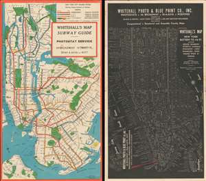
Whitehall's Map Subway Guide.
sold
- Digital Map Information
- Suitable for large format printing
- File Size: 16.02 MB
- File Type: ZIP / TIFF
- ICC color profile embedded
- Delivered instantly via download link
This 1945 George Nostrand subway map of New York City with a city plan or map on the verso. Different colors mark the subway's three divisions - the Independent, IRT, and BMT - which had been 'consolidated' and taken over by the city only five years earlier. White circles mark subway stops, and all are labeled. Prospect Park, Central Park, and the city's newest park, Flushing Meadows, are colored green. Yellow areas in northern Manhattan and the Bronx mark the polo grounds and Yankee Stadium. The city map on the verso labels all major streets and starkly contrasts the difference between Lower Manhattan and the city's grid. Piers, steamship lines, and landmarks, including the Empire State Building, the Chrysler Building, Grand Central Station, and Penn Station, are all identified. A large red arrow announces Whitehall Photo and Blueprint's offices at 39 Broadway. (more details)