
Prévost d'Exiles, Antoine François (sold) (Abbe Provost)
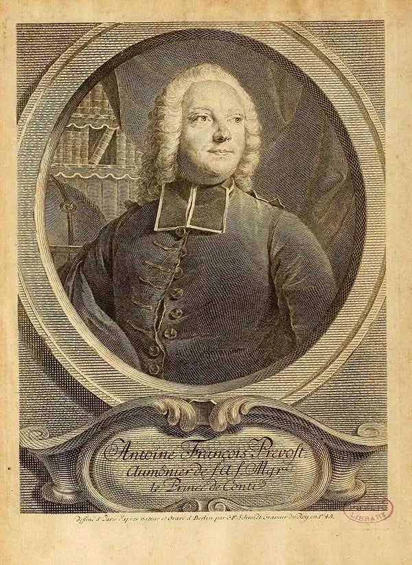
Antoine François Prévost d'Exiles (April 1, 1697 – November 25, 1763), usually known the Abbé Prévost, was a French author and novelist. Having had difficulty in his youth determining a preference for life in the military or life among the Jesuits, he eventually wound up with the Benedictines, with whom he took vows. Despite his taking the vows, the vows evidently did not take with him: in 1728 he abandoned his abbey and fled to London. Naturally, he became a writer. In this he was prolific, both producing his own work and translations of others. Beginning in 1726, he published the first volume of his Histoire générale des voyages, which he worked on for the remained of his life and which was completed by his associates after his death, stretching to 25 volumes.
AKA: Abbe Provost
Beautifully engraved chart of the Pacific Coast with fascinating Tierra del Fuego cartography
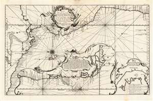
Carte nouvelle et exacte de la mer Pacifique autrement Mer du Sud / dressée sur les memoires et les avis des meilleurs pilotes et routiers de cette mer, ainsi que sur les observations les plus exactes de l'Astronomie et de la navigation en 1744
sold
- Digital Map Information
- Suitable for large format printing
- Full resolution TIFF file
- ICC color profile embedded
- Delivered instantly via download link
This is a 1744 Bellin map of the Pacific coast of Mexico, Central and South America. This beautifully engraved, eastern-oriented chart illustrates the coast line from Acapulco, Mexico to Valparaiso, Chile. The map is continued via inset at bottom center from Valparaiso to Tierra del Fuego. A text annotation along the Chilean coastline identifies the site where Captain David Cheap, one of Anson's sub-commanders, lost his freighter, the Wager, in 1741. (more details)
Revealing the newly-mapped Silk Road regions of the Gobi Desert.
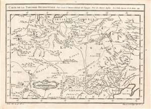
Carte de la Tartarie Occidentale, Pour servir à l'Histoire Générale des Voyages Tirée des Auteurs Anglois. Par N. Bellin Ingenieur de la Marine 1749.
sold
- Digital Map Information
- Suitable for large format printing
- Full resolution TIFF file
- ICC color profile embedded
- Delivered instantly via download link
This is a 1749 Bellin map of the Gobi Desert and the eastern portion of the Silk Route region 'Tirée des Auteurs Anglois.' For 'Auteurs Anglois' read 'Thomas Kitchin', who produced the 1747 A Map of Western Tartary which the present map copies faithfully, and translates. Kitchin's map, itself, was drawn from Jesuit Missionary reports and the monumental 1734 Kirilov map of the Russian Empire. (more details)
An Attractive 18th Century Map of Siam.
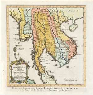
Carte des Royaumes de Siam, de Tunquin, Pegu, Ava, Aracan etc./ Kaart der Koningryken Siam, Tonkin, Pegu, Ava, Arakan etc./ Om te dienen tot de Historische Beschryving der Reizen.
sold
- Digital Map Information
- Suitable for large format printing
- Full resolution TIFF file
- ICC color profile embedded
- Delivered instantly via download link
This is the 1755 Dutch edition of Bellin's map of Southeast Asia, engraved by Jakob van der Schley for inclusion in the Dutch edition of Abbe Prévost's Histoire Générale des Voyages. Centered on the Chao Phraya River, this map covers from the Kingdom of Aracan to the Gulf of Tonkin and from China to the Malay Peninsula, including the modern day nations of Thailand, Cambodia, Laos, Vietnam, Burma, and Malaysia. This map represented a considerable advancement of mapping of the interior of Southeast Asia over the maps of De l'Isle which preceded it, with numerous cities, fortifications, temples, and mountain ranges noted. The map identifies the cities of Siam (Ayutthaya), Bangkok, Lau Chang (Luong Prabong), and Pegu. Many of the islands in the Gulf of Thailand, including Samui, and in the Andaman Islands are noted as well. (more details)
An important map illustrating the Mississippi Valley during the French and Indian War.
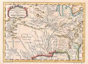
Carte de la Floride, de la Louisiane, et Pays Voisins.
sold
- Digital Map Information
- Suitable for large format printing
- DPI: 600
- File Size: 6.42 MB
- File Type: ZIP / TIFF
- ICC color profile embedded
- Delivered instantly via download link
This is an attractively engraved and detailed 1757 map of the United States by the French cartographer Jacques-Nicholas Bellin. Centered on the Mississippi Valley, Bellin's map covers from the Riviere de Nord (Rio Grande) eastward to Lake Ontario and from Lake Huron to the Gulf of Mexico and Florida. This map is extremely rich in detail illustrating and naming countless American Indian settlements and villages. Bellin offers a wealth of new material throughout marking this map as a unique and meticulously researched production. (more details)
Svalbard - home to polar bears, sled dogs, and the Svalbard Seed Vault.
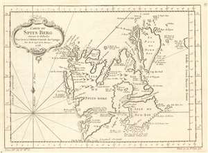
Carte du Spits-Berg Suivant les Hollandois.
sold
- Digital Map Information
- Suitable for large format printing
- DPI: 600
- File Size: 27.29 MB
- File Type: ZIP / TIFF
- ICC color profile embedded
- Delivered instantly via download link
This is a 1758 Jacques-Nicolas Bellin map of Spitsbergen in the Svalbard Archipelago of Norway. The many islands of the arctic archipelago, as well as their bays, capes, and coastal navigation hazards, including submerged rocks, are noted. Safe harbors are marked by anchors. The map also features interesting annotations, such as thie, 'This entire coast is covered in mountains of ice (Toute cette coste est couverte de Mantagnes de Glace)'. (more details)