
Robinson, Herbert Edward Cooper (sold)
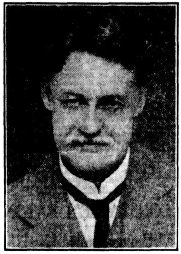
Herbert Edward Cooper Robinson (November 18, 1856 - January 17, 1933) was a Sydney based Australian cartographer active in the late 19th and early 20th centuries. Cooper was born in Winchester, England and emigrated to Australia with his family, settling in Geelong, Victoria. At around 20 - 25 years of age, Robinson moved to Sydney to join the public service, where he mastered cartographic draftsmanship at the Lands Department. In 1882 he left the Lands Office to found a private firm with the Messrs. Higginbotham and Harris, under the imprint of 'Messrs. Higginbotham, Robinson, and Harris.' Within 2 years, both Higginbotham and Harris left the firm, driving it into bankruptcy and leaving Robinson on his own. In 1895, Robinson set up his own map publishing business at Wentworth Court, moving in 1906 to Phillip Street, and in 1913 to permanent location at 221-223 George Street, Sydney. In 1917, the firm formally incorporated as 'H. E. C. Robinson Ltd.' Although based in Sydney, the firm received multiple government contracts and opened annex firms in the Canberra. Robinson is best known for Australian city and regional guides, but he also published Sir Edgeworth David’s gigantic 1932 Geological Map of the Commonwealth of Australia and Donald Mackay's 1930+ aerial surveys of Australia. In addition to his printing work, in 1885, he became a founding member of the Geographical Society of Australasia. He became a fellow of the Royal Geographical Society in the late 1920s. Robinson had two children, Cecil Robinson and Eileen Robinson Brooks, both of whom emigrated to America. His daughter, Eileen, became a famous American stage actress.
Plane Crazy in Australia!
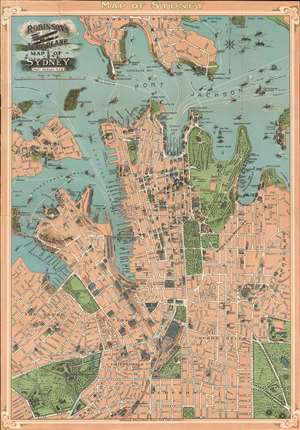
Robinson's Aeroplane Map of Sydney Port Jackson, N.S.W.
sold
- Digital Map Information
- Suitable for large format printing
- File Size: 37.5 MB
- File Type: ZIP / TIFF
- ICC color profile embedded
- Delivered instantly via download link
An interesting early aviation piece, this is Robinson's c. 1909 chromolithograph 'aeroplane' map of Sydney. Centered on the Sydney Town Hall, the map covers from Lavender Street in North Sydney to Victoria Park, and from Elizabeth Island to Potts Point. The map follows in the tradition of similar maps issued of Paris, London, and Rome around the same period, known collectively as 'monumental maps' wherein important buildings and monuments are illustrated in profile against an otherwise simple background. This technique was developed with tourism in mind, to make it easily to navigate to 'must see' sights without the distractions of an otherwise over dense map. The map is surrounded by a striking art nouveau style border. No doubt Robinson, an aviation enthusiast, hope to capitalize on the global fascination with the potential of air travel following the Wright brothers' ground-breaking flight. (more details)
Finest colonial-era map of New Guinea.
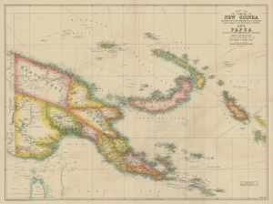
Map of the Territory of New Guinea administered by the Commonwealth of Australia under mandate from the League of Nations and Papua A Territory of the Commonwealth of Australia.
sold
- Digital Map Information
- Suitable for large format printing
- Full resolution TIFF file
- ICC color profile embedded
- Delivered instantly via download link
This large map of New Guinea issued c. 1930 by Herbert Edward Cooper Robinson is the best commercial map of the region to have been issued during the Australian colonial and mandate period. (more details)
Marks gold deposits as well as oil and gas.
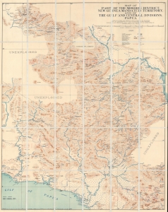
Map of Part of the Morobe District, New Guinea Mandated Territory, and of the Gulf and Central Divisions, Papua.
sold
- Digital Map Information
- Suitable for large format printing
- File Size: 162.84 MB
- File Type: ZIP / TIFF
- ICC color profile embedded
- Delivered instantly via download link
A contrast of incredible detail alongside blank unexplored regions, this is a 1935 James Nason-Jones map of part of Papua New Guinea. A geologist and prospector, Nason-Jones mapped the area while searching for gold and oil and deposits of both are marked here. (more details)
Highlights two puppet states - Manchukuo and Tannu Tuva.
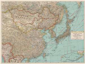
China and Japan with Adjoining Countries.
sold
- Digital Map Information
- Suitable for large format printing
- File Size: 55.93 MB
- File Type: ZIP / TIFF
- ICC color profile embedded
- Delivered instantly via download link
This is a c. 1940 H.E.C. Robinson map of east Asia including China, Japan, Mongolia, Manchukuo (the Japanese puppet state), and Tannu Tuva (a Soviet puppet state) during the Second Sino-Japanese War. Black lines trace railroad lines, including the Trans-Siberian Railway. Solid red lines mark shipping lanes. (more details)