
Rogers, William C. (sold)

William C. Rogers (fl. c. 1860 - 1873) was a New York based lithographer active in the mid to late 19th century. His is best known for his engravings issued in conjunction with Joseph Shannon's Manual of the Corporation fo the City of New York. Rogers issued several maps of New York City in the 1860s and 1870s.
Stunning of upper Manahattan drawn to illustrate the Battle of Harlem Heights.
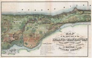
Map of the Upper Part of the Island of Manhattan above eighty-sixth street arranged to illustrate the Battle of Harlem Heights.
sold
- Digital Map Information
- Suitable for large format printing
- File Size: 16.97 MB
- File Type: ZIP / TIFF
- ICC color profile embedded
- Delivered instantly via download link
A stunning and rare 1868 map of the northern part of the island of Manhattan, New York city by W. C. Rogers. The map depicts the upper part of Manhattan, above 86th street (including Morningside Heights, Manhattan Valley, Harlem, Inwood, the Upper West Side, the ... (more details)
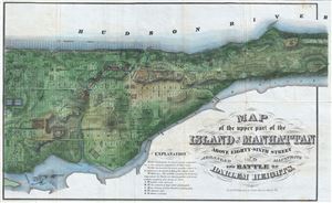
Map of the Upper Part of the Island of Manhattan above eighty-sixth street arranged to illustrate the Battle of Harlem Heights.
sold
- Digital Map Information
- Suitable for large format printing
- Full resolution TIFF file
- ICC color profile embedded
- Delivered instantly via download link
A stunning and rare 1868 Map of the northern part of the island of Manhattan, New York city by W. C. Rogers. The map covers the upper part of Manhattan, above 86th street (including Morningside Heights, Manhattan Valley, Harlem, Inwood, the Upper West Side, the ... (more details)
Stunning of upper Manahattan drawn to illustrate the Battle of Harlem Heights.
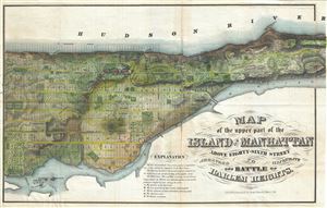
Map of the Upper Part of the Island of Manhattan above eighty-sixth street arranged to illustrate the Battle of Harlem Heights.
sold
- Digital Map Information
- Suitable for large format printing
- Full resolution TIFF file
- ICC color profile embedded
- Delivered instantly via download link
A stunning and rare 1868 Map of the northern part of the island of Manhattan, New York city by W. C. Rogers. The map covers the upper part of Manhattan, above 86th street (including Morningside Heights, Manhattan Valley, Harlem, Inwood, the Upper West Side, the ... (more details)
Stunning of upper Manahattan drawn to illustrate the Battle of Harlem Heights.
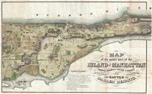
Map of the Upper Part of the Island of Manhattan above Eighty-Sixth Street Arranged to Illustrate the Battle of Harlem Heights.
sold
- Digital Map Information
- Suitable for large format printing
- File Size: 12.49 MB
- File Type: ZIP / TIFF
- ICC color profile embedded
- Delivered instantly via download link
A stunning and rare 1868 map of the northern part of the island of Manhattan, New York city by W. C. Rogers. The map depicts the upper part of Manhattan, above 86th street (including Morningside Heights, Manhattan Valley, Harlem, Inwood, the Upper West Side, ... (more details)
Unusual elongated map of Manhattan Island.
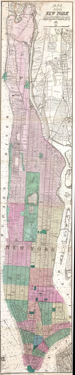
Map of the City of New York.
sold
- Digital Map Information
- Suitable for large format printing
- File Size: 13.12 MB
- File Type: ZIP / TIFF
- ICC color profile embedded
- Delivered instantly via download link
An unusual and very rare 1868 Map of New York city by W. C. Rogers. Map covers the whole of the island of Manhattan with some detail in parts of Queens and the Bronx. This unusual map offer extraordinary detail throughout with names of major landholders ... (more details)
Unusual elongated map of Manhattan Island.
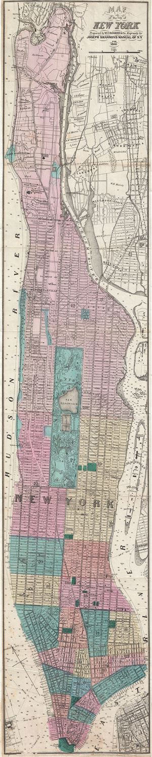
Map of the City of New York.
sold
- Digital Map Information
- Suitable for large format printing
- File Size: 12.06 MB
- File Type: ZIP / TIFF
- ICC color profile embedded
- Delivered instantly via download link
An unusual and very rare 1868 Map of New York city by W. C. Rogers. Map covers the whole of the island of Manhattan with some detail in parts of Brooklyn, Queens and the Bronx. This unusual map offers extraordinary detail throughout with color coding ... (more details)
Unusual elongated map of Manhattan Island.
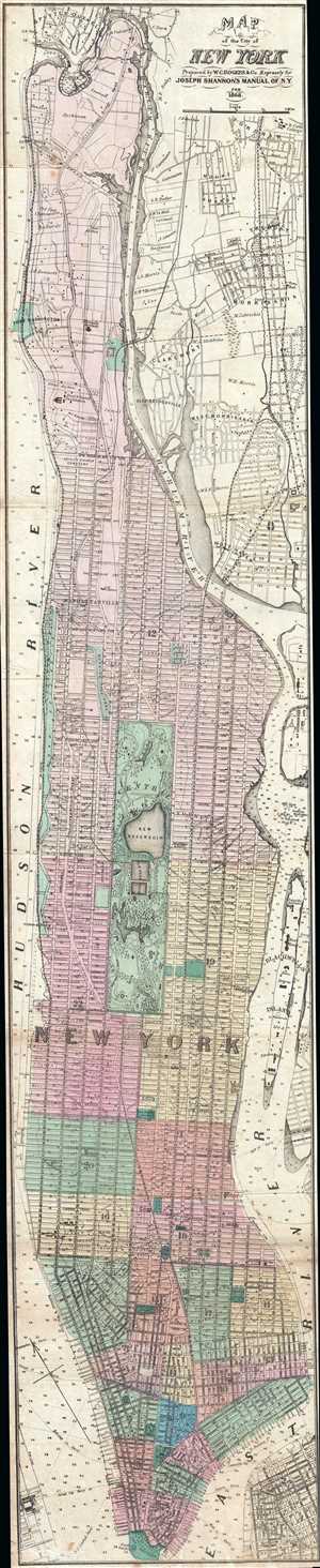
Map of the City of New York.
sold
- Digital Map Information
- Suitable for large format printing
- File Size: 9.98 MB
- File Type: ZIP / TIFF
- ICC color profile embedded
- Delivered instantly via download link
This is an unusual and very rare 1868 Map of New York city by William C. Rogers. The map depicts the whole of the island of Manhattan with some detail in parts of Brooklyn, Queens and the Bronx. This unusual map offers extraordinary detail throughout ... (more details)
Beautiful early view of Central Park's iconic Bow Bridge.
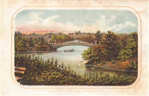
Central Park. The Lake and The Bow Bridge.
sold
- Digital Map Information
- Suitable for large format printing
- File Size: 0.94 MB
- File Type: ZIP / TIFF
- ICC color profile embedded
- Delivered instantly via download link
This is a lovely 1868 Shannon and Rogers view of the Bow Bridge and the Lake in Central Park, by Shannon and Rogers. The Bow Bridge, built in 1862 is located roughly at 74th street in the heart of New York City’s Central Park and connects the ... (more details)
Charming view of Sixth Avenue in Midtown Manhattan c. 1868.
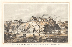
View in Sixth Avenue, Between 55th and 57th Sts. Looking West.
sold
- Digital Map Information
- Suitable for large format printing
- File Size: 1.18 MB
- File Type: ZIP / TIFF
- ICC color profile embedded
- Delivered instantly via download link
This is a beautiful 1868 view looking westward from Sixth Avenue between 55th and 57th streets in what is now Midtown Manhattan, New York City. The view gives an interesting snapshot of what this area looked like in the middle of the 19th ... (more details)
Incredible look at 42nd Street just after the Civil War.
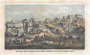
View from School House in 42nd Street Between 2nd and 3rd Avs. Looking North.
sold
- Digital Map Information
- Suitable for large format printing
- File Size: 1.18 MB
- File Type: ZIP / TIFF
- ICC color profile embedded
- Delivered instantly via download link
This is an intriguing 1868 Shannon and Rogers view of 42nd Street between 2nd and 3rd Avenues in Midtown East, Manhattan, New York City. The view depicts the neighborhood looking north across 42nd Street. Various farm animals, including ... (more details)

New York and Environs.
sold
- Digital Map Information
- Suitable for large format printing
- File Size: 9.09 MB
- File Type: ZIP / TIFF
- ICC color profile embedded
- Delivered instantly via download link
A stunning and rare 1868 view of the island of Manhattan, New York City by W. C. Rogers. View depicts the entire island of Manhattan with Hoboken as well as parts of Brooklyn and Queens. Important buildings, especially churches are ... (more details)
Appealing view of New York City.
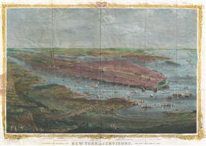
New York and Environs.
sold
- Digital Map Information
- Suitable for large format printing
- File Size: 8.22 MB
- File Type: ZIP / TIFF
- ICC color profile embedded
- Delivered instantly via download link
A stunning and rare 1868 view of the island of Manhattan, New York City by W. C. Rogers. View depicts the entire island of Manhattan with Hoboken as well as parts of Brooklyn and Queens. Important buildings, especially churches are ... (more details)
Wonderful view of the short lived Loew Bridge in lower Manhattan.
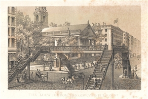
The 'Loew Bridge' Broadway and Fulton St.
sold
- Digital Map Information
- Suitable for large format printing
- File Size: 1.35 MB
- File Type: ZIP / TIFF
- ICC color profile embedded
- Delivered instantly via download link
This is a lovely 1868 view of the Loew Bridge over Broadway and Fulton Street in New York City, by Shannon and Rogers. The view features the short-lived cast iron pedestrian bridge across New York City’s busiest street. ... (more details)
Attractive view of New York City's historically significant Printing House Square.
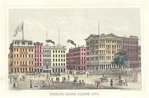
Printing House Square 1868.
sold
- Digital Map Information
- Suitable for large format printing
- File Size: 1.03 MB
- File Type: ZIP / TIFF
- ICC color profile embedded
- Delivered instantly via download link
This is a beautiful 1868 view of the Printing House Square or what is today Park Row near the southern triangle of City Hal Park, New York City by Shannon and Rogers. It depicts what was at the time known as Printing House ... (more details)
Beautiful early view of Central Park's iconic Bow Bridge.
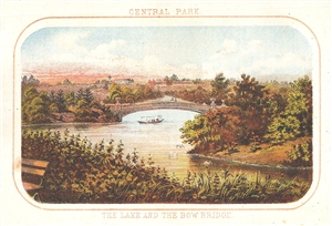
Central Park. The Lake and The Bow Bridge.
sold
- Digital Map Information
- Suitable for large format printing
- File Size: 1.09 MB
- File Type: ZIP / TIFF
- ICC color profile embedded
- Delivered instantly via download link
This is a lovely 1868 view of the Bow Bridge and the Lake in Central Park, by Shannon and Rogers. The Bow Bridge, built in 1862 is located roughly at 74th street in the heart of New York City’s Central Park and connects ... (more details)
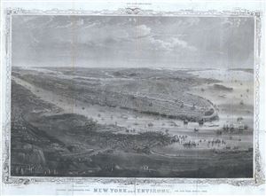
New York and Environs.
sold
- Digital Map Information
- Suitable for large format printing
- Full resolution TIFF file
- ICC color profile embedded
- Delivered instantly via download link
A stunning and rare 1868 view of the island of Manhattan, New York City by W. C. Rogers. The view depicts the entire island of Manhattan with Hoboken as well as parts of Brooklyn and Queens. Important buildings, ... (more details)
View of Central Park's Lake with the Bow Bridge in the background.
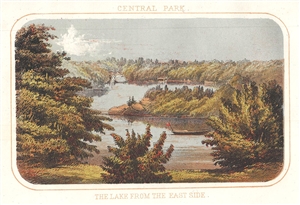
Central Park. The Lake from the East Side.
sold
- Digital Map Information
- Suitable for large format printing
- File Size: 1.08 MB
- File Type: ZIP / TIFF
- ICC color profile embedded
- Delivered instantly via download link
This is a beautiful 1868 view of the Lake in Central Park as seen from the east, by Shannon and Rogers. The view features a boat in the water with the Bow Bridge visible in the distance. The Lake, Central ... (more details)
Attractive view of New York City's historically significant Printing House Square.
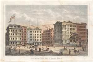
Printing House Square 1868.
sold
- Digital Map Information
- Suitable for large format printing
- File Size: 0.95 MB
- File Type: ZIP / TIFF
- ICC color profile embedded
- Delivered instantly via download link
This is a beautiful 1868 Shannon and Rogers view of the Printing House Square or what is today Park Row near the southern triangle of City Hall Park, New York City by Shannon and Rogers. It depicts what ... (more details)
Charming view of Sixth Avenue in Midtown Manhattan c. 1868.
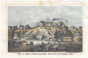
View in Sixth Avenue, Between 55th and 57th Sts. Looking West.
sold
- Digital Map Information
- Suitable for large format printing
- File Size: 1.22 MB
- File Type: ZIP / TIFF
- ICC color profile embedded
- Delivered instantly via download link
This is a beautiful 1868 Shannon and Rogers view looking westward from Sixth Avenue between 55th and 57th streets in what is now Midtown Manhattan, New York City. The view gives an interesting snapshot ... (more details)
An idyllic vision of New York's Bethesda Fountain in Central Park.
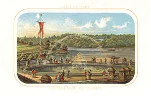
Central Park. The Lake from the Terrace.
sold
- Digital Map Information
- Suitable for large format printing
- File Size: 2.33 MB
- File Type: ZIP / TIFF
- ICC color profile embedded
- Delivered instantly via download link
This is a charming 1868 view of the Lake in Central Park, by Shannon and Rogers. This view of the Lake is seen from the Bethesda Terrace, located roughly at 72nd street in the heart of New York City’s Central Park. This view beautifully depicts the Bethesda Fountain in the foreground with visitors strolling nearby. A colorful rainbow can be seen over the fountain. In the background, we see the Lake with a couple of boats in the water. It is important to realize that this part of the park was merely planned, not completed, when this view was made. The central sculpture, ‘Angel of the Water’ by Emma Stebbins, in not included in this view and would only be completed in 1873. Vaux and Olmstead envisioned the terrace as a meeting place in the heart of the park. Today it is one of the most picturesque parts of the park and a popular hangout for artists and musicians. (more details)
Charming view of Central Park's Lake and Bethesda Fountain.
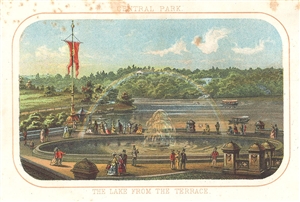
Central Park. The Lake from the Terrace.
sold
- Digital Map Information
- Suitable for large format printing
- File Size: 1.21 MB
- File Type: ZIP / TIFF
- ICC color profile embedded
- Delivered instantly via download link
This is a charming 1868 view of the Lake in Central Park, by Shannon and Rogers. This view of the Lake is seen from the Bethesda Terrace, located roughly at 72nd street in the heart of New York ... (more details)