
Santini, Francois [Francesco] (sold)

Paolo Santini (1729 - June 1793) and his brother Francois [Francesco] Santini (fl. 1776 - 1784) were Italian engravers and map publishers based in Venice. The brothers were born in Venice. They are best known for their Atlas Universel dressé sur les meilleures cartes modernes, a grand atlas presenting state-of-the-art French cartography to a Venetian audience. They drew on the cream of 18th Century French cartographers such as Robert de Vaugondy, Jaillot, De L'Isle, and D'Anville. Their atlas was published by the Remondini house in Venice, who purchased the plates and publishing rights from the Santinis in 1781. Paolo was a priest of the Church of Santa Maria Formosa and a professor of architecture in the public schools of Venice. Moreover, he was an ingenious mechanic and invented a large drill used in the Venetian Arsenal for boring cannons, as well as a cutting instrument designed to verify reliably, under any circumstances, the authenticity of licenses issued to merchant captains. With a zigzag cut made in a single movement of the handle, the original document was divided from its matching counterpart. He appears to have been the primary engraver of the two brothers as well. In addition to maps, he also illustrated and engraved architectural plates. He died in Belluno in June 1793, having traveled there to attend the wedding of a close relative. Francesco is believed to have traveled more broadly, including maintaining an office in Paris, where he purchased many of the maps that would inform the brothers' work. He is known to have associated with several French cartographers of the late 18th century, including Rigobert Bonne. His offices in Paris were located at Rue St. Justine pres de L'Eglise.
Premier Great Lakes Map of the Mid-18th Century.
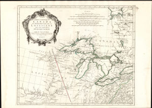
Partie Occidentale du Canada et Septentrionale de la Louisiane avec une partie de Pensilvanie.
sold
- Digital Map Information
- Suitable for large format printing
- Full resolution TIFF file
- ICC color profile embedded
- Delivered instantly via download link
This is Paolo Santini's 1775 map of the western part of Canada, the Upper Mississippi, and the Great Lakes Region. Produced to satisfy European interest in the American Revolutionary War (1775 - 1783), it drew on D'Anville's map, the best French mapping of the region produced during the French and Indian War (1754 - 1763). (more details)
Dreams of a Northwest Passage and the Sea of the West.
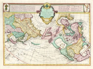
Carte Des Nouvelles Decouvertes au Nord de la Mer de Sud, tant a l'Est de la Syberie et du Kamtchatka, qu'a L'Ouest de la Nouvelle France.
sold
- Digital Map Information
- Suitable for large format printing
- Full resolution TIFF file
- ICC color profile embedded
- Delivered instantly via download link
This is the Buache / De l'Isle map of North America, Siberia, the Arctic, and the North Pacific in its 1776 Venice edition published by Francois Santini. Joseph Nicolas De l'Isle's and Philippe Buache drew this map to illustrate their speculations on the feasibly of a Northwest Passage. Cartographically, this map is derived from data secreted from the Russian 'Academy of Sciences' combined with Buache's own speculations on the Northwest Passage. This map is highly significant for its revival of the 'Sea of the West' hypothesis. This is a landmark map and perhaps the single most influential map of the region issued in the mid-18th century. (more details)
Amazing map of Belarus just after the First Partition of the Polish-Lithuanian Commonwealth.
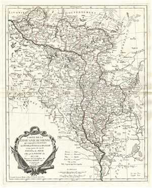
Carte de la Lithuanie Russienne qui comprend les Palatinats de Livonie, de Witepsk, de Miscislaw, et une partie de ceux de Polock et de Minsk cédés par la Pologne à la Russie.
sold
- Digital Map Information
- Suitable for large format printing
- DPI: 300
- File Size: 9.74 MB
- File Type: ZIP / TIFF
- ICC color profile embedded
- Delivered instantly via download link
This is a 1776 Paolo Santini map of Lithuania and Belarus. The map depicts voivodeships (provinces) in the Polish-Lithuanian Commonwealth, which existed from 1569-1795. Stretching from the Grand Duchy of Lithuania ( Grand Duché de Lithuanie ) to the Government of ... (more details)
Historical Map of Crimea, currently a flashpoint of conflict between Russia and the Ukraine.
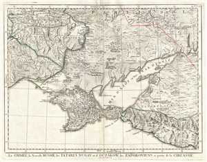
La Crimée, la Nouvelle Russie, les Tatares Nugay et d'Oczakow, les Zaporoviens, et partie de la Circassie.
sold
- Digital Map Information
- Suitable for large format printing
- DPI: 300
- File Size: 12.43 MB
- File Type: ZIP / TIFF
- ICC color profile embedded
- Delivered instantly via download link
This is a 1777 Paolo Santini map of Crimea and Ukraine. The map depicts from southern Ukraine ( Nouvelle Russie ) to the Black Sea. Crimea ( Krim ) is depicted in detail, with numerous settlements and towns labeled and rivers and topography included. Outside ... (more details)
Beautiful map of Arabia based on earlier map by Vaugondy.
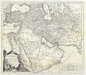
Etats du Grand-Seigneur en Asie, Empire de Perse, Pays des Usbecs, Arabie et Egypte.
sold
- Digital Map Information
- Suitable for large format printing
- DPI: 300
- File Size: 19.06 MB
- File Type: ZIP / TIFF
- ICC color profile embedded
- Delivered instantly via download link
This is Paolo Santini’s spectacular 1778 map of the Persia, Arabia and Turkey or the Ottoman Empire. Covers the Empire at its height, with territory spanning from the Black Sea to the southernmost extension of Arabia and west, inclusive of Persia, as far ... (more details)
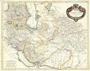
Carte de l'Empire de Perse.
sold
- Digital Map Information
- Suitable for large format printing
- DPI: 300
- File Size: 16.39 MB
- File Type: ZIP / TIFF
- ICC color profile embedded
- Delivered instantly via download link
This is a beautiful example of Paolo Santini's 1779 map of Persia. It covers the Persian Empire from the Black Sea south as far as the Persian Gulf and east as far as Kashmir and Punjab in India, including the modern day nations of Iran, Iraq, Georgia, ... (more details)
Stunning and uncommon Italian map of Corsica.

Carte Particuliere de L'Isle de Corse Divisee par ses Dix Provinces ou Juridictions et ses quatre Fiefs.
sold
- Digital Map Information
- Suitable for large format printing
- DPI: 300
- File Size: 22.45 MB
- File Type: ZIP / TIFF
- ICC color profile embedded
- Delivered instantly via download link
A fine Italian issue map of Corsica published in 1780 by the Venetian cartographer Francesco Santini. Oriented to the east, this map covers all of Corsica with the northern most extension, Capo Corso, appearing in an inset in the lower left quadrant. ... (more details)
Beautiful map of the Kingdom of Slavonia.
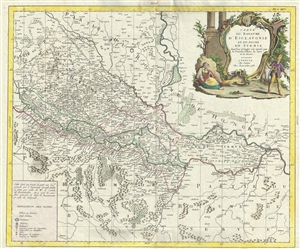
Carte du Royaume D'Esclavonie et du Duche de Syrmie, dont l'un et l'autre est arrose par le Danube, l'Illove, La Save, et la Drave.
sold
- Digital Map Information
- Suitable for large format printing
- DPI: 300
- File Size: 15.83 MB
- File Type: ZIP / TIFF
- ICC color profile embedded
- Delivered instantly via download link
This is a beautiful example of Paolo Santini’s 1783 map of the Kingdoms of Slavonia and Syrmia depicting parts of modern day Croatia, Serbia, Bosnia and Herzegovina as well as parts of Hungary. The map extends south from Tolna in Hungary to Sarajevo ... (more details)
18th Century map of the literary home of Dracula!
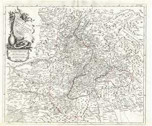
Principaute de Transilvanie et Pays Circonvoisins.
sold
- Digital Map Information
- Suitable for large format printing
- DPI: 300
- File Size: 10.08 MB
- File Type: ZIP / TIFF
- ICC color profile embedded
- Delivered instantly via download link
This is a 1784 Paolo Santini map of Transylvania, or modern-day Romania. The map depicts the Principality of Transylvania, a semi-independent state ruled by Hungarian princes and parts of the Kingdom of Hungary, Moldavia ( Moldavie ), and Wallachia ( ... (more details)