
Sayer, Robert

Robert Sayer (1725 - January 29, 1794) was an important English map publisher and engraver active from the mid to late 18th century. Sayer was born in Sunderland, England, in 1725. He may have clerked as a young man with the Bank of England, but this is unclear. His brother, James Sayer, married Mary Overton, daughter-in-law of John Overton and widow of Philip Overton. Sayer initially worked under Mary Overton, but by December of 1748 was managing the Overton enterprise and gradually took it over, transitioning the plates to his own name. When Thomas Jefferys went bankrupt in 1766, Sayer offered financial assistance to help him stay in business and, in this way, acquired rights to many of the important Jefferys map plates as well as his unpublished research. From about 1774, he began publishing with his apprentice, John Bennett (fl. 1770 - 1784), as Sayer and Bennett, but the partnership was not formalized until 1777. Bennett retired in 1784 following a mental collapse and the imprint reverted to Robert Sayer. From 1790, Sayer added Robert Laurie and James Whittle to his enterprise, renaming the firm Robert Sayer and Company. Ultimately, Laurie and Whittle partnered to take over his firm. Sayer retired to Bath, where, after a long illness, he died. During most of his career, Sayer was based at 53 Fleet Street, London. His work is particularly significant for its publication of many British maps relating to the American Revolutionary War. Unlike many map makers of his generation, Sayer was a good businessman and left a personal fortune and great estate to his son, James Sayer, who never worked in the publishing business.
Scarce, attractive English Map of Spain.
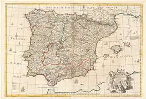
A Correct Map of Spain and Portugal According to the newest observations and discoveries comunicated to the Royal Society at London and the Royal Academy at Paris.
$850.00
Acquire
- Digital Map Information
- Suitable for large format printing
- Full resolution TIFF file
- ICC color profile embedded
- Delivered instantly via download link
This beautiful, large engraving is John Senex’s 1708 map of Spain and Portugal, covering the entire Iberian Peninsula, including the south of France, part of the north coast of Africa, the Strait of Gibraltar and the Balearic Islands of Ibiza, Majorca, and Minorca. It is attractively engraved, with decorative sailing ships and a baroque-inspired cartouche featuring a half-dozen putti wearing the classical iconography of the Greco-Roman gods (with a martial Mars front-and-center, and a commercial Mercury at top.) (more details)
First Modern Chart of the Solar System.
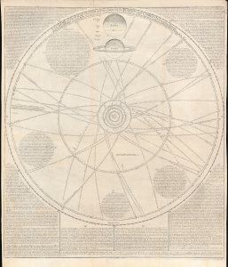
A scheme of the Solar System with the orbits of the planets and comets belonging thereto.
$6,500.00
Acquire
- Digital Map Information
- Suitable for large format printing
- File Size: 28.05 MB
- File Type: ZIP / TIFF
- ICC color profile embedded
- Delivered instantly via download link
This rare broadsheet engraving is a c.1763 Bowles edition of William Whiston's influential 1713 chart of the Solar System, including the orbits of known comets. It is the first modern chart of the Solar System, incorporating the observations of Newton, Halley, and Flamsteed. (more details)
Tower of London, London Bridge, St. Paul's, and Westminster Abbey.
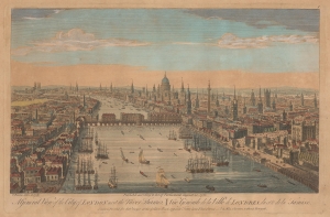
A General View of the City of London next the River Thames. Vüe Générale de la Ville de Londres, du côté de la Tamise.
$850.00
Acquire
- Digital Map Information
- Suitable for large format printing
- File Size: 9.76 MB
- File Type: ZIP / TIFF
- ICC color profile embedded
- Delivered instantly via download link
This is a charming 1751 Thomas Bowles and Robert Sayer bird's-eye view of London as the beating heart of a global empire. (more details)
Separate-Issue Rarity. Vignettes illustrating Asian religous practices. 3 known examples.
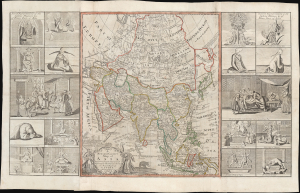
A new and correct map of asia Laid down from the latest and best Observations...
$15,000.00
Acquire
- Digital Map Information
- Suitable for large format printing
- File Size: 71.88 MB
- File Type: ZIP / TIFF
- ICC color profile embedded
- Delivered instantly via download link
This is an extremely rare, separately issued 1754 George Foster / Robert Sayer map of Asia. Although printed in 1754, the map's cartography dates to c. 1735, when it was first issued in a now-lost edition by the map seller George Foster. The map features elaborate decorative side panels, added in 1754 by Sayer, illustrating Asiatic religious practices. This map stands out for its remarkable rarity, being one of only 3 known surviving examples. It is also significant for its use of the term 'Sea of Corea' (Sea of Korea) to denote the sea between Japan and Korea, the naming of which is a matter of international contention. (more details)
Seminal view of Quebec shortly after the French and Indian War.
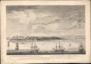
A View of the City of Quebec, the capital of Canada, taken partly from the Pointe des Peres, and partly on Board the Vanguard Man of War. / Vue de la Ville de Québec, capitale du Canada, prise en partie de la Pointe des Peres, et en partie abord de l'Avantgarde Vaisseau de Guerre.
$5,500.00
Acquire
- Digital Map Information
- Suitable for large format printing
- File Size: 25.18 MB
- File Type: ZIP / TIFF
- ICC color profile embedded
- Delivered instantly via download link
This is the rare 1868 Hervey Smyth view of Quebec City, published in 1768. It is one of the earliest obtainable views of Quebec City, offering a look at the city shortly after the French and Indian War (1754 - 1763). The view was published for the Scenographia Americana, one of the most influential and monumental pre-Revolutionary graphic works on North America. (more details)
A region which has gained infamy due to the War on Terror.
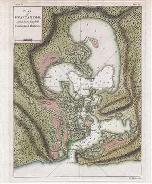
Plan of Guantanimo, called by the English Cumberland Harbour.
$350.00
Acquire
- Digital Map Information
- Suitable for large format printing
- DPI: 300
- File Size: 3.95 MB
- File Type: ZIP / TIFF
- ICC color profile embedded
- Delivered instantly via download link
This is a 1768 Thomas Jefferys map or plan of Guantanamo Bay, Cuba. The map depicts the entirety of Guantanamo Bay and the surrounding area. Highly detailed, the shoreline of the bay is meticulously illustrated, including where the mouths of several rivers enter ... (more details)
Capital of New England - one of the earliest views of Boston based on actual observation.

A View of the City of Boston the Capital of New England, in North America. / Vue de la Ville de Boston Capitale de la Nouvelle Angleterre, dans l'Amérique Septentrionale.
$6,500.00
Acquire
- Digital Map Information
- Suitable for large format printing
- File Size: 29.58 MB
- File Type: ZIP / TIFF
- ICC color profile embedded
- Delivered instantly via download link
This is the rare Thomas Pownall view of Boston, published in 1768. It is one of the earliest obtainable views of Boston, offering a glimpse of the city shortly after the French and Indian War (1754-1763). (more details)
Foaming as white as milk and all in motion like a boiling cauldron.
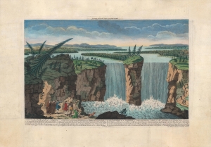
The Waterfall of Niagara...
$1,500.00
Acquire
- Digital Map Information
- Suitable for large format printing
- DPI: 600
- File Size: 33.09 MB
- File Type: ZIP / TIFF
- ICC color profile embedded
- Delivered instantly via download link
A colorful c. 1770 depiction of Niagara Falls, engraved by Robert Hancock and published by Robert Sayer. Below the map, French and English text discusses Niagara Falls' features and natural beauty. (more details)
First commercially available map using Lemprière's cartography.
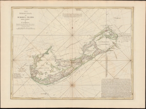
The Bermudas, or Summer's Islands from a Survey by C. Lempriere, regulated by Astronomical Observations.
$4,000.00
Acquire
- Digital Map Information
- Suitable for large format printing
- File Size: 21.99 MB
- File Type: ZIP / TIFF
- ICC color profile embedded
- Delivered instantly via download link
This is a beautiful example of Robert Sayers' Bermuda, incorporating Clement Lemprière's seminal survey of 1738. Lemprière's survey was the first important mapping of Bermuda in the 18th century, and Sayers' imprint was the first widely available commercial application of that new data. (more details)
Presenting the proto-Alaska Muller Peninsula, refuting the Sea of the West.
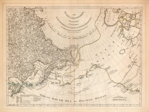
The Russian Discoveries from the Map Published by the Imperial Academy of St. Petersburg.
$1,100.00
Acquire
- Digital Map Information
- Suitable for large format printing
- Full resolution TIFF file
- ICC color profile embedded
- Delivered instantly via download link
An attractive example of Robert Sayer's 1775 translation of Gerhard Friedrich Müller's map presented to refute the spurious geography of the Pacific Northwest proposed by the French cartographers Philippe Buache and Joseph Nicolas De l'Isle. The map covers the same area as the 1752 Buache / De l'Isle map, and uses similarly state-of-the-art data from Russian explorers to show their successes in sailing via a Northeast Passage into the Pacific. This map however presents Müller's cartography of the American Northwest in explicit contradiction of the Buache/De l'Isle imaginary Sea of the West, and reliance on the fictional journeys of Admiral De Fonte. Thus, the map includes the North Pacific, including parts of Alaska, the Pacific Northwest, and Northeast Asia. Coverage extends from the Arctic Circle south to the latitudes of Vancouver and Japan. Most dramatically, the map includes a large, speculative peninsula extending westward from North America towards Asia. This, known as the Müller Peninsula, would become the dominant geographical model for the Pacific Northwest coast until the actual exploration of those coastal areas by Captain Cook in the 1770s. The map is also notable for its unusual Bulbous promontory in northern Siberia, an interpretation of the Witsen Peninsula, itself a mismapping of the Chukchi Peninsula. (more details)
Revelatory map of North America.
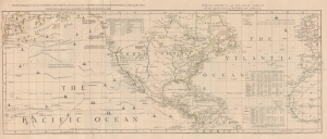
Chart, containing the Coasts of California, New Albion, and Russian Discoveries to the North; with the Peninsula of Kamtschatka, in Asia, opposite thereto; and Islands, dispersed over the Pacific Ocean, to the north of the Line.
$1,500.00
Acquire
- Digital Map Information
- Suitable for large format printing
- Full resolution TIFF file
- ICC color profile embedded
- Delivered instantly via download link
A 1775 map of North America by John Green, also known as Braddock Mead. The map is a masterpiece of late 18th-century cartography by one of the least understood and most controversial cartographers of his age. Mead composed the map in protest to what he considered the flagrantly spurious and irresponsible cartography of Frenchmen Joseph-Nicolas De l'Isle (1688 - 1768) and Phillipe Buache (1700 - 1773). It is noteworthy for its treatment of the speculative 'River of the West,' its naming of the Chinese colony of Fusang, and its tentative mapping of the Aleutian archipelago. (more details)
Spoils of the French and Indian War.
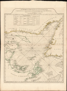
A Chart of the Gulf of St. Laurence.
$1,000.00
Acquire
- Digital Map Information
- Suitable for large format printing
- File Size: 29.3 MB
- File Type: ZIP / TIFF
- ICC color profile embedded
- Delivered instantly via download link
This is a 1775 Sayer and Bennett chart of the Gulf of St. Lawrence, compiled from an array of surveys recorded over the preceding 25 years, including the 1763-5 surveys of Captain James Cook. (more details)
Most important map of the Mississippi during the Revolutionary War.
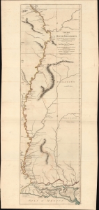
Course of the River Mississipi, from the Balise to Fort Chartres; Taken on an Expedition to the Illinois, in the latter end of the Year 1765.
$7,500.00
Acquire
- Digital Map Information
- Suitable for large format printing
- File Size: 36.6 MB
- File Type: ZIP / TIFF
- ICC color profile embedded
- Delivered instantly via download link
A scarce, important, and dramatic map of the Mississippi River Valley from the Gulf of Mexico to Fort Chartres (Illinois). This was the best map of the Mississippi to appear before the American Revolutionary War (1775 - 1783) and remained significant even after the war when it was the best demarkation of the western boundary of the United States. (more details)
First Specific Map of Lakes Champlain and George.
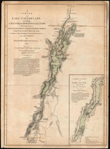
A Survey Of Lake Champlain, including Lake George, Crown Point And St. John. /A Particular Plan of Lake George.
$7,000.00
Acquire
- Digital Map Information
- Suitable for large format printing
- Full resolution TIFF file
- ICC color profile embedded
- Delivered instantly via download link
This is William Furness Brasier's 1762 map of Lakes Champlain and George, in its rare August 5, 1776, first state. It is the first separate map of Lake Champlain and Lake George. It would certainly have been in the hands of the British officers leading the Fall 1777 campaign during the American Revolutionary War (1775 - 1783), which culminated in the pivotal American victory at Saratoga. Most examples of this first state that we have seen on the market were issued in the so-called 'Holster Atlas,' and as such, exhibit significantly more folds and wear than this example, which appears to have been preserved in a larger-format book. (more details)
Spoils of the French and Indian War.
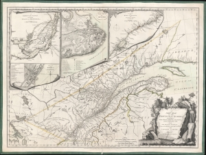
A New Map of the Province of Quebec, according to the Royal Proclamation of the 7th of October 1763 from the French Surveys Connected with those made after the War, by Captain Carver and Other Officers, in His Majesty's Service.
$1,600.00
Acquire
- Digital Map Information
- Suitable for large format printing
- Full resolution TIFF file
- ICC color profile embedded
- Delivered instantly via download link
This is the first state of the 1776 Sayer and Bennett Map of the newly-acquired Province of Quebec, with detail maps of the course of the St. Lawrence River, the Island of Montreal, and inset city plans of Montreal and Quebec City. This region passed from France to Great Britain following the signing of the Treaty of Paris in 1763 at the close of the French and Indian War (1754 - 1763). The map marks settlements, military outposts, major roads, and areas of Native American habitation with their tribal names noted. The two city plans include numbered and lettered keys indicating important structures and fortifications. (more details)
Fallout of the French and Indian War.
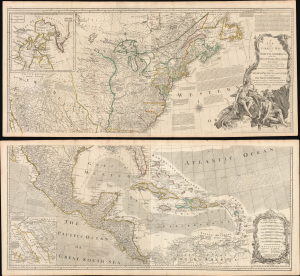
A New and Correct Map of North America, with the West India Islands...
$5,500.00
Acquire
- Digital Map Information
- Suitable for large format printing
- File Size: 129.89 MB
- File Type: ZIP / TIFF
- ICC color profile embedded
- Delivered instantly via download link
This is the 1777 edition of Robert Sayer and John Bennet's two-sheet wall map of North America, published near the start of the American Revolutionary War (1775 - 1783). It is the first 'Pownall' edition of the map, incorporating new surveys and information on the American interior, providing a comprehensive overview of the continent in the aftermath of the French and Indian War. (more details)
Featuring the Guif of Mexico and Lake Ontario!
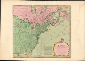
The United States of America with The British Possessions of Canada, Nova Scotia, New Brunswick, and Newfoundland divided with The French, also the Spanish Territories of Louisiana and Florida according to the Preliminary Articles of Peace Signed at Versailles the 20th of Jany. 1783.
$3,500.00
Acquire
- Digital Map Information
- Suitable for large format printing
- Full resolution TIFF file
- ICC color profile embedded
- Delivered instantly via download link
A striking 1794 Laurie and Whittle map of the newly independent United States, capturing North America's transformation in the turbulent decades between the American Revolution (1775 - 1783) and the War of 1812 (1812 - 1815). Most remarkable is its magnificent title cartouche, surmounted by one of the earliest printed representations of the thirteen-star American flag - a bold visual declaration of the new republic's place on the world stage. (more details)