
Tofiño de San Miguel, Vincente (sold)
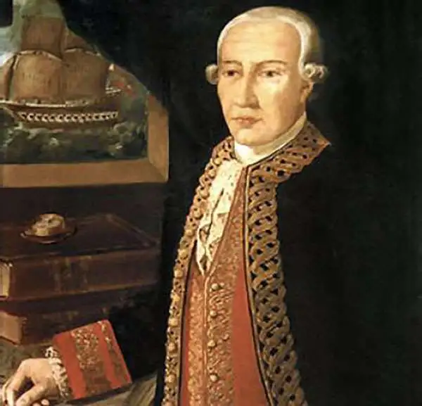
Vincente Tofiño de San Miguel (September 6, 1732 - 1795) was a Spanish naval officer and hydrographer active in the second half of the 18th century. Tofiño was born in Cadiz, Spain. His father, a career army officer, died in the 1746 Battle of Placentia, leaving Vincente an orphan from age 14. He moved to Extremadura where his uncle, a priest, raised him. In 1750, following in his father's footsteps, he joined the army. Having discovered a proficiency in mathematics, Tofiño was assigned to an artillery unit. In 1755, moving from the army to the navy, where his skills were better suited, he became a professor of mathematics at the Academia de Guardia Marinas de Cádiz. He would remain in the navy for the subsequent 30 years, ultimately attaining the rank of Rear Admiral. Between 1783 and 1788, as a navy officer, astronomer, and hydrographer, he was deployed to survey the Mediterranean ports of Spain, the Balearic Islands, and the Barbary Coast. He trained the explorers Dionisio Alcalá Galiano and Cayetano Valdés y Flores Bazán, who named Tofino Inlet, in Vancouver, after him. Tofiño was elected correspondent of the Spanish Academy of History and of the French and Portuguese Academies of Science. He died in Cadiz in 1795.
An incredible large scale naval chart of Gibraltar and the Bay of Gibraltar.
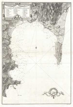
Plano Geométrico de la Bahia de Algeciras y Gibraltar.
sold
- Digital Map Information
- Suitable for large format printing
- DPI: 300
- File Size: 16.01 MB
- File Type: ZIP / TIFF
- ICC color profile embedded
- Delivered instantly via download link
An extremely rare large scale 1786 Spanish nautical chart detailing the Bay of Gibraltar and Gibraltar by the famed hydrographer Vincente Tofiño de San Miguel. The map depicts the Bay of Gibraltar from Algeciras to the Mediterranean. Depth soundings are ... (more details)
Extremely rare and impressively large 18th century map of Ibiza, Spain.
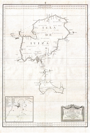
Carta Esférica de las Islas de Iuiza y Formentera;Presentada al Rey Nuestro Señor, Por el Emo. Sr. Bº. Fr. Dn. Antonio Valdés, Secretario de Estado, y del Despacho Universal de Marina;Y Construida Por el Brigadier de la Rl. Armada Dn. Vicente Tofiño de Sn. Miguel, Director de las Academias de Guardias Marinas &c.
sold
- Digital Map Information
- Suitable for large format printing
- DPI: 300
- File Size: 13.96 MB
- File Type: ZIP / TIFF
- ICC color profile embedded
- Delivered instantly via download link
An extremely rare large scale 1786 Spanish nautical chart detailing the Balearic Islands of Ibiza and Formentera by the famed hydrographers Vincente Tofiño de San Miguel and Antonio Valdés y Fernández Bazán. The map covers both islands in full with ... (more details)
Extremely rare and impressively large 18th century map of Mallorca Spain.
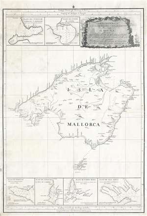
Carta Esferica de la Isla de Mallorca y sus adyacentes. Presentada al Rey N. S. por mano de... Antonio Valdés y construida por... Dn. Vicente Tofiño de S. Miguel, año 1786.
sold
- Digital Map Information
- Suitable for large format printing
- DPI: 300
- File Size: 14.54 MB
- File Type: ZIP / TIFF
- ICC color profile embedded
- Delivered instantly via download link
An extremely rare large scale 1786 Spanish nautical chart detailing the Balearic Island of Mallorca (Majorca) by the famed hydrographers Vincente Tofiño de San Miguel and Antonio Valdés y Fernández Bazán. The map covers Mallorca in full inclusive ... (more details)
Definitive 18th century chart of Mallorca.
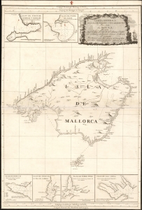
Carta Esferica de la Isla de Mallorca y sus adyacentes. Presentada al Rey N. S. por mano de... Antonio Valdés y construida por... Dn. Vicente Tofiño de S. Miguel, año 1786.
sold
- Digital Map Information
- Suitable for large format printing
- Full resolution TIFF file
- ICC color profile embedded
- Delivered instantly via download link
An extremely rare large scale 1786 Spanish nautical chart detailing the Balearic Island of Mallorca (Majorca) by the famed hydrographers Vincente Tofiño de San Miguel and Antonio Valdés y Fernández Bazán. The map covers Mallorca in full inclusive ... (more details)
Extremely rare and impressively large 18th century map of Menorca, Spain.
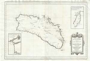
Carta Esférica de las Isla de Menorca; Presentada al Rey Nuestro Señor.
sold
- Digital Map Information
- Suitable for large format printing
- DPI: 300
- File Size: 24.51 MB
- File Type: ZIP / TIFF
- ICC color profile embedded
- Delivered instantly via download link
An extremely rare large scale 1786 Spanish nautical chart detailing the Balearic Island of Menorca (Minorca) by the famed hydrographers Vincente Tofiño de San Miguel and Antonio Valdés y Fernández Bazán. The map covers the island in full with ... (more details)
Extremely rare and impressively large 18th century map of Mallorca Spain.
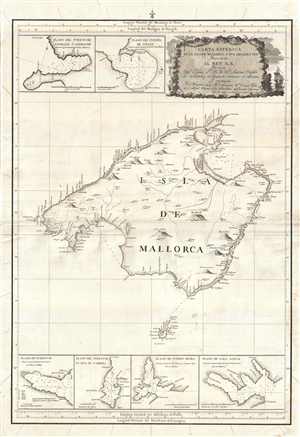
Carta Esferica de la Isla de Mallorca y sus adyacentes. Presentada al Rey N. S. por mano de... Antonio Valdés y construida por... Dn. Vicente Tofiño de S. Miguel, año 1786.
sold
- Digital Map Information
- Suitable for large format printing
- Full resolution TIFF file
- ICC color profile embedded
- Delivered instantly via download link
An extremely rare large scale 1786 Spanish nautical chart detailing the Balearic Island of Mallorca (Majorca) by the famed hydrographers Vincente Tofiño de San Miguel and Antonio Valdés y Fernández Bazán. The map covers Mallorca in full ... (more details)