
Walker, George H.

George Hiram Walker (January 4, 1852 - November 14, 1927) was a Boston based publisher of books, views, and maps active in the late 19th and early 20th centuries. Born in Springfield, Vermont, Walker started his life as a dry goods merchant but developed an active interest in publishing during the early 1870s. Walker began publishing in 1878 when he partnered with an unknown New York Firm. Two years later, Walker brought the operation in house by partnering with his brother, Oscar W. Walker, in the opening of a lithography studio at 81 Milk Street, Boston. Shortly thereafter the firm expanded to new offices at 160 Tremont Street, Boston. The Walker brothers produced a large corpus of works, most of which focused on travel and tourism in New England. Walker also established the Walker-Gordon Milk Laboratory with Dr. Thomas Morgan Rotch and Gustave Gordon. This interesting investment was based on the premise that infant deaths could be avoided by providing higher quality milk. The company eventually became a great success, producing a high-quality cow milk that closely resembled human breast milk. In the process the Walker-Gordon laboratory developed many of the dairy health standards that are still with us today. Walker married Irene L. Loud on March 25, 1885.
Cape Ann and the North Shore.
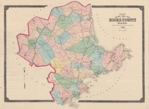
New Driving Road Map of Essex County, Mass.
$700.00
Acquire
- Digital Map Information
- Suitable for large format printing
- File Size: 84.63 MB
- File Type: ZIP / TIFF
- ICC color profile embedded
- Delivered instantly via download link
This is an 1884 George Walker map of Essex County, Massachusetts. The map details the North Shore region, including Cape Ann, Gloucester, Essex, Lawrence, Salem, Newburyport, and Lynn. The county's road and railroad network appears in detail, noting the 'Gloucester, Essex, and Lawrence' branches of the 'Eastern Railroad', the 'Newburyport Railroad', the 'Boston and Maine Railroad', and the 'Salem and Lowell Railroad'. (more details)
Massachusetts Volunteer Militia.
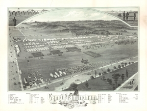
Camp at Framingham. Second Brigade. Mass. Vol. Militia. July 21st to 25th 1885.
$750.00
Acquire
- Digital Map Information
- Suitable for large format printing
- File Size: 44.81 MB
- File Type: ZIP / TIFF
- ICC color profile embedded
- Delivered instantly via download link
This is an 1885 Albert F. Poole bird's-eye view of Camp Framingham, Massachusetts, a former Massachusetts National Guard camp in Framingham. (more details)
Bicycle Boom and Women's Rights.
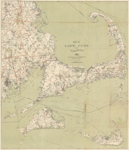
Map of Cape Cod and Vicinity 1892.
$650.00
Acquire
- Digital Map Information
- Suitable for large format printing
- File Size: 41.49 MB
- File Type: ZIP / TIFF
- ICC color profile embedded
- Delivered instantly via download link
A lovely 1892 George H. Walker map of Cape Cod, Martha's Vineyard, Nantucket, and environs. It was produced to capitalize on the bicycle craze of the late 19th century, which revolutionized transportation and opened new possibilities for women's independence. (more details)
Highlights bicycling routes through western Maine!
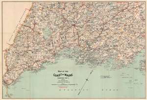
Map of the Coast of Maine [Western Part].
$300.00
Acquire
- Digital Map Information
- Suitable for large format printing
- Full resolution TIFF file
- ICC color profile embedded
- Delivered instantly via download link
This is an 1893 George H. Walker map of the western section of the coast of Maine. The map depicts from Kittery east to Lincolnville and from Norway Lake and Snows Falls south to the Atlantic Ocean. Red overprinting highlights bicycle routes that meander through most of the region, including a coastal route. (more details)
A charming map of Boston compliments of the Hotel Essex.
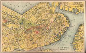
Part of Map of Boston Proper.
$175.00
Acquire
- Digital Map Information
- Suitable for large format printing
- Full resolution TIFF file
- ICC color profile embedded
- Delivered instantly via download link
This is an 1894 George H. Walker and Company city map or plan of Boston, Massachusetts. The map depicts the central part of the city from the intersection of Columbus Avenue and Dartmouth Street to East Boston and from Charlestown to the Point Channel. Highly ... (more details)
Fin-de-siecle Boston.
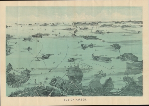
Boston Harbor.
$400.00
Acquire
- Digital Map Information
- Suitable for large format printing
- Full resolution TIFF file
- ICC color profile embedded
- Delivered instantly via download link
An uncommon 1897 early example of a George H. Walker aquatint view of Boston Harbor. It presents the city and harbor as teeming with activity, a testament to Boston's dynamism at the turn of the 20th century. (more details)
Catalog of a prolific Boston map publisher.
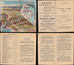
An interesting bit of cartographic ephemera, this is the c. 1898 George H. Walker and Company twenty-four-page catalog of maps, atlases, and other related products. A prolific Boston-based map publisher, this catalog provides an overview of a successful map publisher's output and a glimpse of how maps were sold and advertised around the turn of the 20th century. (more details)
Elite Retreat.
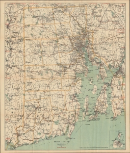
Rhode Island / Road map of Rhode Island showing all the roads and points of interest, with the cycling roads distinguished by red lines.
$400.00
Acquire
- Digital Map Information
- Suitable for large format printing
- Full resolution TIFF file
- ICC color profile embedded
- Delivered instantly via download link
A scarce and lovely c. 1898 folding map of Rhode Island prepared by the prolific New England map publisher George Walker. It highlights features around the state, including Narragansett Bay and Newport, summertime destination for America's crème de la crème. (more details)
Narragansett Bay - including Providence!
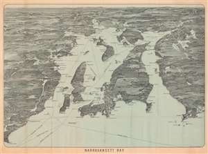
Narragansett Bay.
$350.00
Acquire
- Digital Map Information
- Suitable for large format printing
- Full resolution TIFF file
- ICC color profile embedded
- Delivered instantly via download link
This is an uncommon c. 1900 George H. Walker bird's-eye view map of Narragansett Bay, Rhode Island. This is one of a series of view and maps published by Walker, among others, to serve the on-board and in-terminal newsstand market. The views were sold as souvenirs as well as practical guides to the journey. (more details)
An extraordinary level of detail.
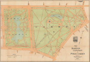
Map of Boston Common and Public Garden.
$1,500.00
Acquire
- Digital Map Information
- Suitable for large format printing
- Full resolution TIFF file
- ICC color profile embedded
- Delivered instantly via download link
This is a 1901 George H. Walker and Co. large-format folding map of Boston Common and the Public Garden in Boston, Massachusetts. It is the most detailed commercial map of these public spaces ever produced, recording many individual trees, floral displays, and tulip beds, among other features. (more details)
Heart of the White Mountains.
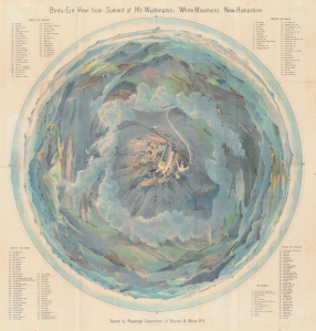
Bird's-Eye View from Summit of Mt. Washington; White Mountains, New-Hampshire.
$3,500.00
Acquire
- Digital Map Information
- Suitable for large format printing
- Full resolution TIFF file
- ICC color profile embedded
- Delivered instantly via download link
A dramatic 1902 top-down George H. Walker chromolithograph bird's-eye view of Mt. Washington and the White Mountains, New Hampshire. This view was issued for the Boston and Maine Railroad, which not only operated the best trains to get to the White Mountains, but also the famous Mount Washington Cog Railway. (more details)
Take a Nice Ride on the Cape.
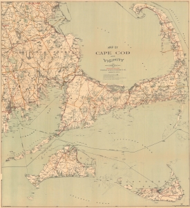
Map of Cape Cod and Vicinity.
$600.00
Acquire
- Digital Map Information
- Suitable for large format printing
- Full resolution TIFF file
- ICC color profile embedded
- Delivered instantly via download link
A charming 1902 map of Cape Cod, Nantucket, Martha's Vineyard, and other points along the coast of Massachusetts, published by George H. Walker and Company. Rich in information, it focuses in particular on cycling routes, reflecting the boom in recreational cycling in the preceding years. (more details)
A first edition chromolithograph bird's-eye-view of New England electric and steam railroads at the turn of the century.
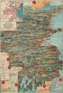
Trolley Wayfinder Birds Eye View of Trolley Routes in New England.
$600.00
Acquire
- Digital Map Information
- Suitable for large format printing
- Full resolution TIFF file
- ICC color profile embedded
- Delivered instantly via download link
A radiantly rich chromolithograph 1904 first edition bird's-eye view style pocket map of New England issued by John Jenness Lane and George Walker for the New England Street Railway Club. The view was produced upon Lane's election as secretary of the Club to promote the extensive but ephemeral New England streetcar network. It is the first such image, combining trolley lines with a bird's-eye perspective, but inspired others, including similar images of the New York area, Long Island, the Mid-Atlantic States, and the vicinity of Chicago. (more details)
Ephemeral New England transport network.
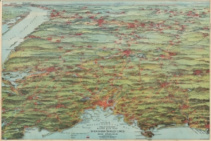
Trolley Pathfinder Birds Eye Map of Interurban Trolley Lines in New England.
$700.00
Acquire
- Digital Map Information
- Suitable for large format printing
- Full resolution TIFF file
- ICC color profile embedded
- Delivered instantly via download link
This is a vivid 1905 chromolithograph bird's-eye view style pocket map of New England by George Walker issued for the Metropolitan News Company. It was issued to promote the extensive but ephemeral New England interurban streetcar network of the early 20th century. (more details)
Wonderfully detailed postal map illustrating the southern parts of Cape Cod and parts of Buzzard Bay.
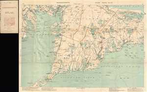
Massachusetts Atlas Plate No. 12.
$250.00
Acquire
- Digital Map Information
- Suitable for large format printing
- File Size: 8.26 MB
- File Type: ZIP / TIFF
- ICC color profile embedded
- Delivered instantly via download link
This is a 1907 George Walker and Company pocket map of southern Cape Cod, Massachusetts. The map depicts from Marion to Hyannis and from Bourne to Nantucket Sound and Vineyard Sound. Several counties are labeled, including Marion, Bourne, Falmouth, and ... (more details)
Heart of the White Mountains.
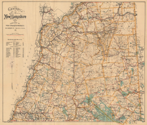
Central New Hampshire / Central New Hampshire including the White Mountain District.
$500.00
Acquire
- Digital Map Information
- Suitable for large format printing
- Full resolution TIFF file
- ICC color profile embedded
- Delivered instantly via download link
This is a rare c. 1907 George Walker pocket map of central New Hampshire, covering the heart of the White Mountains, including the Presidential Range, and the northern part of New Hampshire's Lakes Region. It was published at the height of the turn-of-the-century White Mountains tourism boom. (more details)
New Hampshire's Lakes Region.
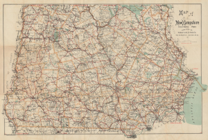
Map of New Hampshire Southern Part / Latest Map of Southern New Hampshire.
$400.00
Acquire
- Digital Map Information
- Suitable for large format printing
- Full resolution TIFF file
- ICC color profile embedded
- Delivered instantly via download link
This is a scarce c. 1907 George Walker pocket map of southern New Hampshire, including much of the state's gorgeous Lakes Region. It was produced during a period of heightened tourism to the Lakes Region and the White Mountains, facilitated by the development of railroads and the expansion of the state's tourism economy. (more details)
Massachusetts railroads at the beginning of the 20th century.
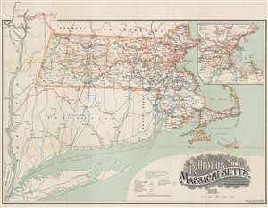
Map of the Railroads of the State of Massachusetts Accompanying the Report of the Railroad Commissioners Corrected to January 1, 1909.
$400.00
Acquire
- Digital Map Information
- Suitable for large format printing
- File Size: 35.91 MB
- File Type: ZIP / TIFF
- ICC color profile embedded
- Delivered instantly via download link
This is a 1908 George Walker railroad map of Massachusetts. Colored lines trace railroads throughout. The red lines highlight the network of the Boston and Maine Railroad, while green follows the Boston and Albany Railroad, and blue the New York, New Haven, and Hartford Railroad. Other colored lines illustrate the networks of the Chester and Becket Railroad, the Central New England Railroad, the Grafton and Upton Railroad, and the New England Northern Railroad. Cities and towns throughout are labeled, and mileage from Boston to various cities provided. An inset in the upper right details the region surrounding Boston and the Boston and Maine, Boston and Albany, and New York, New Haven, and Hartford rail networks in that area. (more details)
Boston Harbor during the Roaring Twenties!
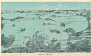
Boston Harbor.
$300.00
Acquire
- Digital Map Information
- Suitable for large format printing
- Full resolution TIFF file
- ICC color profile embedded
- Delivered instantly via download link
This is a c. 1927 George H. Walker and Company bird's-eye view map of Boston Harbor. South Boston occupies the center of the foreground, with a few major streets identified, along with Commonwealth Pier, Pleasure Bay, and Fort Independence on Castle Island. Sailing ships crowd the water between Dorchester Bay and Old Boston Harbor. East Boston, with its many wharves and airport, appear in the foreground on the left. Numerous islands dot the harbor as it stretches toward the horizon. Forts, lighthouses, and other buildings are illustrated on some of these islands. The route of the Nantasket Beach Line Steamers appears as a dashed line, along with the Main Ship Channel between Fort Revere and Boston Light. (more details)
Gorgeous view of Lake Winnipesaukee, New Hampshire
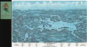
Lake Winnipesaukee New Hampshire
$650.00
Acquire
- Digital Map Information
- Suitable for large format printing
- File Size: 21.8 MB
- File Type: ZIP / TIFF
- ICC color profile embedded
- Delivered instantly via download link
This is a gorgeous 1925 bird's eye view style pocket map of Lake Winnipesaukee, New Hampshire by the Geo. H. Walker and Company, Boston. One of the more obscure and rare maps by George Walker, it covers the popular summertime destination from Little ... (more details)