
Walker, George H. (sold)

George Hiram Walker (January 4, 1852 - November 14, 1927) was a Boston based publisher of books, views, and maps active in the late 19th and early 20th centuries. Born in Springfield, Vermont, Walker started his life as a dry goods merchant but developed an active interest in publishing during the early 1870s. Walker began publishing in 1878 when he partnered with an unknown New York Firm. Two years later, Walker brought the operation in house by partnering with his brother, Oscar W. Walker, in the opening of a lithography studio at 81 Milk Street, Boston. Shortly thereafter the firm expanded to new offices at 160 Tremont Street, Boston. The Walker brothers produced a large corpus of works, most of which focused on travel and tourism in New England. Walker also established the Walker-Gordon Milk Laboratory with Dr. Thomas Morgan Rotch and Gustave Gordon. This interesting investment was based on the premise that infant deaths could be avoided by providing higher quality milk. The company eventually became a great success, producing a high-quality cow milk that closely resembled human breast milk. In the process the Walker-Gordon laboratory developed many of the dairy health standards that are still with us today. Walker married Irene L. Loud on March 25, 1885.
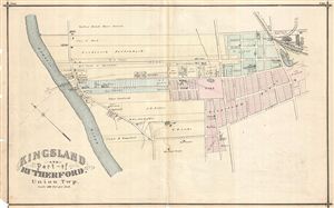
Kingsland and part of Rutherford, Union Township.
sold
- Digital Map Information
- Suitable for large format printing
- File Size: 9.14 MB
- File Type: ZIP / TIFF
- ICC color profile embedded
- Delivered instantly via download link
Detailed 1876 map of Kingsland and part of Rutherford in Union Township, New Jersey. Shows roads, property boundaries and owners' names. Published as plates 148-149 in Walker & Pease' exquisite 'topographical, illustrated, historical, descriptive' Atlas of Bergen ... (more details)
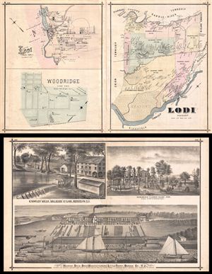
Lodi & Ridgewood.
sold
- Digital Map Information
- Suitable for large format printing
- File Size: 34.34 MB
- File Type: ZIP / TIFF
- ICC color profile embedded
- Delivered instantly via download link
A Map of Lodi Township, New Jersey, with Maps of Wood-Ridge, New Jersey and another map of another part of Lodi Township, New Jersey, all showing roads, property boundaries and owners' names. Notable too is the depiction of school district boundaries-- even at ... (more details)
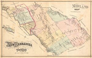
New Baradoes Township. Midland Township.
sold
- Digital Map Information
- Suitable for large format printing
- File Size: 10.86 MB
- File Type: ZIP / TIFF
- ICC color profile embedded
- Delivered instantly via download link
Very detailed map of New Barbadoes and Midland Townships, New Jersey, in 1876, showing roads and property boundaries and owners' names. Notable too is the early depiction of school district boundaries in a state that today publicizes the high quality of its ... (more details)
Beautiful plan of the city showing points of interest.
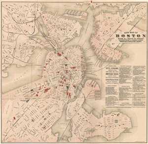
New Map of Boston Giving All Points of Interest : With Every Railway and Steamboat Terminus, Prominent Hotels Theatres and Public Buildings.
sold
- Digital Map Information
- Suitable for large format printing
- File Size: 14.13 MB
- File Type: ZIP / TIFF
- ICC color profile embedded
- Delivered instantly via download link
This is a beautiful 1883 map or plan of the city of Boston, Massachusetts by Geo H. Walker and Company. It covers the city of Boston from Charlestown and Somerville to Marine Park and Old Harbor. Individual streets, important buildings, neighborhoods, ... (more details)
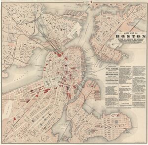
New Map of Boston Giving All Points of Interest : With Every Railway and Steamboat Terminus, Prominent Hotels Theatres and Public Buildings.
sold
- Digital Map Information
- Suitable for large format printing
- Full resolution TIFF file
- ICC color profile embedded
- Delivered instantly via download link
This is a beautiful 1883 map or plan of the city of Boston, Massachusetts by Geo H. Walker and Company. It covers the city of Boston from Charlestown and Somerville to Marine Park and Old Harbor. Individual streets, important buildings, neighborhoods, ... (more details)
Exceptional piece of Maine history!
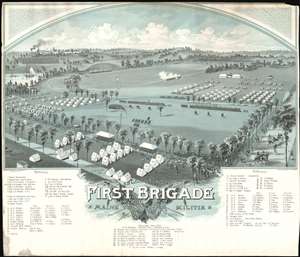
Encampment of First Brigade Maine Volunteer Militia Augusta, Aug. 25, 26, 27, 28, 1885.
sold
- Digital Map Information
- Suitable for large format printing
- File Size: 38.24 MB
- File Type: ZIP / TIFF
- ICC color profile embedded
- Delivered instantly via download link
A rare 1885 Poole / Walker view of the encampment of the Maine Volunteer Melita, First Brigade at Augusta, Maine. The view reveals a large parade ground with tents in the foreground. The Kennebec River appears in the background, as does the Augusta 'State Asylum for the Insane.' This view illustrates an annual encampment of the 1st Brigade required by general orders issued in 1884. (more details)
Bar Harbor's Gilded Age.
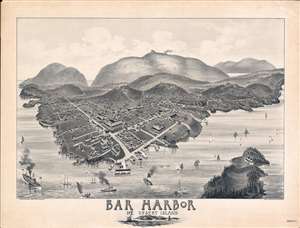
Bar Harbor Mt. Desert Island.
sold
- Digital Map Information
- Suitable for large format printing
- File Size: 60.03 MB
- File Type: ZIP / TIFF
- ICC color profile embedded
- Delivered instantly via download link
A rare and highly unusual 1886 Charles E. Jorgensen bird's-eye view of Bar Harbor, Mount Desert Island, Maine - illustrating the town at the height of Mount Desert Island's gilded age. This view was published to publicize the rebuilding of the Green Mountain Hotel (following a fire) and the inauguration of the Green Mountain Railroad - here visible at the summit of Cadillac Mountain. (more details)
One year after the incorporation of the Newburyport Y.M.C.A, which is labeled!
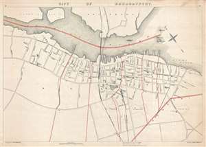
City of Newburyport.
sold
- Digital Map Information
- Suitable for large format printing
- File Size: 8.27 MB
- File Type: ZIP / TIFF
- ICC color profile embedded
- Delivered instantly via download link
This is a George H. Walker and Company 1891 city map or plan of Newburyport, Massachusetts. The map depicts the city of Newburyport from Salisbury and across the Merrimack River to the city line and from Jefferson Street in Ward 6 in Newburyport to the ... (more details)
A detailed map of the central part of Barnstable County on Cape Cod.
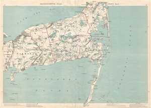
Massachusetts Atlas. Plate No. 9.
sold
- Digital Map Information
- Suitable for large format printing
- File Size: 8.1 MB
- File Type: ZIP / TIFF
- ICC color profile embedded
- Delivered instantly via download link
This is an 1891 George H. Walker and Company map of part of Barnstable County, Cape Cod, Massachusetts. The map depicts the region from Hyannis to the Atlantic Ocean and from Cape Cod Bay to Nantucket Sound and Monomoy Island. Highly detailed, the ... (more details)
The first edition of an impressively detailed map of Cape Ann.
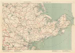
[Cape Ann.] Massachusetts Atlas Plate No. 2.
sold
- Digital Map Information
- Suitable for large format printing
- File Size: 25.06 MB
- File Type: ZIP / TIFF
- ICC color profile embedded
- Delivered instantly via download link
This is a first edition 1891 Oscar W. Walker map of Cape Ann / Gloucester, Massachusetts. Depicting the region from Woodchuck Hill to the Dry Salvages and from South Byfield to Marblehead Neck, the map provides a clear and, more importantly, usable, overview of the area. Cities and towns are labeled throughout, including Salem, Danvers, Marblehead, Ipswich, Beverly, Gloucester, and Rockport. Plum Island and the Plum Island River occupy the top center. Major roads wind across the map, and differentiation between three different road grades allows travelers unfamiliar with the area to know the best roads to take. Stark black lines mark several branches of the Boston and Maine Railroad and railroad stations are identified. (more details)
Detailed map of Narragansett Bay.
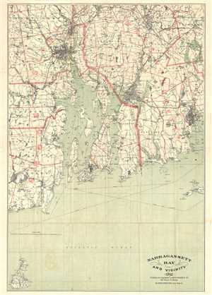
Narragansett Bay and Vicinity.
sold
- Digital Map Information
- Suitable for large format printing
- File Size: 18.71 MB
- File Type: ZIP / TIFF
- ICC color profile embedded
- Delivered instantly via download link
This is an uncommon and attractive 1892 map of Narragansett Bay and vicinity, Rhode Island by the Boston map publisher George H. Walker. It covers the entirety of Narragansett Bay from Block Island to Providence extending eastward as far as New ... (more details)
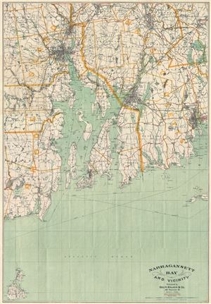
Narragansett Bay and Vicinity.
sold
- Digital Map Information
- Suitable for large format printing
- File Size: 20.49 MB
- File Type: ZIP / TIFF
- ICC color profile embedded
- Delivered instantly via download link
This is an uncommon and attractive 1892 map of Narragansett Bay and vicinity, Rhode Island by the Boston map publisher George H. Walker. It covers the entirety of Narragansett Bay from Block Island to Providence extending eastward as far as New ... (more details)
Striking railroad map of Massachusetts.
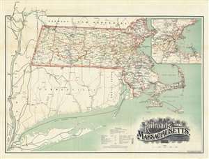
Map of the Railroads of the State of Massachusetts.
sold
- Digital Map Information
- Suitable for large format printing
- File Size: 55.53 MB
- File Type: ZIP / TIFF
- ICC color profile embedded
- Delivered instantly via download link
An uncommon and striking 1892 3-color chromolithograph map of Massachusetts illustrating railroad development throughout the state. The map covers the entire state, with 17 different railroad company routes defined using a combination of color and pattern coding. A large inset in the upper right details the dense greater Boston metropolitan area. The map offers additional coverage to the Hudson Valley and southwest to New York City, illustrating important commercial and passenger connections. The finely engraved title block, appearing in the lower right, stands out for its masterful execution. (more details)
Beautiful North-Coast Maine.
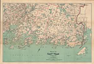
Map of the Coast of Maine (Eastern Part).
sold
- Digital Map Information
- Suitable for large format printing
- Full resolution TIFF file
- ICC color profile embedded
- Delivered instantly via download link
This is a scarce 1893 map of the coast of Maine by George Walker and Company. It covers the eastern coast of Maine from Grand Manan Island west as far as Penobscot Bay and Vinalhaven Island and north as far as Vanceboro. The map offers detail ... (more details)
Early tourist map of the White Mountains highlighting railway lines.
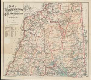
Map of the White Mountains and Central New Hampshire.
sold
- Digital Map Information
- Suitable for large format printing
- Full resolution TIFF file
- ICC color profile embedded
- Delivered instantly via download link
This is a scarce 1893 George H. Walker tourist map of the White Mountains and central New Hampshire. Walker depicts the region from Vermont to Maine and from Lancaster to Lake Winnipesaukee. Townships are outlined in orange and identified, along with purchases, grants, and other locations, many of which are still recognized. Some include Thompson and Meserve's Purchase, Sargent's Purchase, and Crawford's Purchase, as well as the Sargent and Elkins Grant, Low and Burbank's Grant, and Green's Grant. Towns are labeled throughout, many of which highlight the presence of post offices and railroad stations. The Maine Central Railroad, the Boston, Concord, and Montreal Railroad and the Concord and Montreal Railroad traverse this area of New Hampshire, allowing for an ease of access into the region never before possible. (more details)
Transitioning from a whale town to a resort town.
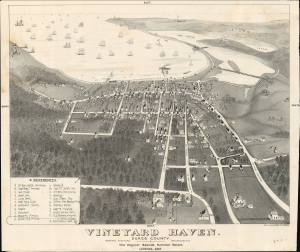
Vineyard Haven. Dukes County. Marthas Vineyard, Massachusetts. The Popular Seaside Summer Resort. Looking East.
sold
- Digital Map Information
- Suitable for large format printing
- File Size: 26.85 MB
- File Type: ZIP / TIFF
- ICC color profile embedded
- Delivered instantly via download link
A stunning c. 1893 bird's-eye view of Vineyard Haven, Tisbury, Martha's Vineyard. The view was drawn and engraved by Joseph L. Jones and published by George H. Walker. It captures Vineyard Haven in a moment of transition from a maritime and whaling community to a resort town. (more details)
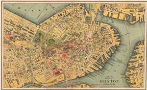
Part of Map of Boston Proper.
sold
- Digital Map Information
- Suitable for large format printing
- Full resolution TIFF file
- ICC color profile embedded
- Delivered instantly via download link
This is a scarce 1894 map or plan of the city of Boston, Massachusetts by Geo H. Walker and Company. It extends from Cambridge and Charleston to East Boston and South Boston. Individual streets, bridges, parks, wharfs, subway lines, ... (more details)
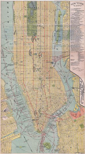
New York City.
sold
- Digital Map Information
- Suitable for large format printing
- Full resolution TIFF file
- ICC color profile embedded
- Delivered instantly via download link
This is a scarce 1894 map or plan of New York City by Geo H. Walker and Company. It covers from 94th street to the Battery and includes parts of Brooklyn and Jersey City. Includes Ellis Island and Governor's Island. Roosevelt ... (more details)
The Young People's Society for the Christian Endeavor!
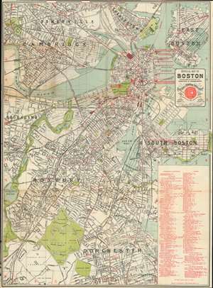
Official Map of Boston.
sold
- Digital Map Information
- Suitable for large format printing
- File Size: 39.37 MB
- File Type: ZIP / TIFF
- ICC color profile embedded
- Delivered instantly via download link
Published for the Fourteenth International Convention of the Young People's Society for the Christian Endeavor, this is an 1895 George H. Walker and Company city plan or map of Boston, Massachusetts. Red overprinting highlights over 100 different locations around the city, including hotels, churches, historic sites, and railroad stations. Seventy-nine of these are numerically labeled, while others are identified by name. Two massive tents erected on Boston Common, named Walliston and Endeavor, hosted many of the convention's events. (more details)
Lovely Lake Escape.
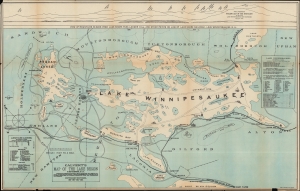
Calvert's Map of the Lake Region in New Hampshire, U. S. A.
sold
- Digital Map Information
- Suitable for large format printing
- File Size: 309.93 MB
- File Type: ZIP / TIFF
- ICC color profile embedded
- Delivered instantly via download link
A fascinating 1896 map of the Lakes Region of New Hampshire, prepared by M. H. Calvert and printed by George H. Walker and Co. It is designed with tourists in mind, emphasizing hotels, attractions, and rail lines. (more details)
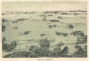
Boston Harbor.
sold
- Digital Map Information
- Suitable for large format printing
- File Size: 9 MB
- File Type: ZIP / TIFF
- ICC color profile embedded
- Delivered instantly via download link
An uncommon 1897 early example of a George H. Walker aquatint view of Boston Harbor. Centered on South Boston, the view covers Boston Harbor from East Boston and Nahant eastward as far as Squantum and Slate Island. The ... (more details)
A wonderful view of Boston Harbor.
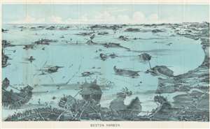
Boston Harbor.
sold
- Digital Map Information
- Suitable for large format printing
- File Size: 21.25 MB
- File Type: ZIP / TIFF
- ICC color profile embedded
- Delivered instantly via download link
An uncommon 1897 early example of a George H. Walker aquatint view of Boston Harbor. Centered on South Boston, the view depicts Boston Harbor from East Boston and Nahant eastward as far as Squantum and Slate Island. The bustling harbor is illustrated full of ships and ferries traveling between various islands and cities. Islands throughout the harbor are illustrated, including Thompson's Island, Castle Island, Spectacle Island, Governors Island, Deer Island, Lovell's Island, Calf Island, and Peodock's Island. Various lighthouses are illustrated and labeled. Among these are Boston Light, Bug Light, and Minots Ledge Light. Ferry routes are indicated. Such views were sold and given to customers of various Boston-based ferry services. (more details)

Boston Harbor.
sold
- Digital Map Information
- Suitable for large format printing
- File Size: 10.71 MB
- File Type: ZIP / TIFF
- ICC color profile embedded
- Delivered instantly via download link
This is an attractive two color lithograph 1897 view of Boston Harbor by George H. Walker & Co. Covers Boston harbor in full with its many islands, light houses, forts, and communities. The map part of the map covers ... (more details)
A scarce map of the Massachusetts Bay.
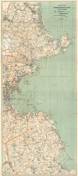
Map of Massachusetts Bay and Shore from Plymouth to Newburyport.
sold
- Digital Map Information
- Suitable for large format printing
- Full resolution TIFF file
- ICC color profile embedded
- Delivered instantly via download link
This is a beautiful and scarce 1898 map of the bay and shore of Massachusetts from Plymouth to Newburyport by George Walker. An uncommon map by Walker, it covers Boston and Vicinity, including the North Shore and ... (more details)
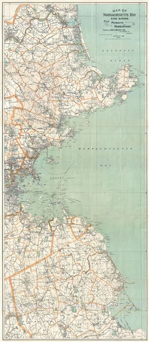
Map of Massachusetts Bay and Shore from Plymouth to Newburyport.
sold
- Digital Map Information
- Suitable for large format printing
- Full resolution TIFF file
- ICC color profile embedded
- Delivered instantly via download link
This is a beautiful and scarce 1898 map of the bay and shore of Massachusetts from Plymouth to Newburyport by George Walker. An uncommom map by Walker, it covers Boston and Vicinity, including the North Shore and ... (more details)
A gorgeous bird's eye view of Narragansett Bay - including Providence!
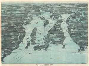
Narragansett Bay.
sold
- Digital Map Information
- Suitable for large format printing
- File Size: 24.13 MB
- File Type: ZIP / TIFF
- ICC color profile embedded
- Delivered instantly via download link
This is an attractive and uncommon c. 1900 bird's eye view map of Narragansett Bay, Rhode Island. The view covers the entirety of Narragansett Bay from Point Judith to Providence, and extending eastwards as far as ... (more details)
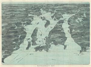
Narragansett Bay.
sold
- Digital Map Information
- Suitable for large format printing
- Full resolution TIFF file
- ICC color profile embedded
- Delivered instantly via download link
This is an attractive and uncommon c. 1900 bird's eye view map of Narragansett Bay, Rhode Island, by the Boston map publisher George H. Walker. The view covers the entirety of Narragansett Bay from Point Judith ... (more details)
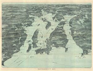
Bird's-Eye View of Narraganset Bay.
sold
- Digital Map Information
- Suitable for large format printing
- File Size: 26.92 MB
- File Type: ZIP / TIFF
- ICC color profile embedded
- Delivered instantly via download link
An attractive and uncommon c. 1900 bird's eye view map of Narragansett Bay, Rhode Island, by the Boston map publisher George H. Walker. The view covers the entirety of Narragansett Bay from Point Judith to ... (more details)
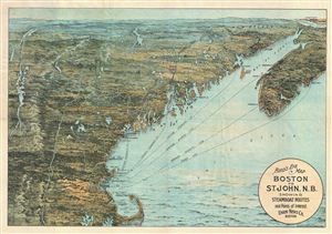
Bird's Eye Map Boston to St. John, N.B. Showing Steamboat Route and Points of interest.
sold
- Digital Map Information
- Suitable for large format printing
- File Size: 14.43 MB
- File Type: ZIP / TIFF
- ICC color profile embedded
- Delivered instantly via download link
An attractive and uncommon c. 1900 bird's eye view map of New England, by the Boston map publisher George H. Walker. Printed with a multicolor lithograph process, Walker's view covers all of New England, ... (more details)
A spectacular view.
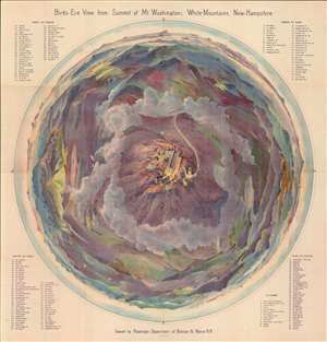
Bird's-Eye View from Summit of Mt. Washington; White Mountains, New-Hampshire.
sold
- Digital Map Information
- Suitable for large format printing
- File Size: 135.45 MB
- File Type: ZIP / TIFF
- ICC color profile embedded
- Delivered instantly via download link
A dramatic 1902 top-down George H. Walker chromolithograph bird's-eye view of Mt. Washington and the White Mountains of New Hampshire. View maps of this style became popular in Europe in the second half of the 19th century, but his is the first such we are aware of to highlight an American mountain. The clever view can be rotated with the uppermost portion always being right-side up. Landmarks, including Lake Winnepesaukee, Sunday River, Sebago Lake, Portland, and the Isle of Shoals to name just a few of the 189 places noted. (more details)
Massachusetts coast from Newburyport to Plymouth.
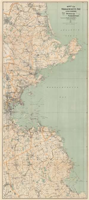
Map of Massachusetts Bay and Shore From Plymouth to Newburyport.
sold
- Digital Map Information
- Suitable for large format printing
- Full resolution TIFF file
- ICC color profile embedded
- Delivered instantly via download link
This is a scarce 1902 George Walker map of the bay and shore of Massachusetts from Plymouth to Newburyport. One of Walker's more uncommon pieces, the map depicts Boston and its vicinity, including the North Shore and South Shore, from Salisbury south to Plymouth and inland as far as Raynham and North Reading, including Cape Ann. The city of Boston is beautifully rendered. Cities and towns are labeled throughout, along with lakes, rivers, and islands off the coast. Roads crisscross the region, many of which are identified by name. The route of the New York, New Haven, and Hartford Railroad is traced, along with several branches of the Boston and Maine Railroad. (more details)
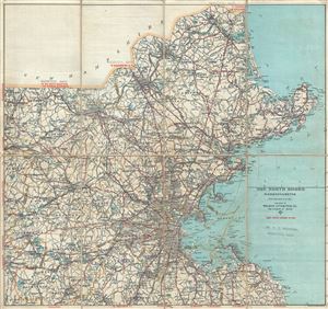
Road Map of the North Shore and part of Middlesex County Massachusetts.
sold
- Digital Map Information
- Suitable for large format printing
- Full resolution TIFF file
- ICC color profile embedded
- Delivered instantly via download link
This is a beautiful c.1902 map of Boston and the north shore of Massachusetts along with parts of Middlesex County by the Walker Lithography and Publishing Company. It covers north east Massachusetts ... (more details)
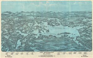
Lake Winnipesaukee, New Hampshire.
sold
- Digital Map Information
- Suitable for large format printing
- File Size: 19.44 MB
- File Type: ZIP / TIFF
- ICC color profile embedded
- Delivered instantly via download link
This is a beautiful 1903 bird's eye view style pocket map of Lake Winnipesaukee, New Hampshire by the Geo. H. Walker and Company, Boston. One of the more obscure and rare maps by George Walker, it ... (more details)
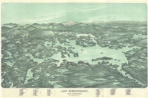
Lake Winnipesaukee, New Hampshire.
sold
- Digital Map Information
- Suitable for large format printing
- File Size: 20.55 MB
- File Type: ZIP / TIFF
- ICC color profile embedded
- Delivered instantly via download link
This is a beautiful 1905 bird's eye view style pocket map of Lake Winnipesaukee, New Hampshire by the Geo. H. Walker and Company, Boston. One of the more obscure and rare maps by George Walker, it ... (more details)
Detailed map of the White Mountain region in New Hampshire.
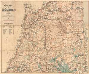
Central New Hampshire.
sold
- Digital Map Information
- Suitable for large format printing
- File Size: 13.79 MB
- File Type: ZIP / TIFF
- ICC color profile embedded
- Delivered instantly via download link
This is a 1903 George H. Walker map of the beautiful White Mountains region of central New Hampshire. The map depicts from the Vermont/New Hampshire state line to the Maine/New Hampshire border and ... (more details)
First edition in rare unfolded presentation format.
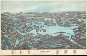
Lake Winnipesaukee, New Hampshire.
sold
- Digital Map Information
- Suitable for large format printing
- File Size: 588.55 MB
- File Type: ZIP / TIFF
- ICC color profile embedded
- Delivered instantly via download link
This is a beautiful 1903 first edition George H. Walker chromolithograph bird's-eye view map of Lake Winnipesaukee, New Hampshire, issued to promote Boston and Maine Railroad service on the scenic Lake Shore Branch (LSB). The LSB, with trackage along the southern shore of Lake Winnipesaukee, was inaugurated in 1897 to capitalize on increased White Mountains tourism. Of great significance, this is not the more common 2-color lithograph view on thin folded paper that Walker issued through about 1909; rather, it is the original presentation issue, in full multi-color chromolithograph on thick stock. (more details)
A first edition chromolithograph bird's-eye-view of New England electric and steam railroads at the turn of the century.
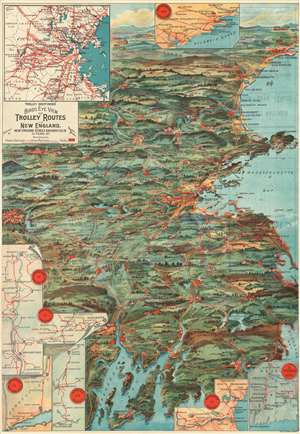
Trolley Wayfinder Birds Eye View of Trolley Routes in New England.
sold
- Digital Map Information
- Suitable for large format printing
- File Size: 22.77 MB
- File Type: ZIP / TIFF
- ICC color profile embedded
- Delivered instantly via download link
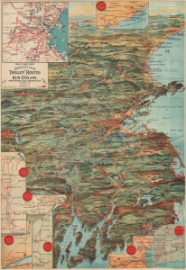
A radiantly rich chromolithograph first edition bird's-eye view style pocket map of New England issued in 1904 by John Jenness Lane and George Walker for the New England Street Railway Club. The view was produced upon Lane's election as secretary of the Club to promote the extensive but ephemeral New England streetcar network. Centered on Boston, New England's streetcar system is revealed extending north as far as Lewistown, Brunswick and Yarmouth, Maine; south to Narragansett Bay, Newport and New Bedford, Massachusetts; and west as far as Worcester. Both electric railroads and steam railroads are noted here, with red lines indicating an electric railroad and a black line marking the route of a steam railroad. Various parks, lighthouses, historic sites, and geographical features are also labeled. Popular routes are highlighted by inset maps and include: Springfield-Turners Falls, Worcester-Springfield, Springfield-New York City, Pittsfield and Vicinity, Rochester-Nashua, Portsmouth-Lewiston, and a triangle route from Worchester to Providence to New London and back. An inset of the vicinity of Boston is situated in the upper left. (more details)
A first edition chromolithograph bird's-eye-view of New England electric and steam railroads at the turn of the century.
Trolley Wayfinder Birds Eye View of Trolley Routes in New England.
sold
- Digital Map Information
- Suitable for large format printing
- Full resolution TIFF file
- ICC color profile embedded
- Delivered instantly via download link
A radiantly rich chromolithograph first edition bird's-eye view style pocket map of New England issued in 1904 by John Jenness Lane and George Walker for the New England Street Railway Club. The view was produced upon Lane's election as secretary of the Club to promote the extensive but ephemeral New England streetcar network. Centered on Boston, New England's streetcar system is revealed extending north as far as Lewistown, Brunswick and Yarmouth, Maine; south to Narragansett Bay, Newport and New Bedford, Massachusetts; and west as far as Worcester. Both electric railroads and steam railroads are noted here, with red lines indicating an electric railroad and a black line marking the route of a steam railroad. Various parks, lighthouses, historic sites, and geographical features are also labeled. Popular routes are highlighted by inset maps and include: Springfield-Turners Falls, Worcester-Springfield, Springfield-New York City, Pittsfield and Vicinity, Rochester-Nashua, Portsmouth-Lewiston, and a triangle route from Worchester to Providence to New London and back. An inset of the vicinity of Boston is situated in the upper left. (more details)
Rare early automobile map of eastern Long Island and the Hamptons.
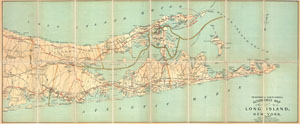
Automobile Map of Long Island, New York. East.
sold
- Digital Map Information
- Suitable for large format printing
- File Size: 13.15 MB
- File Type: ZIP / TIFF
- ICC color profile embedded
- Delivered instantly via download link
An extremely attractive early automobile pocket map of the eastern part of Long Island. Published in 1905 by George Walker and the Automobile Club of America this map covers Suffolk County from ... (more details)
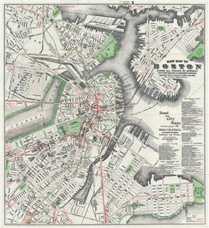
New Map of Boston Giving All Points of Interest : With Every Railway and Steamboat Terminus, Prominent Hotels Theatres and Public Buildings.
sold
- Digital Map Information
- Suitable for large format printing
- Full resolution TIFF file
- ICC color profile embedded
- Delivered instantly via download link
This is a beautiful 1905 map or plan of the city of Boston, Massachusetts by the Walker Lithograph and Publishing Company. It covers the city of Boston from Charlestown and Somerville to Marine ... (more details)
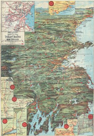
Trolley Wayfinder Birds Eye View of Trolley Routes in New England.
sold
- Digital Map Information
- Suitable for large format printing
- Full resolution TIFF file
- ICC color profile embedded
- Delivered instantly via download link
A scarce and stunning bird's eye view style pocket map of New England issued in 1905 by George Walker published by the New England Street Railway Club. The view reveals New England, centered on Boston, extending north as far as Lewistown, Brunswick and Yarmouth; south to Narragansett Bay, Newport and New Bedford; and west as far as Worcester. Train and trolley routes throughout the region are illustrated, with myriad towns and villages labeled throughout the region. Both electric railroads and steam railroads are noted here, with red lines indicating an electric railroad and a black line marking the route of a steam railroad. Various parks, lighthouses, historic sites, and geographical features are also labeled. Popular routes are highlighted by inset maps, which include: Springfield-Turners Falls, Worcester-Springfield, Springfield-New York City, Pittsfield and Vicinity, Rochester-Nashua, Portsmouth-Lewiston, and a triangle route from Worchester to Providence to New London and back. An inset of the vicinity of Boston is situated in the upper left corner. (more details)
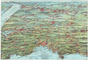
Trolley Pathfinder Birds Eye Map of Interurban Trolley Lines in New England.
sold
- Digital Map Information
- Suitable for large format printing
- Full resolution TIFF file
- ICC color profile embedded
- Delivered instantly via download link
This is a fascinating 1905 bird's eye view style pocket map of New England by George Walker issued by the Metropolitan News Company. Centered on Boston and oriented with north to the right, the ... (more details)
A bird's-eye-view of electric and steam railroads in turn of the century New England.
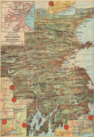
Trolley Wayfinder Birds Eye View of Trolley Routes in New England.
sold
- Digital Map Information
- Suitable for large format printing
- File Size: 31.41 MB
- File Type: ZIP / TIFF
- ICC color profile embedded
- Delivered instantly via download link
A scarce and stunning bird's eye view style pocket map of New England issued in 1905 by George Walker published by the New England Street Railway Club. The view reveals New England, centered on Boston, extending north as far as Lewistown, Brunswick and Yarmouth; south to Narragansett Bay, Newport and New Bedford; and west as far as Worcester. Train and trolley routes throughout the region are illustrated, with myriad towns and villages labeled throughout the region. Both electric railroads and steam railroads are noted here, with red lines indicating an electric railroad and a black line marking the route of a steam railroad. Various parks, lighthouses, historic sites, and geographical features are also labeled. Popular routes are highlighted by inset maps, which include: Springfield-Turners Falls, Worcester-Springfield, Springfield-New York City, Pittsfield and Vicinity, Rochester-Nashua, Portsmouth-Lewiston, and a triangle route from Worchester to Providence to New London and back. An inset of the vicinity of Boston is situated in the upper left corner. (more details)
Ephemeral New England transport network.
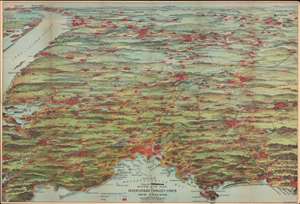
Trolley Pathfinder Birds Eye Map of Interurban Trolley Lines in New England.
sold
- Digital Map Information
- Suitable for large format printing
- File Size: 28.35 MB
- File Type: ZIP / TIFF
- ICC color profile embedded
- Delivered instantly via download link
This is a vivid 1905 chromolithograph bird's-eye view style pocket map of New England by George Walker issued for the Metropolitan News Company. The view was issued to promote the extensive but ephemeral New England streetcar network. Centered on Boston and oriented with north to the right, the map reveals New England from Portsmouth to New York City and Long Island, excluding Cape Cod. It features the extensive trolley lines connecting the major New England cities including Boston, Providence, Brockton, Plymouth, Manchester, Springfield, Portsmouth, Worchester, Hartford and others. It also notes railway lines, parks, lakes, rivers and other geographic features. (more details)
New England's ephemeral trolley network.
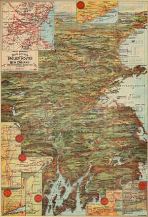
Trolley Wayfinder Birds Eye View of Trolley Routes in New England.
sold
- Digital Map Information
- Suitable for large format printing
- Full resolution TIFF file
- ICC color profile embedded
- Delivered instantly via download link
A radiantly rich chromolithograph bird's-eye view style pocket map of New England issued in 1905 by John Jenness Lane and George Walker for the New England Street Railway Club. The view was produced upon Lane's election as secretary of the Club to promote the extensive but ephemeral New England streetcar network. (more details)
A rare view of Cape Cod, Long Island, Boston and New York illustrating the Joy steamship line.
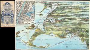
Birds eye view of Massachusetts, Rhode Island and Connecticut. A comprehensive map of the waterways traversed by steamers of the Joy Line between Boston-New York, Providence, with table of distances.
sold
- Digital Map Information
- Suitable for large format printing
- File Size: 12.7 MB
- File Type: ZIP / TIFF
- ICC color profile embedded
- Delivered instantly via download link
This unusual 1905 chromolithograph bird's-eye view of Cape Cod, New York, and Long Island, was issued by George H. Walker to promote the Joy Line. The Joy Line was a regular steamship ferry ... (more details)
Portland and Casco Bay.
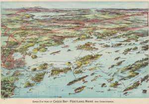
Birds Eye View of Casco Bay: Portland, Maine and Surroundings.
sold
- Digital Map Information
- Suitable for large format printing
- Full resolution TIFF file
- ICC color profile embedded
- Delivered instantly via download link
This is a beautiful 1906 George Walker chromolithograph bird's-eye view map of Casco Bay, Portland, Maine. Such views were made for sale at newsstands in stations and onboard ferry lines. (more details)
Beautiful view of Casco Bay near Portland, Maine.
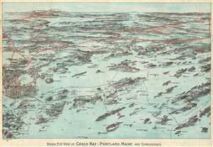
Birds Eye View of Casco Bay: Portland, Maine and Surroundings.
sold
- Digital Map Information
- Suitable for large format printing
- Full resolution TIFF file
- ICC color profile embedded
- Delivered instantly via download link
This is a beautiful 1906 bird’s eye-view map of Casco Bay, Portland, Maine issued by George Walker and Co. It covers Casco Bay, an inlet of the Gulf of Maine on the southern coast of ... (more details)
More than just witches.
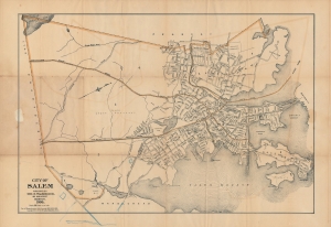
City of Salem.
sold
- Digital Map Information
- Suitable for large format printing
- Full resolution TIFF file
- ICC color profile embedded
- Delivered instantly via download link
A separately-issued 1906 folding map of Salem, Massachusetts published by George H. Walker and Co. in Boston. It depicts the entirety of the city in considerable detail, from its rural southern portion through its historic center in the north. (more details)
Boating on the Charles.
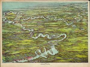
Charles River.
sold
- Digital Map Information
- Suitable for large format printing
- File Size: 59.67 MB
- File Type: ZIP / TIFF
- ICC color profile embedded
- Delivered instantly via download link
This is a beautiful 1907 presentation-issue bird's-eye view map of the Charles River, Massachusetts by the Boston publisher George H. Walker. Printed in chromolithography, Walker's view covers the winding Charles River from Waltham to Medway and includes Riverside, Newton, Wellesley, South Natick, Dover, Needham, Waban, Dedham, Medfield, Rockville and Highlandville. Several landmarks are also noted, including the Waltham Watch Factory, Mount Feake Cemetery, Norumbega Park, Walker-Gordon Milk Farm, an Echo Bridge near Newton Upper Falls. Dams, bridges, lakes, and pumping stations are identified. Walker also notes a number of railway lines and stations throughout. (more details)