
Wytfliet, Cornelius van (sold)

Cornelius van Wytfliet (1555 - 1597) was a Flemish cartographer and engraver active in the second half of the 16th century. Little unfortunately is known of Wytfliet's life or education. He seems to have been employed as secretary to the Council of Brabant, essentially the supreme court of the Duchy of Brabant. In cartographic circles Wytfliet is best known for his publication in 1597 of Descriptionis Ptolemaicae Augmentum, the first atlas dedicated exclusively to the America's. Wytfliet imaged the atlas as a supplement to classical Ptolemaic geographic, which traditionally accounted only for Europe, Africa, and Asia. The 19 maps contained within the Descriptionis Ptolemaicae Augmentum are some of the earliest specific maps detailed various parts of the Americas.
First Printed Map specifically of California.
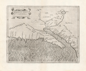
Granata Nova Et California.
sold
- Digital Map Information
- Suitable for large format printing
- DPI: 600
- File Size: 25.61 MB
- File Type: ZIP / TIFF
- ICC color profile embedded
- Delivered instantly via download link
A superb example of Cornelis Wytfliet's 1597 map of California and New Granada - the first printed map specifically of California, and the only one published in the 16th century. It reveals the earliest Spanish glimpses of a region whose remoteness from Europe would leave it prone to dramatic cartographic error throughout the subsequent centuries. (more details)
Discoveries of Frobisher, Davis, and... Zeno?
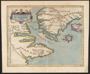
Estotilandia et Laboratoris Terra.
sold
- Digital Map Information
- Suitable for large format printing
- DPI: 600
- File Size: 17.46 MB
- File Type: ZIP / TIFF
- ICC color profile embedded
- Delivered instantly via download link
This is Cornelis Wytfliet's 1597 map of Labrador and Greenland, combining the most up-to-date discoveries in the North Atlantic with one of the most fascinating cartographic frauds committed to print. (more details)
The first map to focus specifically on the Pacific Coast of North America.
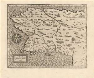
Limes Occidentis Quiuira et Anian. / Anian Regnum.
sold
- Digital Map Information
- Suitable for large format printing
- DPI: 600
- File Size: 8.73 MB
- File Type: ZIP / TIFF
- ICC color profile embedded
- Delivered instantly via download link
A strong example of Cornelis van Wytfliet's 1597 Anian Regnum; this is the first separate map to focus on the Pacific Northwest. The map presents the area now occupied by most of the west coast of the United States, Canada, and Alaska, in spite of this region having been beyond the ken of European explorers and geographers for centuries to come. The westward-reaching land mass bears a serendipitous resemblance to Alaska, although the area depicted is far more massive. (more details)
Enigmatic map of the proto-Canada.
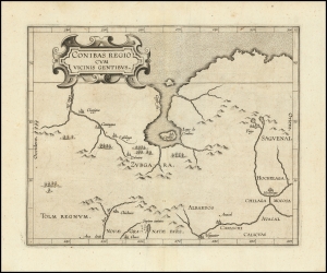
Conibas Regio Cum Vicins Gentibus.
sold
- Digital Map Information
- Suitable for large format printing
- Full resolution TIFF file
- ICC color profile embedded
- Delivered instantly via download link
An intriguing and enigmatic production, this is Cornelis van Wytfliet's uncommon 1597 map of northern central Canada, indeed it is the first specific map to detail this entirely unknown region. The scope of the map, though hard to immediately perceive, is vast, extending from the Arctic as far a south as the American Indian village of Higuater and New Mexico (Septem Civitates). Central to this map is the bizarre lake and city of Conibas. (more details)
An enigmatic map and the first specific map of Northern Canada and the Northwest Passage.
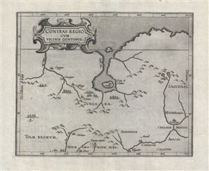
Conibas Regio Cum Vicins Gentibus.
sold
- Digital Map Information
- Suitable for large format printing
- DPI: 300
- File Size: 4.42 MB
- File Type: ZIP / TIFF
- ICC color profile embedded
- Delivered instantly via download link
An intriguing and enigmatic production, this is Cornelis van Wytfliet's uncommon 1597 map of northern central Canada, indeed it is the first specific map to detail this entirely unknown region. The scope of the map, though hard to immediately perceive, is vast, ... (more details)
Strait of Magellan, and the imagined lands to the south.
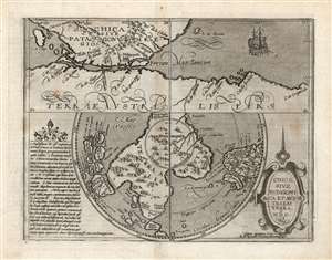
Chica Sive Patagonica et Australis Terra. MDC.
sold
- Digital Map Information
- Suitable for large format printing
- DPI: 600
- File Size: 19.86 MB
- File Type: ZIP / TIFF
- ICC color profile embedded
- Delivered instantly via download link
This scarce and fascinating map is Matthias Quad's 1600 depiction of the Straits of Magellan and the southern polar regions, including Terre Australis - the massive continent believed by many sixteenth and seventeenth century geographers to cover the south part of the world. It is closely derived from a 1597 map by Cornelis Wytfliet, but is much scarcer than the earlier work. (more details)
An enigmatic map and the first specific map of the Pacific Northwest and proto-Alaska.
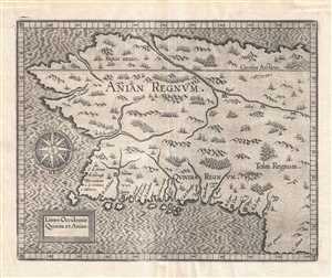
Limes Occidentis Quiuira et Anian. / Anian Regnum.
sold
- Digital Map Information
- Suitable for large format printing
- Full resolution TIFF file
- ICC color profile embedded
- Delivered instantly via download link
A beautiful example of the 1607 edition of Cornelis avn Wytfliet's Anian Regnum . One of Wytfliet's more enigmatic productions, this map speculatively illustrates must of the west coast of the United States, Canada, and Alaska. Although significantly larger ... (more details)