

Italien nach seiner Kirchlichen Eintheilung.
sold
- Digital Map Information
- Suitable for large format printing
- Full resolution TIFF file
- ICC color profile embedded
- Delivered instantly via download link
This fascinating hand colored map depicts Italy and Sardinia. There are detailed insets of the Roman Churches, of the vicinity of Rome, of the vicinity of Naples and the Amalfi coast, and of Central Italy. Issued in the 1850 edition of Karl von Spruner's Histor ... (more details)
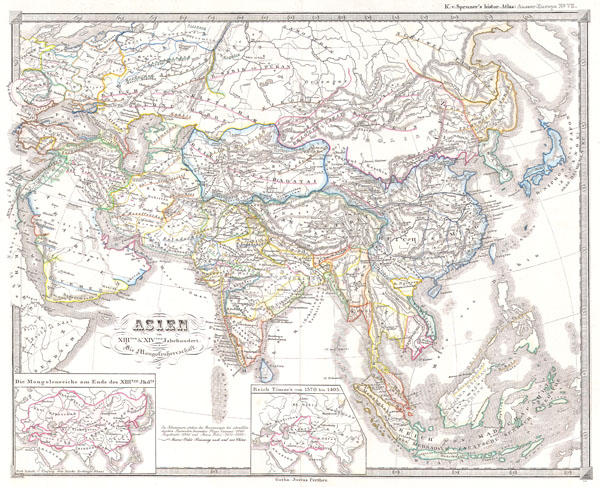
Asien im XIIIten & XIVten Jahrhundert. Die Mongolenherrschaft.
sold
- Digital Map Information
- Suitable for large format printing
- File Size: 4.03 MB
- File Type: ZIP / TIFF
- ICC color profile embedded
- Delivered instantly via download link
This fascinating hand colored map depicts Asia during the period of the Mongol Empire (Genghis Khan & the Golden Horde), roughly corresponding to the 13th and 14th centuries. This period corresponds with the Ming dynasty of China. All text is in German, but the ... (more details)
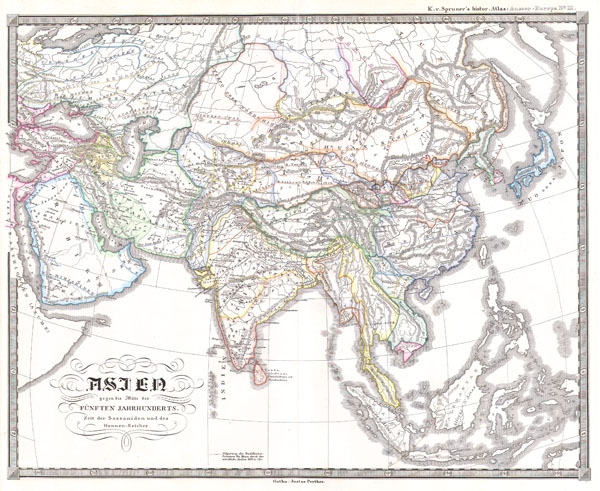
Asien gegen die Mitte des Funften Jahrhunderts. Zeit der Sassaniden und des Hunnen-Reiches.
$130.00
Acquire
- Digital Map Information
- Suitable for large format printing
- File Size: 3.78 MB
- File Type: ZIP / TIFF
- ICC color profile embedded
- Delivered instantly via download link
This fascinating hand colored map depicts Asia at the middle of the 5th century. This period corresponds with the period of the great Sassanid Empire and the Song dynasty of China. The Sassanid were a Zoroastrian Persian dynasty hailing from modern day Iran. ... (more details)
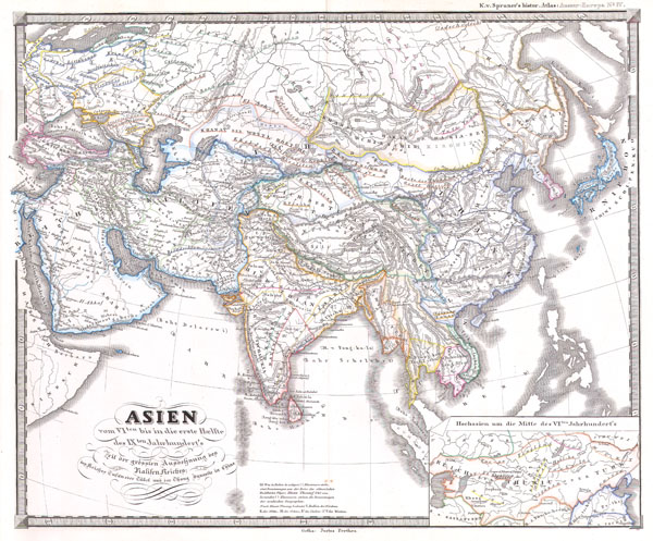
Asien vom VIten bis in die erste Haelfte des IXten Jahrhundert’s Zeit der grossfen Ausdehnung des Ralifen Reiches; des Reiches Tufan oder Tubet und der Chang Dynastie in China
sold
- Digital Map Information
- Suitable for large format printing
- File Size: 3.92 MB
- File Type: ZIP / TIFF
- ICC color profile embedded
- Delivered instantly via download link
This fascinating hand colored map depicts Asia in the 6th through the 9th centuries. This period roughly corresponds to the Chang Dyansty in China and the Tufan kings of Tibet. Title roughly translates to 'Asia from the 6th through the first half of the 9th ... (more details)

Asien am Ende des zweiten jahrhunderts. Zeit des Parther Reiches und der Han Dynastie in China.
$130.00
Acquire
- Digital Map Information
- Suitable for large format printing
- File Size: 3.4 MB
- File Type: ZIP / TIFF
- ICC color profile embedded
- Delivered instantly via download link
This fascinating hand colored map depicts Asia at the end of the 2nd century. This period corresponds with the Han dynasty of China and the Parther Kingdom in Pesia. All text is in German, but the title roughly translates as 'Asia at the end of the second ... (more details)
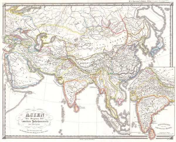
Asien bei Beginn des zweiten jahrhunderts vor Christus. Zeit der Seleuciden und des Turk Reiches der Hiong-nu in Hoch-Asien.
$130.00
Acquire
- Digital Map Information
- Suitable for large format printing
- File Size: 3.59 MB
- File Type: ZIP / TIFF
- ICC color profile embedded
- Delivered instantly via download link
This fascinating hand colored map depicts Asia at the beginning of the 2nd century B.C.E. This period corresponds with the Han dynasty of China, the rise of the Hiongnu Empire in Mongolia, and the Seleucid Turk Empire in Persia. All text is in German, but ... (more details)

Asien im XIten und XIIten Jahrhundert. Die Reiche der Seldschuken; der Altun Khane in Hochasien und der Muhametaner in Indien..
sold
- Digital Map Information
- Suitable for large format printing
- File Size: 3.72 MB
- File Type: ZIP / TIFF
- ICC color profile embedded
- Delivered instantly via download link
This fascinating hand colored map depicts Asia in the 11th and 12th centuries. This period corresponds with the Song dynasty of China, the rule of Altun Khan (Daughter of Ghengis Khan) in Mongolia, and the Seljuk Turk Empire in Persia and Asia Minor. All ... (more details)

Dept. De La Sarthe.
sold
- Digital Map Information
- Suitable for large format printing
- Full resolution TIFF file
- ICC color profile embedded
- Delivered instantly via download link
This is a fascinating 1847 map of the French department of Sarthe, surrounding the city of Le Mans. Sarthe is a Loire valley wine growing region that specializes in the lesser known French varietals of Jasnieres and Coteaux du Loir. It is also one of ... (more details)
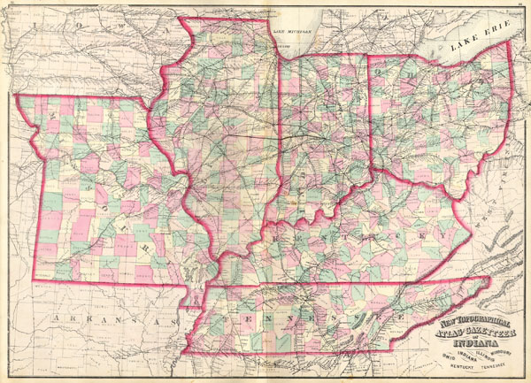
New Topographical Atlas and Gazetteer of Indiana, Ohio, Indiana, Illinois, Missouri, Kentucky, Tennessee.
sold
- Digital Map Information
- Suitable for large format printing
- File Size: 2.35 MB
- File Type: ZIP / TIFF
- ICC color profile embedded
- Delivered instantly via download link
This is an 1874 Asher & Adams hand colored map of the Midwest and Central states of Ohio, Indiana, Illinois, Missouri, Kentucky and ... (more details)
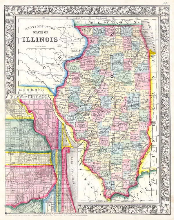
County Map of the State of Illinois. / Plan of Chicago.
sold
- Digital Map Information
- Suitable for large format printing
- File Size: 4.03 MB
- File Type: ZIP / TIFF
- ICC color profile embedded
- Delivered instantly via download link
A beautiful example of S. A. Mitchell Jr.'s 1861 map of Illinois and Chicago. Depicts the state of Illinois in considerable ... (more details)

Westliche Halbkugel / Oestliche Halbkugel.
sold
- Digital Map Information
- Suitable for large format printing
- File Size: 2.51 MB
- File Type: ZIP / TIFF
- ICC color profile embedded
- Delivered instantly via download link
This fascinating 1862 map by Justus Perthes and Stieler depicts the world in two hemispheres with a special area dedicated to ... (more details)

Wyoming ( Teton County ) Grand Teton Quadrangle
sold
- Digital Map Information
- Suitable for large format printing
- File Size: 6.9 MB
- File Type: ZIP / TIFF
- ICC color profile embedded
- Delivered instantly via download link
This beautiful and fascinating topographical chart depicts Grand Teton National Park in Wyoming. This map was made shortly ... (more details)
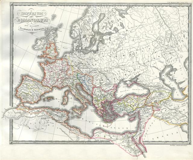
Roman Empire as Divided into East and West (Ancient Rome).
sold
- Digital Map Information
- Suitable for large format printing
- Full resolution TIFF file
- ICC color profile embedded
- Delivered instantly via download link
This magnificent hand colored 1850 map by Spruneri represents the Roman Empire after its division by Constantine into ... (more details)
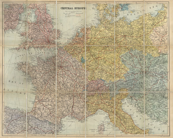
Central Europe
sold
- Digital Map Information
- Suitable for large format printing
- File Size: 3.43 MB
- File Type: ZIP / TIFF
- ICC color profile embedded
- Delivered instantly via download link
This is a fascinating 1895 map depicts Europe from England to the Balkans, from NW Spain to the Baltic Sea. ... (more details)
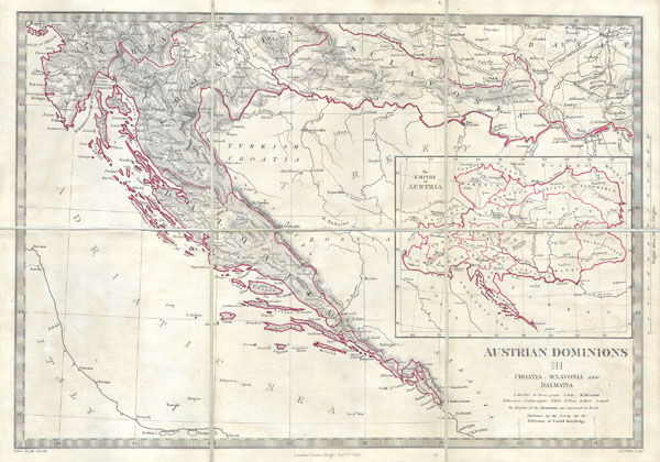
Austrian Dominions III: Croatia, Sclavonia and Dalmatia.
sold
- Digital Map Information
- Suitable for large format printing
- Full resolution TIFF file
- ICC color profile embedded
- Delivered instantly via download link
This is a S.D.U.K. map of a rarely depicted portion of Europe including most of modern day Croatia. Depicts ... (more details)

Map of Persia (Iran, Iraw, Kuwait).
sold
- Digital Map Information
- Suitable for large format printing
- File Size: 2.6 MB
- File Type: ZIP / TIFF
- ICC color profile embedded
- Delivered instantly via download link
This hand colored map is a steel plate lithograph depicting the Persian Empire. It was published in 1850 by ... (more details)

Ireland.
sold
- Digital Map Information
- Suitable for large format printing
- Full resolution TIFF file
- ICC color profile embedded
- Delivered instantly via download link
A beautiful hand colored map of Ireland from Butler's 1822 School ... (more details)

Plan of Detroit
sold
- Digital Map Information
- Suitable for large format printing
- File Size: 2.38 MB
- File Type: ZIP / TIFF
- ICC color profile embedded
- Delivered instantly via download link
This hand colored map is a lithographic engraving, dating to 1873 ... (more details)
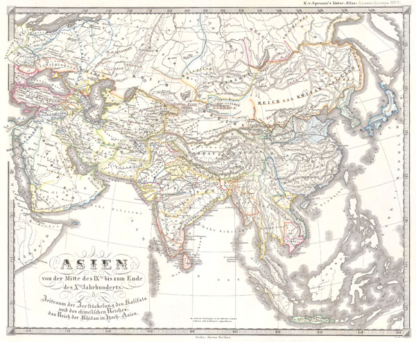
Asien im XIIIthn & XIVten Jahrhundert. Die Mongolenherrschaft.
$130.00
Acquire
- Digital Map Information
- Suitable for large format printing
- File Size: 3.75 MB
- File Type: ZIP / TIFF
- ICC color profile embedded
- Delivered instantly via download link
This fascinating hand colored map depicts Asia during 9th and ... (more details)

Asien im VIten und XVIten Jahrhundert. Begrundung der russuschen, grosste ausdehnung der osmannischen Herrschaft; die Sofi in Persien die Timuriden und Portugiesen in Indien die Ming in China
sold
- Digital Map Information
- Suitable for large format printing
- File Size: 4.01 MB
- File Type: ZIP / TIFF
- ICC color profile embedded
- Delivered instantly via download link
This fascinating hand colored map depicts Asia in the 10th ... (more details)