

Gouvernement de Lorraine et celui D’ Alsace.
sold
- Digital Map Information
- Suitable for large format printing
- Full resolution TIFF file
- ICC color profile embedded
- Delivered instantly via download link
This is a beautiful 1780 map of the Alsace Lorraine region of France by the Royal Cartographer for France, Rigobert Bonne. Depicts the region in considerable detail and includes both political and topographical information. Prepared by R. Bonne and Desmarest for ... (more details)

Preliminary Chart of the Entrance to Pensacola Bay, Florida.
sold
- Digital Map Information
- Suitable for large format printing
- File Size: 7.93 MB
- File Type: ZIP / TIFF
- ICC color profile embedded
- Delivered instantly via download link
This is a rare hand colored 1857 U.S. Coast Survey nautical chart of the Entrance to Pensacola Bay, Florida. Covers Pensacola Bay from The Lagoon eastward past Warrington and Woolsey to Pensacola. Depicts the Islands of Santa Rosa and Fort Pickens as well as the ... (more details)

Beaufort Harbor, North Carolina.
sold
- Digital Map Information
- Suitable for large format printing
- File Size: 11.48 MB
- File Type: ZIP / TIFF
- ICC color profile embedded
- Delivered instantly via download link
This is a rare and unusual 1857 U.S.C.S. Map of Beaufort Harbor, North Carolina. Depicts the North Carolina coast from Carolina City westward through Beaufort as far as Lenoxville Point. Features superb inland detail of the region as well as innumerable depth ... (more details)
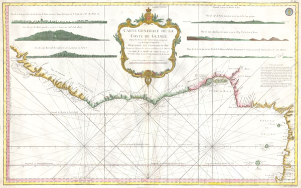
Carte Generale de la Coste de Guinee Depuis la Riviere de Sierra Leona jusqu'au Cap de Lopes Gonsalvo Pour servir Aus Vaisseaux du Roy Dressee au Depost des Cartes et Plans de la Marine Par Ordre de M. Rouille Dhr. Comte de Jouy & ca. Secretaire d' Etat ayant le Departement de la Marine.
sold
- Digital Map Information
- Suitable for large format printing
- Full resolution TIFF file
- ICC color profile embedded
- Delivered instantly via download link
This is a rare and attractive 1865 J. N. Bellin nautical chart or map of West Africa. Depicts the African coast from Sierra Leone south past the Bay of Benin and the Gulf of Guinea to Cape Lopez. This roughly consists of the modern day nations of Guinea, ... (more details)
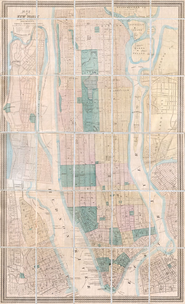
Map of New York City and Vicinity.
sold
- Digital Map Information
- Suitable for large format printing
- File Size: 17.89 MB
- File Type: ZIP / TIFF
- ICC color profile embedded
- Delivered instantly via download link
This is a rare pocket map of New York City by M. Dripps. Covers the entire island of Manhattan as well as parts of Brooklyn, Queens, Hoboken and Jersey City. Shows the city in considerable detail with all streets and, in Manhattan, block numbers clearly ... (more details)

Environs de Paris.
sold
- Digital Map Information
- Suitable for large format printing
- Full resolution TIFF file
- ICC color profile embedded
- Delivered instantly via download link
A rare and beautifully hand colored c. 1780 Bonne map of Paris and its environs. Covers from Poissy in the northwest to Ferolles in the southeast, and from Chateaufort in the southwest to Gonnesse in the northeast. Depicts roads, gardens, forests, ... (more details)

Peru and Bolivia.
sold
- Digital Map Information
- Suitable for large format printing
- DPI: 300
- File Size: 4.83 MB
- File Type: ZIP / TIFF
- ICC color profile embedded
- Delivered instantly via download link
An attractive example of S. A. Mitchell Senior's 1850 Map of Peru and Bolivia. Covers from Equator south to La Plata. When this map was made Bolivia had access to the sea through the province of Potosi – this territory is not controlled by Chili. ... (more details)

Brazil.
sold
- Digital Map Information
- Suitable for large format printing
- DPI: 300
- File Size: 4.5 MB
- File Type: ZIP / TIFF
- ICC color profile embedded
- Delivered instantly via download link
A fine and rare 1849 S. A. Mitchell Sr. map of Brazil and Paraguay. Map depicts the eastern part of South American including the Guianas, Brazil ( Brasil ) and Paraguay. Features impressive detail of the amazon basin and the interior of Brazil. ... (more details)

Argentina, Chili, La Plata and Uruguay.
sold
- Digital Map Information
- Suitable for large format printing
- Full resolution TIFF file
- ICC color profile embedded
- Delivered instantly via download link
This hand colored map is a copper plate engraving, dating to 1850 by the legendary American Mapmaker S.A. Mitchell, the elder. It represents the state of Alabama. This historically important map is extremely rare as it existed only in the 1850 ... (more details)

Northern Regions.
sold
- Digital Map Information
- Suitable for large format printing
- File Size: 5.76 MB
- File Type: ZIP / TIFF
- ICC color profile embedded
- Delivered instantly via download link
This rare hand colored map is a copper plate engraving, dating to 1855 by the well known 19th century American Mapmaker J. H. Colton. It is a representation of the North Pole and is formally titled 'Northern Regions.' This is a rare and ... (more details)

South Central Africa.
sold
- Digital Map Information
- Suitable for large format printing
- File Size: 3.19 MB
- File Type: ZIP / TIFF
- ICC color profile embedded
- Delivered instantly via download link
This is an 1868 Weekly Dispatch Atlas map of south-central Africa. (more details)
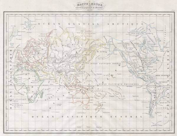
Mappe-monde suivant la projection de Mercator.
sold
- Digital Map Information
- Suitable for large format printing
- Full resolution TIFF file
- ICC color profile embedded
- Delivered instantly via download link
This rare hand-colored map is a copper-plate lithographic engraving, dating to 1832 by the respected German cartographer Conrad Malte-Brun. . It is a representation of the world on a Mercator projection. Map is hand colored in ... (more details)

Massachusetts.
sold
- Digital Map Information
- Suitable for large format printing
- Full resolution TIFF file
- ICC color profile embedded
- Delivered instantly via download link
This hand-colored map is a steel-plate engraving, dating to 1871 by the American mapmakers Walling & Gray. It is a geological chart of Massachusetts. Vivid hand coloring, fine workmanship, and extreme detail are the hallmarks of ... (more details)

Southern India and the Maldives.
sold
- Digital Map Information
- Suitable for large format printing
- Full resolution TIFF file
- ICC color profile embedded
- Delivered instantly via download link
This remarkable map of South India, Ceylon (Sir Lanka), and the Maldives by the mapmaker Rigobert Bonne was made in 1780. Bonne was the successor to Bellin as head Engineer of the French Hydrographe del la Marine Department. ... (more details)

Northern India.
sold
- Digital Map Information
- Suitable for large format printing
- Full resolution TIFF file
- ICC color profile embedded
- Delivered instantly via download link
This remarkable map of North India, Tibet, and Bangledesh by the mapmaker Rigobert Bonne was made in 1780. Bonne was the successor to Bellin as head Engineer of the French Hydrographe del la Marine Department. Towns, ... (more details)

Plan of Philadelphia
sold
- Digital Map Information
- Suitable for large format printing
- File Size: 4.45 MB
- File Type: ZIP / TIFF
- ICC color profile embedded
- Delivered instantly via download link
This hand colored item is a copper plate lithograph plan or map of Philadelphia dating to 1860. Produced by the important American cartographer S. A. Mitchell Jr. Depicts the whole of Philadelphia divided into 21 ... (more details)

Sweden & Norway..
sold
- Digital Map Information
- Suitable for large format printing
- Full resolution TIFF file
- ICC color profile embedded
- Delivered instantly via download link
This scarce hand colored map is a lithographic engraving of Norway and Sweden, dating to 1846 by the legendary American Mapmaker S.A. Mitchell, the elder. Depicts Scandinavia in full from the Arctic to Denmark. ... (more details)

Vereins¬ Staaten vor Nord Amerika und Mexico.
sold
- Digital Map Information
- Suitable for large format printing
- File Size: 1.95 MB
- File Type: ZIP / TIFF
- ICC color profile embedded
- Delivered instantly via download link
This fascinating 1862 map by Justus Perthes and Stieler depicts the United States, Mexico and the West Indies. Made at the height of the Civil War, this map separates the Union and Confederate States. The Union ... (more details)
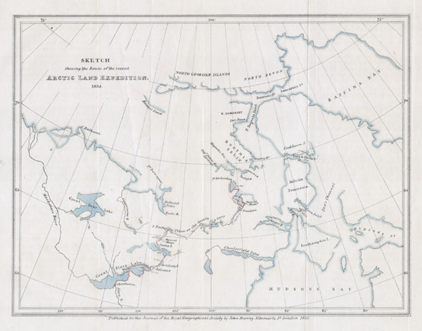
Sketch shewing the Route of the recent Arctic Land Expedition.
sold
- Digital Map Information
- Suitable for large format printing
- Full resolution TIFF file
- ICC color profile embedded
- Delivered instantly via download link
This hard to find map, dating to 1835, was drawn by the Royal Geographical Society cartographer John Murray to illustrated the journal of the Arctic Land Expedition. Depicts the parts of Canada north of Hudson ... (more details)

Regnum Alexandri Magni.
sold
- Digital Map Information
- Suitable for large format printing
- File Size: 2.92 MB
- File Type: ZIP / TIFF
- ICC color profile embedded
- Delivered instantly via download link
This fascinating hand colored map depicts the Empire of Alexander the Great at its greatest extent. Shows From Greece as far as east as modern day India and Pakistan and includes the entire Arabian peninsula. ... (more details)