
Features the oldest existing colonial building in South Africa.
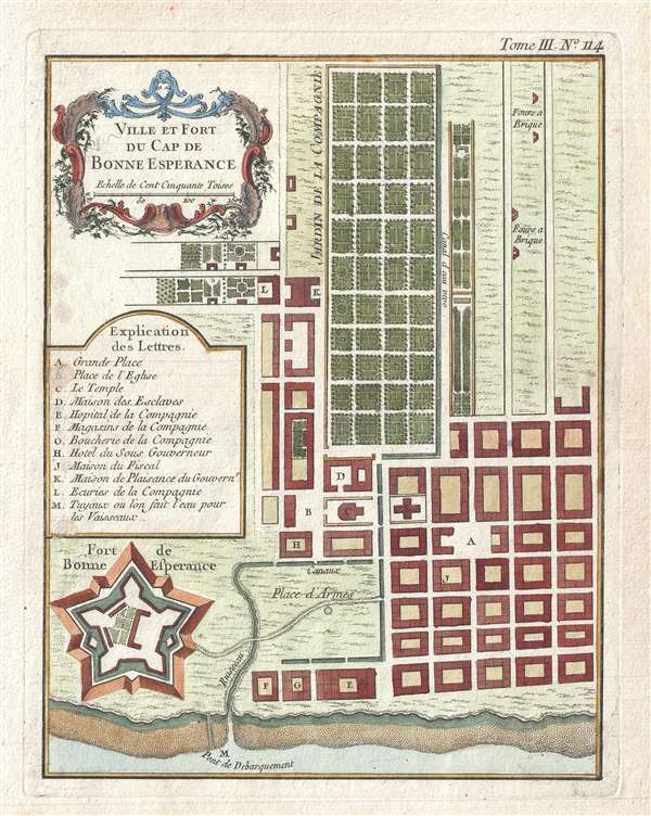
Ville et Fort du Cap de Bonne Esperance.
sold
- Digital Map Information
- Suitable for large format printing
- DPI: 300
- File Size: 2.19 MB
- File Type: ZIP / TIFF
- ICC color profile embedded
- Delivered instantly via download link
This is a scarce c.1764 plan or map of Cape Town, South Africa by French cartographer Bellin. The map depicts the city and fort of Cape Town in considerable detail with particular emphasis on the identifications of individual buildings and gardens. A key near the ... (more details)
Early speculative nautical chart of the Persian Gulf.
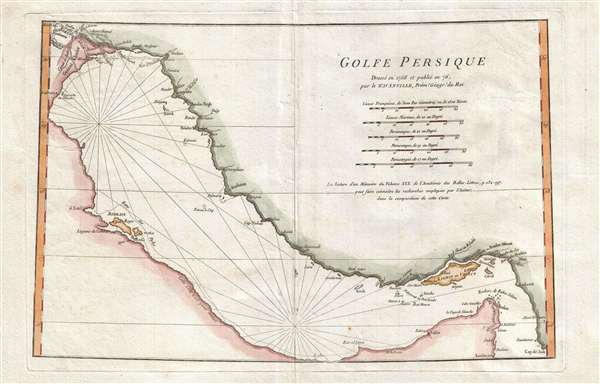
Golfe Persique.
sold
- Digital Map Information
- Suitable for large format printing
- Full resolution TIFF file
- ICC color profile embedded
- Delivered instantly via download link
A scarce 1776 map of the Persian Gulf by Jean Baptiste Bourguignon d'Anville. Essentially a nautical chart, this map covers from Basrah to the Straits of Hormuz. D'Anville prepared this map in 1758 to illustrate a lecture presented to the Paris Academie des ... (more details)
Johnson's most sophisticated rendition of Germany and the North German Confederation.

Johnson's Prussia and Germany.
sold
- Digital Map Information
- Suitable for large format printing
- File Size: 16.15 MB
- File Type: ZIP / TIFF
- ICC color profile embedded
- Delivered instantly via download link
This is A. J. Johnson and Ward's 1866 map of Prussia and Germany. Covers the region in considerable detail with color coding according to districts. Also includes much of Austria. An inset in the lower left quadrant details northeastern Prussia or Konigsberg. ... (more details)
Whimsical manuscript map of Greece and the Balkans.
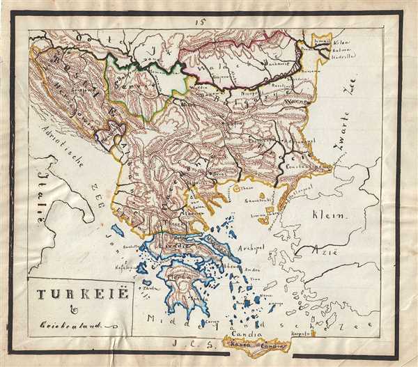
Turkeie and Griekenland.
sold
- Digital Map Information
- Suitable for large format printing
- File Size: 2.78 MB
- File Type: ZIP / TIFF
- ICC color profile embedded
- Delivered instantly via download link
This is a lovely 1871 manuscript map of Greece, the Balkans and the European part of Turkey by J. C. Sikkel. Entirely hand-drawn with beautifully rendered topography, the map covers from Romania to Candia or Crete. The modern day states of Greece, Albania, ... (more details)
Whimsical manuscript map depicting the Austrian Empire.
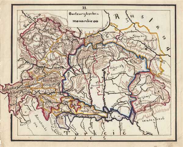
Oostenryksche-monarchie.
sold
- Digital Map Information
- Suitable for large format printing
- File Size: 2.78 MB
- File Type: ZIP / TIFF
- ICC color profile embedded
- Delivered instantly via download link
This is a wonderful whimsical 1871 manuscript map of the Austrian Empire. Hand-drawn by J. C. Sikkel, the map covers the territories claimed by the once vast Austrian Empire, including in whole or part of the modern day nations of Austria, Hungary, Germany, ... (more details)
One of the earliest obtainable specific maps of the Gulf Coast.
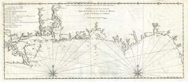
Carte de la Coste de la Louisiane depuis l'embouchure de la Riviere de Micissipi jusques à la Riviere de S. Martin.
sold
- Digital Map Information
- Suitable for large format printing
- Full resolution TIFF file
- ICC color profile embedded
- Delivered instantly via download link
An extremely rare and important 1728 Antoine Laval map of the Mississippi River Delta and the coast of Louisiana and Mississippi. The map covers from Lake Pontchartrain and Lake Maurepas eastward along the coast past the Delta of the Mississippi, Mobile ... (more details)
Intriguing map showing speculative Chinese colony of Fusang in the Pacific northwest and De Fonte's fictional Northwest Passage.

Nuove Scoperte De'Russi al Nord del Mare del Sud si nell'Asia, che nell'America
sold
- Digital Map Information
- Suitable for large format printing
- DPI: 300
- File Size: 6.11 MB
- File Type: ZIP / TIFF
- ICC color profile embedded
- Delivered instantly via download link
A stunning example of Antonio Zatta's 1776 map of the northwestern parts of America and the northeastern parts of Asia. This map is one of the most sought after and decorative 18th century pre-Cook maps of the Pacific Northwest. The map covers the region from the Hudson Bay and the Great Lakes westward as far as Siberia and Japan, north well into the Arctic, and southwards as far as Cabo San Lucas in Baja California. In this stunning map, Zatta, combining almost every 17th and 18th century myth and fact of the American west into a single map, offers up a veritable smorgasbord of speculative geography. (more details)
Important thematic map showing American Indian Languages in North America.
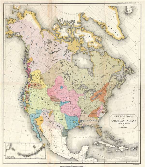
Linguistic Stocks of American Indians North of Mexico by J. W. Powell.
sold
- Digital Map Information
- Suitable for large format printing
- File Size: 11.26 MB
- File Type: ZIP / TIFF
- ICC color profile embedded
- Delivered instantly via download link
A remarkable 1891 chromolithograph map of North America showing American Indian language groups prepared by J. Wesley Powell under the directly of Henry Gannett, for the Seventh Annual Report of the Bureau of American Ethnology . The map covers the whole ... (more details)
Scarce wall map of the mountainous Malaysian state of Pahang.

Pahang 1928.
sold
- Digital Map Information
- Suitable for large format printing
- File Size: 34.35 MB
- File Type: ZIP / TIFF
- ICC color profile embedded
- Delivered instantly via download link
An exceptional and very rare 1928 wall map of the state of Pahang, a large state in Peninsular Malaysia just east of Kuala Lumpur. This map was issued by the Federated Malay States (F. M S.) Survey and printed in London by Edward Stanford. Being of ... (more details)
Shows American Indian Lands and the Military Bounty Lands in western Illinois.

Illinois and Missouri by H. S. Tanner.
sold
- Digital Map Information
- Suitable for large format printing
- DPI: 300
- File Size: 17.22 MB
- File Type: ZIP / TIFF
- ICC color profile embedded
- Delivered instantly via download link
A rare and important map of Illinois and Missouri by H. S. Tanner. This elephant folio map covers all of Illinois and Missouri as well as, in less detail, adjacent parts of Arkansas, Kentucky, and Minnesota. The map shows rivers, topography by ... (more details)
One of the first scientific-thematic maps of Southeast Asia - here illustrating the hydro-geographic theories of Athanasius Kircher.
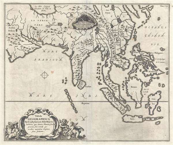
Tabula Geographica Hydrophylacium Asiae Majoris exhibens, quo Omnia Flumina sive proximè sive remotè per occultos meandros Originem suam sortiuntur.
sold
- Digital Map Information
- Suitable for large format printing
- Full resolution TIFF file
- ICC color profile embedded
- Delivered instantly via download link
A fine example of Athanasius Kircher's 1665 map of Asia. Centered on India, this map covers from the Arabian Peninsula to the Philippines and from the Caspian Sea and Japan to java. It is one of several maps prepared by Kircher to illustrate ... (more details)
One of the first scientific-thematic maps of Africa - here illustrating the hydro-geographic theories of Athanasius Kircher.
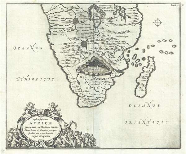
Hydrophylacium Africae precipuum, in Montibus Lunae Situm, Lacus et Flumina praecipua fundens, ubi et nova inventio Originis Nili describitur.
sold
- Digital Map Information
- Suitable for large format printing
- DPI: 300
- File Size: 6.08 MB
- File Type: ZIP / TIFF
- ICC color profile embedded
- Delivered instantly via download link
A fine example of Athanasius Kircher's 1665 map of southern Africa. The map covers Africa roughly from the Congo south to the Cape of Good Hope, including the Island of Madagascar. Cartographically the map is primitive, even for its time, ... (more details)
Modern signed map of Japan as Godzilla.

Nautical Chart of the Sea of Japan.
sold
A signed modern cartographic masterpiece, this is artist Anthony Petrie's 2016 map of Japan overlaid with the image of Godzilla. The map covers all of Japan. Adjacent lands that would presumably represent China or Korea, are fictional. ... (more details)
An exceptionally beautiful early map of Kentucky and Tennessee.
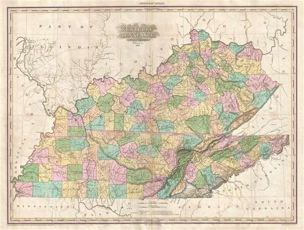
Kentucky and Tennessee by H. S. Tanner.
sold
- Digital Map Information
- Suitable for large format printing
- DPI: 300
- File Size: 15.45 MB
- File Type: ZIP / TIFF
- ICC color profile embedded
- Delivered instantly via download link
A rare and important map of Kentucky and Tennessee by H. S. Tanner. This elephant folio map covers both states in full as well as, in less detail, parts of adjacent states. The map shows rivers, topography by hachure, cities, towns and ... (more details)
Stunning large format map of Virginia, Maryland, and Delaware.
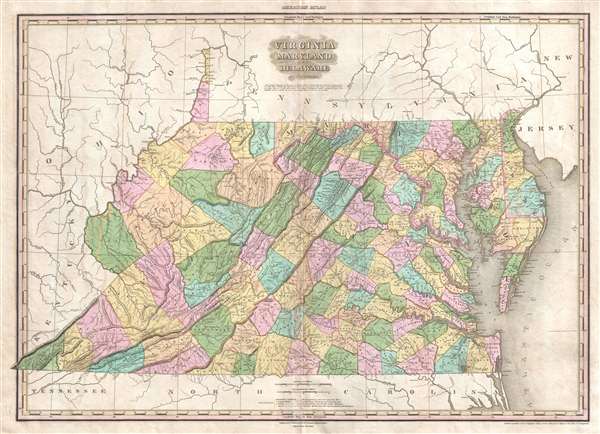
Viginia Maryland Delaware By H.S. Tanner.
sold
- Digital Map Information
- Suitable for large format printing
- DPI: 300
- File Size: 14.78 MB
- File Type: ZIP / TIFF
- ICC color profile embedded
- Delivered instantly via download link
A rare and important map of Virginia (and West Virginia), Maryland and Delaware by H. S. Tanner. This elephant folio map covers these states in full as well as, in less detail, parts of adjacent states. The map shows rivers, topography ... (more details)
Extremely rare Japanese perspective satirical 'Octopus Map' of Asia.

A Humorous Diplomatic Atlas of Europe and Asia. / 滑稽欧亜外交地図 / Kokkei Ō-A Gaikō Chizu.
sold
- Digital Map Information
- Suitable for large format printing
- File Size: 13.3 MB
- File Type: ZIP / TIFF
- ICC color profile embedded
- Delivered instantly via download link
A wonderful example of the rare 1904 Kisaburō Ohara / Shingo Nakamura satirical 'Octopus Map' of Europe. Composed at the outbreak of the Russo-Japanese War (1904 - 1905), Ohara here follows the conventions established by J. J. van Brederode ( Humoristische-Oorlogskaart, 1870) and Fred Rose (Serio-Comic War Map, 1877). These two maps established the convention of satirizing Russian expansionism as a menacing Kraken-like 'Black Octopus.' Whereas Brederode and Rose confine their images to Russia, Ohara has here expanded the idea to encompass all of Eurasia. Russia's eight grasping tentacles extend across Europe and Asia; on many countries they already have a firm grip. Finland, Poland, Crimea, and the Balkan nations are represented as skulls, while tentacles grasp Turkey around the foot and waist, Persia about the neck, and Tibet by the arm. The Trans-Siberian Railway and the South Manchuria Railway, represented by the rightmost tentacle, had by this time extended Russian influence into Manchuria as far as the valuable ice-free Russian stronghold of Port Arthur. As this map was issued in March of 1904, the struggle between Russian and Japan over control of Port Arthur was ongoing. Port Arthur was surrendered to the Japanese, who defeated the Russian Fleet in December of 1905, several months after this map was printed. Ohara sums up the situation in his English language descriptions of the map, printed in the upper left,
Black Octopus is a name newly given to Russia by a certain prominent Englishman. For the black octopus is so avaricious, that he stretches out his eight arms in all directions, and seizes up every thing that comes within his reach. But as it sometimes happens he gets wounded seriously even by a small fish, owing to his too much covetousness. Indeed, a Japanese proverb says: 'Great avarice is like unselfishness.' We Japanese need not to say much on the cause of the present war. Suffice it to say that the further existence of the Black Octopus will depend entirely upon how he comes out of this war. The Japanese fleet has already practically annihilated Russia's naval powers in the Orient. The Japanese army is about to win a signal victory over Russia in Corea and Manchuria. And when ... St. Petersburg? Wait and see! The ugly Black Octopus! Hurrah! Hurrah! for Japan.Certainly the map had a strong message, but who saw it? (more details)
Rare bird's eye view of Jefferson, Wisconsin.

Bird's Eye View of The City of Jefferson C. S. F Jefferson Co. Wis.
sold
- Digital Map Information
- Suitable for large format printing
- File Size: 12.39 MB
- File Type: ZIP / TIFF
- ICC color profile embedded
- Delivered instantly via download link
This is a beautiful 1880 bird’s eye view of the city of Jefferson County, Wisconsin by Henry Wellge. The view depicts Jefferson from the east, looking westward, with the Rock River flowing in the center of the view. The Crawfish River ... (more details)
Amusing pictorial map of the United States with its various legends and folklore.

American Folklore and Legends.
sold
- Digital Map Information
- Suitable for large format printing
- File Size: 24.42 MB
- File Type: ZIP / TIFF
- ICC color profile embedded
- Delivered instantly via download link
This is an whimsical and attractive c.1950 pictorial map of the United States by John Dukes McKee. The map covers the entire nation with numerous illustrations and scenes representing the nations folklore and legends. Some of the ... (more details)
Bird's eye-view tourist map of Havana, Cuba.
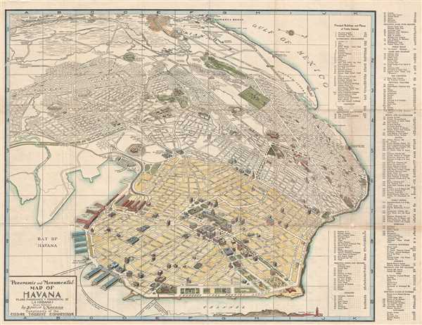
Panoramic and Monumental Map of Havana. (Plano Panoramico y Monumental de La Habana).
sold
- Digital Map Information
- Suitable for large format printing
- File Size: 22.17 MB
- File Type: ZIP / TIFF
- ICC color profile embedded
- Delivered instantly via download link
This is a beautiful 1950 panoramic map of Havana, Cuba issued by the Cuban Tourist Commission. The map covers from Rancho Boyeros to the Canal de Entrada. Also includes part of the Morro Castle. A key on the right of the map ... (more details)
One of the first tourist maps of Lake Champlain.
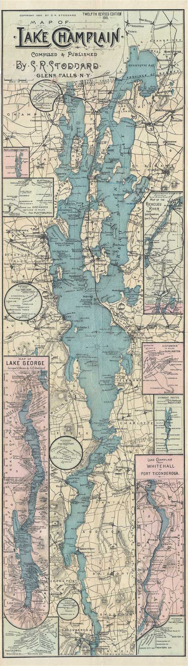
Map of Lake Champlain. Compiled & Published by S. R. Stoddard. Glens Falls, NY.
sold
- Digital Map Information
- Suitable for large format printing
- File Size: 16.04 MB
- File Type: ZIP / TIFF
- ICC color profile embedded
- Delivered instantly via download link
A rare map of Lake Champlain issued by Seneca Ray Stoddard of Glens Falls, New York, in 1911. Issued in an unusual elongated format, this map covers the entirety of Lake Champlain, and the adjacent parts of Vermont and New ... (more details)